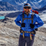
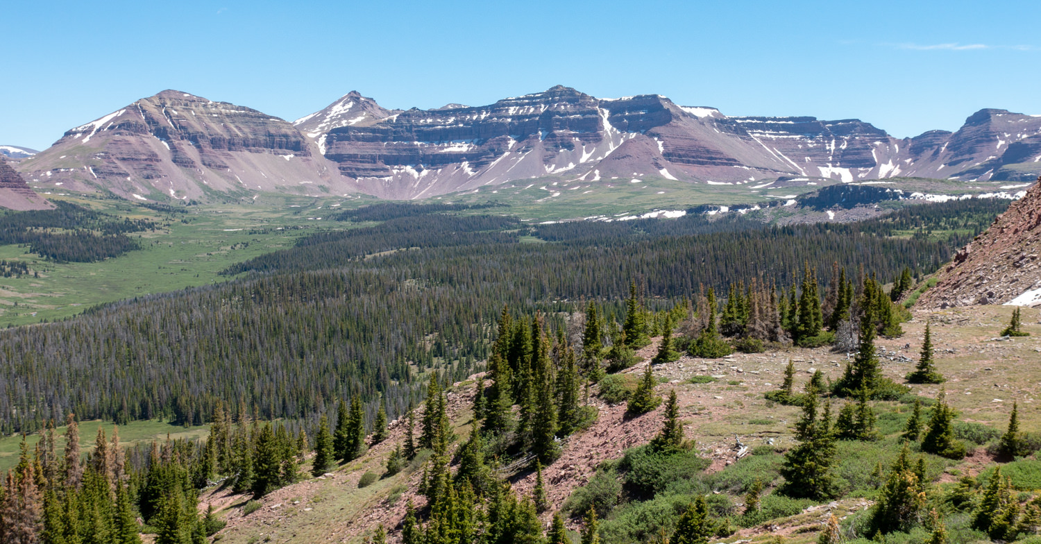
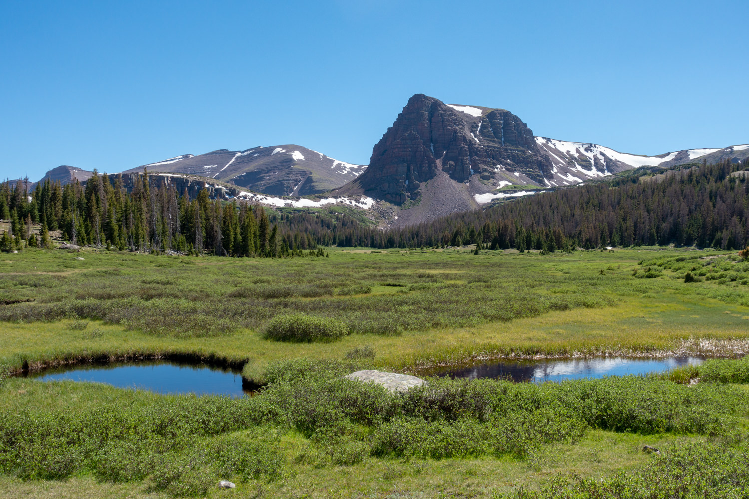
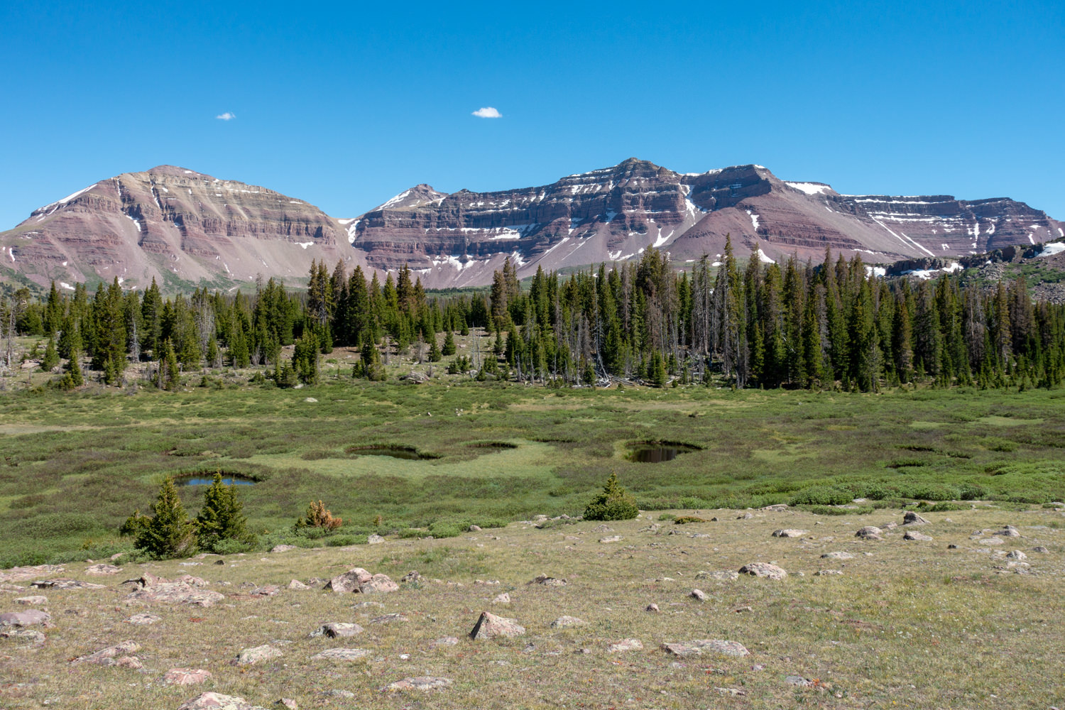
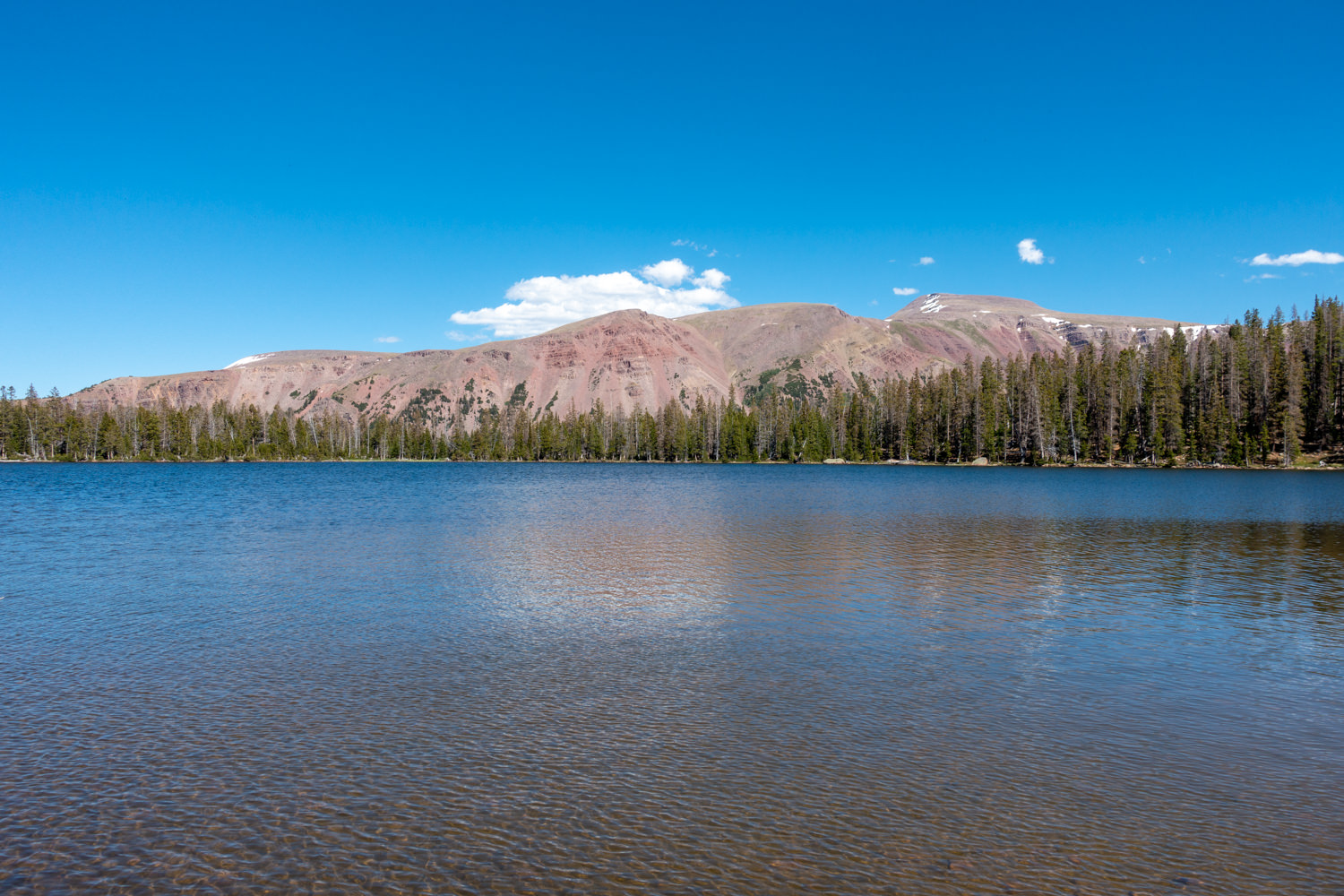
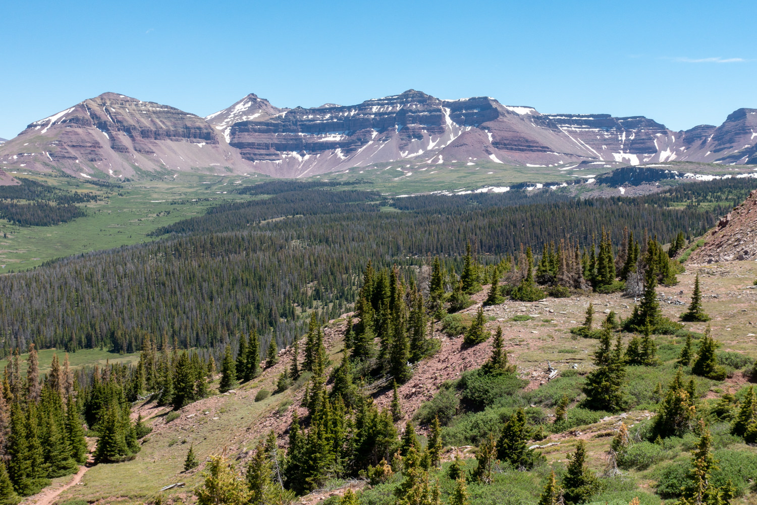
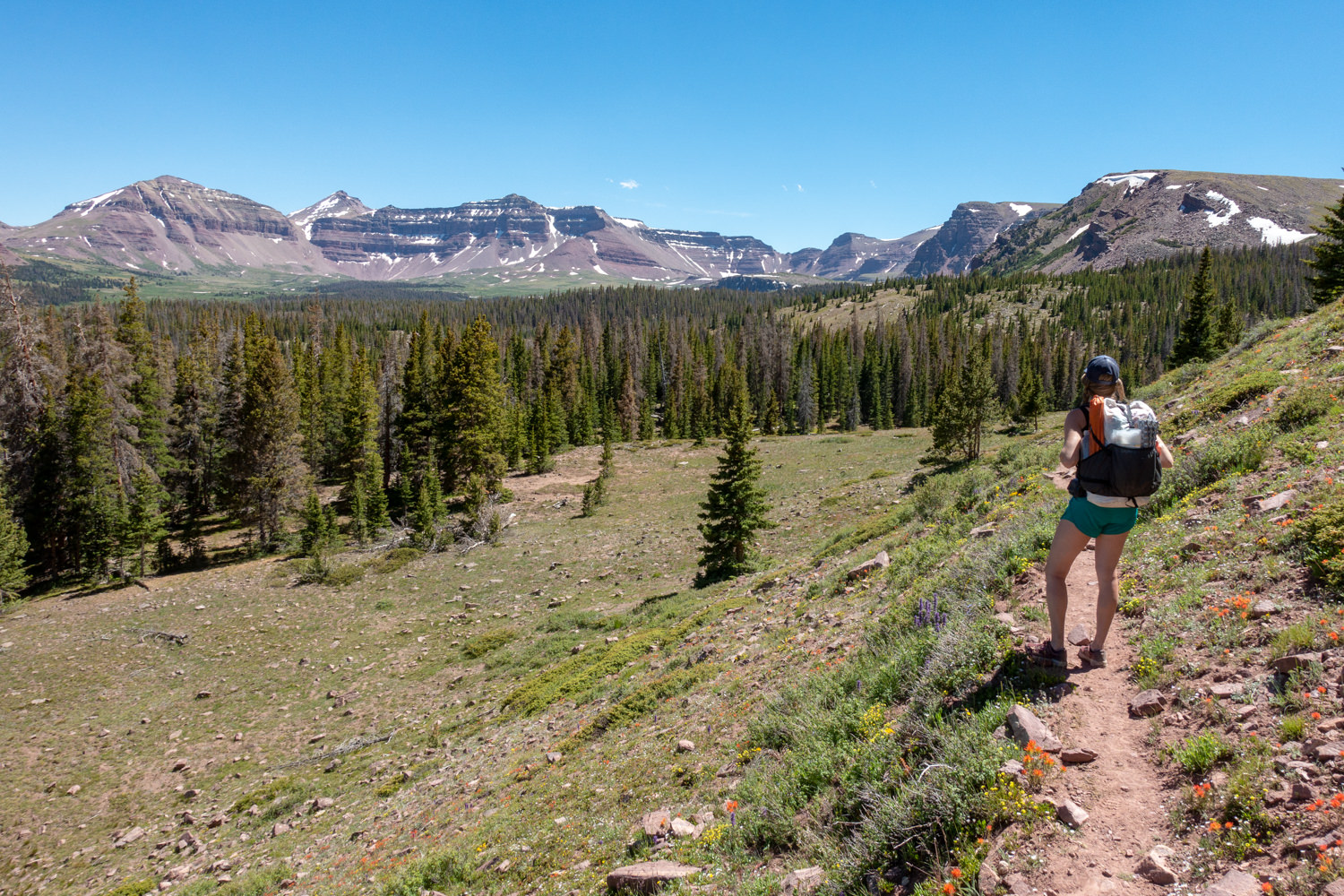
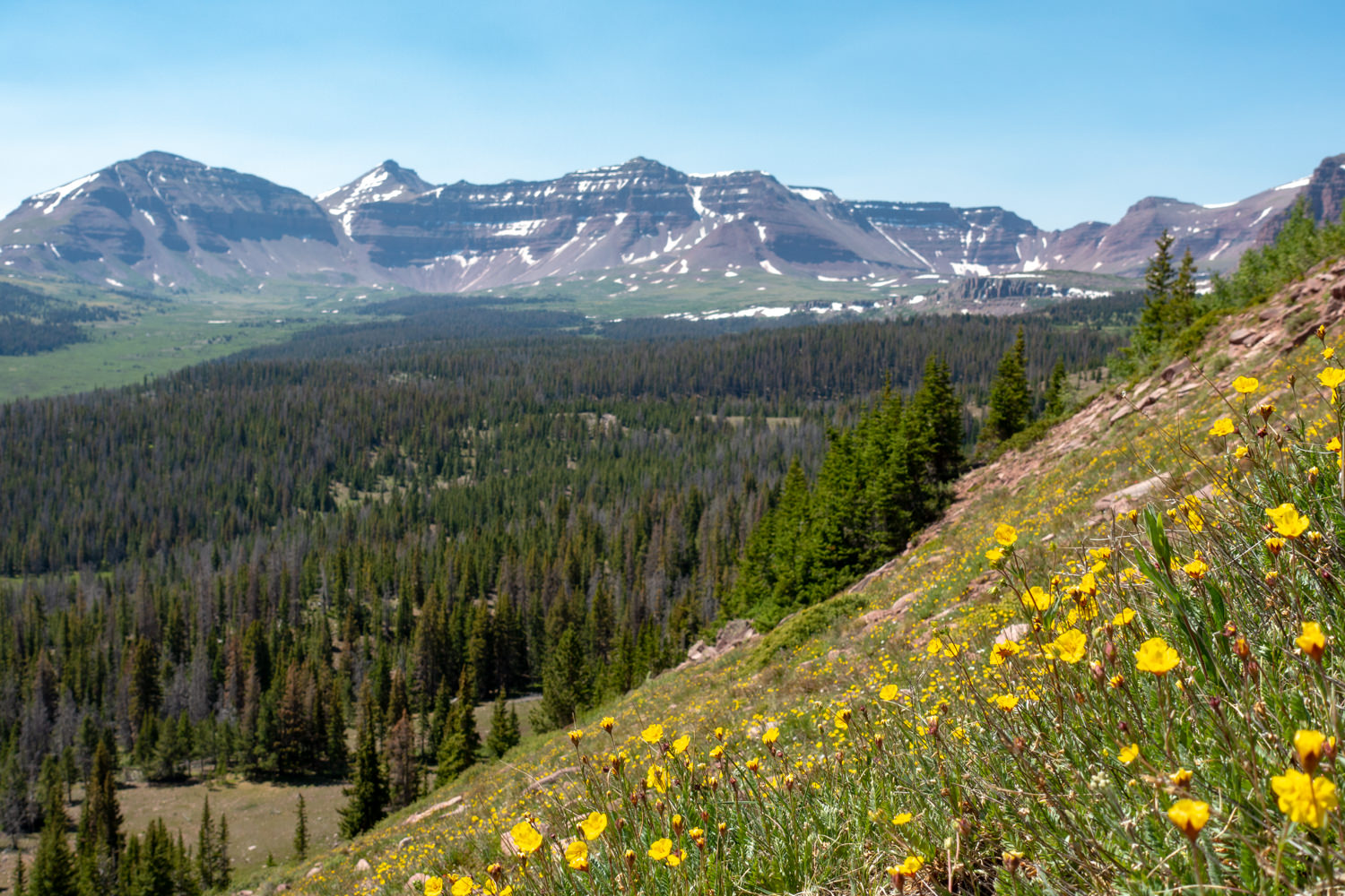
This loop explores a gorgeous alpine mountain basin with every enticement you dream of — misty mountain meadows, tall pines, small lakes and winding streams that tie it all together. And if that weren’t enough, the whole scene is framed by a massive mountain range with Kings Peak at its head. This trip is truly a gem in the High Uintas, with an opportunity for some solitude along the way.
QUICK FACTS
- Distance: 18.2 miles (29 km) round-trip (depending on itinerary add ons)
- Days Needed: 2-3 days (depending on itinerary add ons)
- Elevation Gain: 1,532 feet (467 m)
- Peak Elevation: 10,830 feet (3,300 m)
- Best Travel Time: June – October
HIGHLIGHTS
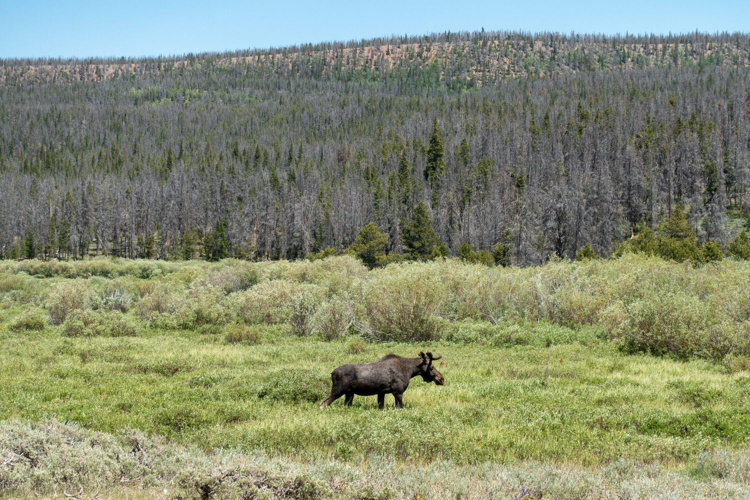
- Possible wildlife sightings, including elk, mule deer, black bear
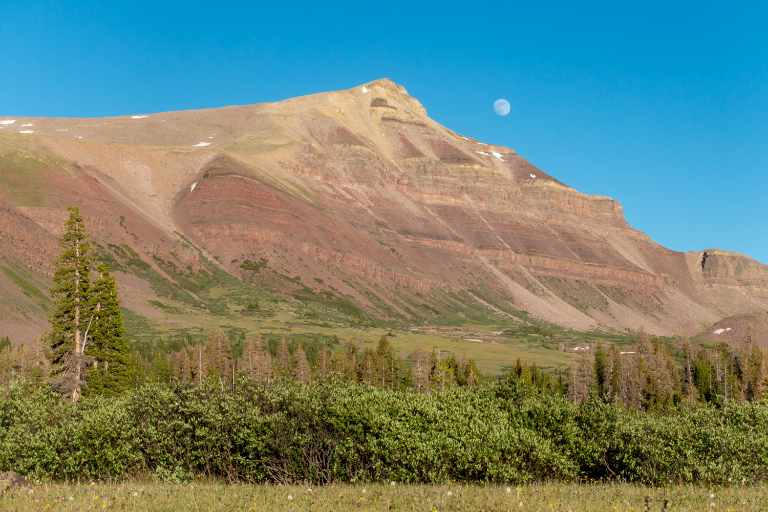
- Fascinating geology
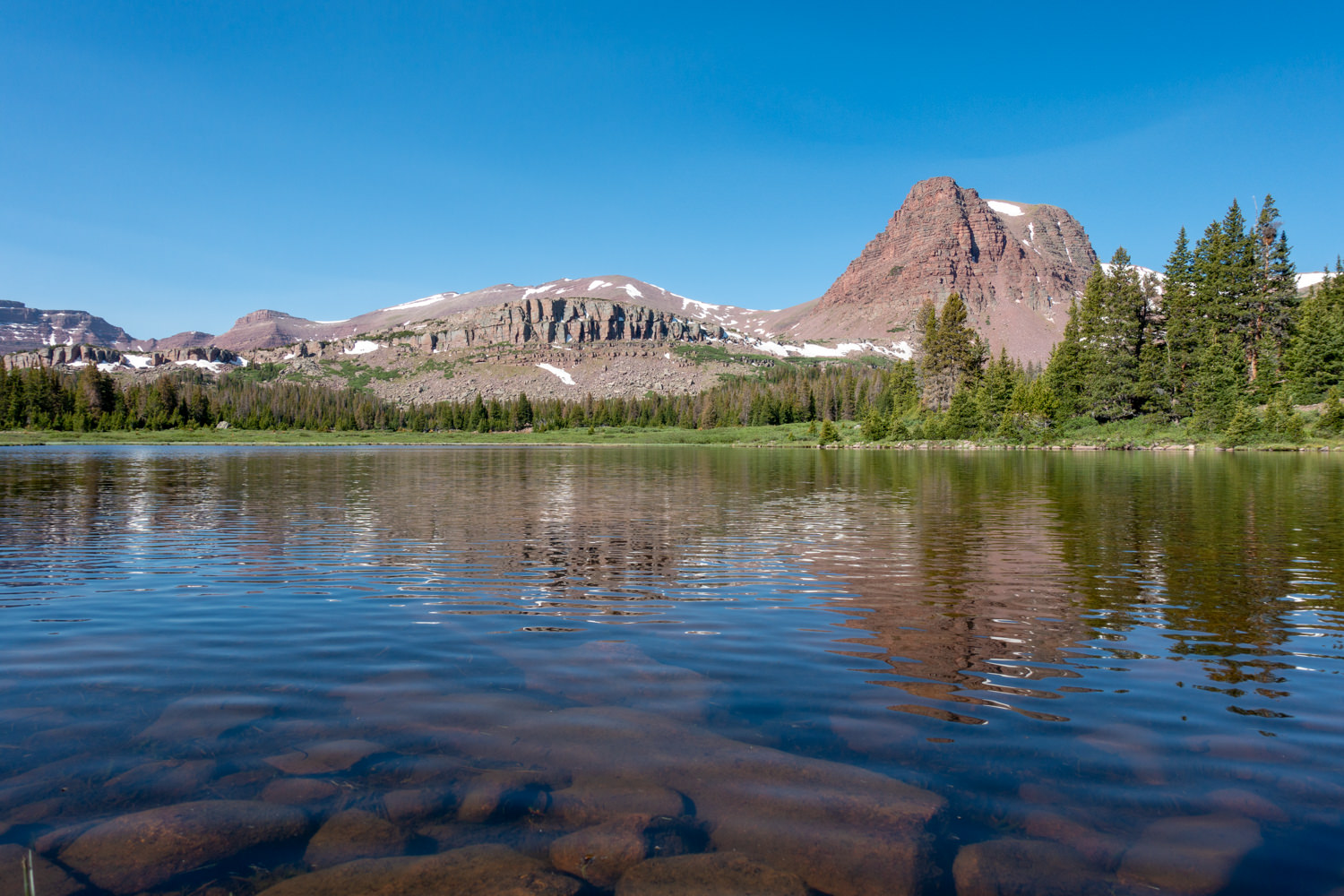
- Beautiful lakes and rivers
- Tall pines
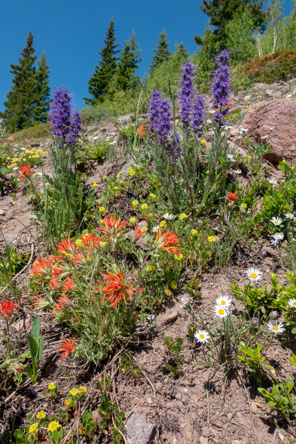
- Beautiful meadows and wildflowers
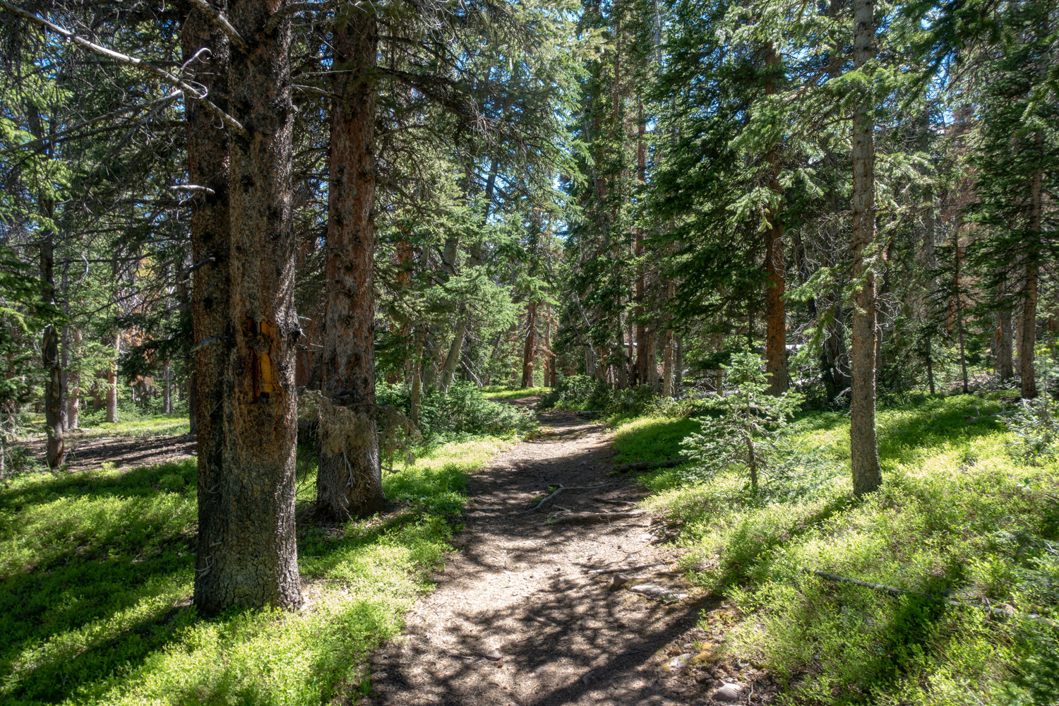
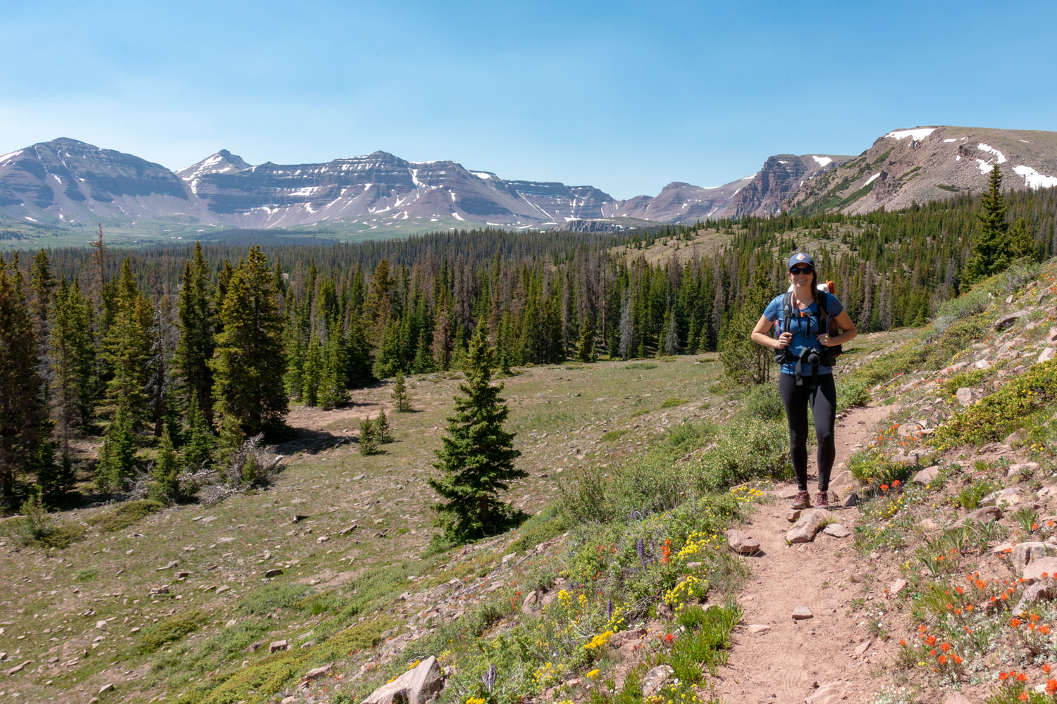
- Well-maintained trails for the most part
- Dogs allowed
- High-country lake fishing
LOWLIGHTS
- Muddy and rocky trails at times
- Armies of mosquitos and horseflies, but also ticks and yellow jackets
- Cold/muddy lakes makes swimming tempting but challenging
- Giardia and campylobacter are prevalent in the streams and lakes – treat all drinking water (more below)
BEST TIME TO TRAVEL
July through September offers the best temperatures in the High Uinta Wilderness. Daytime highs are typically in the 70-80s, while night temperatures range between 30-40 degrees. Afternoon thunderstorms are fairly typical and lightening is always a serious threat above treeline too.
August is the busiest month for backpacking in the high country, specifically in the Uinta basins. To avoid the crowds, we recommend visiting this area mid-week or during shoulder seasons, if possible.
Prior to any trip into the backcountry, check the National Weather Service for the local forecast.
DIFFICULTY
We rate most backpacking trips in this area as moderate due to rocky and sometimes muddy trails. The elevation gain and loss of this trip is fairly moderate and gentle, unless you are adding a climb to King’s Peak to your itinerary.
As always, difficulty ratings depend on the route you choose, experience, physical fitness, backpack weight, and weather conditions. Although most routes in Uintas are not technically demanding, you should always plan thoroughly, train properly, know your limitations, brush up on your skills, and dial in your gear. Doing so will make for a more safe and enjoyable adventure.
PERMITS/FEES
There are no permits or fees required for backpacking in this area. For more information contact the Mt. View Ranger District Office 307-782-6555.
TRAILHEAD
The best way to access this area is by starting at the Henrys Fork Trailhead. This trailhead is on the north side of the range. Take exit 39 off Interstate 80 on Wyoming and turn south on State Route 414. Go 6 miles to Mountain View, WY where route 414 turns west through Mountain View and becomes Route 410 as the road turns south at the west end of town. Drive Route 410 for 6.7 miles toward Robertson, WY to the point where it turns west. From this point, drive Uinta County Road 283 (also named Forest Road 072) south toward Grahams Reservoir and Bridger Lake for 12.1 miles to Forest Road 017. Turn left on Forest Road 017 and continue south 6.8 miles to Forest Road 077. Drive south on Forest Road 077 for 2.8 miles, and turn right on the road to Henry’s Fork Campground and the Henry’s Fork Trailhead.
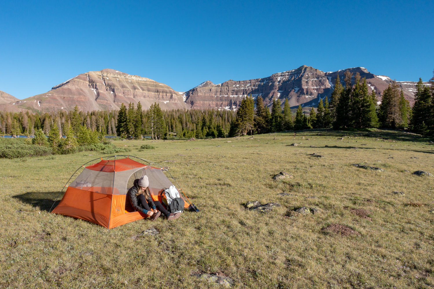
CAMPSITES
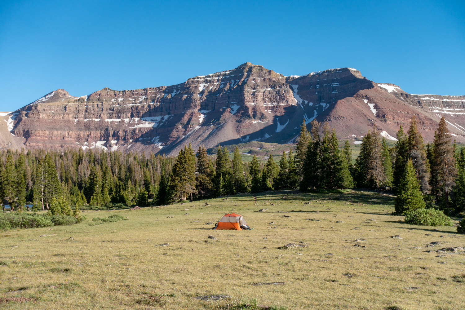
Campsites are first come, first serve along this route with good options around most lakes in the basin, with the exception of Castle, Blanchard, and Cliff lakes. Always try to camp in designated campsites and make sure they are all 200 feet from lakes and ponds. For those looking to climb King’s Peak, you’ll most likely want to set up a base camp at Dollar or Henry’s Fork lake.
- Dollar Lake 7.5 miles
- Henrys Fork Lake 9.1 miles
- Vicinity of Gunsight Pass, about 3 miles beyond Dollar Lake
POSSIBLE ITINERARIES
Dollar Lake makes a good basecamp for climbing Kings Peak, which means that it is often crowded. Henrys Fork Lake may be slightly less crowded. The lakes on the west side of the Henry’s Fork loop tend to see less traffic, so they’re a good option as well.
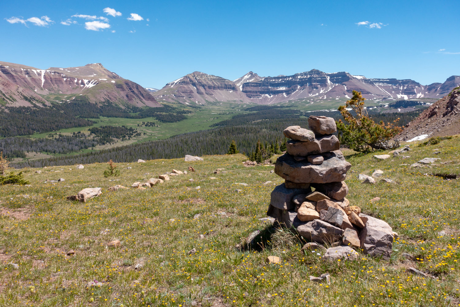
There is an option to connect Henry Forks Loop to Red Castle Lakes, but the connecting trails are very hard to follow and non-existent at times. Connecting these two areas will require excellent map reading skills, following cairns/blazes, and using GPS as you go past the Lake Hessie turnout. The view from the top of range is stunning (also a good day hike option), but we would only recommend this route for experienced backpackers.
Two Day Itinerary
STARTING TRAILHEAD:Henrys Fork
ENDING TRAILHEAD: Henrys Fork
Day 1 – Hike to Dollar Lake or Henry Fork Lake
Day 2 – Return to Henrys Fork TH
TOTAL MILEAGE: 15.1 miles (depending on where you camp)
Three Day Itinerary
STARTING TRAILHEAD: Henrys Fork
ENDING TRAILHEAD: Henrys Fork
Day 1 – Hike to Dollar Lake, basecamp
Day 2 – Hike to Kings Peak and return to camp
Day 3 – Return to Henrys Fork Trailhead
TOTAL MILEAGE: 28.8 miles
MAPS & GUIDEBOOKS
- Hiking Utah’s High Uintas: A Guide to the Region’s Greatest Hikes by Brett Prettyman, an outdoors editor for the Salt Lake City Tribune. This guide includes descriptions of 99 routes throughout the backcountry wilderness of Utah’s Uinta Mountains and High Uintas Wilderness, including easy day hikes to great fishing spots, adventurous treks to remote campsites, and extended backpacking trips for intrepid wilderness travelers.
- National Geographic High Uinta’s Wilderness Trails Illustrated Map This map covers the High Uintas Wilderness, as well as the Ashley and Wasatch-Cache National Forests. It features key points of interest and is printed on “Backcountry Tough” waterproof, tear-resistant paper. A full UTM grid is printed on the map to aid with GPS navigation.
- 60 Hikes Within 60 Miles: Salt Lake City by Greg Witt. This book includes many of the best hikes in the Western Uintas with detailed trail descriptions that range from easy strolls to challenging backpacks. Extensive key-at-a-glance information makes it easier to choose a hike based on length, difficulty, or scenery.
- High Uintas Backcountry by Jeffrey Probst This trail guide travels the length of the Uintas with descriptions on 99 hikes, 600 fishable lakes, and over 400 miles of streams. Each story includes a trip planner, photo, and map. The appendix includes full maps of all areas, a campground and trailhead directory with directions. There are over 200 photos and maps.
- Gaia Phone app GPS and Caltopo Mapping Software – We use both these services for many of our backpacking trips to assist with route planning (Caltopo) and on-trail navigation (Gaia).
WATER
Water is plentiful along the Henrys Fork Trail and accessible from small streams and lakes. Though many sources look pure, Giardia and Campylobacter are present in this area so we highly recommend bringing a lightweight water filter. We carried the MSR Trail Shot on our most recent trip to the Uintas and we were happy with its performance. Two other good lightweight options are the SteriPen Ultra and Aquamira Drops. Check out our best water filters list for more excellent options.
REGULATIONS
For a full list of wilderness regulations in this area, visit the Forest Service website. But in, general, the following apply:
- Stay on designated trails and do not cut switchbacks.
- Select a campsite 200 feet from trails or streams.
- Wash yourself and dishes away from water sources and only use biodegradable soap when necessary.
- Bury human waste and fish entrails at least 6-8″ deep and 200 feet away from water sources.
- Campfires are prohibited near some lakes in this area – always obey posted signs.
CRITTERS & FOOD STORAGE
Black bears are not a problem in this area so there are no food storage requirements. That said, you should always protect your food against rodents and small critters, which actually tend to cause many more problems than bears. We recommend packaging all your food and scented products in a food storage container such as an Ursack.
BUGS
Mosquitoes are present along this route and can be pretty vicious, especially early in the season and near bogs and water sources. Hiking later in the season may be bug-free, but we usually bring some bug repellent just in case. Use a combination of permethrin on your clothing and bring a small bottle of DEET for exposed skin to provide full protection.
BACKPACKING GEAR
We prefer lightweight backpacking because it’s more comfortable and allows us to cover more ground with less effort. For recommendations on our favorite lightweight backpacking equipment, check out the CleverHiker Gear Guide and Top Picks page.
What to Pack
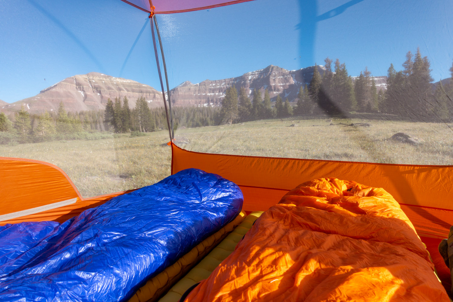
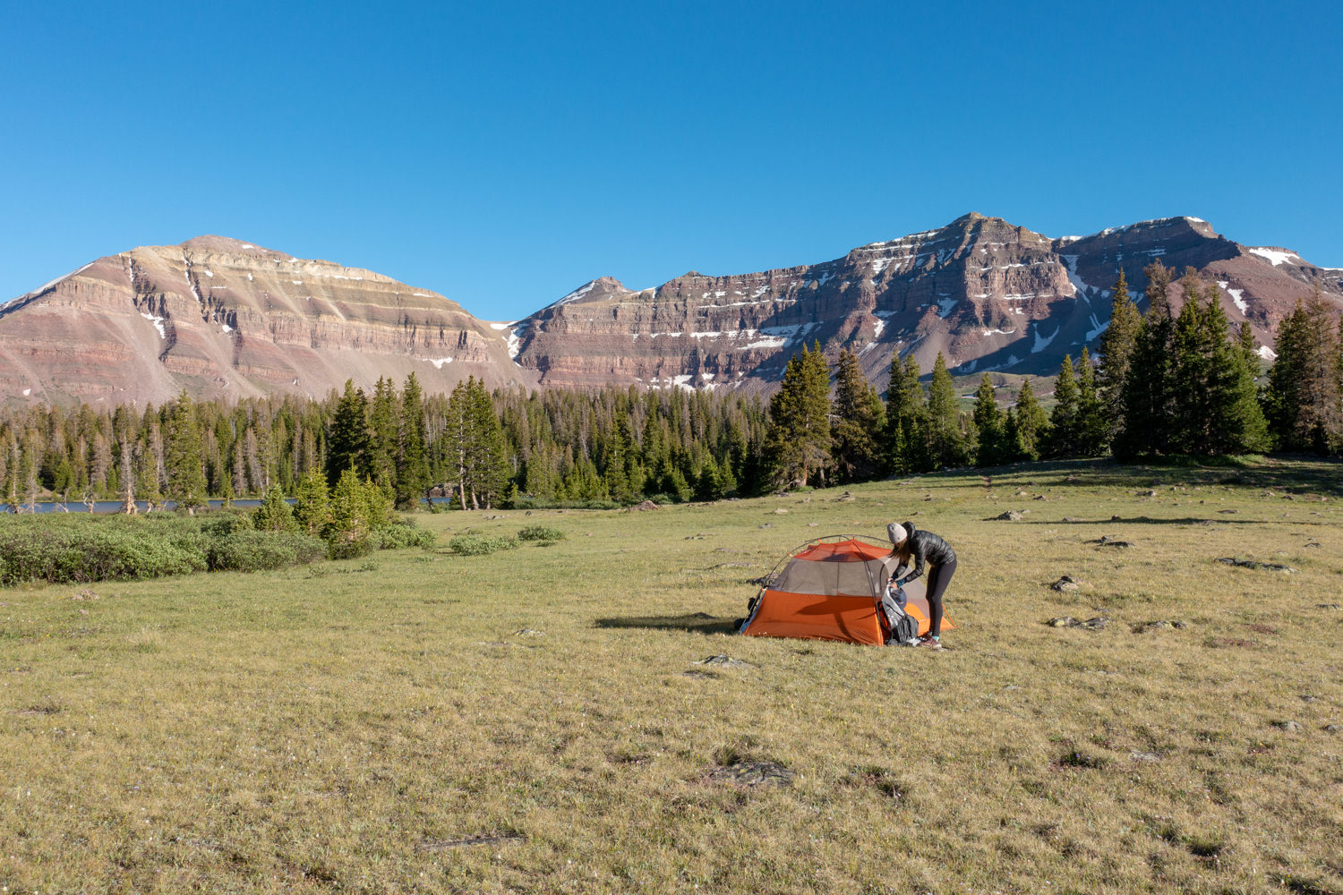
TENT: We used the Big Agnes Copper Spur HV UL3 tent on this trip for its lightweight livability. The Copper Spur is a top pick on our best lightweight backpacking tents list as well.
BACKPACK: We used Hyperlite Mountain Gear’s Southwest 2400 backpacks on this trek. The Southwest is incredibly lightweight, durable, nearly waterproof, and is a top pick on our best lightweight backpacks list too.
SLEEPING BAG: We used the Feathered Friends Egret UL 20 and the Western Mountaineering UltraLite sleeping bags on this hike for night time temperatures right around freezing. Both sleeping bags are lightweight, very warm, and make our list of the best backpacking sleeping bags.
SLEEPING PAD: We used the Therm-a-Rest NeoAir XLite andNEMO Tensor Insulated sleeping pads on this trip. Both are light, comfortable, warm, and make our list of the best backpacking sleeping pads.
COOKING SYSTEM: We used the BRS Stove, Snow Peak Mini Solo Cookset, and Snow Peak Folding Spoons on this hike, all of which make our top picks gear list and best lightweight stove list.
WATER PURIFIER: We used the MSR Trail Shot as our main purification method on this trip. It’s lightweight, affordable, and makes our best water purifiers list.
SHOES OR BOOTS: We wore Saucony Peregrine 8 trail runners (men’s and women’s) on this trail and they were excellent. If you prefer boots, make sure they’re lightweight and break them in really well before your trip. Here’s why we prefer hiking in trail running shoes: 5 Reasons to Ditch Your Hiking Boots. Also, here’s our list of the best backpacking shoos and boots.
HEADLAMP: A small headlamp like the Petzl Actik is an affordable, bright, and lightweight option. We’re big fans of ours.
FOOD:You’ll have to carry all the food you’ll need on this trip. Check out our Best Lightweight Backpacking Food Guide and our Best Freeze Dried Backpacking Meals for some of our go-to grub recommendations.
CLOTHING:
Here are some of our favorite hiking/backpacking clothing items from our Top Gear list.
- 1 Rain jacket shell – Patagonia Storm Racer / Rab Kinetic Plus
- 1 Pair rain pants (optional) – Mountain Hardwear Stretch Ozonic
- 1 Down jacket – Patagonia Micro Puff Hoody & Montbell Plasma 1000
- 1 Fleece jacket – Extra warmth under your down jacket that will be warmer when damp and better to hike in.
- 1 Pair hiking pants: PrAna Zion Stretch or running tights
- 1 Pair hiking shorts – Nike dri fit running shorts
- 1-2 Hiking t-shirts – Nike dri fit t-shirts
- 1 Long-sleeve shirt – Nike dri fit quarter zip
- 1-3 Pair underwear – ExOfficio boxer briefs or ExOfficio women’s briefs
- 2-3 Pair socks (add thin sock liners if using boots) – Balega running socks for warm weather & SmartWool mountaineer socks for in camp and on snow.
- 1 Pair long john bottoms and a long john top for nighttime use (optional).
- 1 Warm fleece hat
- 1 Sun hat
- 1 Pair fleece gloves or mittens
- 1 Pair rain mitts for wet trips (optional)
MAP &COMPASS: Although the trails here are well-marked, you always want to hike with a good map and GPS system, such as Gaia GPS. For our trip, we hiked with the National Geographic High Uinta’s Wilderness Trails Illustrated Map and used the route description provided in Hiking Utah’s High Uintas: A Guide to the Region’s Greatest Hikes. In addition, we always hike with a lightweight compass.
FIRST AID KIT: Always bring a small personalized first aid kit. We use the Ultralight .7 Kit and add extras, like painkillers and personal medications.
SUN PROTECTION: Sunglasses (polarized recommended), sunscreen, and spf lip balm are an absolute must for every backpacking trip.
POCKET KNIFE: We brought along a small Swiss Army Knife, which came in handy here and there.
OTHER ITEMS:
- SMALL TOWEL: the Nano pack towel is great.
- CASH and ID
- PERMITS
- PERSONAL TOILETRIES
- HAND SANITIZER: Always apply after using a bathroom and before eating.
- WET WIPES: These can be useful for cleaning up after hiking.
- INSECT REPELLANT: Use a combination of permethrin on your clothing and bring a 1oz bottle of DEET for exposed skin to provide full protection.
- CAMERA: The Sony RX100 is our go-to camera for lightweight backpacking
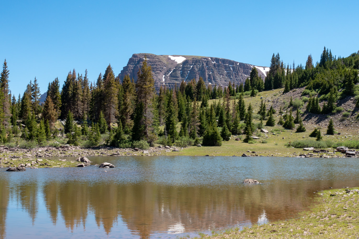
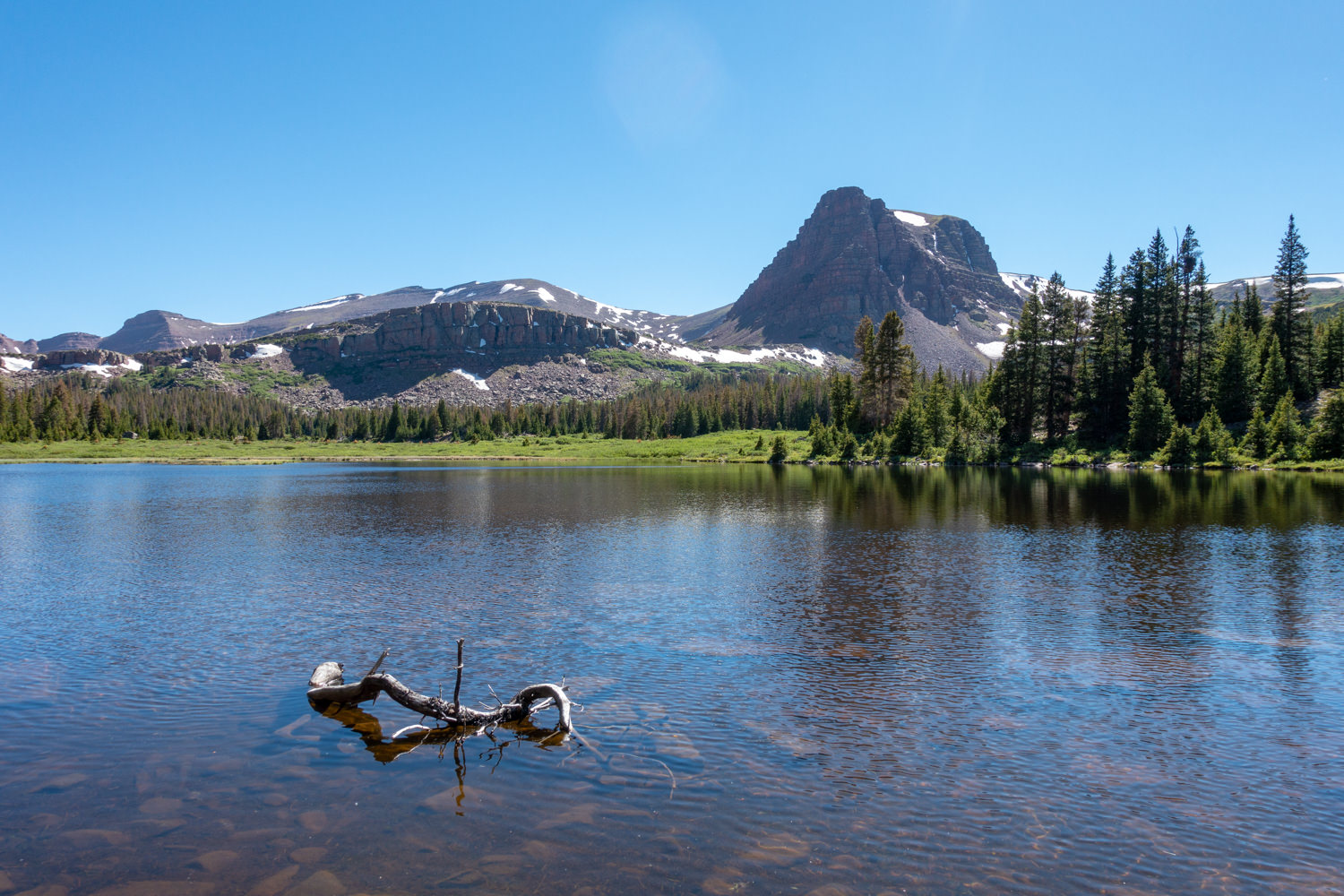
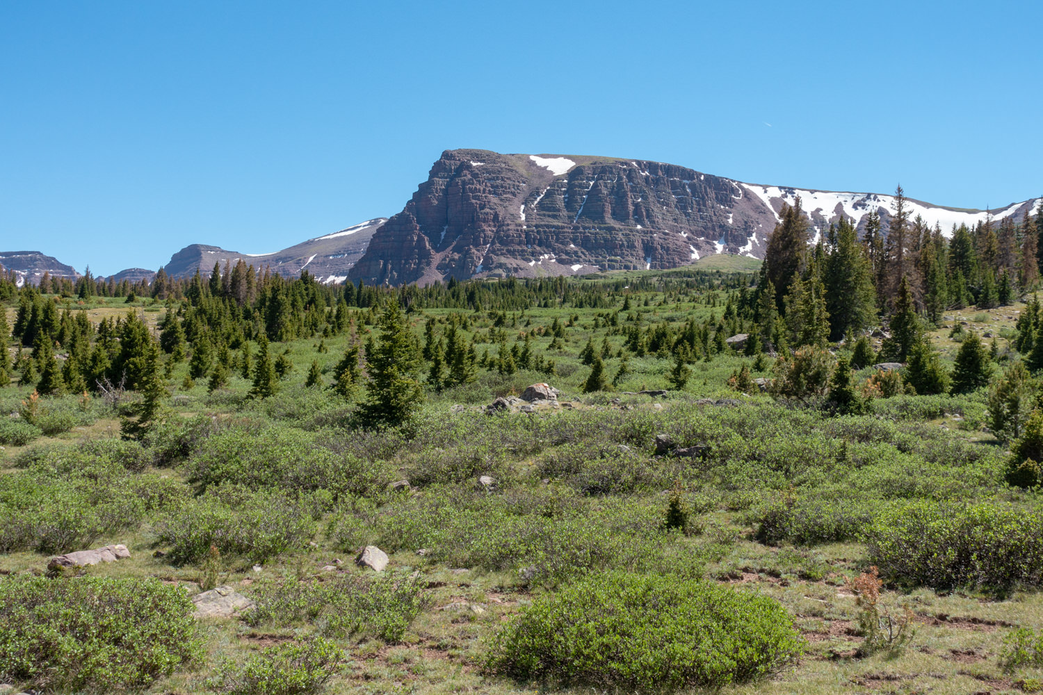
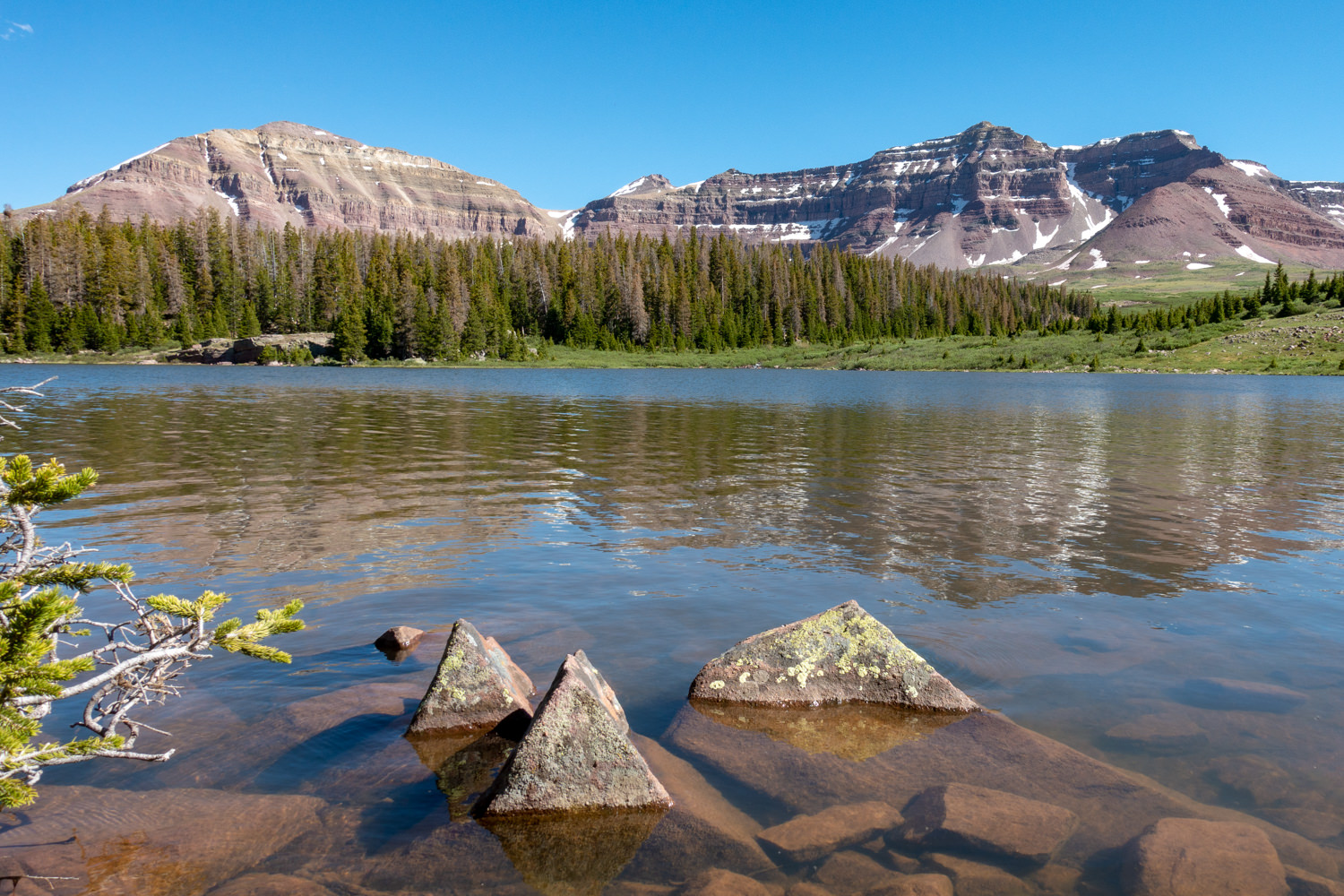
More Henry’s Fork Photos
More Information
We hope this guide helps you plan an awesome backpacking trip in the High Uintas Wilderness. If you found this guide helpful, please share on social media and give us a digital high five by clicking the little red heart below!
For more popular CleverHiker content, check out the following links:
Some of the links on this page are affiliate links, which means we may receive a small commission if purchases are made through those links. This adds no cost to our readers and helps us keep our site up and running. Our reputation is our most important asset, which is why we only provide completely honest and unbiased recommendations.