The Wind River Range in Wyoming is a place you truly have to see to believe. It’s an outdoor adventurer’s dream come true. Immense glacier-carved granite spires tower over crystal-clear lakes, rolling meadows, and fields blanketed by high-alpine wildflowers. It’s one of the most stunningly beautiful places we’ve ever seen. If you haven’t been to Wyoming’s Wind River Range, start planning a trip there now.
The Cirque of the Towers is one of the most iconic and easily accessible stretches of the Wind River Range and this 3-day itinerary is just barely enough to get a taste but fits well into an (extra) long weekend.
Highlights
- No permits
- Jaw-dropping Views
- Easily Accessible
- Seasonal Wildflowers
- Immense Glacial-Carved Granite
- Pristine Lakes & Rivers
- Excellent Backcountry Fishing
Lowlights
- Some Extremely Steep Climbs & Descents
- Some “Off-trail” Navigation
- No Campfires
- Seasonal Bugs & Snow
Best Time To Travel
In general July-September is the best time to travel to this area. Snowpack is a key factor for trip planning in the Winds. Some years a heavy winter snowpack and early season storms will keep trails covered in snow well into July. In warmer years with lighter snowpack, June backcountry trips are possible. The same is true for autumn hiking – some years early snowstorms make this area inaccessible and other years it’s passable (but perhaps cold) into October.
July and August are usually great for wildflowers. That’s also the time when mosquitoes and biting flies will be the worst, though. So use a combination of permethrin on your clothing and a small amount of 30% DEET on exposed areas for full protection. Mid-August to mid-September is generally a great window for this area as well because crowds will be minimal and bugs will be gone.
Afternoon showers are common during the summer months in the Winds and thunder and hailstorms are also not out of the ordinary. There is a year-round possibility of snow here, so pay close attention to the weather and be prepared for any change in conditions.
Difficulty
Difficulty depends on your experience, physical fitness, pack weight, & weather conditions. This is not a technically demanding hike, but there are a few good climbs and some basic off-trail navigation along the way. For most people, this loop is moderately difficult. Some sections are quite easy, and some sections are a little tricky and physically demanding.
As always, the heavier your backpack is, the harder your hike will be. So do yourself a favor and pack light. For lightweight hiking tips and gear recommendations, check out our Lightweight Basics Video Series and Gear Guides.
Route Summary
This loop starts and ends at the Big Sandy Trailhead. A very small portion of this loop requires backtracking, so you’re on a new trail for the majority of your trip, which is ideal.
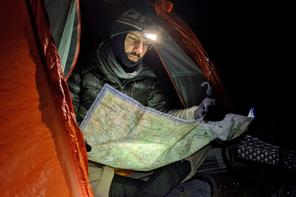
The total distance of the loop is about 24 miles, making it a great 2-4 day trip depending on your hiking style and fitness. Part of this loop (the section over Texas Pass) is technically “off trail,” so the exact distance of the loop is tough to pin down. The “off-trail” section is not marked on the map, but there is a trail and rock cairns to follow. The route along the off-trail section is not always as easy to follow as the official trail, but it is still well defined. That said, I’d definitely carry a good map and compass and know how to use them.
Big Sandy Trailhead (9,100 Ft) To Shadow Lake (10,300 Ft) – 10.9 Miles
Gradually gain 1,200ft of elevation through gentle and picturesque terrain. Pass by Mirror Lake, Dad’s Lake, and Marm’s Lake before making the turn-off to Shadow Lake. There are ample opportunities for camping and side trips along this less-traveled side of the loop.
Shadow Lake (10,300 Ft) To Texas Pass (11,500 Ft) – About 2 Miles
After Shadow Lake, the official trail ends, and you’ll travel “off trail.” There is still a faint “goat” trail to follow, but keep your wits about you. Travel along the North side of Shadow Lake and make a short climb to Billy’s Lake (unnamed on the map). Travel along the northwest side of this lake and continue up the valley. Continue your gradual climb to Barren Lake (also unnamed on the map). Pass along the southern edge of this lake to find the fourth lake in this series, Texas Lake (unnamed as well). From Texas Lake (10,750 ft) you’ll have a short but steep climb south to the top of Texas Pass (11,500 ft).
Texas Pass (11,500 Ft) To Lonesome Lake (10,200 FT) – About 1 mile
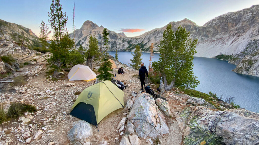
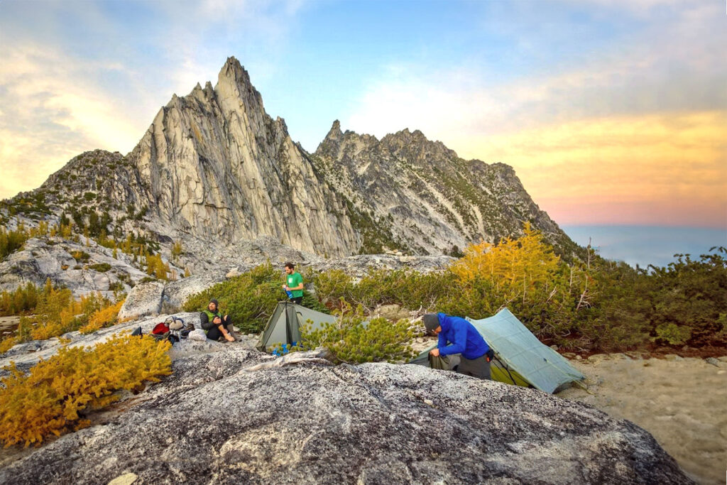
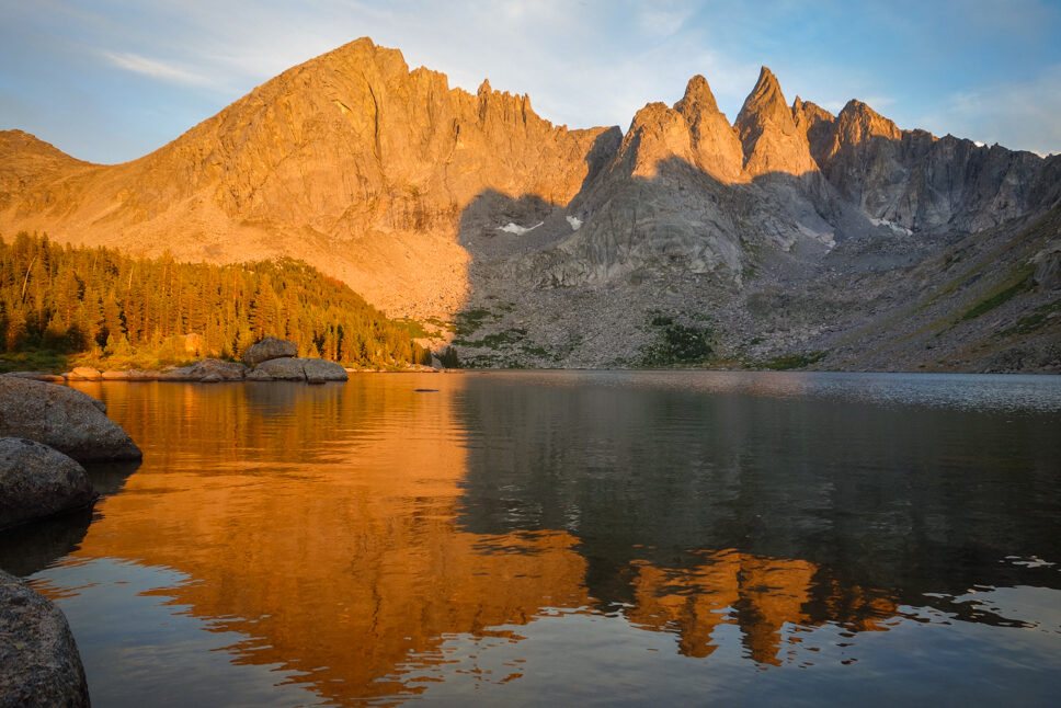
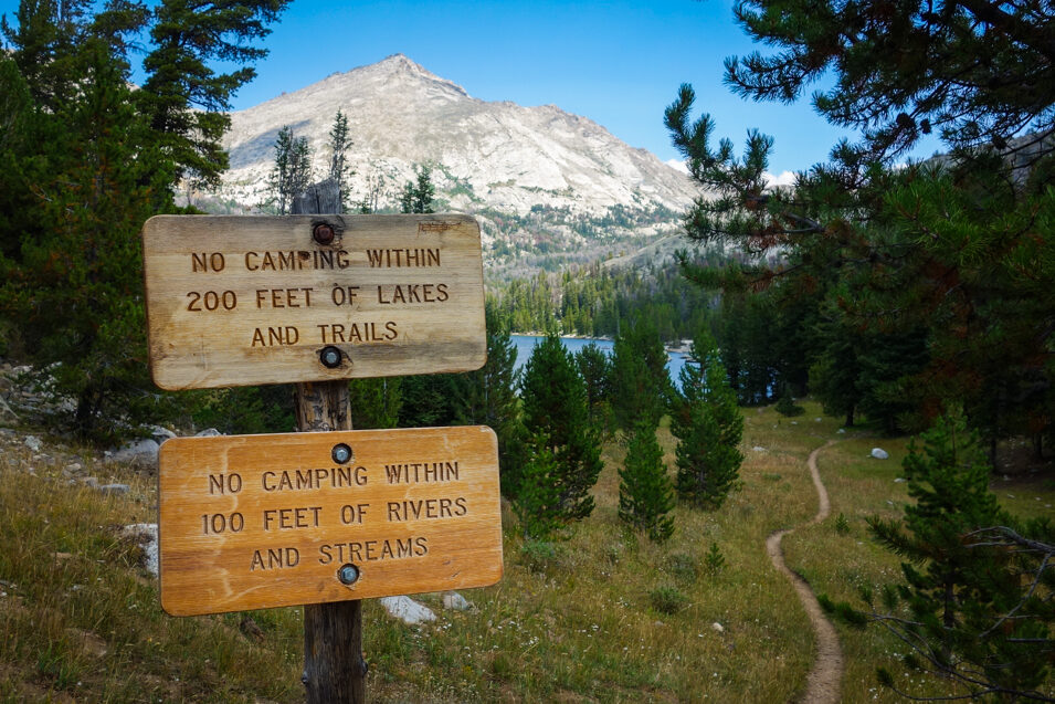
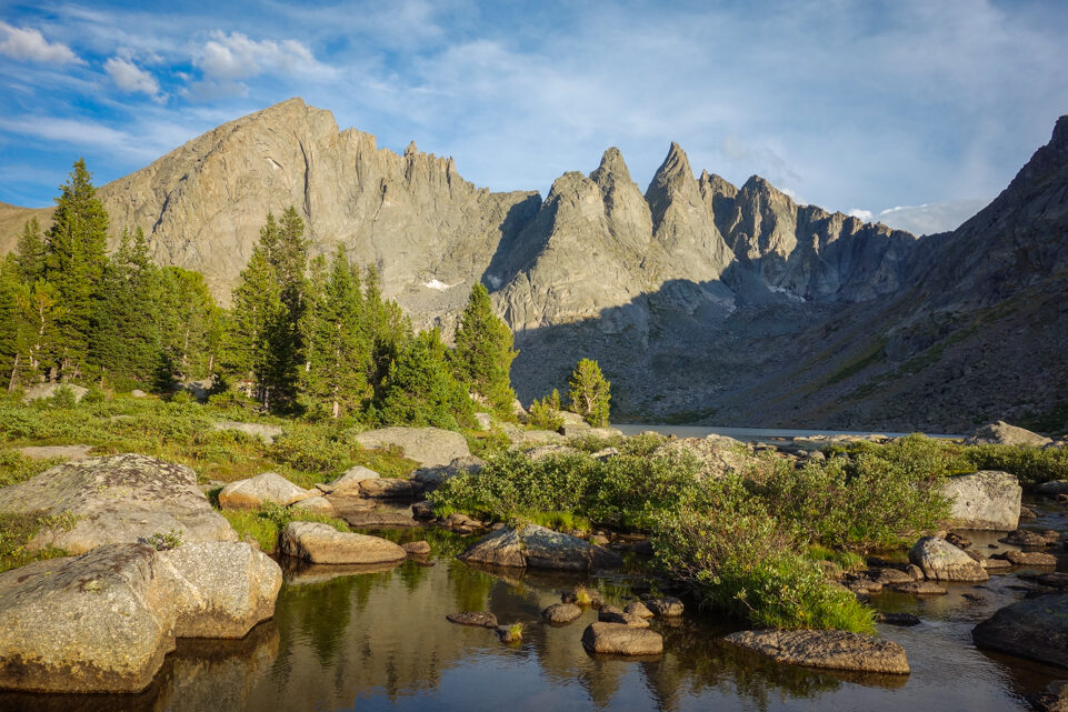
From the top of Texas Pass, you’ll get your first view of the Cirque of the Towers. Pingora Peak, a popular climb, is the large spire set in front of the Cirque. Descend along the loosely marked trail towards the western shore of Lonesome Lake. There is no camping allowed within ¼ mile of Lonesome Lake.
The main camping area for the Cirque is located a short climb above Lonesome Lake to the southwest. There are lots of little loose unmarked trails throughout this picturesque area where campsites (and campers) are common. For a short sidetrip, head east along the official trail to Lizard Head Meadows (about 2 miles).
Lonesome Lake (10,200 FT) To Jackass Pass (10,750 Ft) – About 1 Mile
The official trail can be found to the east of Lonesome Lake and makes a moderate ascent to Jackass Pass. If you camp in the area above Lonesome Lake to the southwest, there is an alternate route that goes to a lower unmarked pass to the southwest of Jackass Pass. This is the most common route for those camping in the Cirque. After crossing the unmarked pass, the trail boulder hops along the west side of Arrowhead Lake (the official trail is on the east side) and meets up with the official trail south of Arrowhead Lake.
Jackass Pass (10,750 Ft) To Big Sandy Lake (9,700 Ft) – About 2.4 Miles
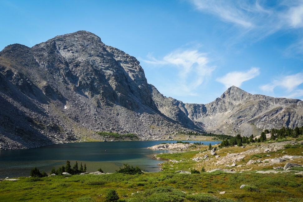
From Jackass Pass (or the lower unmarked pass to the southwest) the well-marked trail descends and eventually hits a series of switchbacks that lead down to Big Sandy Lake. Big Sandy is a picturesque and easily accessible lake, making it a popular choice for camping. It is a good spot for setting up a basecamp for day trips in the surrounding area, but it is far from secluded.
Big Sandy Lake (9,700 Ft) To Big Sandy Trailhead (9,100 Ft) – 5.6 Miles
The walk from Big Sandy Lake is well-traveled and gentle. For a less traveled and more picturesque route, take the trail that goes to Diamond Lake and V Lake. This route will add .4 miles and no elevation gain to your trek. There are a couple of decent camping opportunities along this route as well.
Getting There
The Big Sandy Trailhead is where this loop hike starts and ends. This is a popular trailhead because it’s the best access point for the Cirque of the Towers and Pyramid Lake. Getting to this trailhead will require 27 miles of dirt road driving. The last 10 miles are pretty rough with lots of potholes. Our low-riding sedan made it to the trailhead, but it was slow going.
Be sure to have maps downloaded on your phone to use in airplane mode or take screenshots and write down the directions to the Big Sandy Trailhead. Although there are signs to the trailhead/campsite, it can still be confusing, and you won’t have any phone signal once you get out there.
Solitude
The Cirque of the Towers is one of the most popular destinations in the Wind River Range. You won’t be alone on this route. It is also a popular climbing area.
While the traffic in the Cirque can be heavy at times (summer weekends in particular), the terrain is good for tucking away a tent in a hidden camp spot, so you won’t feel like you’re camping on top of other hikers.
In addition, the first section of this loop (Big Sandy to Shadow Lake) sees a lot less traffic. Many other routes are accessed through Big Sandy. We didn’t feel overwhelmed by the number of other hikers and climbers, and the scenery is well worth it. If you’re looking for complete solitude, there are less popular trails out there, but on the whole, there are many, many moments of quiet to be found.
Elevation
The Wind River Range runs along the Continental Divide and boasts some high elevations. The highest point on this loop is Texas Pass at 11,500 feet above sea level. Even the low point along this trip (Big Sandy Trailhead) is at 9,100 feet, so you’ll be at high elevation for the duration of the trip.
Know the symptoms of altitude sickness and know what to do if you encounter it. It’s never a good idea to travel from a low elevation to a high elevation like this without a few days to acclimate. Check out our high elevation hiking and lightning storms guide for more info.
Regulations
- Groups of 15 or fewer
- No camping within ¼ mile of Lonesome Lake (the lake is contaminated according to the EPA, please pack out your poop and drink water from sources other than Lonesome Lake and its outlet)
- No camping within 200ft of lakes and trails
- No campfires
- No biking
- No motor vehicles or motor tools
- No damaging live vegetation
- LNT – If you pack it in, pack it out
Maps & Guidebooks
- Hiking Wyoming’s Wind River Range – This is an excellent book with pictures, highlights, and detailed descriptions of hiking trails throughout the Winds. It’s not specifically designed for backpacking trips, but it does reference good multi-day trips and tells you how to string together hiking trails for longer trips. This is a very useful book that I highly recommend for this trip and others.
- Wind River South Range Map – We chose this map over the Southern Wind River Range Hiking Map because it was made more recently, is more durable, has shaded topo relief, and is easier to read. It’s an excellent map that I highly recommend.
- FarOut App – Continental Divide Trail Wyoming – Cirque of the Towers is a recognized alternate route along the Continental Divide Trail so it appears in the FarOut CDT guide. Though the entire Wyoming section of this app covers far more than you need for this particular trip, you benefit from all of the waypoints and comments left by CDT thru-hikers from earlier in the season.
Water
Water is plentiful along this trail and is easily accessible from lakes and streams. Carry enough water to get from one source to the next, as well as a lightweight water purifier (see guide to the best water filters).
Bear Spray & Food Storage
There are bears in the Wind River Range – both grizzly bears and black bears. So protection and food storage are critical. Other people can be a blessing and a curse. On the one hand, the voices and sounds of passing backpackers may keep bears away from the immediate trail corridor. However, more people equals more food and increases the likelihood that someone near you will be storing it improperly. It’s better to take the correct precautions just in case.
We carried bear spray when hiking in the Winds because there are grizzly bears in the area. We knew it was highly unlikely that we would see any, but if we did, we wanted to be prepared to protect ourselves. Bear spray is an essential item when hiking in grizzly country. The chances of a negative encounter are rare, but it can save your life if you have it and know how to use it.
Food storage is another important consideration. Make sure you know how to hang a bear bag properly or carry a food storage container. Bear canisters and Ursacks are the most effective storage methods and the easiest to use. There are no food storage requirements for this area, but you should always store your food properly. That will protect against bears and keep small critters from chewing through your spendy backpacking gear.
Gear List
Make sure to check out our Ultimate Backpacking Checklist, so you don’t forget something important.
Below you’ll find our current favorite backpacking gear. If you want to see additional options, our curated gear guides are the result of many years of extensive research and hands-on testing by our team of outdoor experts.
BACKPACK
- Best Backpacking Pack Overall: Gregory Paragon 58 – Men’s / Gregory Maven 58 – Women’s
- Best Ultralight Backpacking Backpack: Hyperlite Mountain Gear Unbound 40
- More: Check out our best backpacking backpacks guide for ultralight and trekking options
TENT
- Best Backpacking Tent Overall: Big Agnes Copper Spur HV UL2
- Best Ultralight Tent: Zpacks Duplex
- Best Budget Tent: REI Half Dome 2
- Best Tent Stakes Overall: All One Tech Aluminum Stakes
- More: Check out our best backpacking tents guide for more options
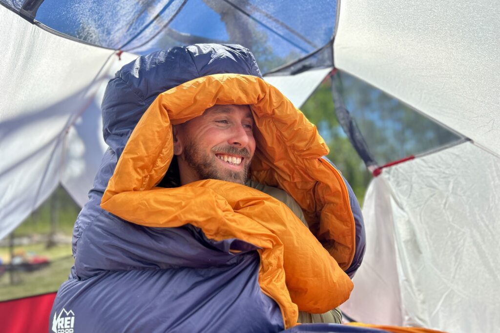
SLEEPING BAG/QUILT
- Best Sleeping Bag Overall: Men’s Feathered Friends Swallow YF 20 / Women’s Feathered Friends Egret YF 20
- Best Quilt Overall: Enlightened Equipment Revelation 20
- More: Check out our best backpacking sleeping bags guide and best backpacking quilts guide for more options
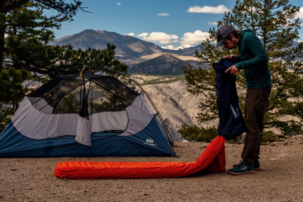
SLEEPING PAD
- Best Sleeping Pad Overall: NEMO Tensor All-Season
- Best Foam Sleeping Pad: NEMO Switchback
- More: Check out our best backpacking sleeping pads guide for ultralight and trekking options
CAMP KITCHEN
- Best Backpacking Stove Overall: MSR PocketRocket 2
- Best Backpacking Cookware Overall: TOAKS Titanium 750ml
- Best Backpacking Coffee Overall: Starbucks VIA
- More: Check out our best backpacking stoves guide and best backpacking cookware guide for ultralight and large group options
WATER & FILTRATION
- Best Water Filter Overall: Sawyer Squeeze
- Best Hydration Bladder Overall: Gregory 3D Hydro
- Best Backpacking Water Bottles: Smartwater Bottles
- More: Check out our best backpacking water filters guide and best backpacking water bottles guide for ultralight and large group options
CLOTHING
- Best Hiking Pants Overall: Men’s Outdoor Research Ferrosi / Women’s The North Face Aphrodite 2.0
- Best Hiking Shorts Overall: Men’s Patagonia Quandary / Women’s Outdoor Research Ferrosi
- Best Women’s Hiking Leggings: Fjallraven Abisko Trekking Tights HD
- Best Rain Jacket Overall: Men’s Patagonia Torrentshell 3L / Women’s Patagonia Torrentshell 3L
- Best Rain Pants: Men’s Patagonia Torrentshell 3L / Women’s Patagonia Torrentshell 3L
- Best Down Jacket Overall: Men’s Patagonia Down Sweater Hoodie / Women’s Patagonia Down Sweater Hoodie
- Best Fleece Jacket Overall: Men’s Patagonia Better Sweater / Women’s Patagonia Better Sweater
- Best Sunshirt Overall: Men’s Outdoor Research Echo / Women’s Outdoor Research Echo
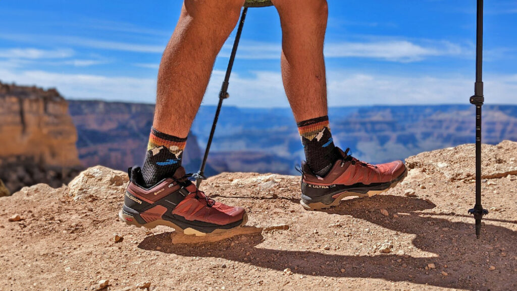
- Best Socks Overall: Men’s Darn Tough Light Hiker Micro Crew / Women’s Darn Tough Light Hiker Micro Crew
- Beste Ultralight Liner Glove: Patagonia Capilene Midweight Liner
- More: Check out our best backpacking apparel lists for more options
FOOTWEAR & TRACTION
- Best Hiking Shoes Overall: Men’s HOKA Speedgoat 6 / Women’s HOKA Speedgoat 6
- Best Hiking Boots Overall: Men’s Salomon X Ultra 5 GTX / Women’s Lowa Renegade Evo GTX
- Best Hiking Sandals Overall: Men’s Chaco Z/1 Classic / Women’s Chaco Z/1 Classic
- Best Camp Shoes Overall: Crocs Classic Clogs
- Best Traction Device for Hiking Overall: Kahtoola MICROspikes
- More: Check out our best backpacking footwear lists for more options
NAVIGATION
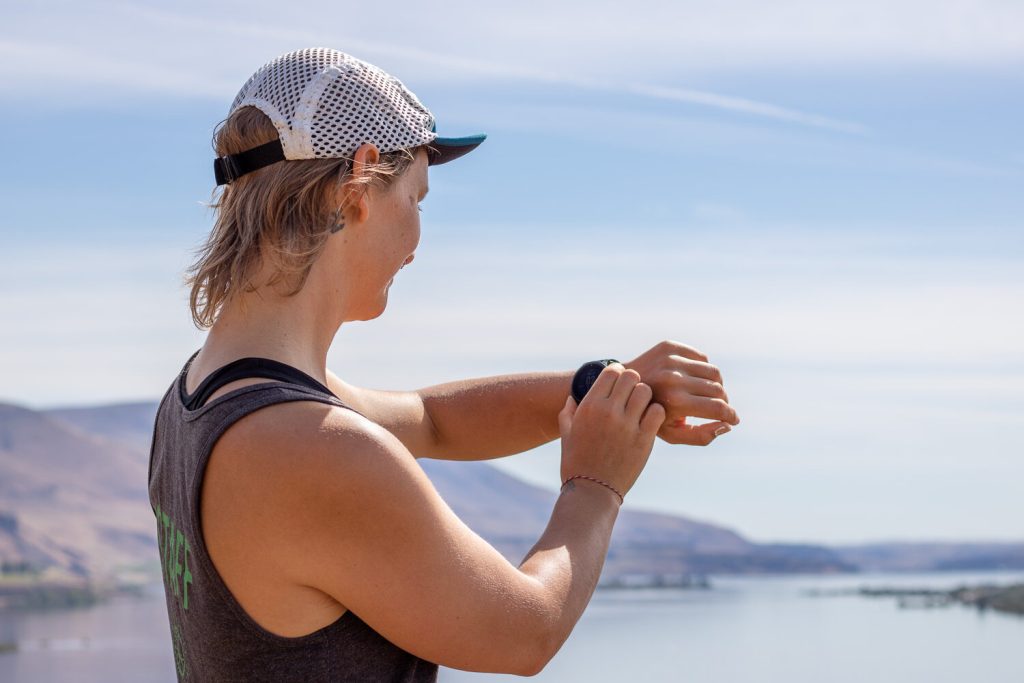
- Best GPS Watch Overall: Garmin Instinct 2 Solar
- Best Personal Locator Beacon (PLB): Garmin inReach Mini 2
- More: Check out our article How to Use Your Phone as a GPS Device for Backpacking & Hiking to learn more
FOOD
FIRST-AID & TOOLS
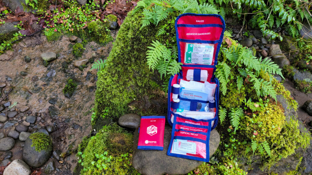
- Best First-Aid Kit Overall: Adventure Medical Kits Ultralight/Watertight .7
- Best Pocket Knife Overall: Kershaw Leek
- Best Multitool Overall: Leatherman Wave+
- Best Headlamp Overall: Black Diamond Spot 400-R
- Best Power Bank Overall: Nitecore NB 10000 Gen 3
- More: Check out our best first-aid kit guide, best pocket knife guide, best multitool guide, best backpacking headlamps guide, and best power banks guide for more options
MISCELLANEOUS
- Best Trekking Poles Overall: Black Diamond Pursuit
- Best Backpacking Chair Overall: REI Flexlite Air
- Best Backpacking Stuff Sack Overall: Hyperlite Mountain Gear Drawstring
- More: Check out our best trekking poles guide, best backpacking chairs guide, and best stuff sacks guide for more options
Additional Resources
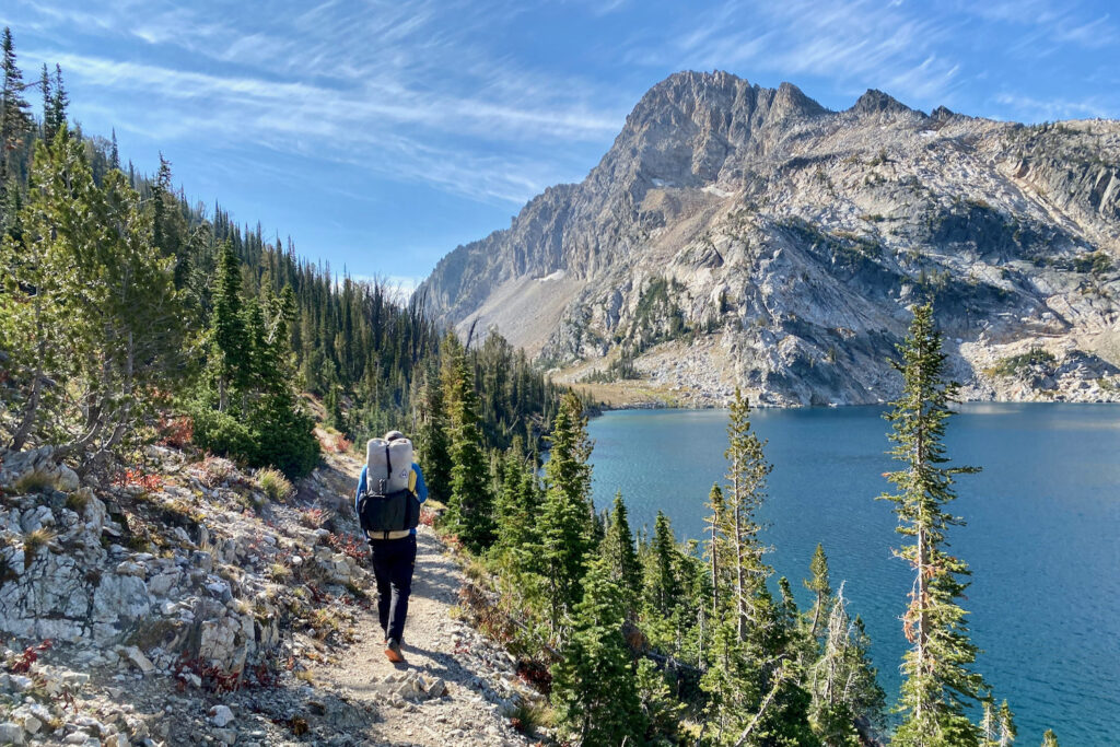
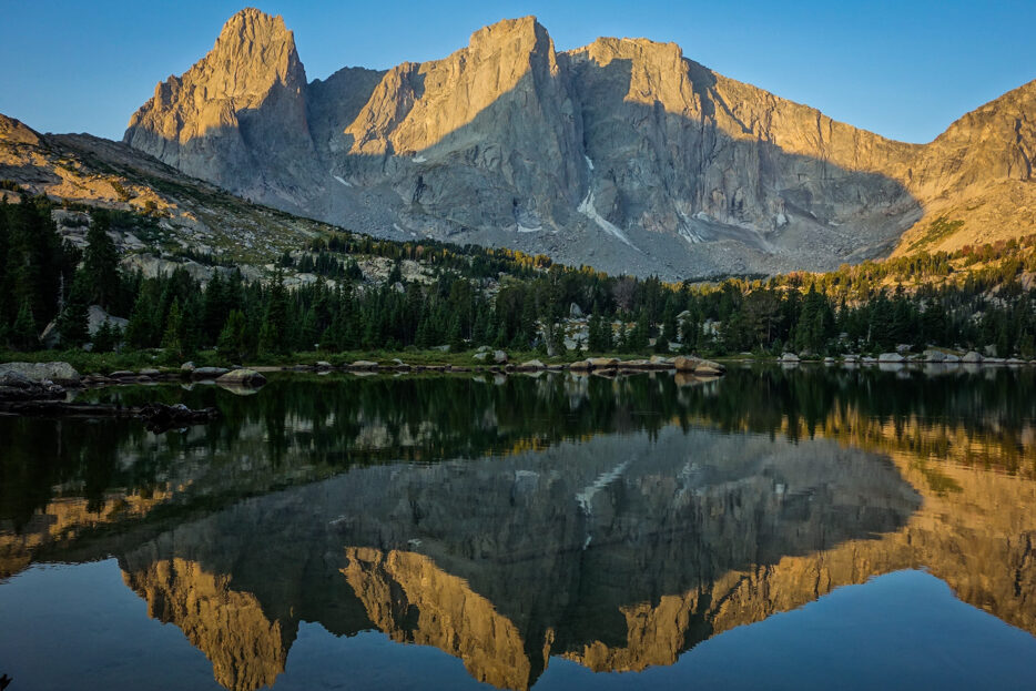
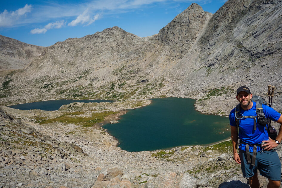
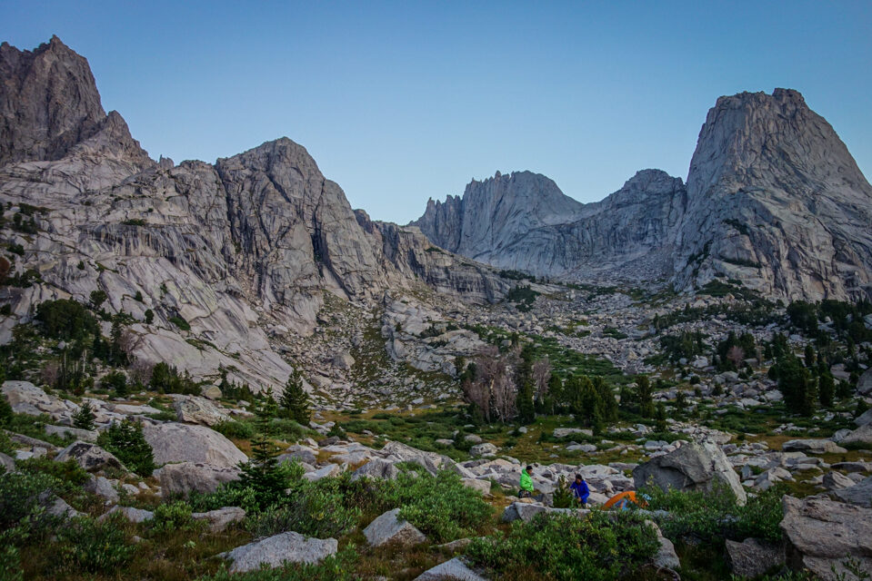
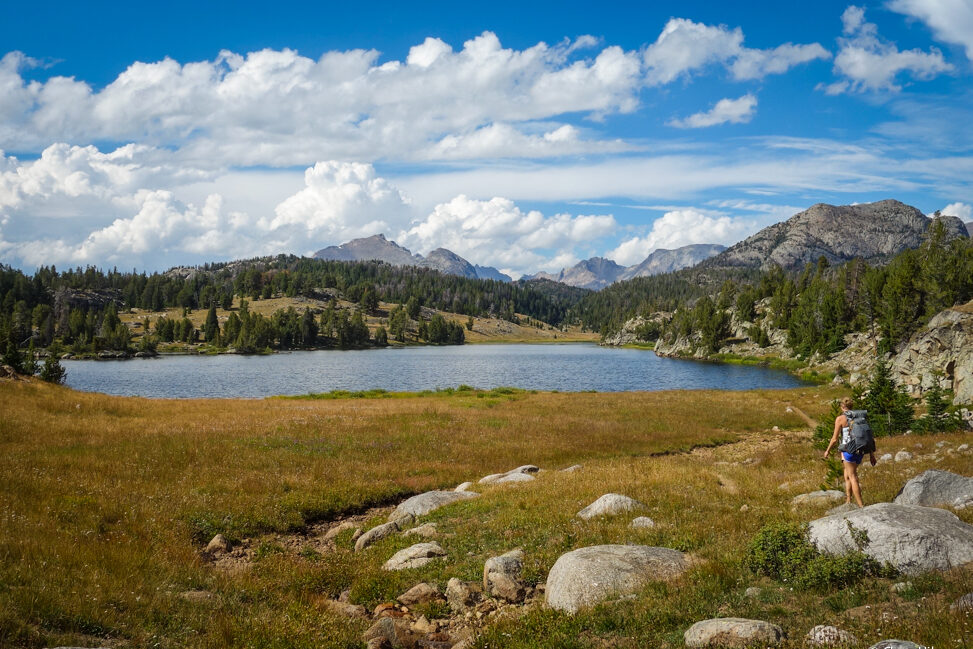
the granite and glittery lakes is favorite of ours. – photo credit: dave collins (cleverhiker.com)
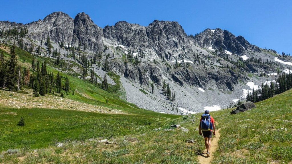
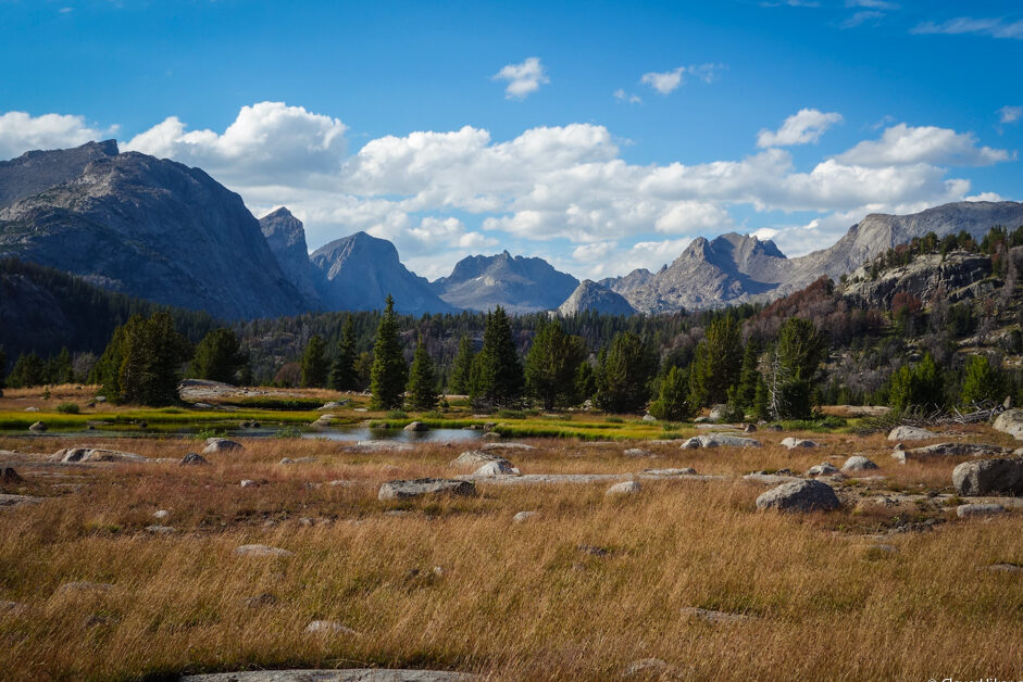
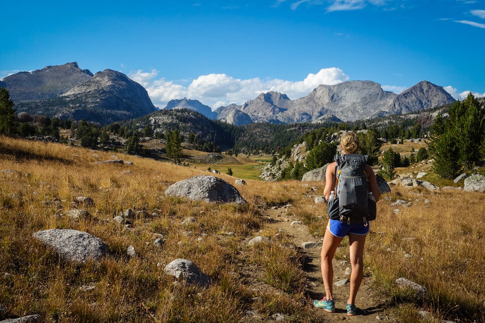
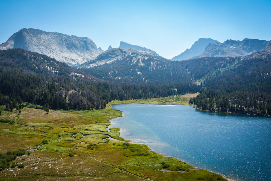
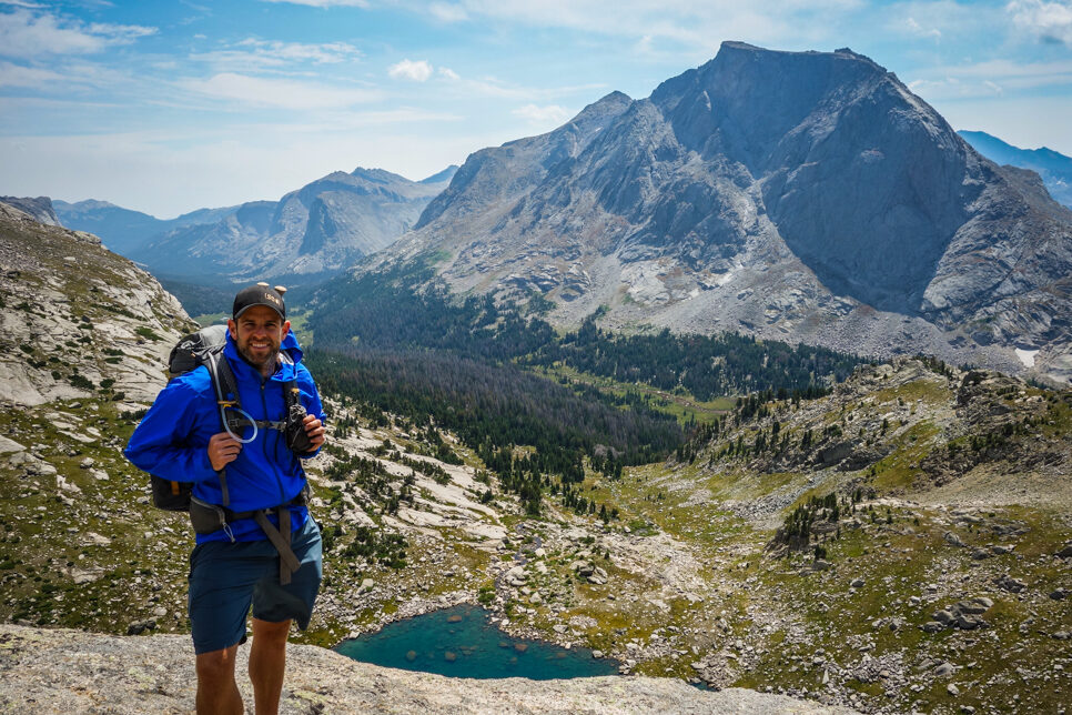
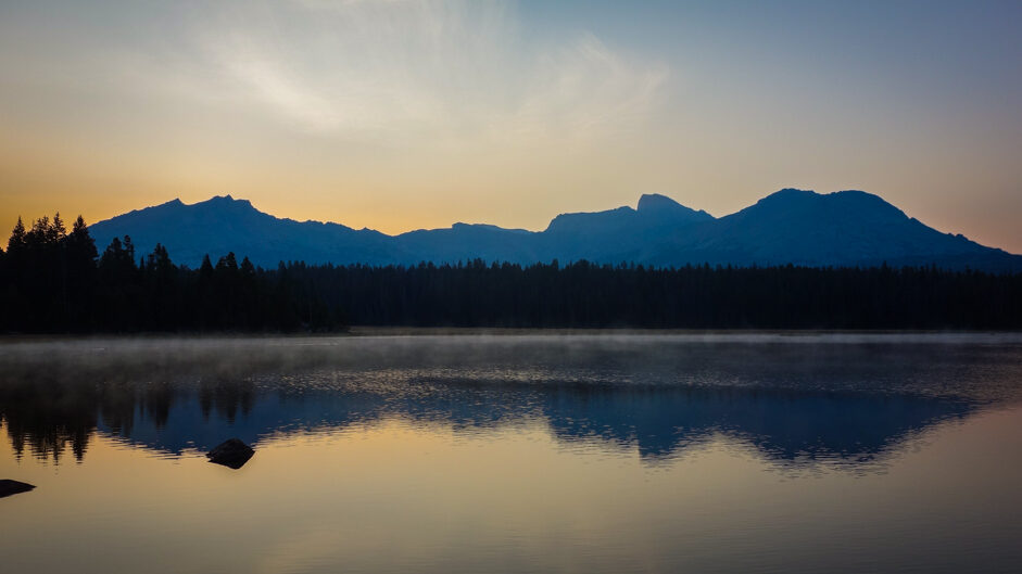
even the gradual approach is at 9000 ft. – photo credit: dave collins (cleverhiker.com)
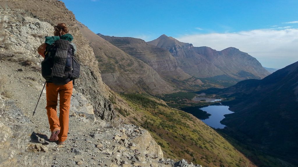
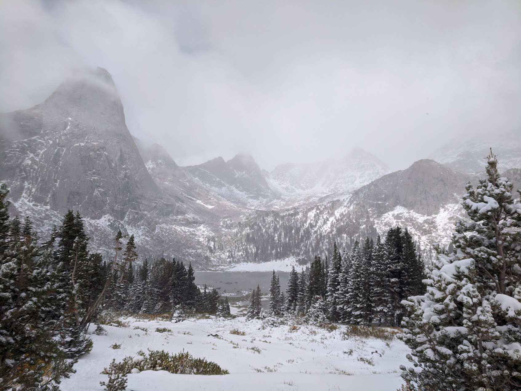
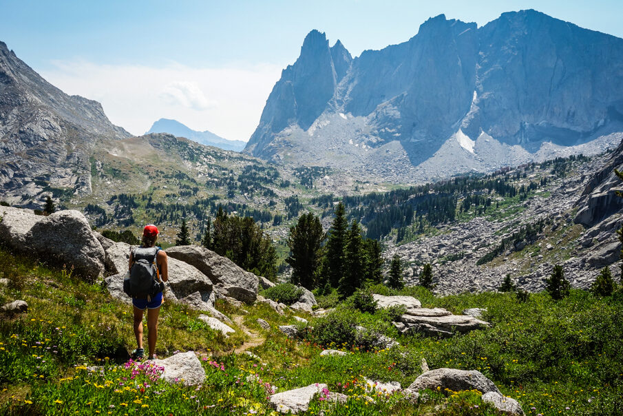
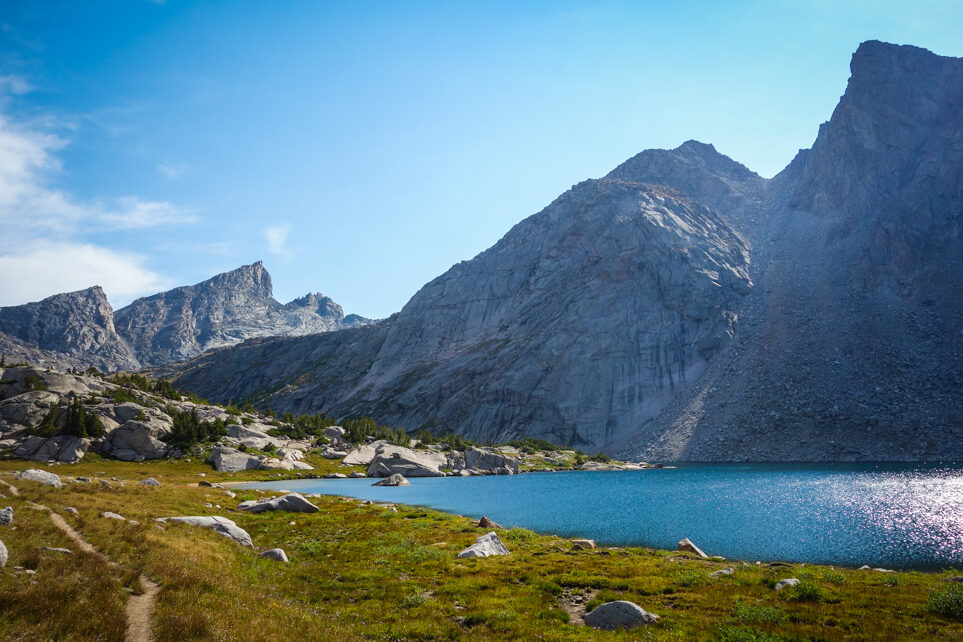
lonesome lake is stunning and no camping is allowed. We also suggest packing out your #2 because of the contamination problems the area is having. – photo credit: dave collins (cleverhiker.com)
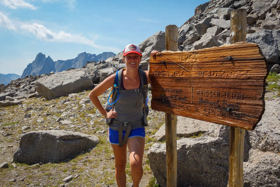
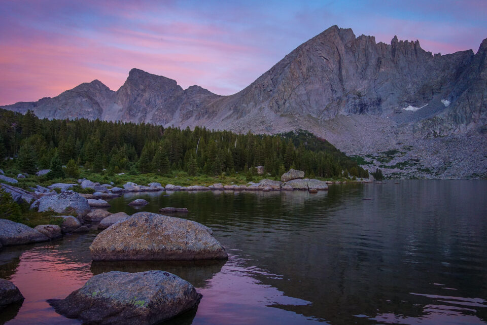
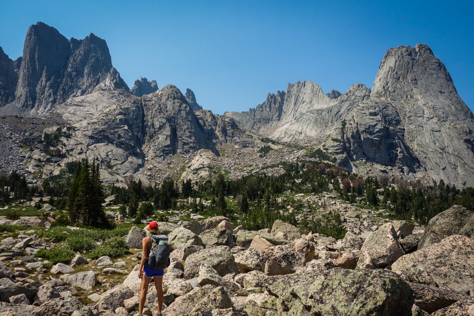
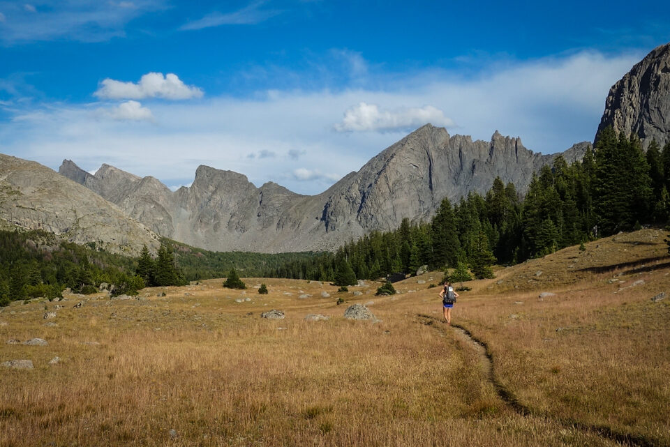
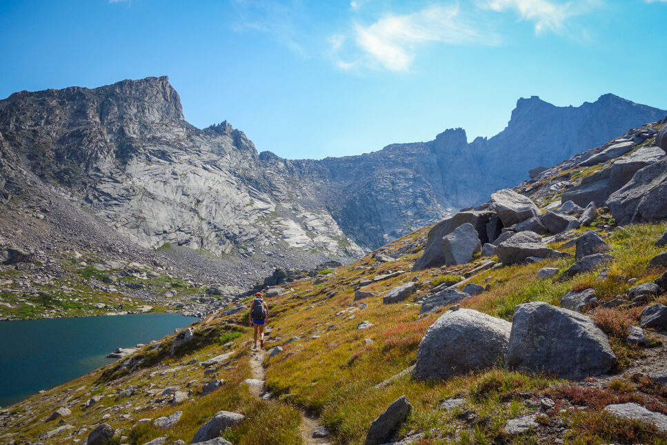
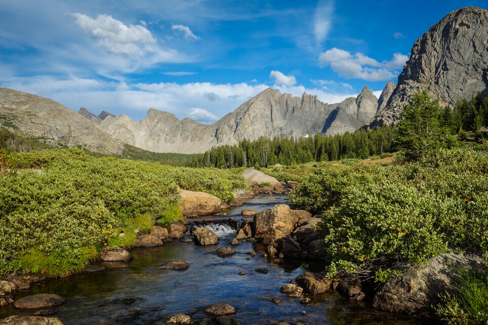
stunning granite and lakes are a dime a dozen in the winds. – photo credit: dave collins (Cleverhiker.com)