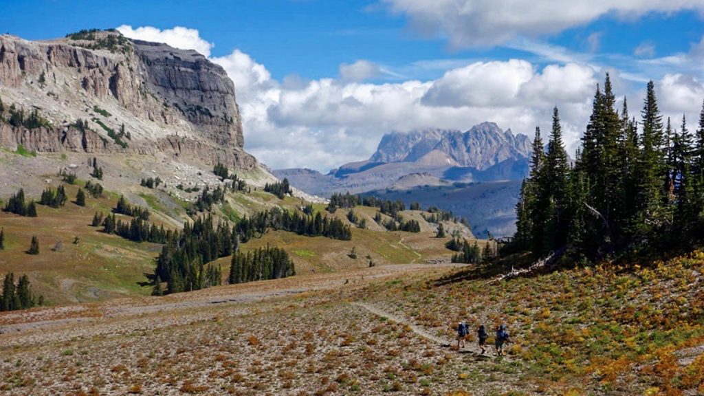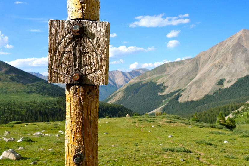
Backpacking the San Juan Mountains in Southern Colorado is a special experience. This trip guide outlines a 60-mile backpacking loop through the Central San Juans via Vallecito Reservoir – a route that’s remote, physically demanding, and packed with beauty.
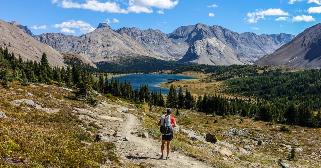
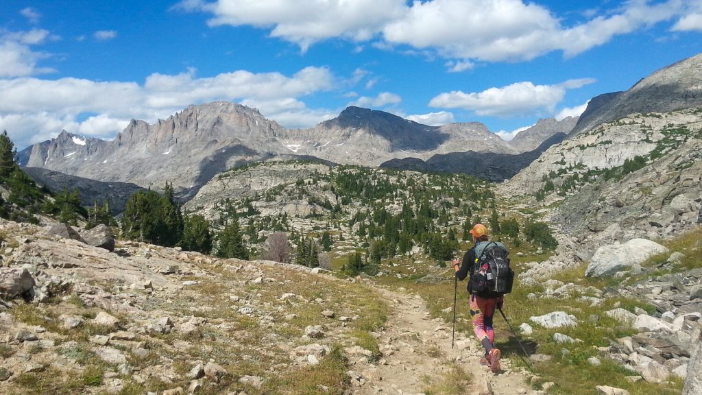
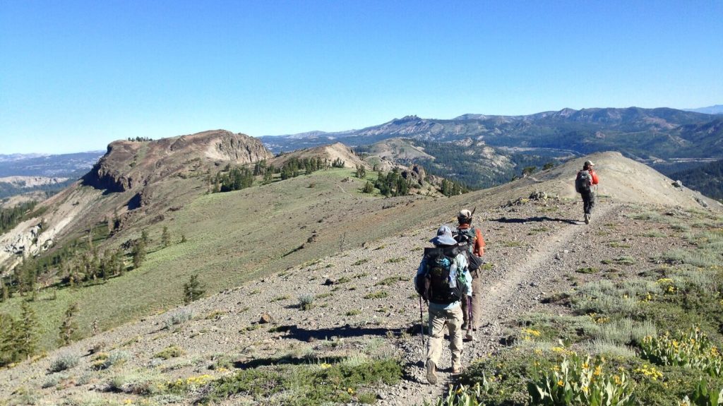
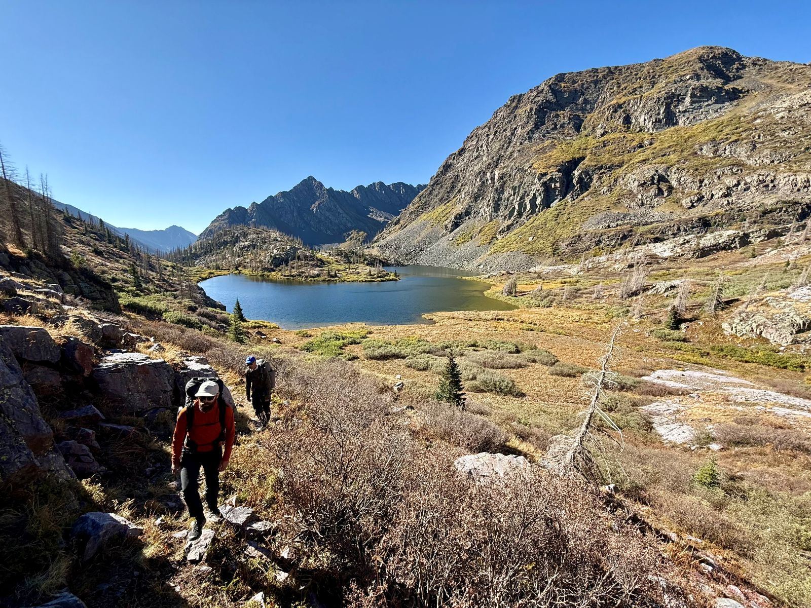
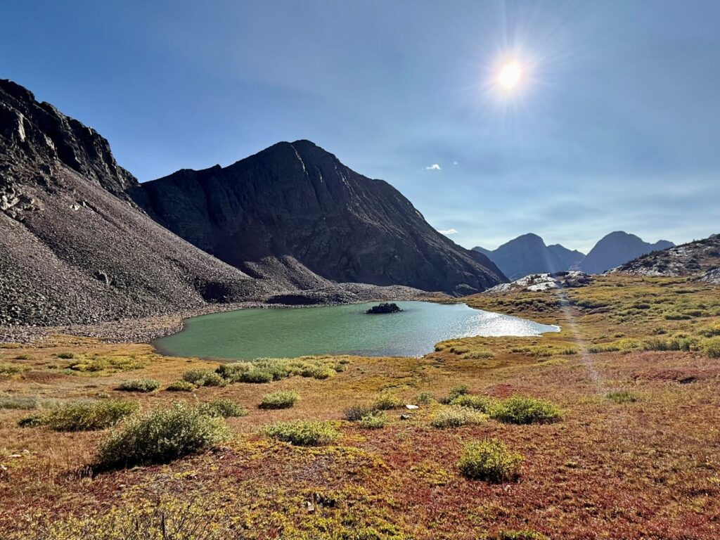
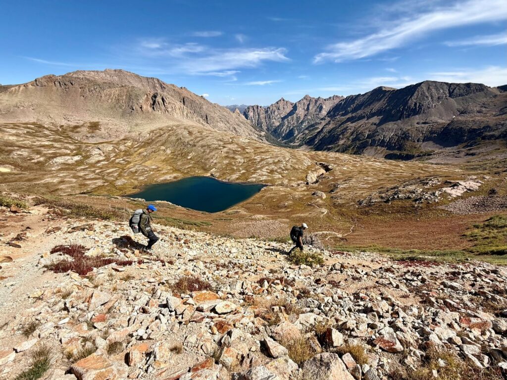
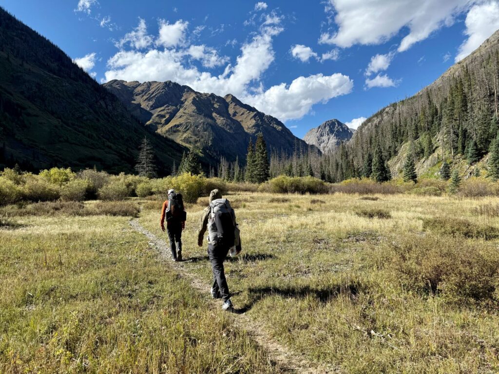
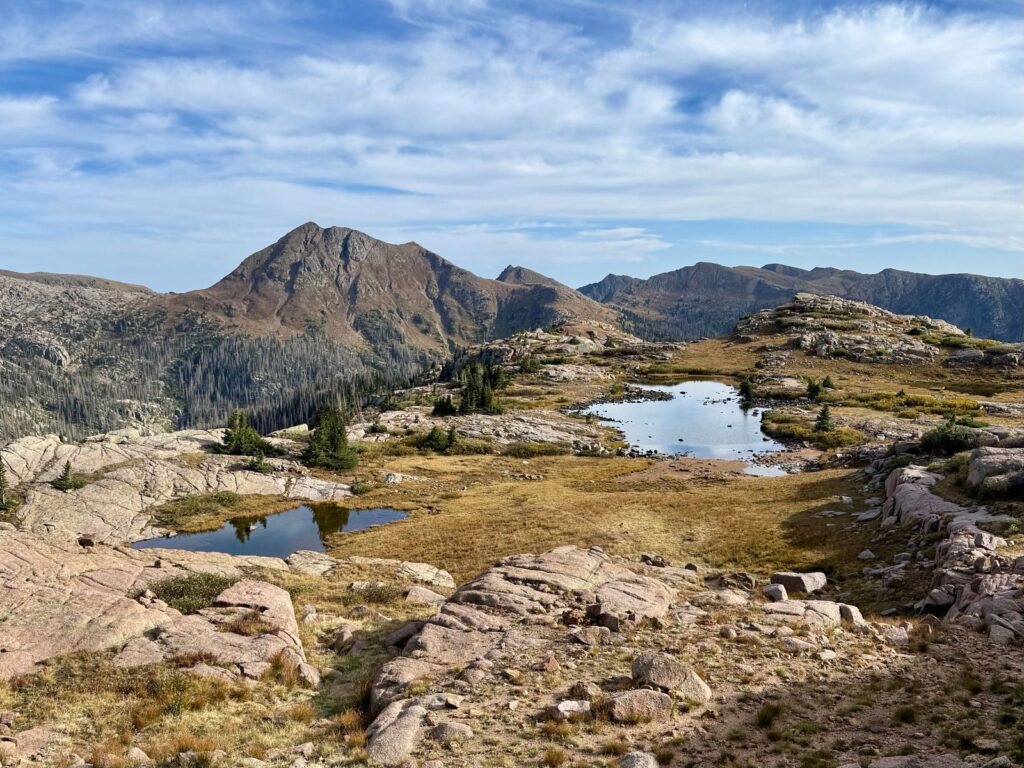
The Vallecito Reservoir Loop (for lack of a better name) links some of the most spectacular alpine lakes, high passes, and remote ridgelines in the San Juan National Forest. The loop begins on the east side of Vallecito Reservoir, climbs up the Pine River drainage past Emerald Lake, winds deep into the Weminuche Wilderness, and eventually circles back along Columbine Pass, Silver Mesa, and Endlich Mesa before dropping back down to the reservoir.
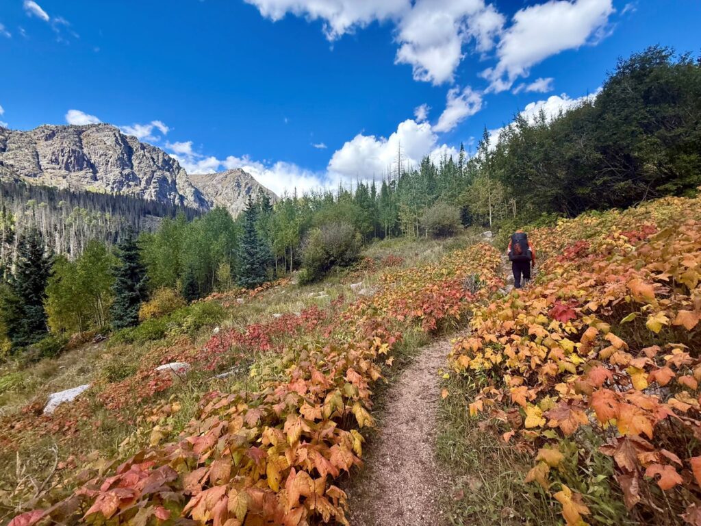
We hiked this loop in mid-September over four days and three nights, covering about 65 miles and 14,000 feet of elevation gain. That’s a lot of ground in a short amount of time—most backpackers will want to take longer—but the reward was enormous. We found pristine alpine lakes, sweeping mountain vistas, clear running water, and very few people. Outside of a few hunters, we had long stretches of complete solitude.
Trails are generally well-graded and maintained, but there are exceptions. A stretch of Silver Mesa after Trimble Pass requires cairn-to-cairn navigation. And the descent from Miller Mountain on the Endlich Mesa Trail is faint, overgrown, and riddled with blowdowns—you’ll need patience and solid navigation skills to get through. A GPS track is absolutely essential here. (We provide one below to download.)
For experienced backpackers looking for a challenging route with big payoffs, this loop delivers. Thru-hikers on the Continental Divide Trail often rank this stretch as a highlight of the entire trail. After hiking it, we can see why. For us, it was the perfect mix of pushing hard, reconnecting with close friends, and soaking up some of the most dramatic wilderness Colorado has to offer.

Quick Facts
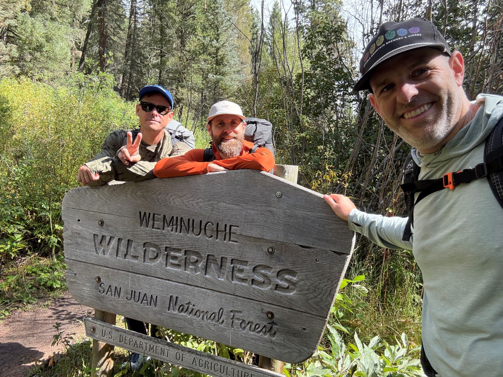
- Location: San Juan National Forest/Weminuche Wilderness near Durango, CO
- Trailheads: Start at Pine River Trailhead, end near Vallecito Lake Event Center. Shuttle or vehicle shuttle required.
- Distance: 55-65 miles (with alternate loop and out-and-back options of varying lengths – see Route Options section below)
- Days Needed: 4-7 days
- Best Travel Time: July – Mid-September
- Permits: None
- Campsites: dispersed camping only
- Water sources: Reliable streams and lakes throughout most of the loop, except for a long dry stretch on Endlich Mesa. Water treatment essential — see Water Sources section.
- Dogs: Allowed but must be on leash or under voice control (varies by section)
- Maps/Navigation: Topo Maps+ app (iOS), Gaia GPS (Android/iOS), and Caltopo Weminuche Wilderness Map. A full GPS track download is highly recommended.
- Google Map Link: Google Map Overview
- Difficulty: Very strenuous
Highlights
- Gorgeous alpine lakes (Emerald, Rock, Moon, Twin, Ute, etc.)
- Expansive high mountain views across rugged terrain
- Strong variety of scenery — from lush river valleys to alpine passes to airy mesas
- Wildlife viewing (elk, deer, bald eagles, black bears, foxes, mountain lions, etc.)
- Excellent solitude later in the season (September and beyond)
- Beautiful wildflowers in July and August
- Brilliant fall colors around Vallecito Reservoir and in higher meadows (late September/early October)
- Generally well-graded trails that make big climbs more manageable
- Clean, clear mountain water along most of the route
- Remote feel with few access points once deep in the loop
- Lots of trail connections and alternate options (including the Continental Divide Trail and Vallecito Creek Trail)
Lowlights
- Very strenuous mileage and elevation gain (depending on route choice)
- Overgrown, faint, and blowdown-heavy trail south of Miller Mountain on the Endlich Mesa route
- A few unmarked trail junctions can cause missed turns without GPS
- Long dry stretch after City Reservoir across Endlich Mesa — must carry water
- Afternoon thunderstorms are common in July and August (lightning, hail, heavy rain)
- High-altitude challenges: headaches, restless sleep, and altitude sickness are possible for those not acclimated
- Exposure above treeline leaves hikers vulnerable to storms and sun
- Campsites not abundant in alpine areas — planning ahead is important
- Very remote — rescues and bailouts are difficult; carrying a Garmin inReach Mini or similar satellite device is recommended
Best Time to Travel
The best time to backpack the Vallecito Reservoir loop is mid-July through mid-September, once high snow has melted. Snowpack timing varies year to year, and some seasons may allow earlier trips.
- Wildflowers: Peak bloom July to early August
- Monsoon season: Afternoon thunderstorms are common in July and August — start early and plan to be off high passes by early afternoon.
- Fall trips: Early September can be excellent, with solitude and nice fall colors. However, early-season snowstorms and below-freezing nights are common later in the month.
Always check the NOAA forecast before your trip.
DIFFICULTY
We’d rate this loop as very strenuous. The full circuit is long, steep, and remote, with sustained climbs and high-elevation travel that will push even experienced hikers.
We hiked the loop in 4 days and 3 nights, averaging about 16.5 miles and 3,500 feet of elevation gain per day. That pace is only realistic for expert backpackers with lightweight packs, strong fitness, and lots of backcountry experience.
Most hikers will want to take 5–7 days for this loop. This drops the daily mileage into a more manageable range and allows extra time for taking breaks, exploring side trails, and soaking up the views. Even at a slower pace, expect big climbs and full days on the trail.
This loop is not well-suited for beginners. Altitude, weather, and remoteness all add to the challenge. This trip requires a high level of preparation to complete safely.
PERMITS, FEE, REGULATIONS
Permits: None required.
Fees: None for parking or camping.
Campfires: Allowed when we hiked, but seasonal bans are common due to drought.
Group size: 15 maximum (Weminuche Wilderness)
Food storage: Black bears are common in this area. Each member of our group carried an Ursack. Bear hangs are possible but not as effective, and they take a lot more time. See our bear bagging tutorial.
TRAILHEADS & ACCESS
- Start: Pine River Trailhead, east side of Vallecito Reservoir. Dirt road in decent condition — no clearance issues.
- End: Freeman Creek Trail to Highway 501 near the Vallecito Event Center. Not a formal trailhead; confirm permission to park.
- Other trailheads: Vallecito Creek TH is a larger, well-traveled alternative.
- Shuttle: Required — we arranged a local ride by calling around.
WATER SOURCES
Water is generally abundant throughout the loop with frequent streams and lakes.
Exception: Endlich Mesa. After climbing above City Reservoir to the saddle, there are no reliable sources for around 15 miles. Plan to carry extra water for this stretch.
Treatment methods:
- We used chlorine dioxide tablets (simple, quick, foolproof, lightweight).
- The rest of our crew used a Sawyer Squeeze and Platypus Gravity Filter. The Platypus saw the most use.
Recommended capacity: 2–3 liters most of the time – maybe more for Endlich Mesa, depending on your timeline. See our Best Water Filters & Purifiers Guide for more info.
Note: After City Reservoir, water is scarce until the end of the loop. Camping after this point will require extra water for a dry camp.
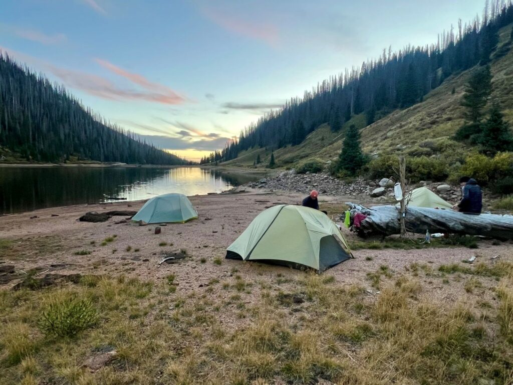
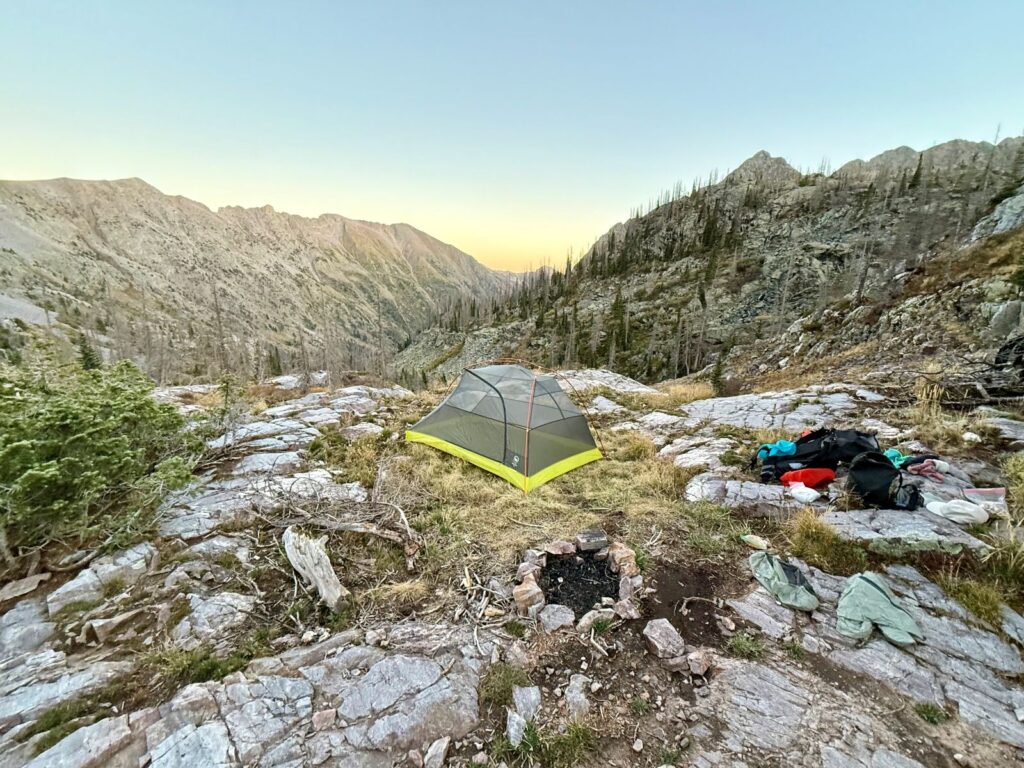
CAMPSItES & ITINERARY
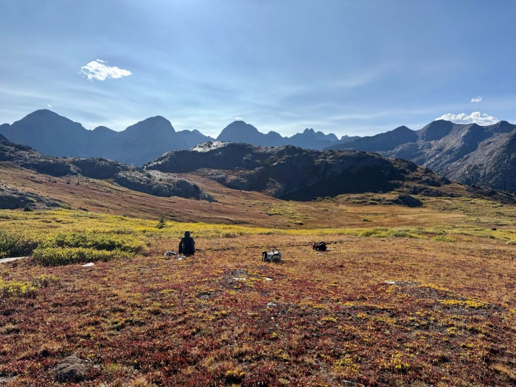
Campsites are dispersed only. Use established sites when possible. Options are decent near lakes and creeks but can be sparse above treeline.
Our itinerary (4 days / 3 nights):
- Night 1: Moon Lake
- Night 2: Junction of Rock Creek & Vallecito Creek Trails
- Night 3: City Reservoir
Other potential camping locations:
- Little Emerald Lake / Emerald Lake
- Rock Lake
- Twin Lakes
- West Ute Lake
- Nebo Creek Trail / Vallecito Creek Trail Junction
- Johnson Creek Trail / Vallecito Creek Trail Junction
- Valley halfway up the Columbine Pass Climb
- Lake Marie
- Along Endlich Mesa Trail (Dry)
ROUTE Options
- Full Loop (our trip): Pine River → Emerald Lake → Moon Lake → Rock Lake → CDT past Twin Lakes & West Ute Lake → Nebo Creek → Vallecito Creek → Johnson Creek → Columbine Pass → Trimble Pass → City Reservoir → Endlich Mesa → Freeman Creek → Vallecito Reservoir. (~65 miles, ~14,000 ft gain)
- Rock Creek Cutoff Trail: Shaves off 9–10 miles and about 2,500 feet of elevation gain by bypassing the Twin Lakes / CDT section of this loop.
- Pine River–Flint Lakes Loop: A shorter option from Pine River Trailhead up the Flint Creek Trail, past Flint Lakes, Rock Lake, Moon Lake, and Emerald Lake before looping back down Pine River.
- Pine River Out-and-Back: A simpler trip up the Pine River drainage to Emerald and Moon Lakes, then back down the same way.
- No Columbine Pass / Endlich Mesa: End the loop at the Vallecito Creek Trailhead instead of continuing over Columbine Pass, Trimble Pass, and Endlich Mesa. This eliminates the overgrown, hard-to-follow Endlich Mesa descent and simplifies logistics, but you’ll also miss some beautiful high-country scenery.
- Vallecito Creek Out-and-Back: Out-and-back trips along the Vallecito Creek Trail are popular. You can also connect with the Rock Creek Trail and the CDT to make a shorter loop near the end of the valley.
Other Options: This area has a large and well-connected trail system. With some planning, a reliable GPS track, and a good map, it’s easy to create custom loops or out-and-backs that fit your timeframe, fitness level, and goals.
MAPS & RESOURCES
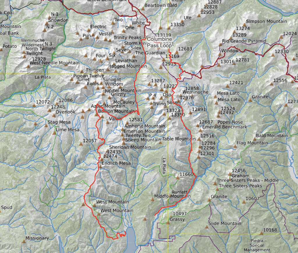
- Download: Full GPX track for this loop.
- Apps: Topo Maps+ (iOS), Gaia GPS (iOS/Android). We used Topo Maps+ for this route, and it worked well. Once you learn how to use it, there are many helpful features.
- Custom map: Build a map using Caltopo and print it for use on the trail.
- Backups: Everyone in our group downloaded GPS maps for offline use as a redundancy and for emergencies.
- Paper map: NatGeo Weminuche Wilderness, Weminuche Wilderness West / East
- Guide: How to Use Your Phone as a GPS Device
WILDLIFE, BUGS, & HAZARDS
Wildlife: Elk, deer, mountain goats, bighorn sheep, black bears, bald eagles, etc.
Bugs: Expect mosquitoes at lower elevations and near standing water in July and August. We experienced few in September.
Hazards: Afternoon thunderstorms (lightning, hail, heavy rain), exposure above treeline, high altitude/risk of altitude sickness (see our Altitude Safety video).
Trail challenges: Silver Mesa cairn navigation, Endlich Mesa overgrowth/blowdowns, a few steep drop-offs.
Safety: Carrying a Garmin inReach Mini or similar device is recommended.
LEAVE NO TRACE
The Weminuche Wilderness is rugged and fragile. Please help protect it by following Leave No Trace principles:
- Camp in established, impacted sites.
- Pack out all trash; dig catholes 200 feet from water.
- Treat all water and keep soaps, food waste, and suds out of streams and lakes.
- Store food securely — black bears and small critters are common.
- Check fire restrictions; use a stove when possible.
- Leave rocks, plants, and other natural features as you found them.
Please travel thoughtfully so this wild place stays pristine for the next visitor.
Gear List
Make sure to check out our Ultimate Backpacking Checklist, so you don’t forget something important.
Below you’ll find our current favorite backpacking gear. If you want to see additional options, our curated gear guides are the result of many years of extensive research and hands-on testing by our team of outdoor experts.
BACKPACK
- Best Backpacking Pack Overall: Gregory Paragon 58 – Men’s / Gregory Maven 58 – Women’s
- Best Ultralight Backpacking Backpack: Hyperlite Mountain Gear Unbound 40
- More: Check out our best backpacking backpacks guide for ultralight and trekking options
TENT
- Best Backpacking Tent Overall: Big Agnes Copper Spur HV UL2
- Best Ultralight Tent: Zpacks Duplex
- Best Budget Tent: REI Half Dome 2
- Best Tent Stakes Overall: All One Tech Aluminum Stakes
- More: Check out our best backpacking tents guide for more options
SLEEPING BAG/QUILT
- Best Sleeping Bag Overall: Men’s Feathered Friends Swallow YF 20 / Women’s Feathered Friends Egret YF 20
- Best Quilt Overall: Enlightened Equipment Revelation 20
- More: Check out our best backpacking sleeping bags guide and best backpacking quilts guide for more options
SLEEPING PAD
- Best Sleeping Pad Overall: NEMO Tensor All-Season
- Best Foam Sleeping Pad: NEMO Switchback
- More: Check out our best backpacking sleeping pads guide for ultralight and trekking options
CAMP KITCHEN
- Best Backpacking Stove Overall: MSR PocketRocket 2
- Best Backpacking Cookware Overall: TOAKS Titanium 750ml
- Best Backpacking Coffee Overall: Starbucks VIA
- More: Check out our best backpacking stoves guide and best backpacking cookware guide for ultralight and large group options
WATER & FILTRATION
- Best Water Filter Overall: Sawyer Squeeze
- Best Hydration Bladder Overall: Gregory 3D Hydro
- Best Backpacking Water Bottles: Smartwater Bottles
- More: Check out our best backpacking water filters guide and best backpacking water bottles guide for ultralight and large group options
CLOTHING
- Best Hiking Pants Overall: Men’s Outdoor Research Ferrosi / Women’s The North Face Aphrodite 2.0
- Best Hiking Shorts Overall: Men’s Patagonia Quandary / Women’s Outdoor Research Ferrosi
- Best Women’s Hiking Leggings: Fjallraven Abisko Trekking Tights HD
- Best Rain Jacket Overall: Men’s Patagonia Torrentshell 3L / Women’s Patagonia Torrentshell 3L
- Best Rain Pants: Men’s Patagonia Torrentshell 3L / Women’s Patagonia Torrentshell 3L
- Best Down Jacket Overall: Men’s Patagonia Down Sweater Hoodie / Women’s Patagonia Down Sweater Hoodie
- Best Fleece Jacket Overall: Men’s Patagonia Better Sweater / Women’s Patagonia Better Sweater
- Best Sunshirt Overall: Men’s Outdoor Research Echo / Women’s Outdoor Research Echo
- Best Socks Overall: Men’s Darn Tough Light Hiker Micro Crew / Women’s Darn Tough Light Hiker Micro Crew
- Beste Ultralight Liner Glove: Patagonia Capilene Midweight Liner
- More: Check out our best backpacking apparel lists for more options
FOOTWEAR & TRACTION
- Best Hiking Shoes Overall: Men’s HOKA Speedgoat 6 / Women’s HOKA Speedgoat 6
- Best Hiking Boots Overall: Men’s Salomon X Ultra 5 GTX / Women’s Lowa Renegade Evo GTX
- Best Hiking Sandals Overall: Men’s Chaco Z/1 Classic / Women’s Chaco Z/1 Classic
- Best Camp Shoes Overall: Crocs Classic Clogs
- Best Traction Device for Hiking Overall: Kahtoola MICROspikes
- More: Check out our best backpacking footwear lists for more options
NAVIGATION
- Best GPS Watch Overall: Garmin Instinct 2 Solar
- Best Personal Locator Beacon (PLB): Garmin inReach Mini 2
- More: Check out our article How to Use Your Phone as a GPS Device for Backpacking & Hiking to learn more
FOOD
FIRST-AID & TOOLS
- Best First-Aid Kit Overall: Adventure Medical Kits Ultralight/Watertight .7
- Best Pocket Knife Overall: Kershaw Leek
- Best Multitool Overall: Leatherman Wave+
- Best Headlamp Overall: Black Diamond Spot 400-R
- Best Power Bank Overall: Nitecore NB 10000 Gen 3
- More: Check out our best first-aid kit guide, best pocket knife guide, best multitool guide, best backpacking headlamps guide, and best power banks guide for more options
MISCELLANEOUS
- Best Trekking Poles Overall: Black Diamond Pursuit
- Best Backpacking Chair Overall: REI Flexlite Air
- Best Backpacking Stuff Sack Overall: Hyperlite Mountain Gear Drawstring
- More: Check out our best trekking poles guide, best backpacking chairs guide, and best stuff sacks guide for more options
CONCLUDING THOUGHTS
The Vallecito Reservoir Loop in the Central San Juans is a big, burly adventure in one of Colorado’s most spectacular wilderness areas. With big climbs, high passes, and stunning alpine lakes, it delivers a true backcountry adventure for hikers who are up for the challenge.
This isn’t a beginner-friendly route. However, for experienced backpackers who don’t mind long miles and remote terrain, it offers solitude, beauty, and a sense of accomplishment that few trails can match. With a flexible network of connecting trails, it’s also an area where you can adjust mileage and difficulty to fit your goals.
If you’re looking for a strenuous, scenic trip deep in the San Juans, the Vallecito Reservoir loop deserves a spot on your list.