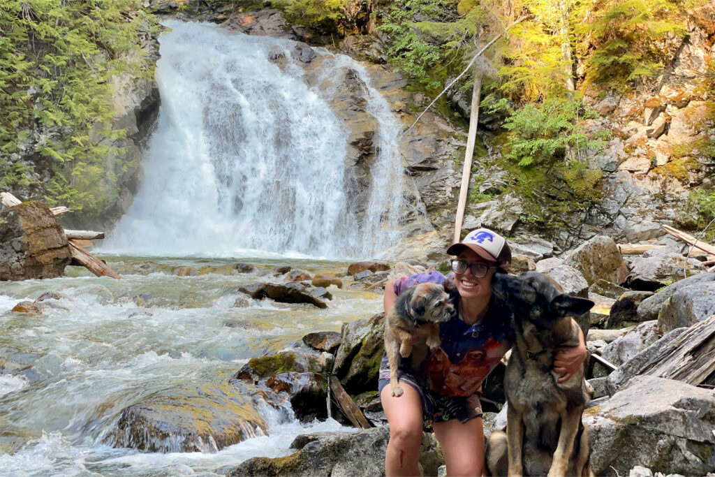
The Idaho Centennial Trail is one of the most remote long-distance trails in the US. Hikers who tackle this route need to be self-reliant, flexible, and determined. Those with the grit to complete this trail are rewarded with dramatic changes in scenery and a sense of accomplishment at the end.
Quick Facts
- Distance: 996 miles
- Days Needed: 6-9 weeks
- Peak Elevation: 9,170 ft at Willow Creek Summit
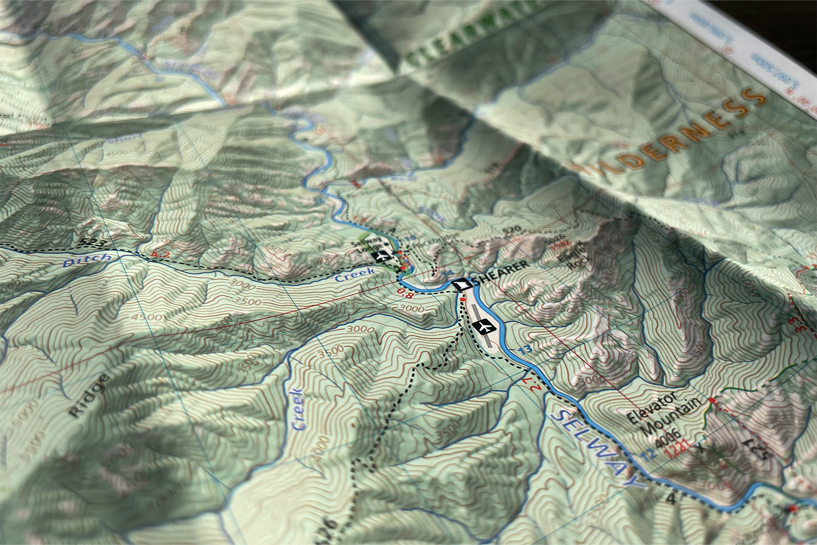
- Low Elevation: 1,900 ft along the Selway River
- Permits: None
- Difficulty: Very Difficult
Highlights
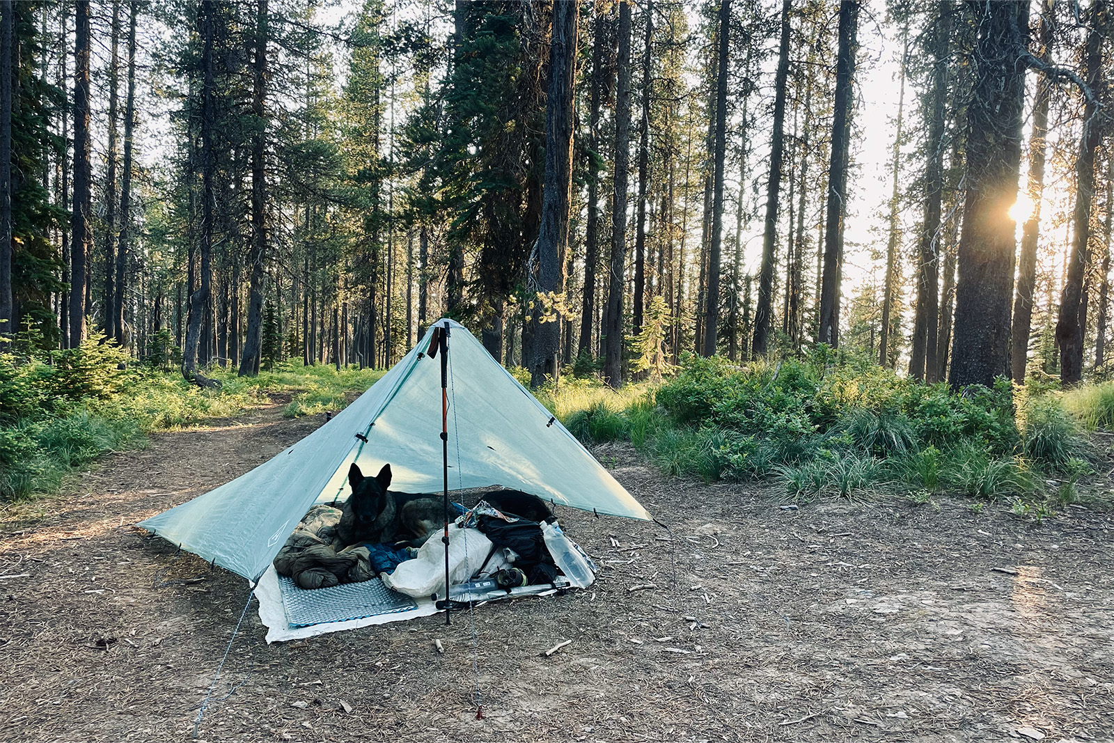
- Solitude
- Abundant wildlife
- Endless possibilities for alternate routes
- Both mountains and desert in a shorter thru-hike
- Hiking along the Salmon, Selway, and Snake rivers is a unique experience
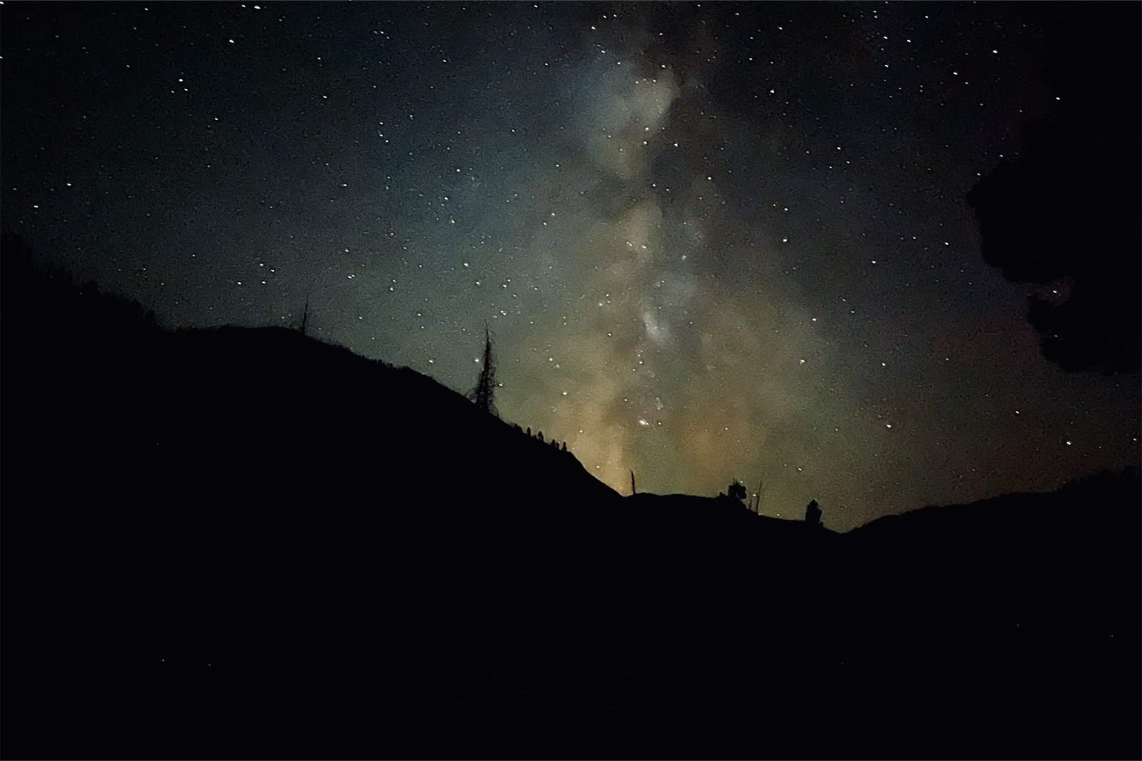
- Dark night skies for stargazing
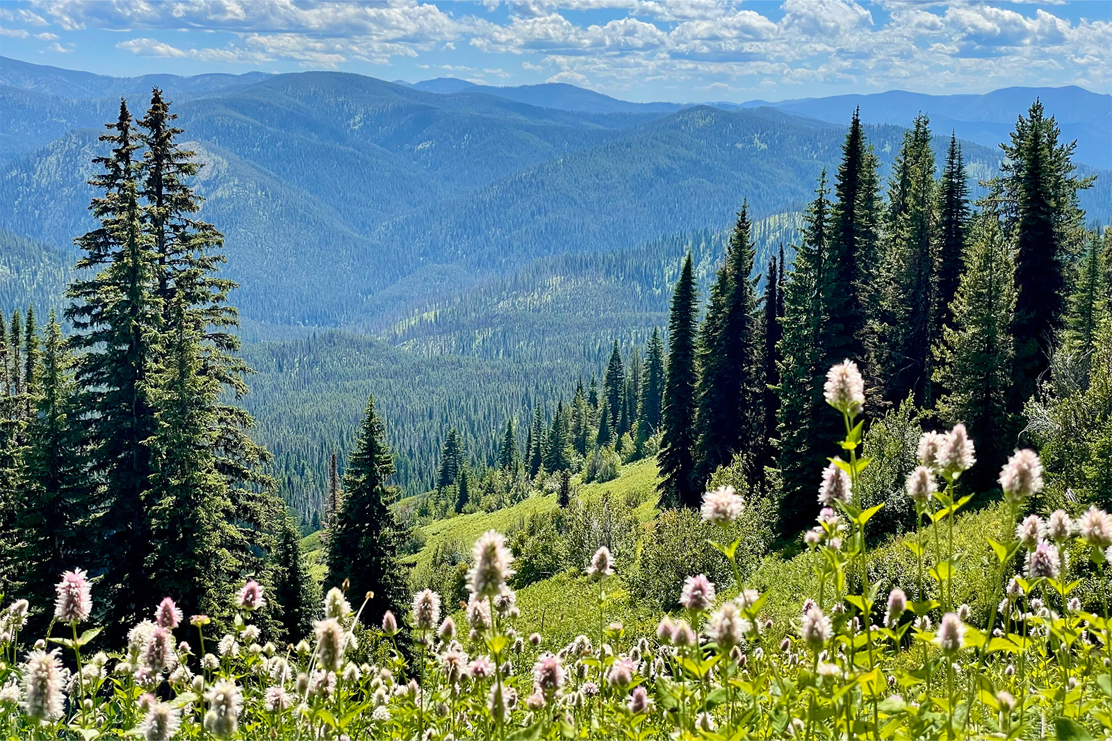
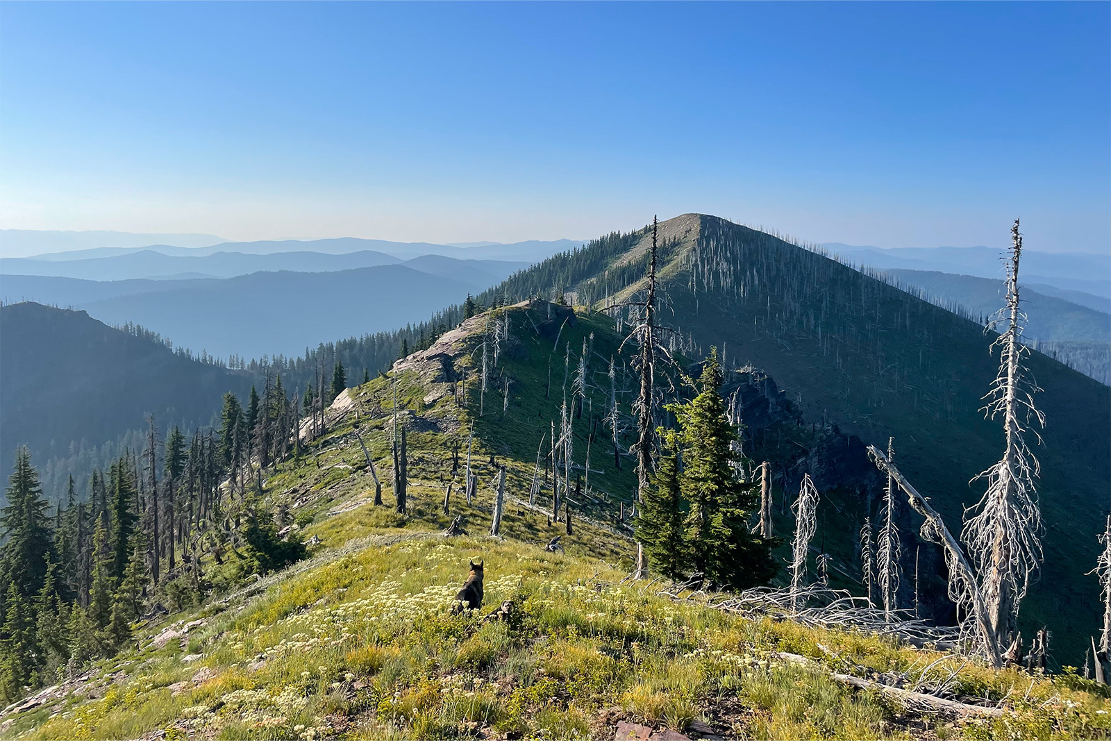
- Incredible ridge views
Lowlights
- Mosquitoes
- Many miles are not maintained, which makes for slow progress
- Lack of information on conditions
- Logistics are difficult at times
- Food must be flown into the Selway and Frank
- Long water carries or caches are necessary in the Owyhee
- Time zone changes can be confusing on the State Line Trail and the Salmon River
Best Time to Hike
Like many mountainous and northern latitude thru-hikes, the Idaho Centennial Trail (ICT) is best tackled in the summer when the high peaks are free of snow. Unlike more popular routes, such as the Colorado Trail or Long Trail, part of this thru-hike is in the desert, which can make timing a bit more challenging.
Many thru-hikers attempt to complete the desert portion by mid-June, which is also when the Sawtooths become passable. Heading southbound, the Owynee can still be quite hot through August. At the end of the day, some compromise will likely be needed, and hikers will either need to plan for sections, hope for favorable weather, or just deal with the conditions by using appropriate gear.
Difficulty of Trail
Though it is named the Idaho Centennial “Trail”, in reality, the ICT is more of a route or trail concept. Many of the trails are overgrown or non-existent. The remote nature of central Idaho leads to long distances between resupplies, and the conditions are quite rugged at times. Potential hikers need to be flexible and have the necessary skills to tackle this route safely.
For all of these reasons, outlined in more detail below, it is significantly more difficult than any of the Triple Crown trails or other popular thru-hikes.
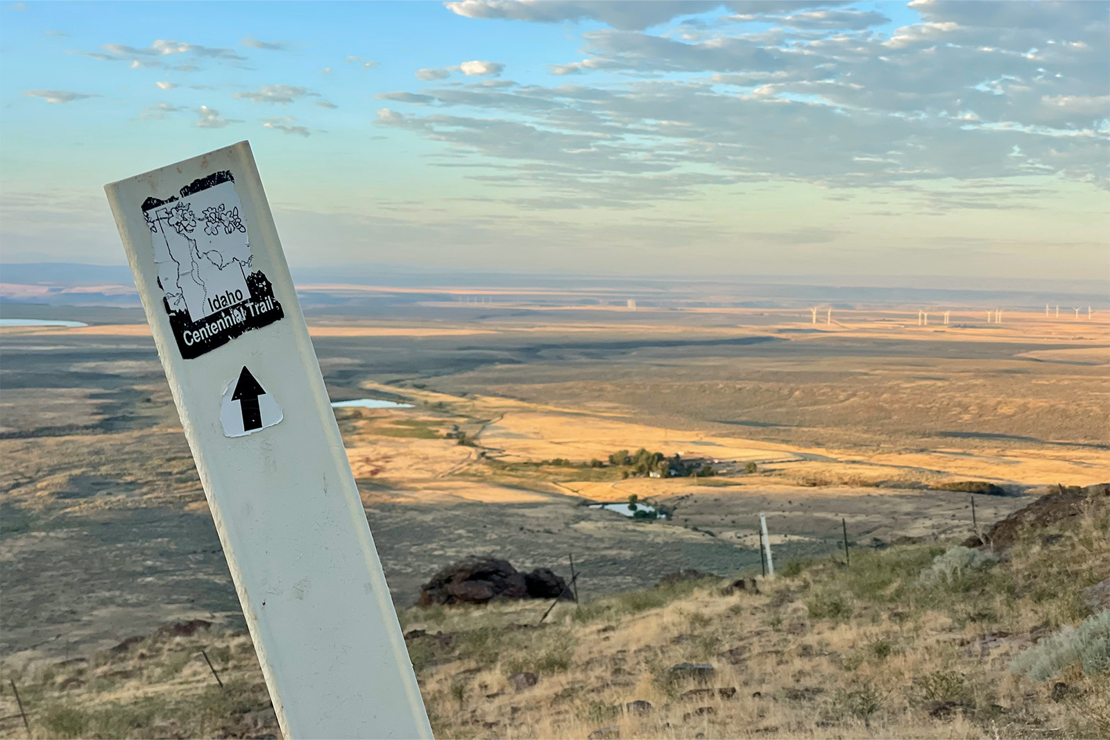
ROUTE FINDING
Unlike more popular thru-hikes, the Idaho Centennial Trail is not a fully blazed route. There is not a FarOut app or a specific map set for this trail. Instead, hikers will need to purchase their own paper maps for the quadrants that include the trails the ICT uses, download a GPX file to a GPS app such as GAIA GPS, or a combination of both. While there are some ICT markers in the Owhyee desert, most trail junctions are not marked. Hikers need to pay attention to where they are going, understand how to read the landscape, and be able to make navigation decisions every single day.
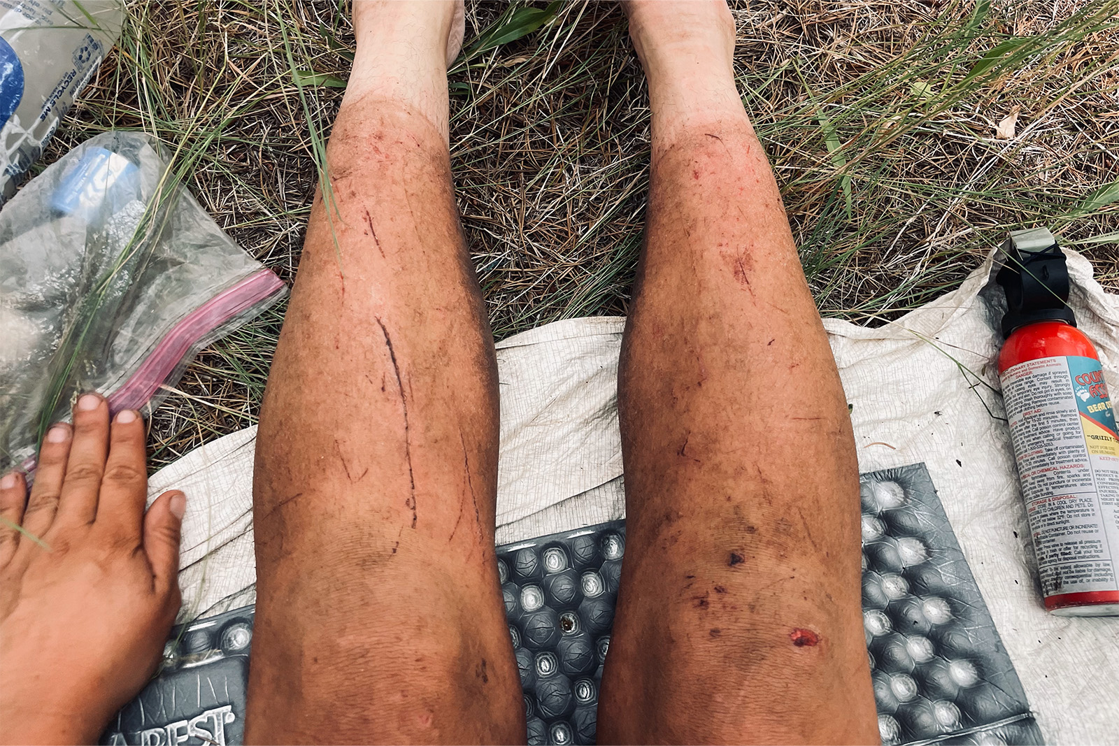
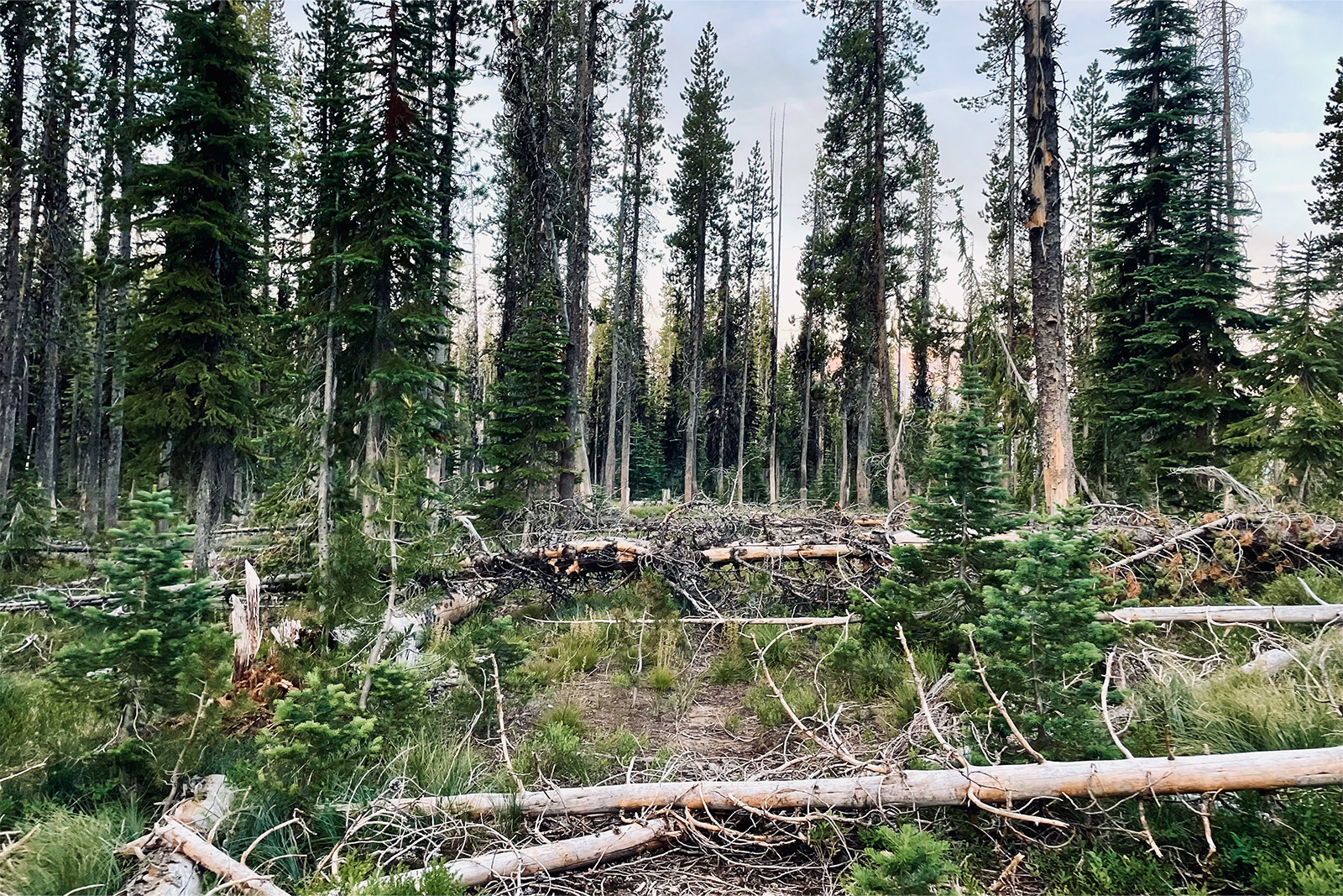
The other route-finding piece that is different from other long-distance hikes is the quality of the trails. There are many places where the trails the ICT follows have not been cleared or maintained for some time. This is especially true in the Selway-Bitterroot and Frank Church River of No Return Wilderness areas. The trails are brushy with many downed trees, and the trail tread may not even exist in some places. These conditions are slow to hike in when resupplies are already few and far between. Many thru-hikers choose to reroute to roads or better-maintained trails when needed.
REMOTENESS
One of the incredible features of the ICT is how far some sections are from the nearest town. This also means that hikers need to be much more self-reliant and really understand their limitations to stay safe. Many sections would require several hours of hitchhiking on dirt roads to reach the nearest town. Many of those towns are incredibly small and would not have many amenities to help out a hiker.
While the entire route is much more remote than a standard thru-hike, two sections really stand out. The Selway-Bitterroot Wilderness and Frank Church River of No Return Wilderness are large swaths of protected land that are adjacent to each other. Together, they make up a huge area in central Idaho that is far away from any town of any size. For reference, it is normal to hike almost 300 miles without resupplying in any towns in this section. Hikers generally need to have their food flown into Forest Service guard stations or delivered to private landowners with an airstrip on their property. There are bailout points and reroute options, but even those roads are generally far from any towns.
Another section to plan for is the Owyhee Desert between the Nevada border and I-84. The route here primarily follows double tracks and dirt roads. It is possible to find a ride by hiking out to the main dirt road to the east, but the nature of hiking in a waterless desert makes this section serious. It could take well over one to two hours to get help by car in some areas, so care is needed to stay safe.

WATER ACCESS & SUN EXPOSURE
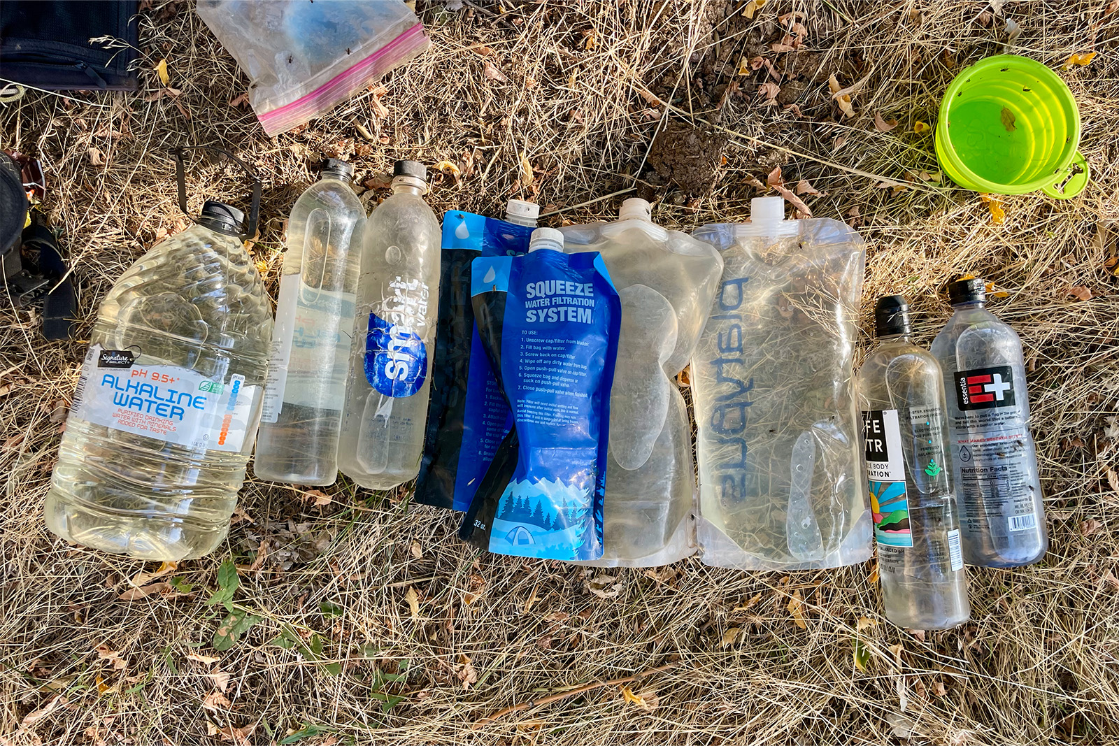
Aside from the most northern section of the trail, which is technically part of the Pacific Northwest, much of the trail is arid and dry. There are long waterless sections on the 100-mile State Line Trail in addition to the Owyhee Desert. Most water carries max out at about 20 miles on the State Line section, though it can be hot in the summer. In the Owyhee desert, most hikers cache water as otherwise there is a 30+ mile and a 55-mile long stretch without easy access to water. A 4×4 vehicle or dirt bike is needed to cache water in this section.
The heat can also provide a big challenge during a thru-hike. Temperatures in the Owyhee and on the Columbia Plateau can reach into the upper 90s even in late August. There is little shade, just occasional swaths of sagebrush. Most hikers try to tackle this section in early June when it is slightly cooler. Some even will hike this area earlier in the season, then finish the rest of the trail in the summer. Temperatures can also be in the 80s in the northern parts of the state. The elevation along the Salmon River is quite low, and there are many burn areas that can heat up quickly. With proper planning and good heat tolerance, these sections are still enjoyable.
LIMITED OUTSIDE RESOURCES
Though the ICT was first established in 1990, few people have successfully completed end-to-end thru-hikes. While it is hard to find exact estimates on the number of completers, it is safe to say that even with its recent growth in popularity, only a few people complete it each year. Many people do tackle sections, particularly local Idahoans, but due to the lower level of interest in this trail, there are fewer planning resources and on-trail support. There is a Facebook page dedicated to the ICT where those curious about the trail can get their questions answered, and a guidebook was released in 2023. Idaho State Parks and Recreation can also help to answer questions and has some planning resources on their website, including overview maps and some basic planning information.
Prospective hikers should note there is not an established trail culture or support network for thru-hikers. While people in Idaho are generally friendly and hitchhiking isn’t an issue, any trail magic will be spontaneous from people who are genuinely concerned about your well-being due to not knowing much about the route. Don’t expect to find hiker discounts, water caches, or hostels while hiking the ICT.
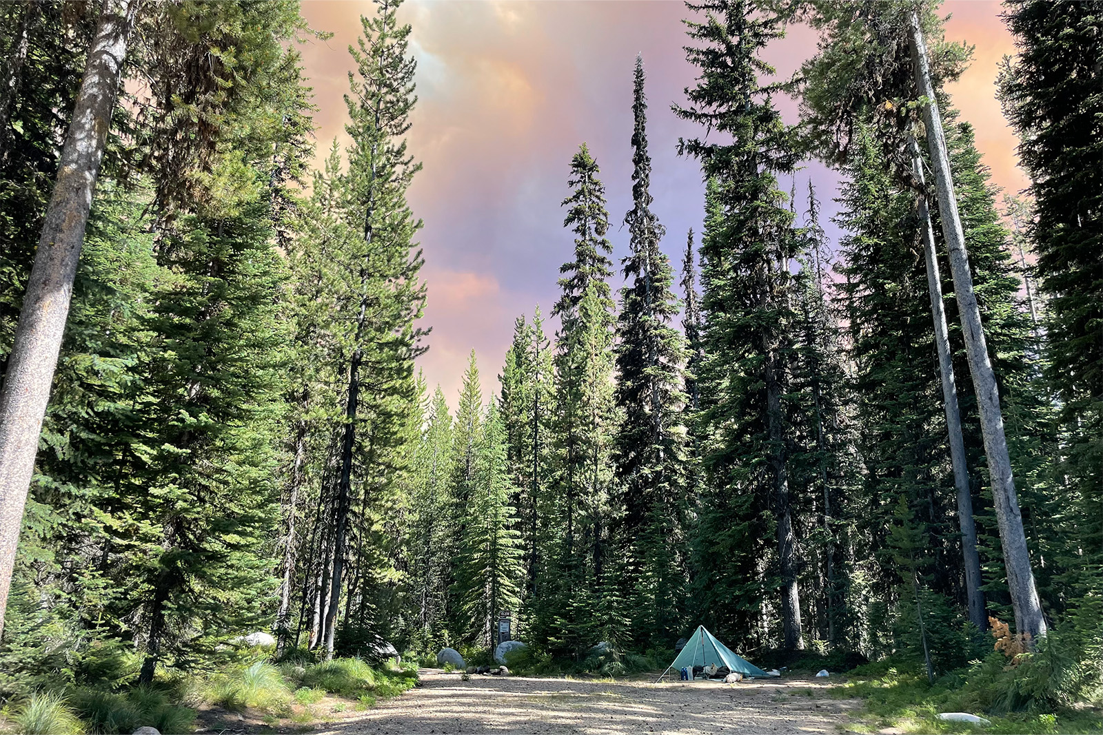
WILDFIRES
While much of the West is prone to wildfires, they can quickly derail an Idaho Centennial Trail hike. Central Idaho, in particular, is prone to devastating wildfires due to the lower elevations and arid climate along the rivers. Once a fire starts, they are difficult to fight due to the remote nature of the area and rugged terrain.
However, fires can start pretty much anywhere along the trail. It is good to be diligent when hiking and watch for smoke. Carrying a satellite messaging device is helpful to get updates on the status of fire conditions when hiking in the Selway and Frank wilderness areas. Be prepared to reroute if necessary in order to avoid fire closures.
NORTHBOUND VS. SOUTHBOUND
As with any long-distance hike, those looking to thru-hike need to plan properly for the time and finances necessary to complete a 1,000-mile trail.
Though most experienced thru-hikers and Idahoans recommend hiking the ICT NOBO, depending on the year, SOBO might be a better option. Generally speaking, fires and snowpack are the main reasons for choosing a NOBO thru-hike. By hiking the desert first, thru-hikers can pick an earlier start date. An earlier start date translates to finishing the trail earlier in the fire season.
The downside is that the Sawtooths may still be covered in snow by the time most hikers get there. We hiked the ICT southbound and were fortunate to only encounter two fires and no snow. However, this is not typically the norm, and our experience in the Owyhee was much warmer as a result.
Getting There
Both the northern and southern termini are fairly remote and can take some time to reach.
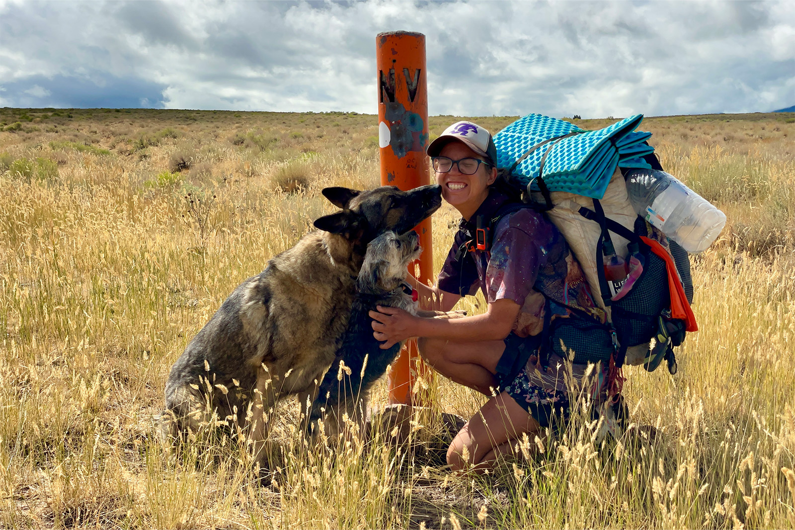
SOUTHERN TERMINUS
The southern terminus of the ICT is located on the Idaho-Nevada border about two miles east of Murphy Hot Springs, ID. Murphy Hot Springs is a small unincorporated community located on the Bruneau River, and both the community and terminus are approximately three and a half hours from Boise. There are many miles of dirt road to drive on the way, and hitchhiking to this terminus would be difficult. Most thru-hikers arrange a shuttle with family, friends, or by posting on the ICT Facebook group.
NORTHERN TERMINUS
The ICT officially ends at American Falls, which is about a half mile south of the Canadian border in the panhandle. There is a trailhead with a bear box about eight miles from the falls, but the drive to the trailhead is long. In total, the drive from the trailhead to Spokane is about three hours. Like the southern terminus, most hikers arrange a shuttle through family, friends, and trail angels. We had success hitchhiking, but it can be tough to hitchhike around Spokane.
-Planning Your Itinerary (any resource recommendations, i.e., apps, websites, books, as well as a specific itinerary outline if there are consensus best campsites or best routes)
Resources are limited compared to other long-distance hikes, but are available with enough searching! The Idaho Department of Parks and Recreation website is a great place to start for general information and planning. We have also found the Idaho Centennial Trail Updates and Information group on Facebook to be quite helpful. There are other websites with useful information that can be found with enough digging, including a page that outlines where to send packages for the remote wilderness sections. A new guidebook was published in 2023 and is available on Amazon and at REI.
As for maps, there is no FarOut app for this trail. A GPS app such as GAIA, OnX, or CalTopo is a good idea due to the terrain. Idaho Parks and Rec has a GPX file that can be downloaded from their website and uploaded into your navigation app of choice. Paper maps are also a good idea on this route, at least as a backup. The National Geographic Sawtooth Wilderness Map and the Cairn Cartographics Selway-Bitterroot Wilderness Maps are waterproof and provide good detail. The Benchmark Road & Recreation Atlases provide a good, large-scale overview at a reasonable price and are also useful for caching food or water.
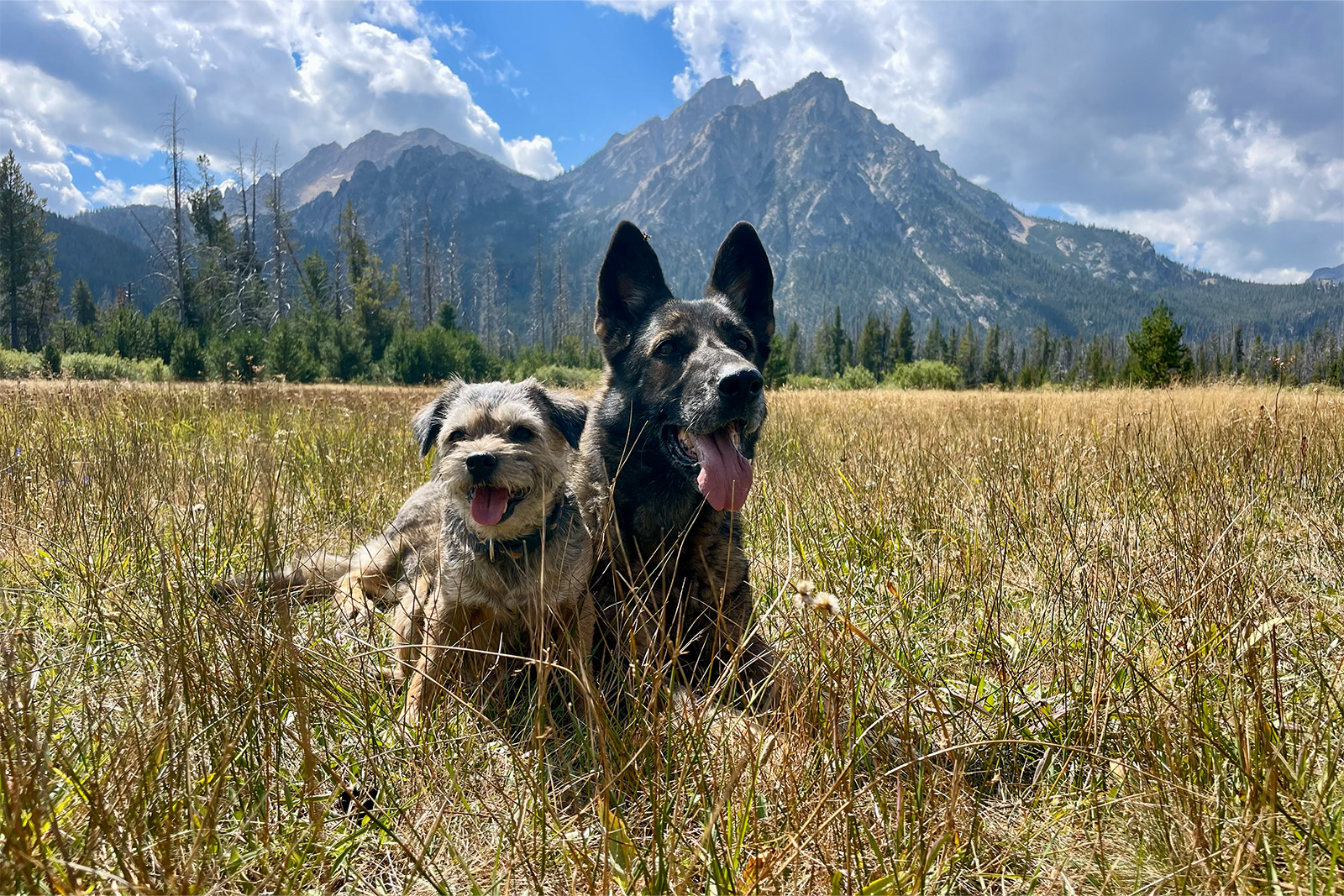
Wildlife
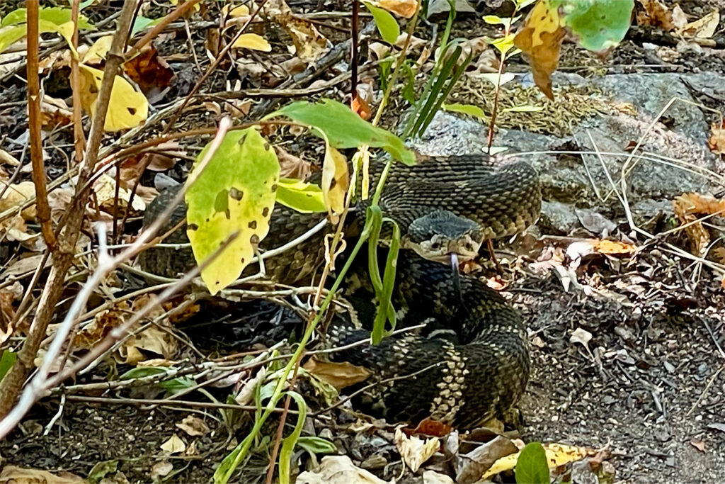
A wide range of wildlife is found across Idaho due to the diversity of terrain and elevation. Hikers should be prepared to encounter Grizzly Bears, Black Bears, Wolves, Mountain Lions, Moose, Deer, Elk, Coyotes, Rattlesnakes, and so on. Grizzly Bears are less common in Idaho than in neighboring Canada or Glacier National Park, but it is still suggested to take precautions by carrying bear spray and storing food properly from the Sawtooths north to the terminus.
We were surprised at the number of rattlesnakes – they are very common along the Selway and Salmon rivers due to the lower elevations in those areas. Of course, they can be found in the Owyhee Desert as well. Most other animals commonly encountered are skittish or are uninterested in humans when given proper space.
Mosquitoes are the main bug concern in Idaho. There are some places where they are quite aggressive, but many places where there are few, if any. Generally, picaridin lotion or a fully enclosed tent will be enough to stay sane. We did not notice any problems with ticks on this hike, though there may be more of them in June. The most interesting bug found in Idaho is the Mormon Cricket, which may experience population booms or surges. During these surges, they can be found in great numbers in the Owyhee Desert, covering the ground and becoming a hazard for drivers and cyclists alike.
Where to Resupply
One of the most unique aspects of an ICT thru-hike is having food flown into the backcountry landing strips in the Frank Church and Selway-Bitterroot Wilderness Areas. Because the trail through these sections is so remote and long, most thru-hikers must have their food flown in. There are several Guard Stations run by the Forest Service that will accept and hold packages, as well as some private landowners who are supportive of ICT thru-hikers.
The United States Postal Service contracts with local pilots to deliver mail to these remote landing strips. This means that for most locations, it is relatively affordable to send a resupply box. Just mail your package through your local post office and pay the regular package fee.
That said, permission from the landowners is needed before any boxes can be sent. When permission is granted, the airstrip owners will provide the appropriate mailing address. We also suggest contacting Smith Air for more information, as they deliver the packages in this area or can direct you to a better resource.
Resupply options are limited on the ICT, so pre-planning at least part, if not all, resupplies will be necessary. Many of the towns along the Idaho Centennial Trail have post offices that will hold general delivery packages. Most postal workers are even familiar with hikers. Special consideration is needed to resupply in the Selway-Bitterroot and Frank Church River of No Return Wilderness areas. Here are some of the common resupply locations to consider, though not every hiker will resupply at every location.
*Note: All miles are approximate due to the choose-your-own adventure style of this trail.
HAMMETT (NOBO ~MILE 100)
As an unincorporated community, there are not many amenities in this small town. However, it does have a post office, which means that food can be sent here to shorten the carry to or from the border. Hammett is located just off I-84, and the official route passes right through the community.
Don’t Miss: Post office, Lulu’s Cafe
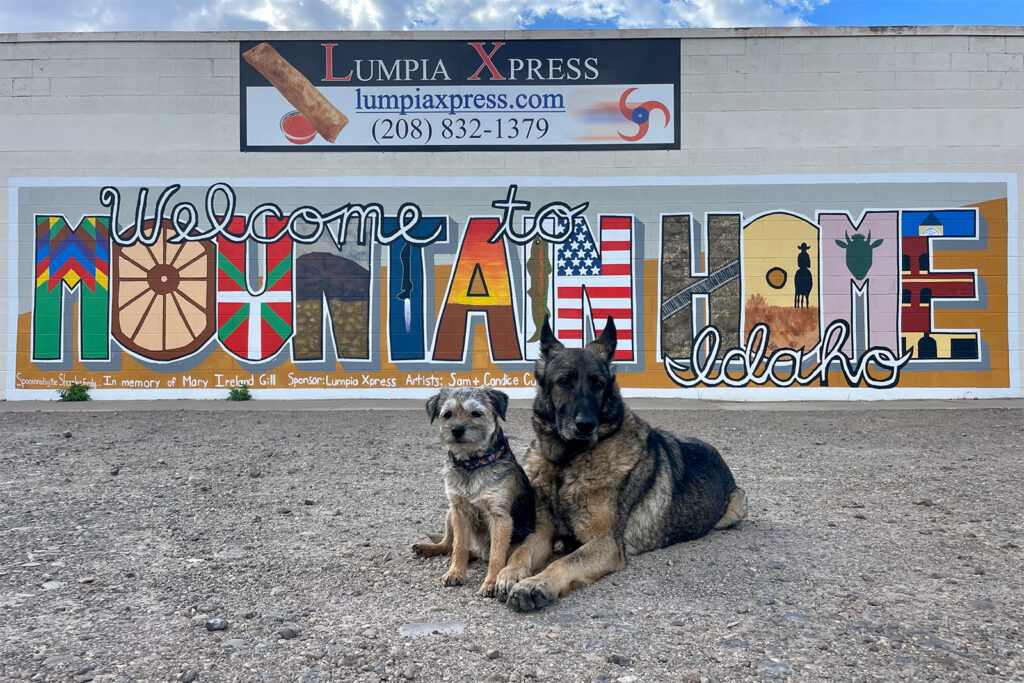
MOUNTAIN HOME (NOBO ~MILE 130)
This stop will require a hitch into town, but it’s a straight shot on US HWY-20 from the ICT. Mountain Home is a full-service town with multiple grocery stores, motels, and amenities. The town is a bit spread out, but it is surprisingly pedestrian-friendly thanks to plentiful sidewalks. We stayed at the Gem State RV park, but there are also hotels and motels throughout town and along the interstate. Make sure to visit Lumpia Xpress to take your picture next to the Mountain Home mural and order some tasty Filipino food before leaving town.
Don’t Miss: Lumpia Xpress, Grocery Outlet
STANLEY (NOBO ~MILE 260)
Stanley sits just outside the Sawtooths and, as such, is popular with tourists despite its small size. The town comprises a few tourist-focused restaurants, lodges, and guiding services. Sending a package to the post office here is a good idea, as the food selection is both limited and expensive at the Mountain Village Mercantile. If the hotels are booked out due to summer visitors, try asking at the Mountain Village Resort about dry camping. Be ready to spend a pretty penny on dining out, though it is worth it to fuel up before or after tackling the Frank.
Don’t Miss: Post office, Mountain Village Hot Springs, Mountain Village Mercantile, Stanley Baking Company
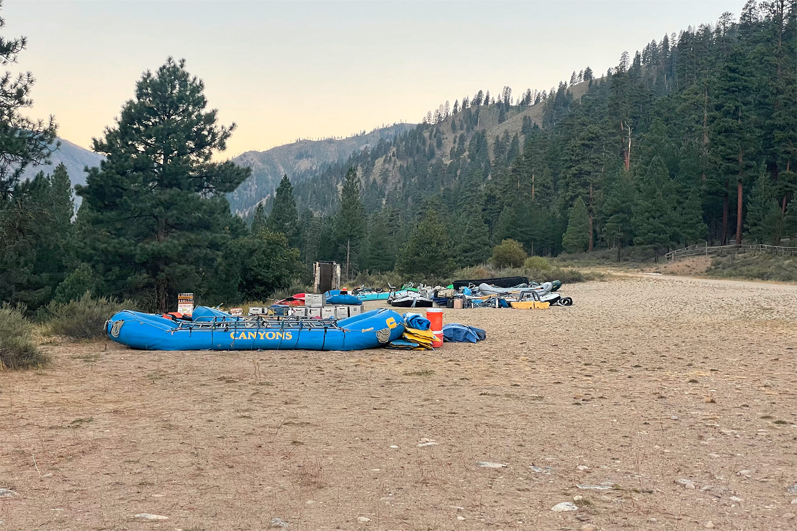
INDIAN CREEK GUARD STATION (NOBO ~MILE 308)
One of several fly-in resupply options, the Indian Creek Guard Station is located right on the Idaho Centennial Trail and the Middle Fork of the Salmon. It is manned by the Forest Service, and permission is needed before sending a package here. There is camping along the river and a water spigot, but no other amenities. This air strip can be popular with raft guiding companies for camping and sometimes for flying into the Frank if there are hazards up river. Mail is delivered once per week, so plan accordingly.
Don’t Miss: Great camping right along the Middle Fork of the Salmon River!
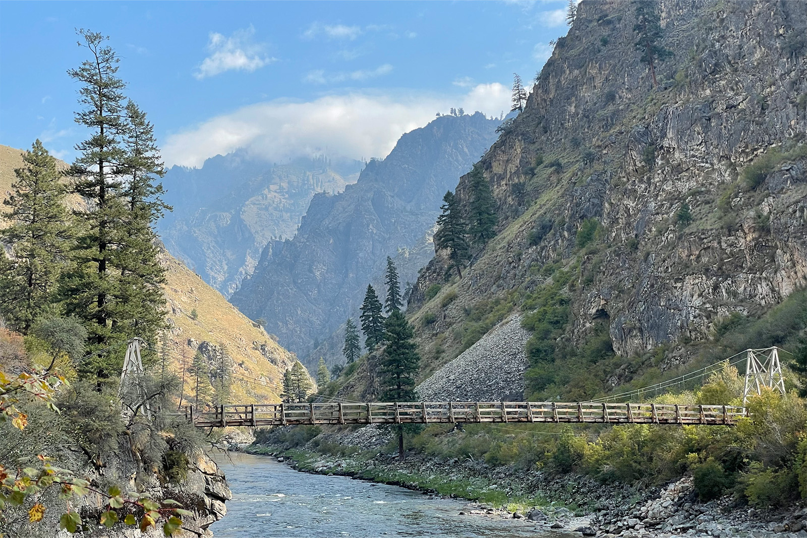
CAMPBELL’S FERRY (NOBO ~MILE 408)
This property is part of the National Register of Historic Places and was originally an important ferry crossing on the Salmon River. Today, it is privately owned, and there is a hiker bridge just outside the property. There are no roads that reach this location: all supplies are flown into the airstrip. Permission will need to be attained to send a box here, though the owners have historically been friendly to thru-hikers.
MOOSE CREEK RANGER STATION (NOBO ~MILE 488)
It is possible to have a resupply box flown into the Moose Creek Guard Station, managed by the Forest Service. The biggest hurdles are getting permission and finding someone to deliver the package without it costing an arm and a leg. Smith Air does not generally take mail this far out from Cascade, so do your research if you plan to use this location.
KOOSKIA, ID / MISSOULA, MT (NOBO ~MILE 540)
The ICT crosses US HWY-12 at the Wilderness Gateway Campground. Unfortunately, that location is quite a way from both Kooskia and Missoula, with limited traffic on the highway. It can be a difficult hitch, but doable with some patience. Hikers have the choice of either heading west to the small town of Kooskia or east to Missoula. There are more amenities in Montana, but it is further away and may be more difficult to find a ride back to the trail.
SUPERIOR, MT (NOBO ~MILE 630)
Those looking to shorten the carry between Highway 12 and Mullan should consider hitching into Superior, MT. Much of the ride would be on dirt roads, but Missoula Lake is a popular destination, so it is possible to get a ride with some patience. Like many of the resupply towns along the ICT, Superior is small with a population under 1,000. There are just enough amenities to make it a worthwhile stop, such as a motel, grocery store, post office, and restaurant.
Don’t Miss: Big Sky Motel, Darlow’s Ace Hardware (grocery), River Side Soups & Sandz
MULLAN (NOBO ~MILE 700)
The postmaster at the post office in Mullan is very hiker friendly, and the pavilion at the park is a great place to regroup, both good things as this town doesn’t have many amenities. Sending a box is a good idea, as the only other option is the convenience store. We loved the outdoor seating and friendly staff at the Outlaw Bar and Grill. However, there are not any motels in this town, so be prepared to try for a hitch on the interstate or just hike in and out of town on the same day.
Don’t Miss: Outlaw Bar and Grill, post office
CLARK FORK (NOBO ~MILE 780)
Another small town, Clark Fork, has a small independent grocery store, post office, a few restaurants, and a motel. There is enough selection to resupply at the Monarch Market or Clark Fork Pantry, but for hikers who need more amenities, it might be a good idea to hitch to Sandpoint, which is a full-service town.
Don’t Miss: Monarch Market, Clark Fork Pantry, Rocco’s
SANDPOINT (NOBO ~MILE 780 VIA ID 200 or ~MILE 840 VIA HWY 2)
ICT hikers can hitch into Sandpoint from either State Route 200 or US Highway 2. Almost anything a hiker could need is available in this town, including box stores, breweries, and hotels. Walking between stops can take a while, though there is a local bus system that is free to use.
Don’t Miss: Hoot Owl Cafe, Joel’s, MickDuff’s Brewery
NAPLES (NOBO ~MILE 840)
The first or final stop, depending on which direction you hike, Naples is an incredibly small though doable resupply option. There is a General Store which has both food for sale and a small post office in the back where packages can be sent. Next door is the Northwoods Tavern for a hot meal. There are no hotels in town, but the Blue Lake RV Resort, just a mile up the highway, offers tent camping and is very friendly to hikers. Those needing more food and accommodation options may want to hitch to Sandpoint.
Don’t Miss: Naples General Store, Blue Lake RV Resort
MAPS & RESOURCES
- CalTopo: Overview Map
- Cairn Cartographics Maps
Gear List
Make sure to check out our Ultimate Backpacking Checklist, so you don’t forget something important.
Below you’ll find our current favorite backpacking gear. If you want to see additional options, our curated gear guides are the result of many years of extensive research and hands-on testing by our team of outdoor experts.
BACKPACK
- Best Backpacking Pack Overall: Gregory Paragon 58 – Men’s / Gregory Maven 58 – Women’s
- Best Ultralight Backpacking Backpack: Hyperlite Mountain Gear Unbound 40
- More: Check out our best backpacking backpacks guide for ultralight and trekking options
TENT
- Best Backpacking Tent Overall: Big Agnes Copper Spur HV UL2
- Best Ultralight Tent: Zpacks Duplex
- Best Budget Tent: REI Half Dome 2
- Best Tent Stakes Overall: All One Tech Aluminum Stakes
- More: Check out our best backpacking tents guide for more options
SLEEPING BAG/QUILT
- Best Sleeping Bag Overall: Men’s Feathered Friends Swallow YF 20 / Women’s Feathered Friends Egret YF 20
- Best Quilt Overall: Enlightened Equipment Revelation 20
- More: Check out our best backpacking sleeping bags guide and best backpacking quilts guide for more options
SLEEPING PAD
- Best Sleeping Pad Overall: NEMO Tensor All-Season
- Best Foam Sleeping Pad: NEMO Switchback
- More: Check out our best backpacking sleeping pads guide for ultralight and trekking options
CAMP KITCHEN
- Best Backpacking Stove Overall: MSR PocketRocket 2
- Best Backpacking Cookware Overall: TOAKS Titanium 750ml
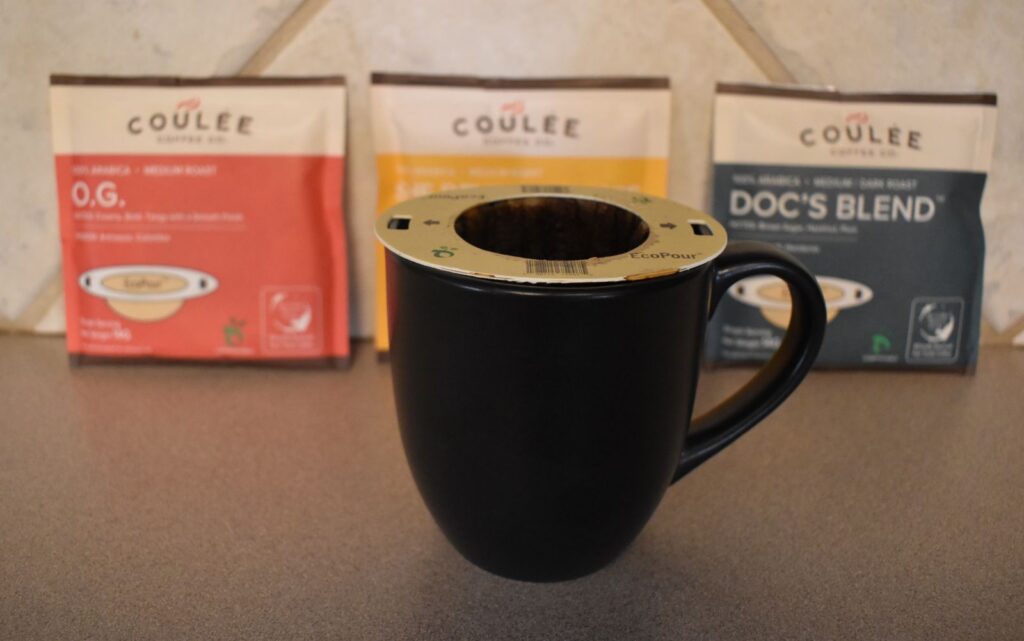
- Best Backpacking Coffee Overall: Starbucks VIA
- More: Check out our best backpacking stoves guide and best backpacking cookware guide for ultralight and large group options
WATER & FILTRATION
- Best Water Filter Overall: Sawyer Squeeze
- Best Hydration Bladder Overall: Gregory 3D Hydro
- Best Backpacking Water Bottles: Smartwater Bottles
- More: Check out our best backpacking water filters guide and best backpacking water bottles guide for ultralight and large group options
CLOTHING
- Best Hiking Pants Overall: Men’s Outdoor Research Ferrosi / Women’s The North Face Aphrodite 2.0
- Best Hiking Shorts Overall: Men’s Patagonia Quandary / Women’s Outdoor Research Ferrosi
- Best Women’s Hiking Leggings: Fjallraven Abisko Trekking Tights HD
- Best Rain Jacket Overall: Men’s Patagonia Torrentshell 3L / Women’s Patagonia Torrentshell 3L
- Best Rain Pants: Men’s Patagonia Torrentshell 3L / Women’s Patagonia Torrentshell 3L
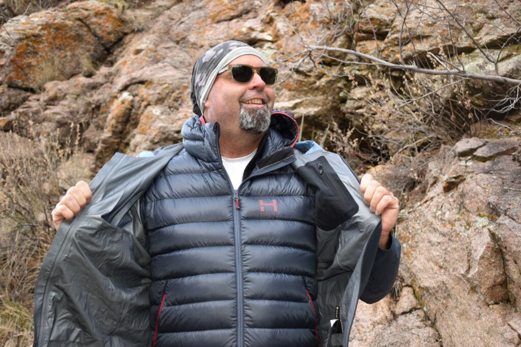
- Best Down Jacket Overall: Men’s Patagonia Down Sweater Hoodie / Women’s Patagonia Down Sweater Hoodie
- Best Fleece Jacket Overall: Men’s Patagonia Better Sweater / Women’s Patagonia Better Sweater
- Best Sunshirt Overall: Men’s Outdoor Research Echo / Women’s Outdoor Research Echo
- Best Socks Overall: Men’s Darn Tough Light Hiker Micro Crew / Women’s Darn Tough Light Hiker Micro Crew
- Beste Ultralight Liner Glove: Patagonia Capilene Midweight Liner
- More: Check out our best backpacking apparel lists for more options
FOOTWEAR & TRACTION
- Best Hiking Shoes Overall: Men’s HOKA Speedgoat 6 / Women’s HOKA Speedgoat 6
- Best Hiking Boots Overall: Men’s Salomon X Ultra 5 GTX / Women’s Lowa Renegade Evo GTX
- Best Hiking Sandals Overall: Men’s Chaco Z/1 Classic / Women’s Chaco Z/1 Classic
- Best Camp Shoes Overall: Crocs Classic Clogs
- Best Traction Device for Hiking Overall: Kahtoola MICROspikes
- More: Check out our best backpacking footwear lists for more options
NAVIGATION
- Best GPS Watch Overall: Garmin Instinct 2 Solar
- Best Personal Locator Beacon (PLB): Garmin inReach Mini 2
- More: Check out our article How to Use Your Phone as a GPS Device for Backpacking & Hiking to learn more
FOOD
FIRST-AID & TOOLS
- Best First-Aid Kit Overall: Adventure Medical Kits Ultralight/Watertight .7
- Best Pocket Knife Overall: Kershaw Leek
- Best Multitool Overall: Leatherman Wave+
- Best Headlamp Overall: Black Diamond Spot 400-R
- Best Power Bank Overall: Nitecore NB 10000 Gen 3
- More: Check out our best first-aid kit guide, best pocket knife guide, best multitool guide, best backpacking headlamps guide, and best power banks guide for more options
MISCELLANEOUS
- Best Trekking Poles Overall: Black Diamond Pursuit
- Best Backpacking Chair Overall: REI Flexlite Air
- Best Backpacking Stuff Sack Overall: Hyperlite Mountain Gear Drawstring
- More: Check out our best trekking poles guide, best backpacking chairs guide, and best stuff sacks guide for more options
Conclusion
The Idaho Centennial Trail is a rugged long-distance adventure that requires a fair amount of planning and comfort in the backcountry. But for those who love solitude and natural beauty, the ICT is one of our favorite backcountry adventures.
And be sure to check out some of our other popular content: