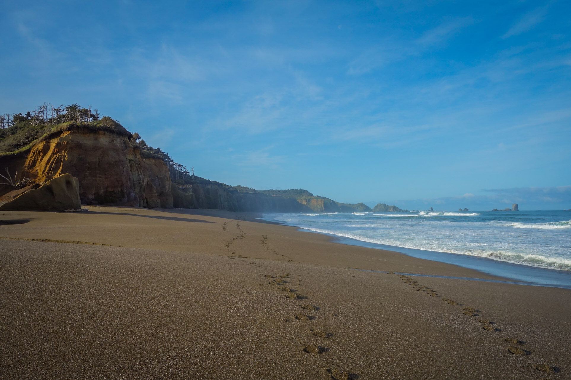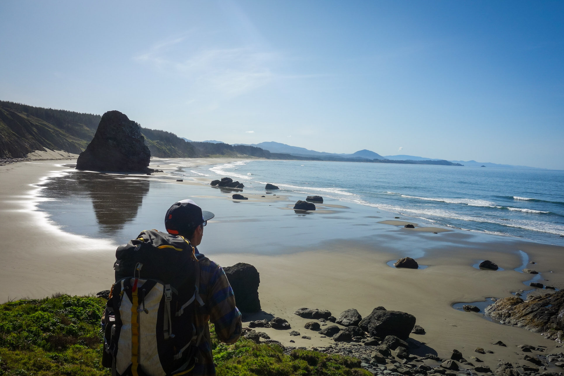
Exploring this beautiful section of the Oregon Coast Trail was a spectacular reminder of how rewarding and diverse backpacking can be. The pristine seclusion of this 30-mile stretch of Oregon coast blew us away. We highly recommend placing this trip on your Oregon backpacking to-do list. You will not be disappointed.
Here’s a quick trip report and some helpful planning tips to make your trek more straightforward. If you have any thoughts or questions, please leave a comment below.
Highlights
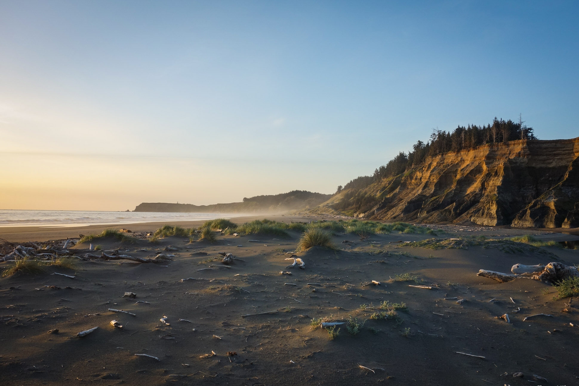
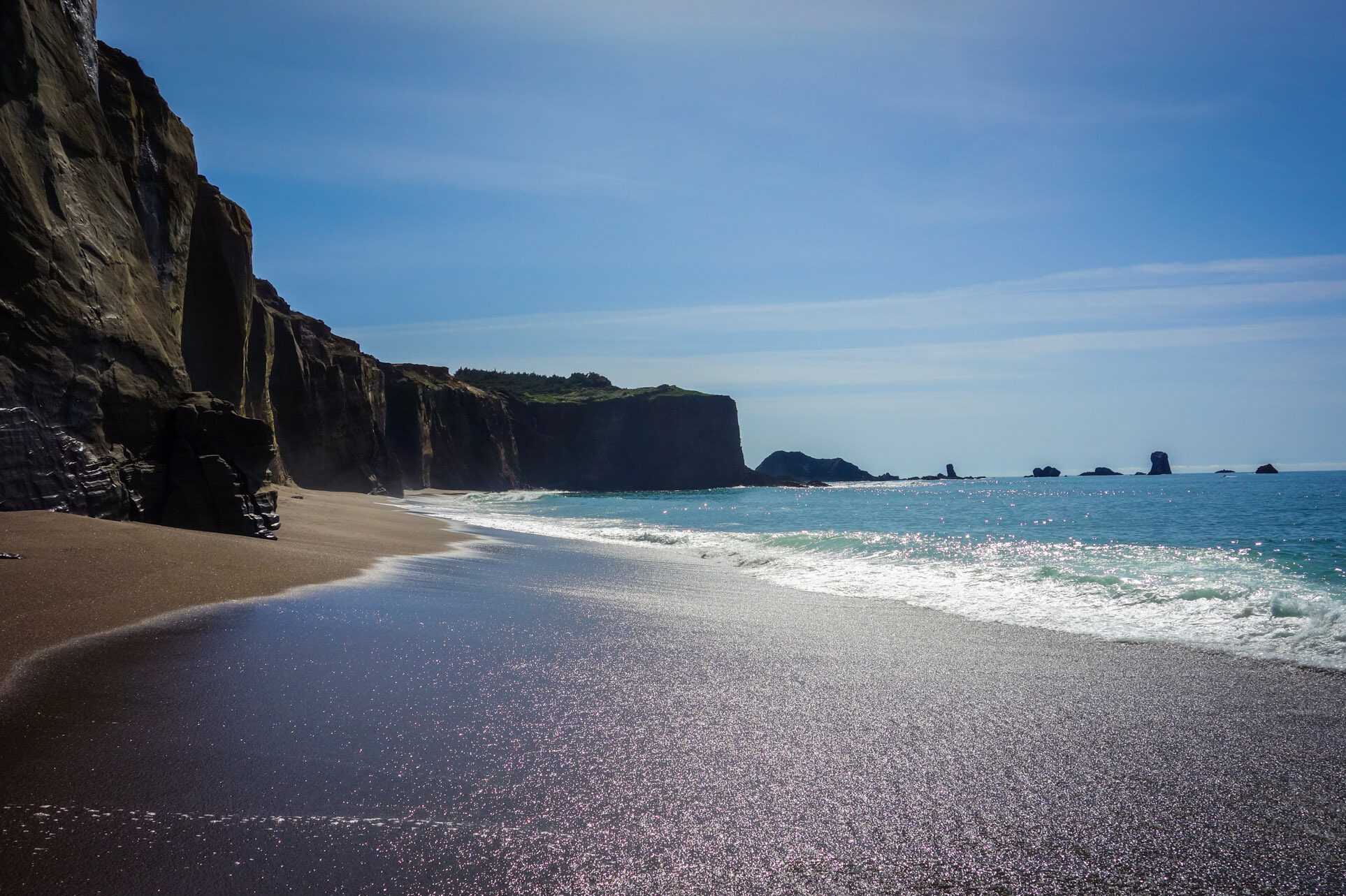
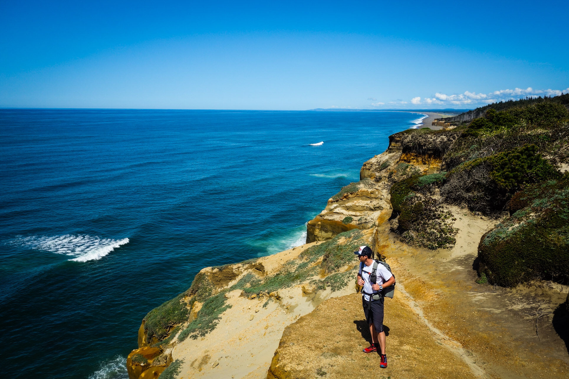
- Pristine beach scenery
- Surprising solitude
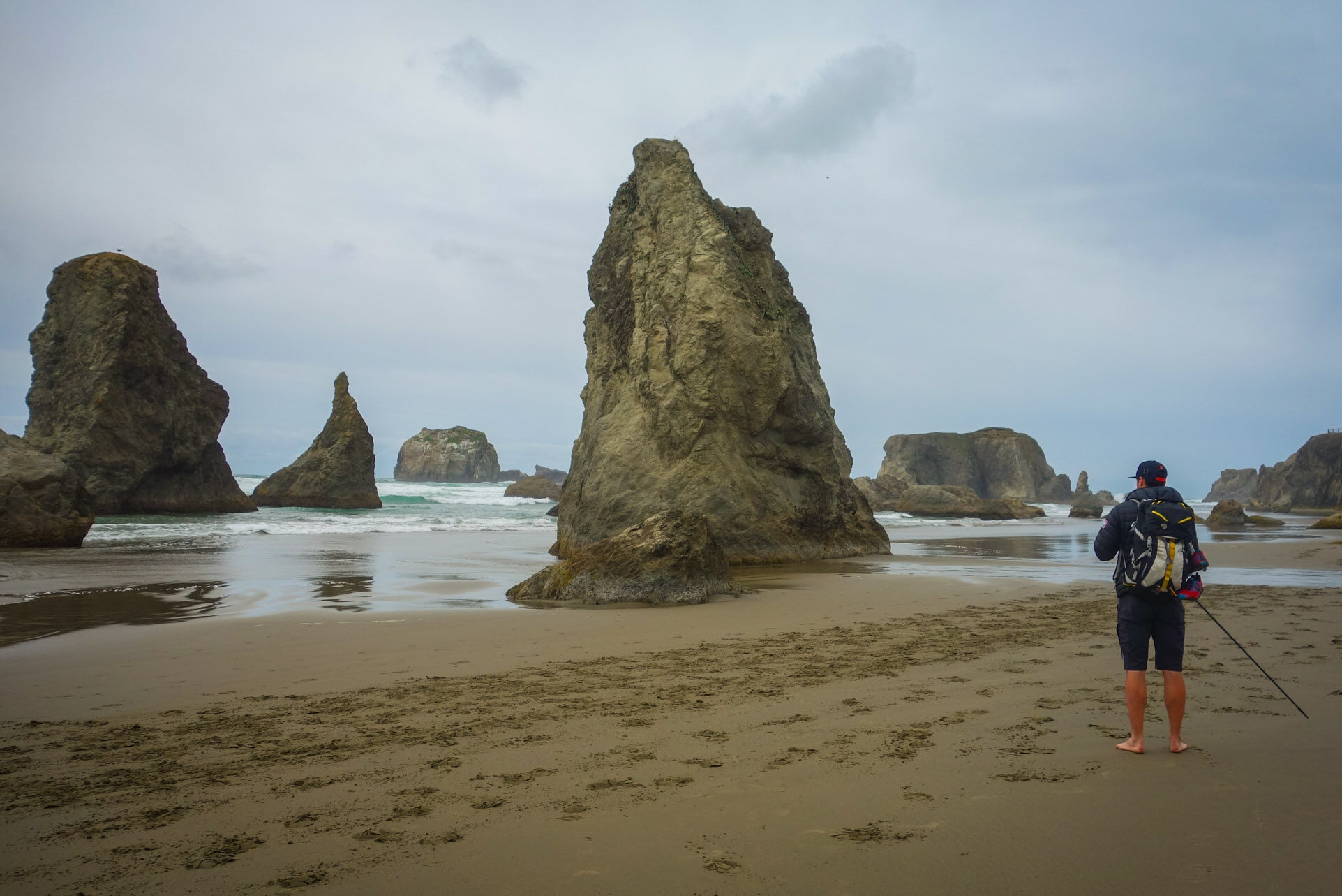
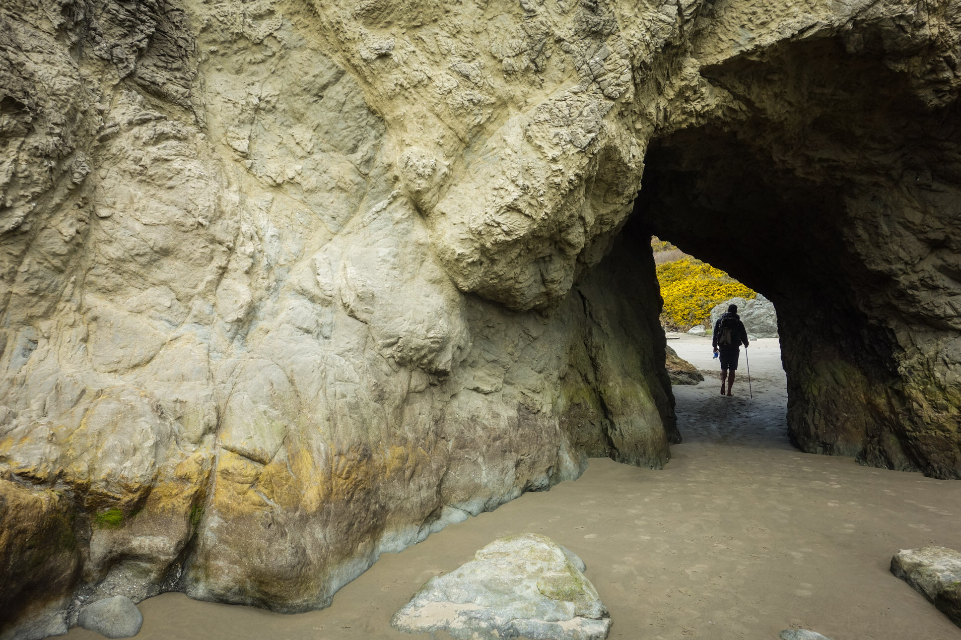
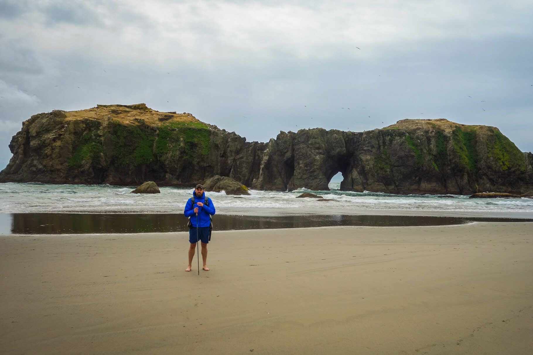
- Rugged rock formations
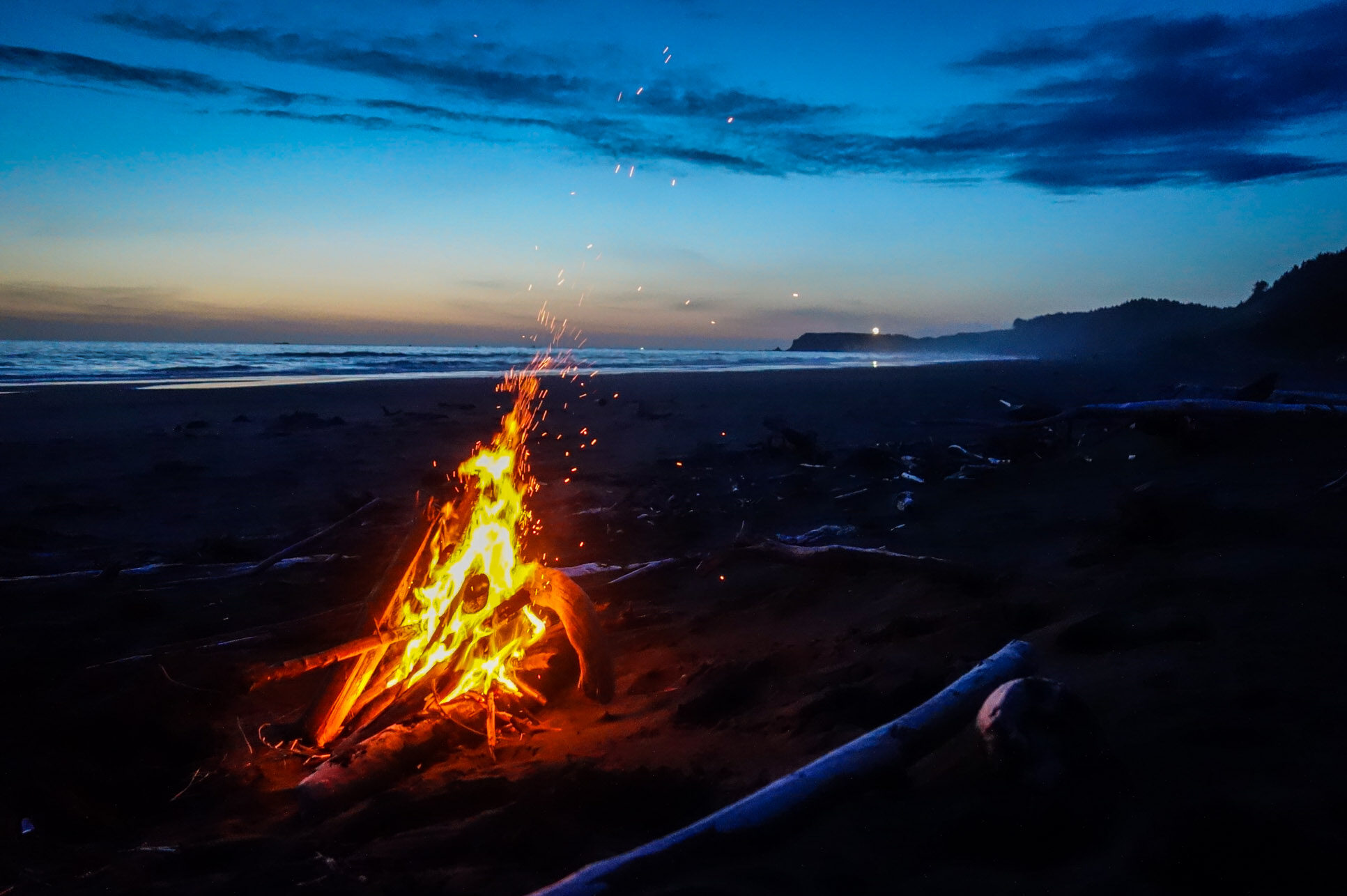
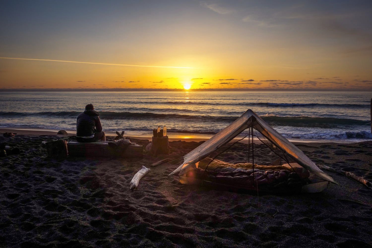
- Magnificent sunsets
- Abundant ocean wildlife (bring binoculars)
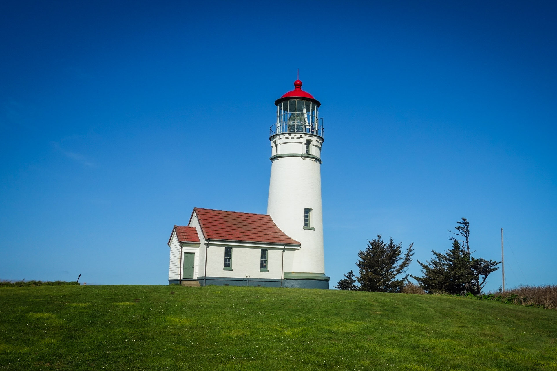
- Cape Blanco Lighthouse
- No permits needed
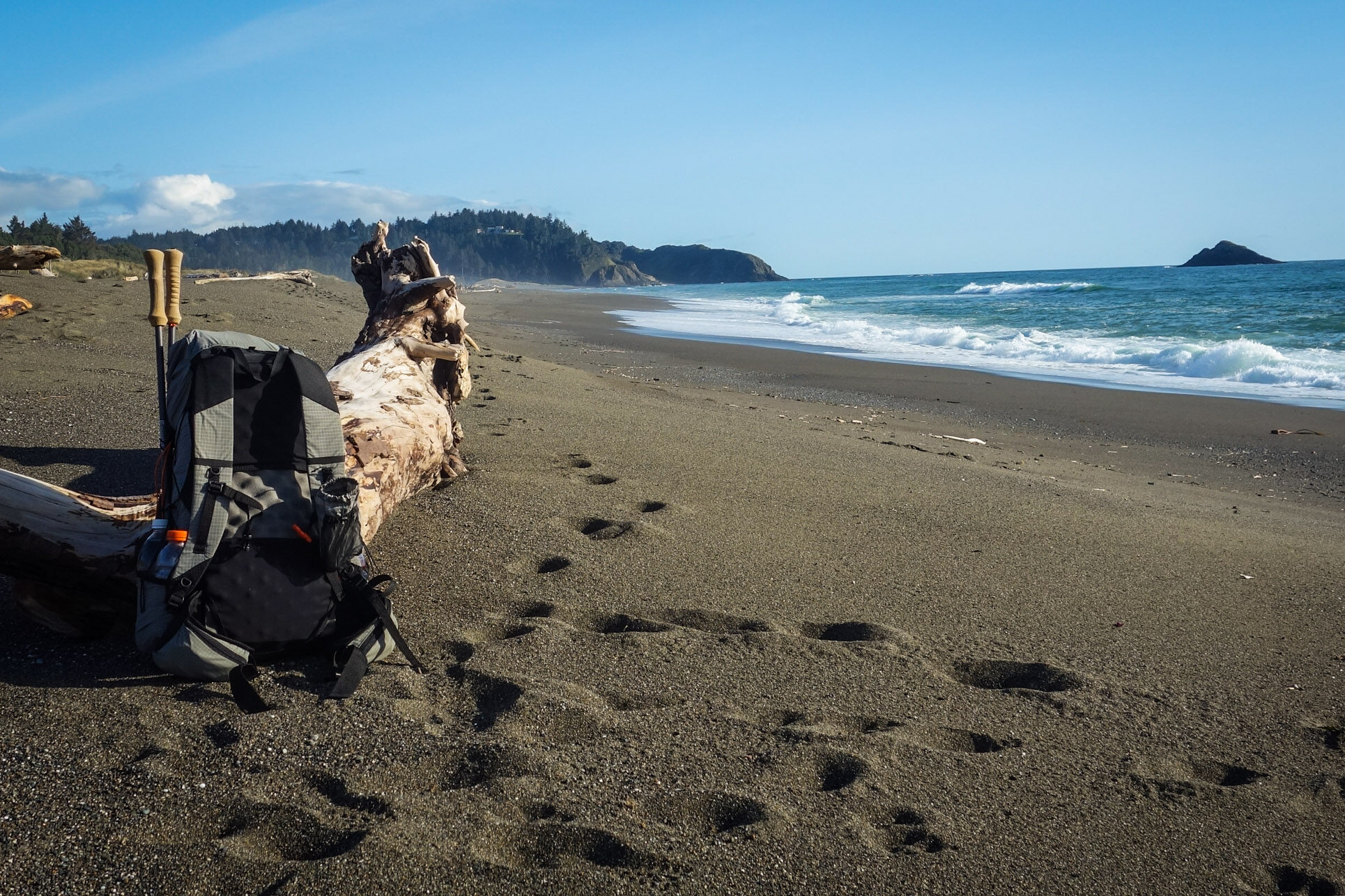
- Walking on hard-packed sand
Lowlights
- 3 large river crossings
- Some camping restrictions
- Shuttle or hitchhike necessary
- Possibility of strong storms and wind
- Walking on soft sand
Trip Timing
We spent 3 days and 2 nights hiking this 30-mile stretch of beach. We packed light, so the pace of the trip was quite relaxing. It was almost too relaxing actually – we kind of wanted more walking and ended up taking a couple of side trips to add mileage. If you think you’d enjoy a lighter pack (who doesn’t?), check out our article on ultralight backpacking basics.
We completed this trip at the beginning of April. This trek is open year-round, but it will be best in the spring, summer, and fall when the weather is warmer and river levels are lower. April could have been a tough time for us to cross the rivers, but we didn’t have any issues. Also, pay close attention storm warnings before your trip. The sea can get very angry on the coast when heavy storms roll in, so don’t take any chances.
Difficulty – Moderate
This trip is about 30 miles with very little elevation gain and three large rivers to ford. When the tide is low, there are large sections of hard-packed sand that make walking easy. When the tide is high (and on some narrow beach sections), you’ll have to walk on softer sand, which will wear out your calves. You’ll only have to walk in soft sand for about ¼ of the trip, and it’s not that bad. Print out a tide timetable for the dates of your trip. Be aware of king tides (exceptionally high tides from new moons or full moons) and storm swells that can bring in massive and rogue waves.
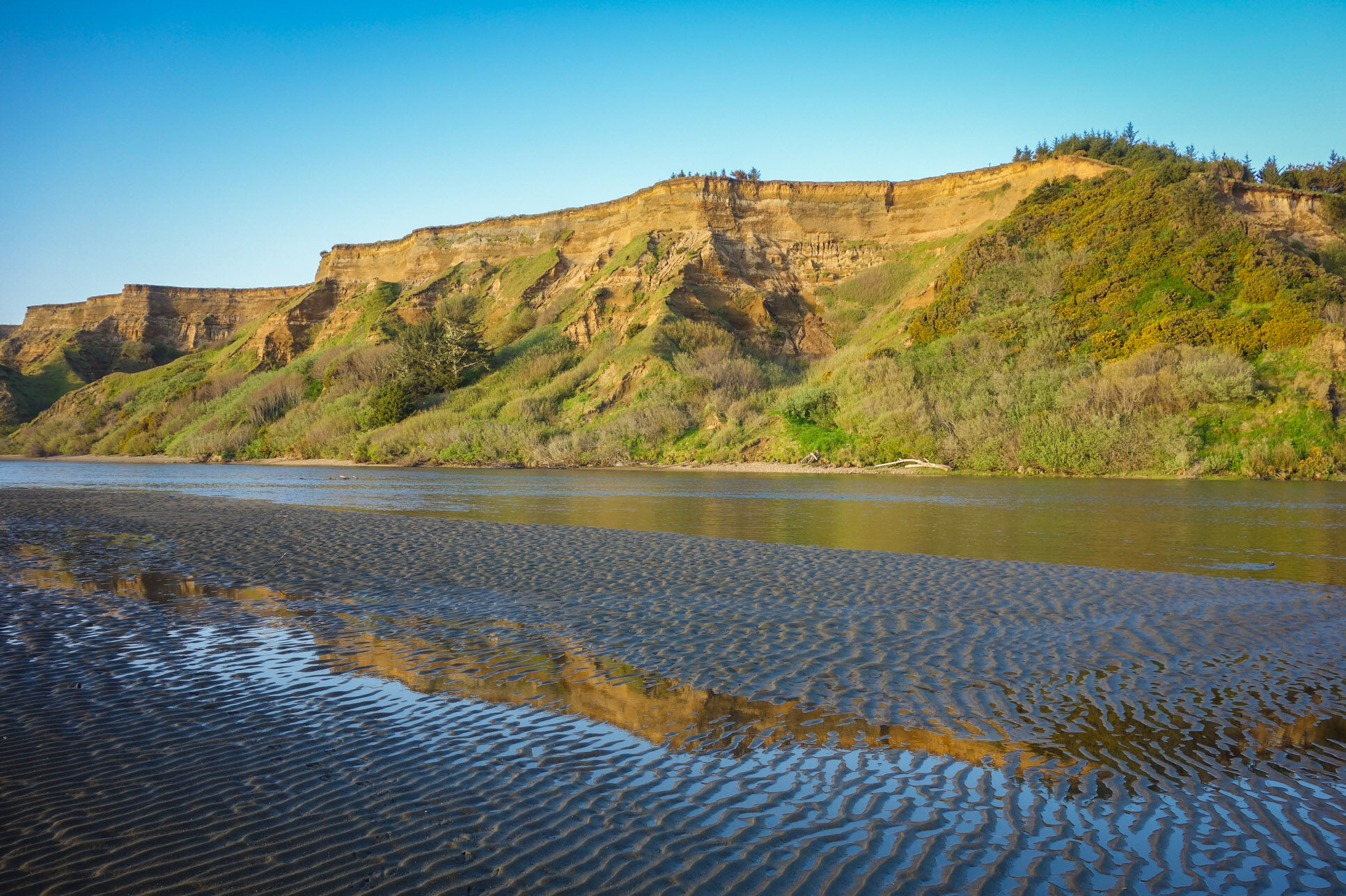
River Crossing
The other possibly challenging element of this trek is fording rivers. The Elk River, the Sixes River, and Fourmile Creek will all require getting your feet wet – likely up to thigh level. We considered these moderate to advanced crossings, depending on the conditions. They will be easy when the river levels are low (summer, early fall) and more challenging when the rivers are high. But don’t be dissuaded from this trip just because of these crossings. Learn or refresh the skill of river crossings with our backcountry river crossing skills tutorial. Check on conditions before you travel, scout out a safe ford, cross a wide section of the river, and turn back if it ever feels unsafe.
Shuttle / Bus / Hitchhike
You could plan a shorter out-and-back hike on this section, but it’s more common to hike from Bandon to Port Orford (or vice versa) and then shuttle/bus/hitchhike back to where you started. Heading south or north will both be rewarding routes, so choose what’s easiest for you.
The obvious challenge with this strategy is getting back to where you started. You could take two cars, but that rarely makes sense. The Curry Coastal Express is a bus system that runs between the two towns. The stops are at Ray’s grocery store. Alternatively, you could hitchhike, which is what we did. The 101 runs directly through both towns and is less than a mile from the beach in either town. For that reason, it was very easy to pick up a ride. We got a hitch in about 15 minutes, and the drive took about 30 minutes.
Note: If you’re hitchhiking, don’t get in the car if it doesn’t feel right. Tell the car to go on without you and walk away.
Snowy Plover Restrictions
In general, you can camp anywhere on the Oregon Coast as long as you’re not in a state park, you’re not within view of any houses, and you’re not in a restricted area. In the Bandon to Port Orford section (see this state park-provided map), some clear restrictions delineate where you can hike and camp on the beach. Additionally, the Oregon State Parks notices page has information on temporary changes, restrictions and closures.
There’s an 11-12 mile section where you won’t be able to camp starting at Bandon and heading south. The area is restricted due to an endangered bird species – the Western Snowy Plover. It’s a neat little bird, so the hassle is worth it.
Snowy plovers nest in dry open sand, in tiny, shallow scrapes that are very well-camouflaged. Not only are nests easy to miss (or step on), but the bird will abandon its eggs if disturbed too frequently. Restrictions in this stretch limit you to hiking only on wet sand. Fires, dogs, and camping are also prohibited during the nesting season (March 15-Sept 15).
If you plan on hiking south from Bandon, start out early so you can get past this section. If you are heading north from Port Orford, don’t expect to camp anywhere within 11-12 miles of Bandon before your last day of hiking.
Campfires
Oregon continues to have severe forest fires. While backpackers rarely start them on the coast, there might be strict seasonal campfire/flame restrictions in place when you go to hike the Oregon Coast Trail. Practice extreme caution if you plan on having a campfire, even at a campground. It’s an extreme rarity that forest fires are started on purpose. Most of the time, people who start forest fires are outdoor enthusiasts who make simple mistakes.

Water, Bugs & Animals
Water is readily accessible along this route. Bring a good water filter, and don’t drink the salt water.
Coastal breezes provided us with no bug issues at all. You never know, though, so be prepared. A combination of Permethrin on your clothing and a VERY small amount of 30% DEET on exposed skin will keep you 100% protected. It’s like wearing a frickin’ mosquito forcefield.
We had no problems with animals either. However, that doesn’t mean that they aren’t out there. The Pacific Coast has some well-fed and clever raccoons. Review how to properly store your food with our essential skills tutorial so your rations don’t tempt the wildlife.
Maps & Guidebook
Maps aren’t really required for this section because you mostly follow the coast with a couple of bluff walk-arounds. That said, Oregon State Parks has a helpful informational page with maps of all the sections of the Oregon Coast Trail, including the Bandon to Port Orford section. It is always good backpacking sense to carry a printed map and download a map (we like Gaia GPS and Topo Maps+ to your phone so you know all the mileages and landmarks on the trail. There are a few places you could get confused, and that’s always a bummer. Oregon State Park also publishes an annual tide chart that we suggest taking a picture of.
The Backpacking Oregon Guidebook is an excellent guide for this hike, as well as many other Oregon backpacking adventures. It provides detailed descriptions of the trail and includes a straightforward, easy-to-read map. I strongly suggest grabbing a copy—along with any of the other state-specific editions in the series.
Getting There
It’s pretty easy to get on this “trail” which is mostly beach walking. If you head to Bandon or Port Orford, hit the beach, and start walking toward the other town. You might find parking restrictions in either town if you’re looking to park next to the beach, but if you drive a short distance away, you’ll find a place to stash your rig.
Gear List
Make sure to check out our Ultimate Backpacking Checklist, so you don’t forget something important.
Below you’ll find our current favorite backpacking gear. If you want to see additional options, our curated gear guides are the result of many years of extensive research and hands-on testing by our team of outdoor experts.
BACKPACK
- Best Backpacking Pack Overall: Gregory Paragon 58 – Men’s / Gregory Maven 58 – Women’s
- Best Ultralight Backpacking Backpack: Hyperlite Mountain Gear Unbound 40
- More: Check out our best backpacking backpacks guide for ultralight and trekking options
TENT
- Best Backpacking Tent Overall: Big Agnes Copper Spur HV UL2
- Best Ultralight Tent: Zpacks Duplex
- Best Budget Tent: REI Half Dome 2
- Best Tent Stakes Overall: All One Tech Aluminum Stakes
- More: Check out our best backpacking tents guide for more options
SLEEPING BAG/QUILT
- Best Sleeping Bag Overall: Men’s Feathered Friends Swallow YF 20 / Women’s Feathered Friends Egret YF 20
- Best Quilt Overall: Enlightened Equipment Revelation 20
- More: Check out our best backpacking sleeping bags guide and best backpacking quilts guide for more options
SLEEPING PAD
- Best Sleeping Pad Overall: NEMO Tensor All-Season
- Best Foam Sleeping Pad: NEMO Switchback
- More: Check out our best backpacking sleeping pads guide for ultralight and trekking options
CAMP KITCHEN
- Best Backpacking Stove Overall: MSR PocketRocket 2
- Best Backpacking Cookware Overall: TOAKS Titanium 750ml
- Best Backpacking Coffee Overall: Starbucks VIA
- More: Check out our best backpacking stoves guide and best backpacking cookware guide for ultralight and large group options
WATER & FILTRATION
- Best Water Filter Overall: Sawyer Squeeze
- Best Hydration Bladder Overall: Gregory 3D Hydro
- Best Backpacking Water Bottles: Smartwater Bottles
- More: Check out our best backpacking water filters guide and best backpacking water bottles guide for ultralight and large group options
CLOTHING
- Best Hiking Pants Overall: Men’s Outdoor Research Ferrosi / Women’s The North Face Aphrodite 2.0
- Best Hiking Shorts Overall: Men’s Patagonia Quandary / Women’s Outdoor Research Ferrosi
- Best Women’s Hiking Leggings: Fjallraven Abisko Trekking Tights HD
- Best Rain Jacket Overall: Men’s Patagonia Torrentshell 3L / Women’s Patagonia Torrentshell 3L
- Best Rain Pants: Men’s Patagonia Torrentshell 3L / Women’s Patagonia Torrentshell 3L
- Best Down Jacket Overall: Men’s Patagonia Down Sweater Hoodie / Women’s Patagonia Down Sweater Hoodie
- Best Fleece Jacket Overall: Men’s Patagonia Better Sweater / Women’s Patagonia Better Sweater
- Best Sunshirt Overall: Men’s Outdoor Research Echo / Women’s Outdoor Research Echo
- Best Socks Overall: Men’s Darn Tough Light Hiker Micro Crew / Women’s Darn Tough Light Hiker Micro Crew
- Beste Ultralight Liner Glove: Patagonia Capilene Midweight Liner
- More: Check out our best backpacking apparel lists for more options
FOOTWEAR & TRACTION
- Best Hiking Shoes Overall: Men’s HOKA Speedgoat 6 / Women’s HOKA Speedgoat 6
- Best Hiking Boots Overall: Men’s Salomon X Ultra 5 GTX / Women’s Lowa Renegade Evo GTX
- Best Hiking Sandals Overall: Men’s Chaco Z/1 Classic / Women’s Chaco Z/1 Classic
- Best Camp Shoes Overall: Crocs Classic Clogs
- Best Traction Device for Hiking Overall: Kahtoola MICROspikes
- More: Check out our best backpacking footwear lists for more options
NAVIGATION
- Best GPS Watch Overall: Garmin Instinct 2 Solar
- Best Personal Locator Beacon (PLB): Garmin inReach Mini 2
- More: Check out our article How to Use Your Phone as a GPS Device for Backpacking & Hiking to learn more
FOOD
FIRST-AID & TOOLS
- Best First-Aid Kit Overall: Adventure Medical Kits Ultralight/Watertight .7
- Best Pocket Knife Overall: Kershaw Leek
- Best Multitool Overall: Leatherman Wave+
- Best Headlamp Overall: Black Diamond Spot 400-R
- Best Power Bank Overall: Nitecore NB 10000 Gen 3
- More: Check out our best first-aid kit guide, best pocket knife guide, best multitool guide, best backpacking headlamps guide, and best power banks guide for more options
MISCELLANEOUS
- Best Trekking Poles Overall: Black Diamond Pursuit
- Best Backpacking Chair Overall: REI Flexlite Air
- Best Backpacking Stuff Sack Overall: Hyperlite Mountain Gear Drawstring
- More: Check out our best trekking poles guide, best backpacking chairs guide, and best stuff sacks guide for more options
Oregon Code of the Coast
You’re probably familiar with the principles of leave no trace (LNT) as a code of conduct to reduce human impact on wild places. Beyond practicing LNT, visitoregoncoast.com created 15 things to keep in mind while recreating on the Oregon Coast. This Code of the Coast is a social contract intended to respect each other and the coast. From how to explore tidepools, to protecting Oregon’s Silverspot Butterfly, to seal pups and sea stacks, this is your guide on how to enjoy and protect the rich landscape of the Oregon coast.
Additional Resources
This vlogger made two YouTube videos of his Bandon to Port Orford hike in January 2013. Warning: In the first video, he spends a lot of time discussing a river crossing that gives him trouble, and he’s carrying a much heavier pack than a lightweight backpacker would. The second video shares some good shots of the area’s scenery, and it’s inspiring to witness his guts to get out into the wild and hike.
The Oregon Coast Trail runs the length of Oregon along the coast with some walk-arounds for big rivers and tough sections. Oregon.gov has some helpful info on the OCT as does the National Coast Trail Association.
More Information
We hope this guide helps you plan an unforgettable journey along the Arizona Trail. For more popular CleverHiker content, check out the following links: