The GR11 – also known as the Senda Pirenaica – is one of three main routes that traverse the Pyrenees from the Atlantic Coast to the Mediterranean Sea. The GR11 stays almost entirely on the Spanish side of the Pyrenees, parallel to the GR10, another thru-hiking trail on the French side. This route offers a rewarding and challenging adventure through one of the most spectacular mountain ranges on Earth.
Quick Facts
- Distance: ~500 miles (820-850 km)
- Time Needed: 5-8 weeks
- Highest Elevation: 9,200 feet
- Lowest Elevation: 0 ft
- Elevation Gain/Loss (Approximate): 150,000 ft
- Best Time to Hike: July-September
- Permits: None
- Difficulty: Difficult
Highlights
- Incredible mountain views
- Tons of culture
- Hikers from all over the globe
- Refugios (mountain huts)
- Lots of wine and coffee
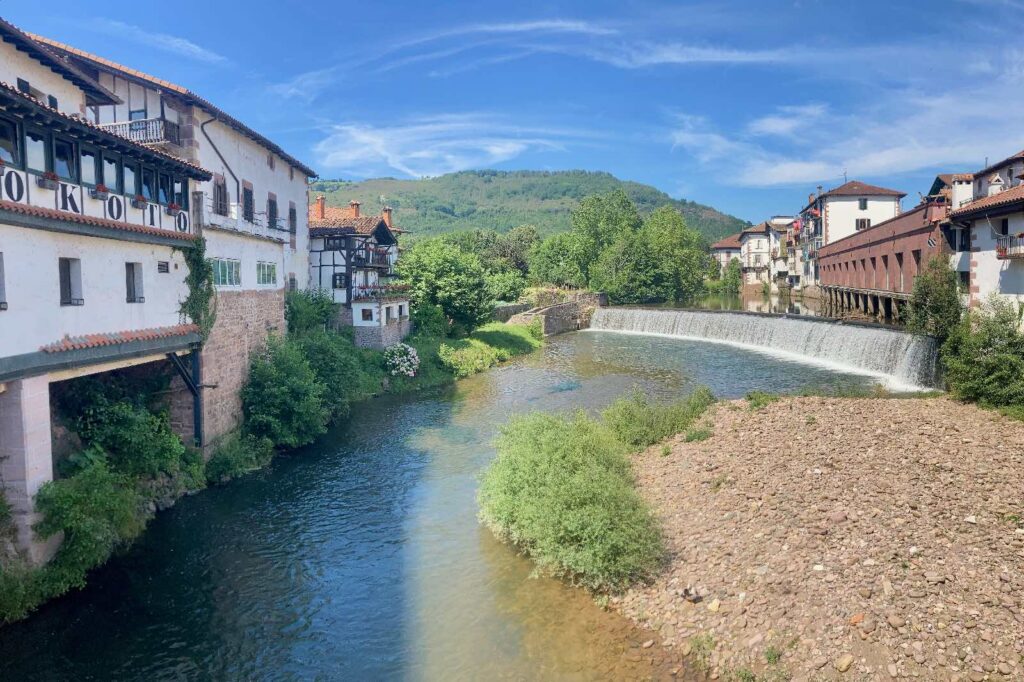
- Medieval villages
Lowlights
- Tricky navigation in some sections
- Murky camping laws
- Language barrier
- Extremely strenuous
- Cows everywhere
When is the best time to hike?
The best time to hike the GR11 is between July and September. By late June, most refugios (mountain huts) are opening their doors, and high mountain passes are mostly snow free. For more open refugios and drier trails, consider going in late July to August – although the trail will be at its busiest during that window.
How long does it take to hike the GR11?
Traversing the entire range of the Pyrenees on the GR11 typically takes between 5 and 8 weeks. Even if you’ve previously hiked a 500-mile trail in the U.S. (such as the Colorado Trail), we recommend adding at least another week onto your trip duration. The reason? The mileage might be the same, but the GR11 has significantly more elevation gain than almost any other US trail of the same length.
How difficult is the GR11?
The GR11 has a number of formidable challenges, such as difficult terrain, complicated navigation, and unpredictable weather, which make it an especially challenging trail. However, each is manageable with the proper expectations and planning.
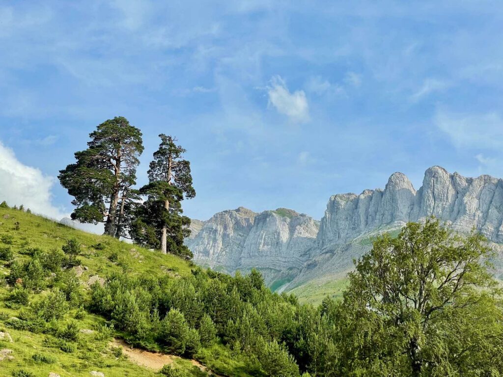
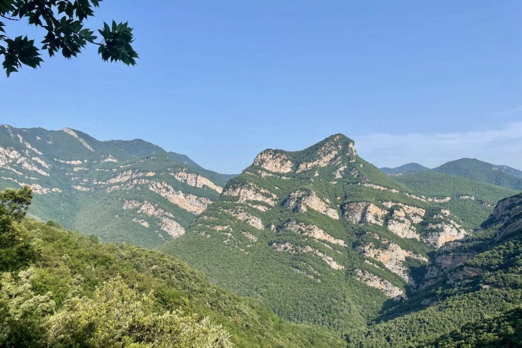
What is the Terrain like?
The GR11 is no walk in the park. We chose it over the more popular Camino De Santiago for its more mountainous terrain and wilderness experience. In fact, the two trails could not be more unalike.
Depending on which variants you take, the GR11 is about 520 miles long with a little over 150,000 feet of elevation gain and loss. This means if you attempt to knock out the trail in 30 days, you’ll be tackling a whopping 5000 feet of elevation gain and loss every single day. To add to the difficulty, the Pyrenees feature extremely rocky, uneven terrain. Switchbacks are a rare luxury.
What are the best Navigation tools?
The GR11 is more of a rough concept than a well-defined path. That said, there are countless variants and opportunities to hop on the Haute Route or other GR trails to ease up on the intensity. The route can also feel ambiguous because it’s shared with livestock who carve their own paths.
The standard guidebook for the GR11 is the Cicerone Guide, which provides valuable information on resupply, mileage, refugios, and more.
Our top recommendation, though, is the Czech app, Mapy.cz. It’s a comprehensive map/gps that works amazingly well once you download the region. It gives point-to-point distances, elevation gain, and even approximate hiking times.
What is the WEATHER like on the GR11?
Compared to the GR10 on the French side of the Pyrenees, the GR11 more arid in the summer, but storms aren’t uncommon. Rain tends to hit most often on the western half of the trail in Basque country. During our roughly 30 days on trail, we had about 2-3 full days of moisture.
Like many high mountain ranges, the Pyrenees experience daily late afternoon thunderstorms during the summer. To mitigate lightning risk, you’ll want to get up and over the high point for the day as early as possible.
How to plan your GR11 trip
Here are our first-person tips on choosing which direction to hike the GR11, arranging transportation, and budgeting.
Choosing a Direction: Eastbound vs. Westbound
Most people hike the GR11 from west to east, beginning in the humid, rolling hills of Basque country and climbing over the high peaks of Aragon and Andorra, and then ending in the hot, arid climate of Catalonia on the Mediterranean Sea.
In hiking terms, direction doesn’t make much difference – the views are just as beautiful and the elevation gain and loss is comparable. It more depends on whether you want to travel to and from your terminus at the start of your trip, or save coordinating transportation for the end of your journey.
What’s the best Starting Point?
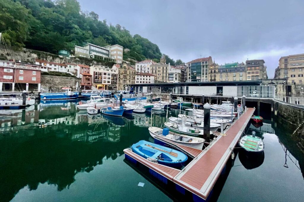
If you’re planning on hiking the trail in the typical Westbound direction, you’ll fly into and out of Bilbao, Spain, then take a short bus ride to Irun (just north of San Sebastian) to start the hike. If you’ve got an extra day, it’s worth spending time in the picturesque (and romantic) city of San Sebastian.
What are the Transportation options in Spain?
Spain has a number of convenient transportation options, but it’s still best to plan ahead.
Flixbus is a handy app that compares bus fares across the country and allows you to track routes in real time.
BlaBlaCar is another indispensable app which helped on numerous occasions. It’s essentially a paid hitchhiking app where drivers can list their planned driving route, and travelers can hop in an extra seat for a fee. It’s mutually beneficial – offsetting fuel costs for drivers and offering affordable transportation for travelers. It also offers an excellent opportunity to meet locals and fellow travelers!
Hitchhiking is one option we would not recommend in Spain. Finding a ride can be difficult and slow. Thumbing is not unheard of, but it’s not as common as it is in the United States and other parts of the world.
What’s the best way to get Home?
The official eastern terminus of the GR11 is the remote peninsula of Cap Da Creus. If you don’t time it just right to catch the seasonal tourist bus back to the town of Cadeques, you’ll need to walk two hours along the coastal path back to town or arrange a taxi in advance. From Cadaques, you can take a local bus directly to Barcelona and then fly back to Bilbao.
What Budgeting considerations are there?
Not including travel, hiking the GR11 is slightly less expensive than most long trails in the US. On average, a stay at a refugio with full board – including dinner, a bed, shower, and breakfast – costs €60+ per night. On our trip, food typically was 10-20% cheaper than we’re used to in the States.
How should I pack FooD and Resupply on the GR11?
Finding resupply opportunities on the GR11 is a piece of cake. One of the reasons the overall elevation gain/loss is so hefty is because the trail climbs up to the high peaks and then dips right back down into a town or village pretty much every single day. When the trail doesn’t head back into town, it passes an average of one refugio per day, where you can eat a hot meal and take away a snack or sandwich to hold you over until the next refugio or town.
The main difficulty is variety and options for people with allergies and dietary restrictions. Most of the trail towns along the GR11 are small mountain villages that don’t cater to hikers as much as trail towns in the US. Certain hiker staples such as peanut butter are hard to come by. Gluten and meat are essential parts of the typical Spanish diet.
Where can I source Water?
A good water treatment plan – including a backup method – is critical on the GR11. With the exception of the far eastern stretches of the trail in Catalonia, water sources are common. However, most easily-accessible water is heavily contaminated by farm land and free range cattle. Even in high elevations, you’ll find herds of cows and horses congregating (and defecating) around lakes, streams, and rivers.
To our surprise, many Europeans hiked the trail with no water purification – simply relying on their best judgment. We weren’t willing to take the chance.
Where can I Sleep on the GR11?
There are numerous refugios and towns along the GR11 that offer lodging. Many people simply hike with a day pack and rely solely on these places for lodging along the entire trail. However, that can get pricey, and rooms often fill up. There are also plenty of small, abandoned emergency structures along the trail called “bothies,” which vary in size and comfort.
Wild camping laws in Spain are grey to say the least. The vast amounts of public land in the US make camping near long trails easy. In Spain, however, the trail is usually adjacent to private land.
In most cases, wild camping is illegal. However, you can “emergency” bivouac above a certain elevation between 8pm and 8am or ask permission from a local refugio or land owner to set up camp nearby for the night. We were able to utilize these grey areas to tent camp most nights on the GR11.
What Wildlife is on the GR11?
There’s hardly any wildlife to speak of in Spain. There are bears in Spain, but the population is extremely low and the likelihood of running into one is negligible. You’ll just see plenty of horses and cows along the trail.
The only animal of concern is wild boars. We never actually saw a wild boar but heard plenty of them rooting around at night. A couple even ran right past our tent!
What gear should I pack for the GR11?
Packing for the GR11 is similar to packing for most long distance trails in the Mountain West: ample sun protection, reliable rain gear, and a good water purification strategy. Here are the broad strokes of the kit my partner and I carried on the GR11:
Pack
Sleep System
Shelter
Hiking Gear
Rain Gear
Water Treatment
Camp Kitchen
- Toaks Titanium 750mL Pot
- MSR PocketRocket 2 Stove
- BRS 3000T Stove
- Snow Peak Titanium Spork
- Toaks Titanium Long Handle Spoon
Electronics
Final Thoughts
The Pyrenees is a breathtaking mountain range with lots to offer, from high alpine scenery to centuries of history and medieval villages. However, the GR11 is no light undertaking. A little bit of preparation goes a long way to making your trip not only a success but an adventure of a lifetime.
No matter where your wanderlust takes you, we hope this guide has inspired you to get out there and enjoy this beautiful space rock we live on.