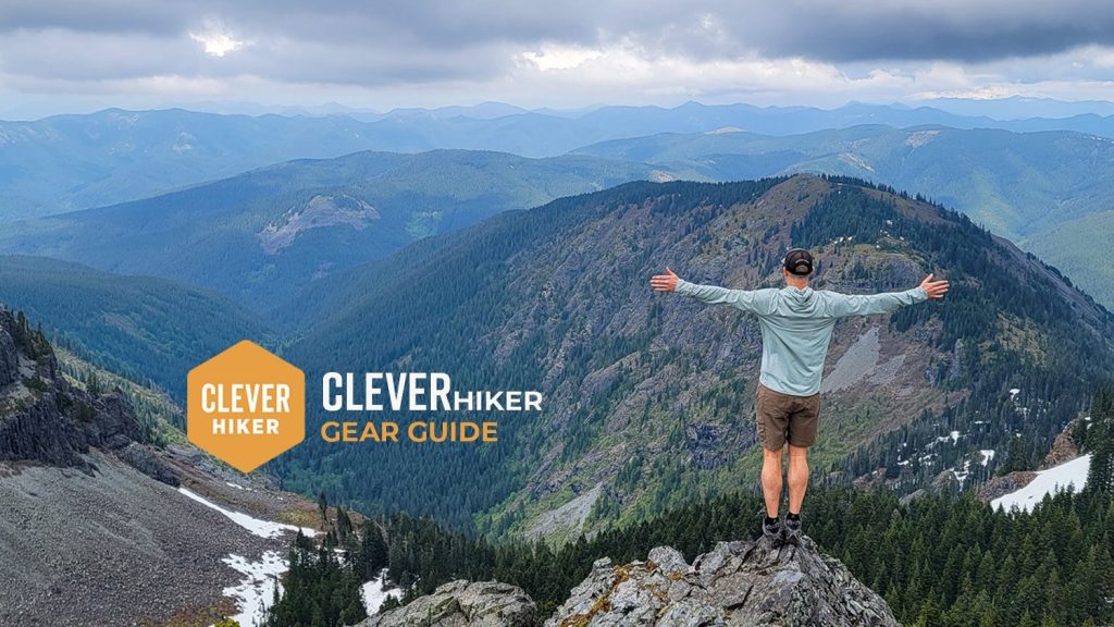
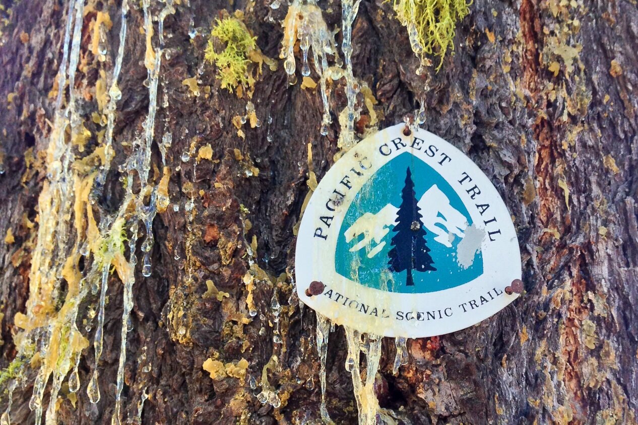
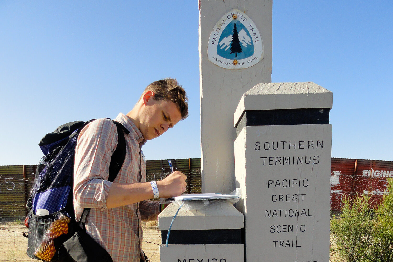
The Pacific Crest Trail is a long-distance hiking and equestrian trail that traverses the backbone of the western United States from the US/Mexican border to the US/Canadian border. Thru-hiking the Pacific Crest Trail, or PCT, is a fun, powerful, and rewarding experience.
Each year, thousands of people attempt a thru-hike along the trail, but only a little over 17% finish depending on the year and conditions. As experienced thru-hikers, we put together this guide to thru-hiking the PCT, so you know what to expect and how to plan this famous thru-hike.
Quick Facts
- 2,650 – Approximate length in miles of the Pacific Crest Trail
- 3 – Number of states the PCT traverses (California, Oregon, and Washington)
- 6 – Number of National Parks the PCT passes through
- 25 – Number of National Forests the PCT passes through
- 51 – Number of federal and state Wilderness areas the PCT passes through
- 100 – Number of major mountain passes the PCT climbs and descends
- 150 – Average number of days it takes to complete a PCT thru-hike (4.5-5.5 months)
- 489,418 – Approximate elevation gain and loss in feet of the PCT
- 16 – Amount of times a PCT hiker would have climbed Mt. Everest after finishing a thru-hike
- $8,000-$12,000 – Average on-trail expenses, plan to spend $3 – $4 per mile
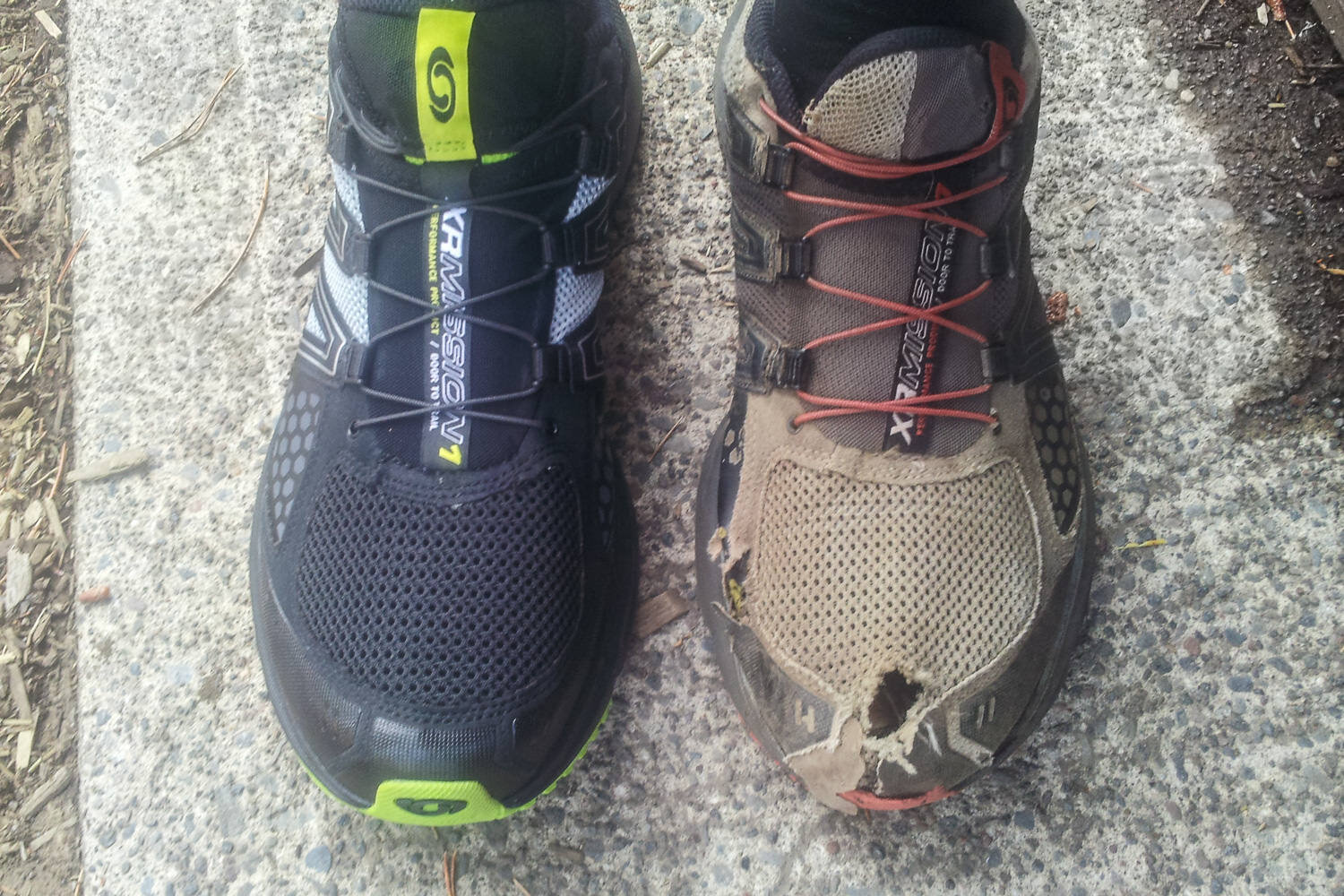
- 4-5 – Average pairs of shoes a PCT hiker will go through
- ~17% – Percentage of people who complete the PCT as a thru-hike out of those who attempt it
What to Expect on a PCT Thru-Hike
Thru-hiking can be one of the most impactful adventures you embark on. If this is going to be your first thru-hike, check out our 21 tips for the first time thru-hiker – it’s packed with good information to help make your first trek a success! It’s really hard to prepare for the lifestyle you’ll have on a long distance trail, but here are some common things you’re likely to experience.
People
Many people start their hike expecting solitude, but the PCT can be a surprisingly social experience. This is especially true in the first few hundred miles of a northbound (NOBO) journey. Since most hikers begin within a short window of time and there are few water sources in Southern California, north bounders tend to gather around the “watering holes.” Many people even group up and hike together.
Since the PCT has become hugely popular in the last few years, the Pacific Crest Trail Association has a stricter permit system (more on this below), which helps disperse hikers along the trail.
Expect isolation and solitude to increase as you enter into the northern states. Some hikers choose to hike southbound (SOBO) to avoid the crowds.
Trail culture
Some people prefer to be lone wolves, which offers a more quiet experience and an increased chance of seeing wildlife. But most thru-hikers embrace the vibrant trail culture that organically springs to life on the PCT.
Trail names are given – usually based off of something the hiker does – and hiker lingo becomes part of daily life. Generally, the trail vibe is fun, lighthearted, supportive, and encouraging. PCT thru-hikers often form deep bonds that can lead to a wide network of friends all over the world.
If you do decide to hike with a group, remember that group dynamics can change over the course of a thru-hike due to various circumstances. Always think for yourself, be self-reliant, and do what makes you happiest – you’re on the adventure of a lifetime, after all!
Extreme conditions
The PCT passes through a gamut of climates, so thru-hikers should be prepared to encounter both intense hot/dry and drenching cold/wet conditions.
One person’s PCT experience may be dramatically different from another hiker’s, based on start date, snow pack, weather, and other variables. But generally speaking, all PCT thru-hikers will pass through unshaded desert, snowy and windswept mountains at high-elevation, and the rain forests of the Pacific Northwest, which can be relentlessly wet.
Some hikers use the same gear for their entire trip. Others swap items in and out as they transition through different seasons, climates, and topography.
Hunger
Thru-hikers burn up to 5,000 calories every day, so it’s nearly impossible to carry and eat enough food to stave off “hiker hunger.” After a couple weeks on the trail, your body will start to deplete its glycogen stores, which usually leads to an insatiable appetite.
To keep energy levels up and to avoid losing too much weight, thru-hikers need to eat copious amounts of calorie- and protein-rich foods. Ideal foods are lightweight, slow to spoil, and affordable.
If you don’t want to be eating the same stuff every day, you’ll need to plan well, do some food prep, and get creative. For some great meal ideas, check out our best backpacking food guide, our guide to making your own backpacking meals, and our best freeze-dried backpacking meals list.
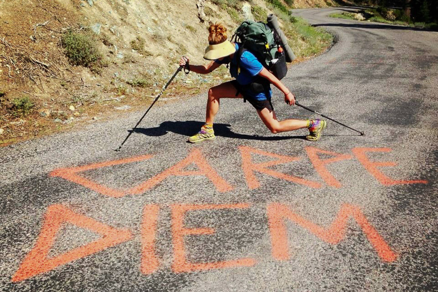
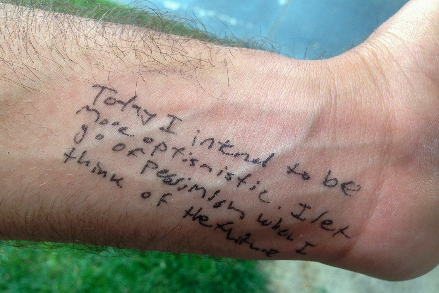
Most challenges are mental, not physical
Hiking the PCT is most certainly physically challenging, but the mental mountains are often harder to clear than the physical ones.
Approximately 25% of people who attempt a PCT thru-hike actually finish. People quit the trail due to many factors, but a gloomy outlook, homesickness, and worries over money are some pretty common reasons why people jump ship.
Make sure you surround yourself with good people who lift you up, do some solid logistical planning before you hit the trail, and never, EVER quit on a bad day.
Planning
Good planning can help relieve a good amount of stress that you – and your loved ones – will likely experience over your thru-hike. The following tips will help you feel more prepared – and help your loved ones understand your journey, too.
MAPS & RESOURCES
Most hikers use the following resources to plan their hikes:
- Craig’s PCT Planner (free resupply calculator/planner)
- PCTA website (permit info, bear canister/fire regulations, current conditions)
- Yogi’s Pacific Crest Trail Handbook (PCT hiker advice, trail towns maps and info)
- The Mountaineers ‘Hiking the Pacific Crest Trail’ series (detailed regional guidebooks with beautiful photography)
- PCT Data Book (mileages, landmarks, facilities, resupply data – available in Kindle or paperback)
Popular maps/navigation tools:
- National Geographic PCT Maps
- Halfmile’s PCT Trail Notes
- Pacific Crest Trail Association’s GPS data (updated as of 2023)
- PCT Maps by Post Holer (for overview, geographic info., and planners)
- USGS PCT Section Maps
- FarOut’s Pacific Crest Trail Guide (GPS) Smartphone App
Current conditions resources:
- The Water Report (intermittently updated by crowd-sourcing and volunteers)
- Google Earth (activate layers that show snow, active fire perimeters, etc.)
- Snow Reports & Charts
Choosing a direction
Choosing which direction to thru-hike the Pacific Crest Trail really depends on your style, schedule, and what you want to get out of the hike. An estimated 80-90% of hikers go northbound on the PCT, but southbound thru-hikes have gained popularity. Here are some things to consider when making your decision.
NOBO (Northbound)
Pros:
- More prevalent trail culture and people to interact with
- slightly longer window of good weather to start and finish in
- Southern California is much easier hiking than Northern Washington (time to build up fitness)
- ending in Washington/Canada feels a lot more epic
Cons:
- Campsites and trail towns can be crowded in the beginning
- more competition for start dates (permit)
- the desert can be hot in April, May, and June
SOBO (Southbound)
Pros:
- Trail is less crowded (more solitude)
- starting with epic scenery
- the desert is cooler in the fall
- lots of transportation options close to the southern terminus
- Cons:
- Can be lonely
- trail is difficult right out of the gate (need to train beforehand)
- mountaineering skills may be required
- slightly shorter window of snow-free conditions to complete your hike
- resupply points can be closed for the season in the Sierra Nevada
- the southern terminus isn’t as epic as the northern one (still beautiful in its own right though)
Picking a start date
Cons:
In a normal year, NOBOs start between March and May. Most head out around mid-late April to get to the Sierra Nevada by June 15th, when snowpack has usually had a chance to dissipate in the passes. NOBO hikers will generally want to reach the Canadian border by late September before snow starts to blanket the North Cascades.
SOBOs will need to wait a little longer to get started since they’ll have to wait for the snow pack to be manageable in the North Cascades. Most SOBOs start in early July. Some start earlier, but snowfield/water crossings can be extremely dangerous and require more technical skill. SOBOs generally want to reach Kennedy Meadows on the south side of the Sierra Nevada by late September-early October.
Permits
Because thru-hiking the PCT has become so popular, the Pacific Crest Trail Association requires a long-distance permit that locks hikers into a set start date.
This makes planning and trail culture slightly different than it used to be – but for a good reason. Staggering start dates prevents overcrowding and disperses the “herd” of hikers, which can be destructive to the environment.
Here’s when and how to apply for a PCT permit. Because of the new permit system, prospective thru-hikers will need to do some initial planning, so they’re prepared to choose an available start date when applying for a permit on one of the PCTA’s release days.
Permits are free, but applicants need to be punctual, patient, and a bit flexible.
Other permits include:
- The California fire permit – Required in most of California to cook on a camp stove.
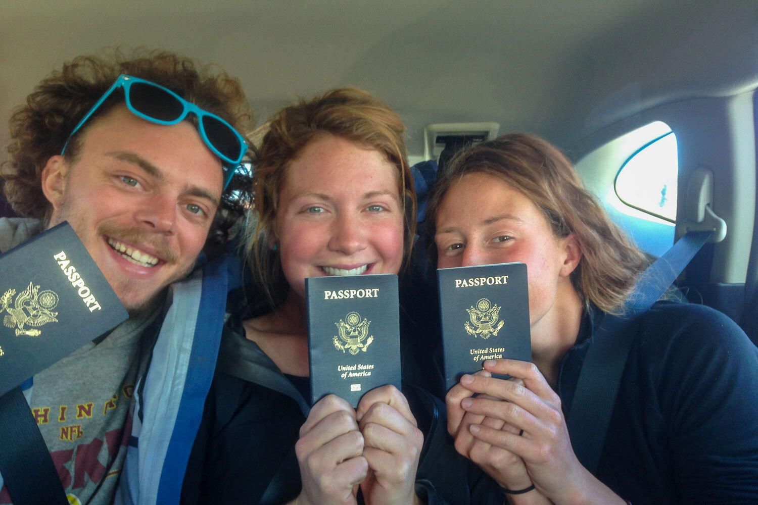
- NOBO: If you’re entering Canada via the PCT, you’ll need a Canada PCT entry permit along with a U.S. passport or passport card. Without an approved and printed copy of this permit in your possession, crossing into Canada via the PCT is strictly prohibited and a serious violation of Canadian Federal Law. The consequences could result in imprisonment, deportation, and a lifetime ban from Canada.
- SOBO: It’s illegal to enter the US from Canada via the PCT. Don’t do it. Instead start at Hart’s Pass in Washington.
Familiarize yourself with LNT
As long distance trail hiking becomes more popular, it’s more important than ever to help minimize your impact on the environment. Make sure you know and practice the Leave No Trace Principles during your hike. For an in-depth look at what the principles mean for backpackers, check out our leave no trace video.
Budgeting
We can’t emphasize enough how important budgeting is – and how potentially difficult it can be. Many people have to end their hikes early due to running out of money.
The average thru-hiker spends $3-$4 per mile (between $8,000 & $12000) during a hike on the PCT. This includes things like transportation to and from trailheads, hostels, food, drinks, and replacing gear.
This does NOT include the initial investment in gear which can set you back anywhere from $0-$5,000+ depending on what gear you have/need (more on this below).
For some great tips to make your budget go further, check out our 21 tips for backpacking on a budget article.
Putting your regular life on hold
Leaving “regular life” behind for five or six months is a big commitment and can be a real challenge. Here are some helpful tips to know before you go:
- Quitting your job/taking a leave of absence – This is a big one. Not many people get the privilege of being able to take months off of work for a thru-hike. Most people quit their jobs before hitting the trail, which means no pay and likely no health insurance. We think it’s best (in most cases) to have a conversation about your thru-hike with your employer as far in advance as possible to explore options. It goes without saying, but you will also need to save, save, save to prepare for trail life with no income and to be able to somewhat quickly and comfortably rejoin society when you finish.
- Auto-pay your bills – Make sure any obligatory bills – mortgage, insurance, phone, etc. – are on auto-pay before you leave. Cell service is certainly not a guarantee on the PCT, but you’ll probably want to have one with you.
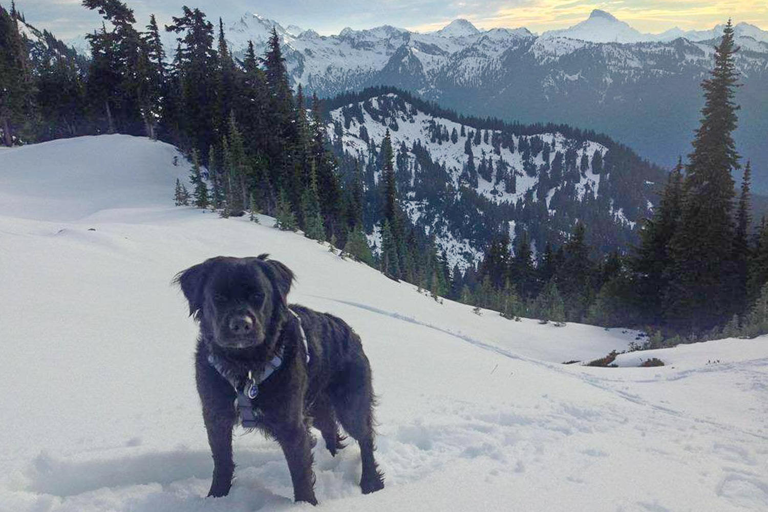
- Pets – Make sure you arrange a comfortable accommodation with a friend, family member, or extended-term boarding facility for your furry friend. Have all up-to-date proof of vaccinations and medical documents, as well as any medications your pet needs readily available for their temporary guardian. Dogs are allowed on many parts of the PCT, but not all of them. It’s not legal or advisable to bring a dog on a thru-hike. PCTA’s article on hiking with dogs is a good read for more information.
Physical prep
Not much can prepare you for hiking thousands of miles across the country besides just doing it. Many people find that their bodies quickly adapt to conditions on the trail, but if you want to get a little prep in before your big hike to speed the process along, here are a few tips:
- Start small – If you are new to backpacking in general, it’s a good idea to start with shorter trails and a daypack. Gradually work your way up to overnight trips with a light pack, and then to extended trips with a backpacking pack loaded with the weight you plan to carry on your thru-hike. Check out our trip guides page to see some of our favorite backpacking trips that you can use to get your feet wet!
- Practice hiking with trekking poles – Trekking poles offer extra security for river crossings and save a lot of strain on your muscles and joints, especially on long or steep descents. They also help distribute some weight to your arms and keep your hands elevated to reduce swelling. Check out our pros and cons of hiking with trekking poles for more info, and then head over to our best trekking poles list to find the perfect pair for you.
Safety
By the numbers, you are generally much safer on a thru-hiking trail than in a big city. Being prepared and knowing what to look out for are important – no matter where you are. Here are a few tips to get you started.
Real dangers PCT thru-hikers face
Thru-hiking brings opportunities to problem solve, assess risk and make judgement calls. Your safety awareness and preparedness are your best tools for minimizing accidents and emergencies. Fatal incidents for thru-hikers, though uncommon, have occurred due to falls (especially on icy slopes), heatstroke, drowning, and vehicle collisions.
Here’s a list of some dangers and helpful resources on how to mitigate them:
- Giardia (see our article on the best water filters)
- Dehydration (check out 20 tips for backpacking in the desert)
- Exposure leading to heat exhaustion/stroke & hypothermia (see our tutorial on emergency first aid skills for the backcountry)
- Blisters & overuse injuries (see our article on how to prevent and treat blisters and PCTA’s tips on how to avoid lower limb overuse injuries)
- Poisonous plants like poodle-dog bush and poison oak (see PCTA’s article on how to spot and treat poison oak exposure)
- Rattlesnakes (see our tutorial on snake safety)
- Snow and Avalanches (see our tutorial on snow and ice travel safety)
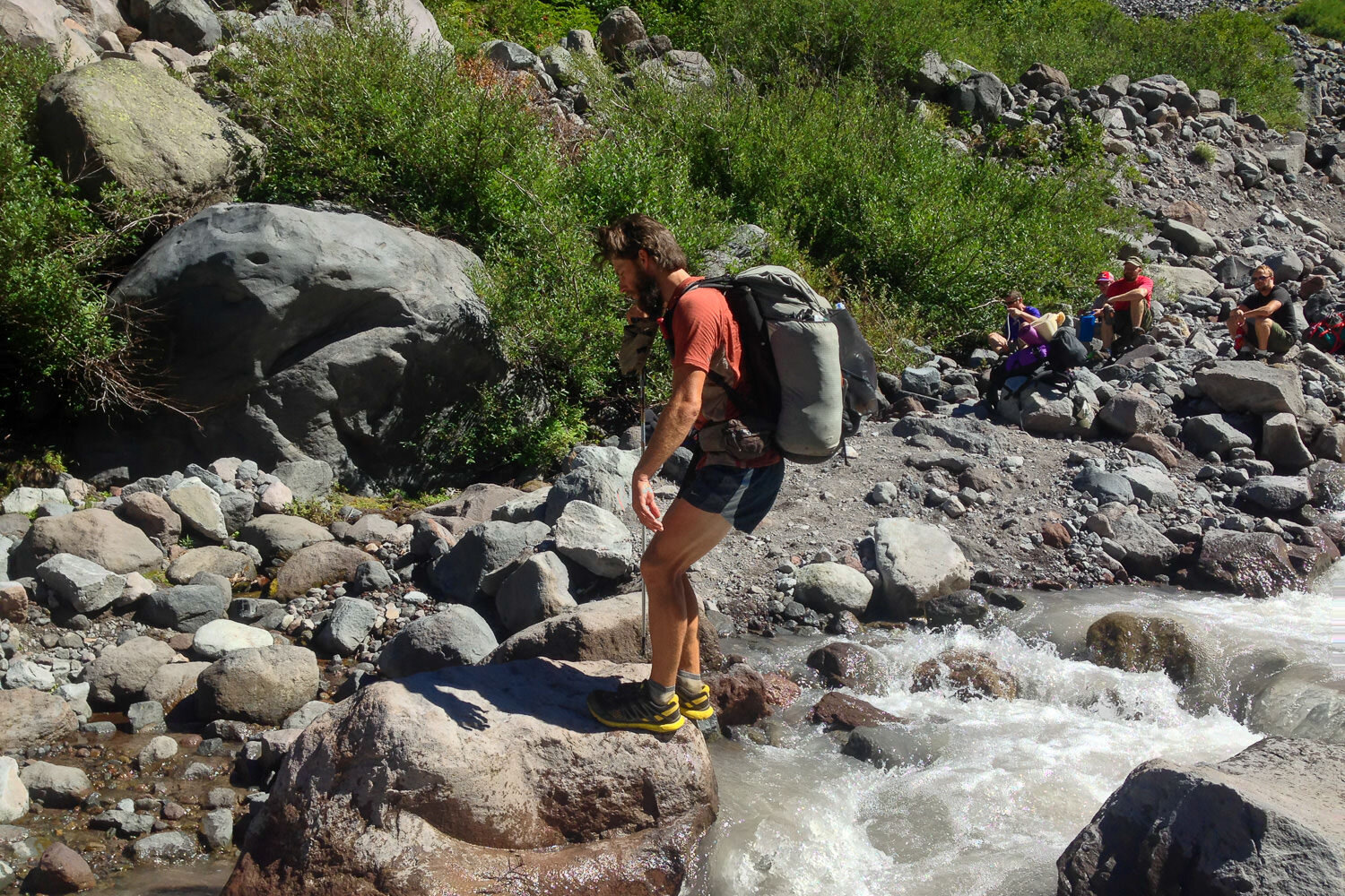
- Sketchy river crossings (see our tutorial on how to safely cross rivers)
- Cars/busy road crossings
- Lightning strikes (see our tutorial on how lighting safety)
- Wildfire (see PCTA’s wildland fire safety tips)
- For more information on PCT safety, we recommend reading PCTA’s safety tips.
Make a rough itinerary and Let someone know your Plans
Do your best to plan out goals for miles per day, town stops for rest days (“zeros” in thru-hiker language), and resupplies before you go. This not only allows you to set a goal for finishing and plan logistics but also a plan you can share with loved one for their peace of mind. In our experience, friends and family really appreciated being included in the planning process.
Consider carrying a personal locator beacon (PLB)
A Personal Locator Beacon (PLB) is a great safety net in case the worst should happen. If you injure yourself or find yourself in a dangerous situation, help is just a button press away.
Most PLBs will also allow friends and family back home to follow your hike on a map in real time – which is just plain fun. Our favorite satellite communication device is the Garmin InReach Mini – it uses top-notch satellite systems and offers a lot of useful features like on-device mapping and two-way texting. If you’re in the market for something a little more affordable, the less feature-rich Spot Gen4 will also get the job done.
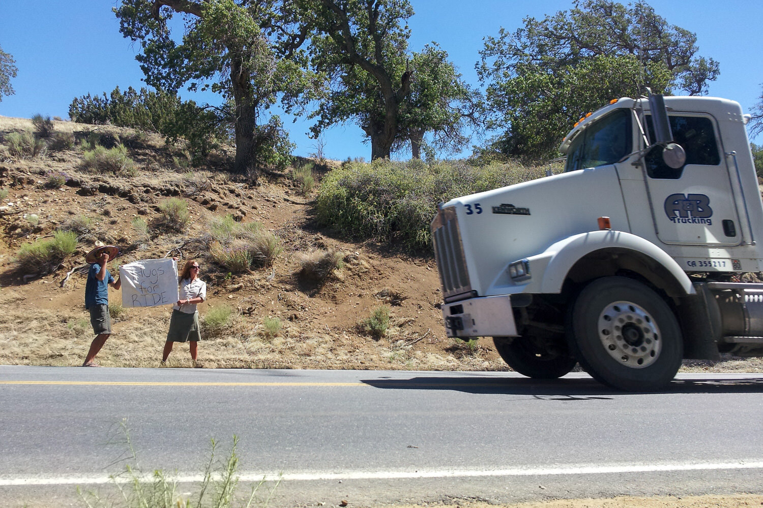
Hitchhiking
Hitchhiking is part of the adventure for most PCT thru-hikers since many of the towns used for resupply are many miles from trailheads. We’ve accepted many rides from strangers over multiple thru-hikes and have seen a lot of good in people.
We’re really grateful for our positive experiences with hitchhiking, but we definitely recommend being cautious. Never get in a car if it doesn’t feel right. Say you left something in the woods that you need to go back for, tell the car to go on without you, and walk away – you don’t want to take an unnecessary risk. Always stay aware of your surroundings and, if possible, have a partner with you if you must hitchhike.
Tips for getting a ride: Many hikers find that it’s easier to get cars to stop if they have a sign saying something like, “Hiker to Town.” Writing in bold letters on the back of your ground sheet is effective and doesn’t require carrying any extra weight. Tidy up a bit, and make yourself as approachable as possible before you stick out your thumb.
If you carry them, keep your trekking poles in plain sight. Trekking poles help immediately identify you as a trail hiker and make people more likely to stop for you. It’s also really important to secure items in your pack and pockets before lobbing it into the back of a truck. The last thing you want is to drop something important like a wallet or a cell phone. When you’re hitchhiking, remember to smile, wave, and be courteous.
Wildlife
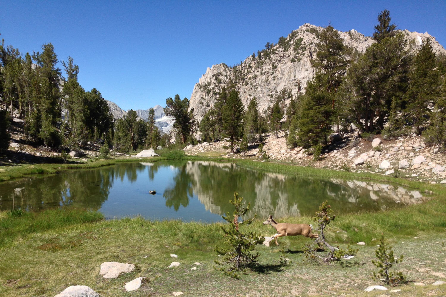
There’s a lot of wildlife on the PCT, and most encounters are exciting and enjoyable. Regional critters like deer, elk, and desert toads are easy to spot on a daily basis. If you’re lucky, you might also get to see rarer creatures like a ringtail or – one of the cutest animals that ever lived, the pine marten.
Here are some critters to keep a more cautious eye out for:
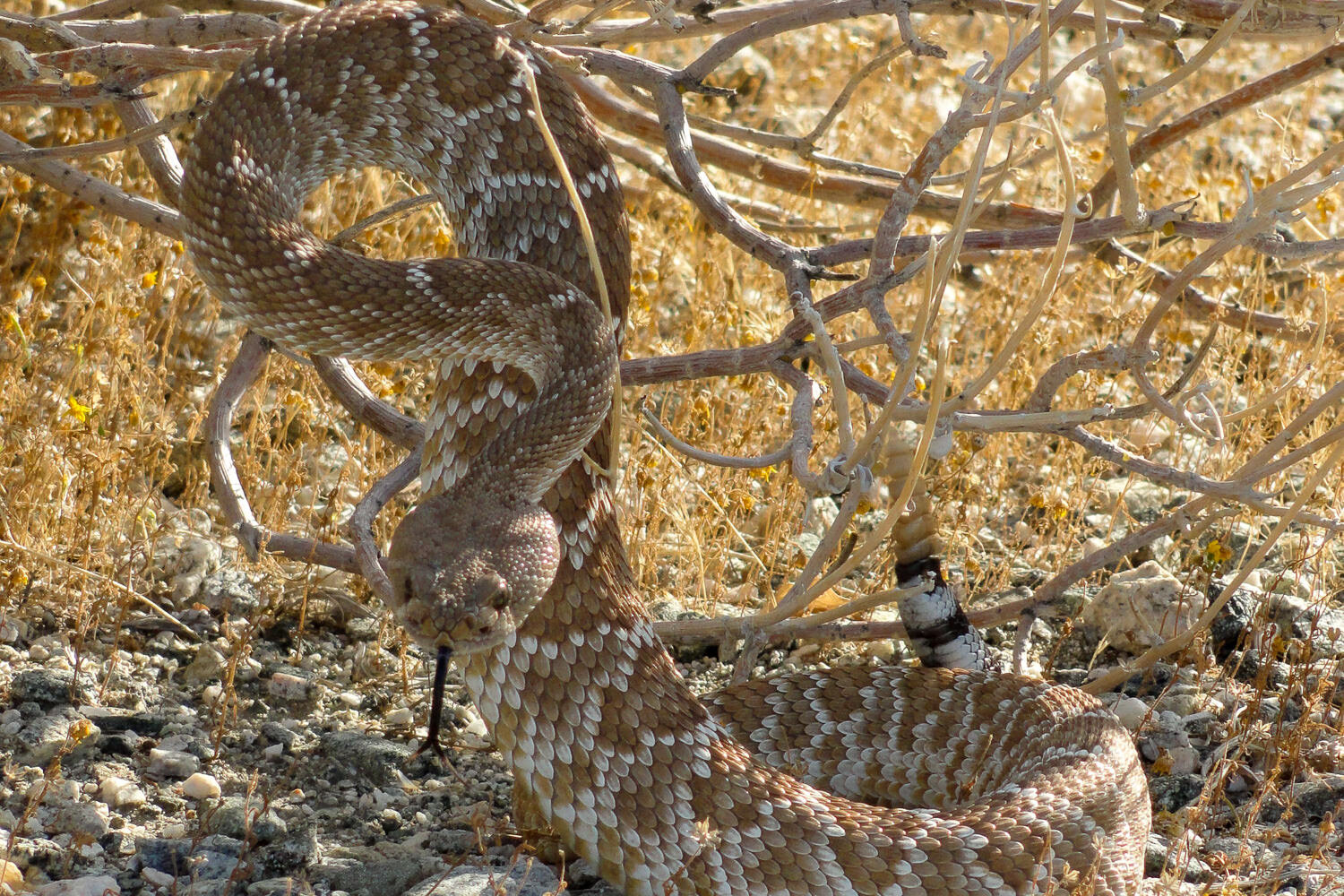
Rattlesnakes
Rattlesnakes are venomous – and abundant on certain parts of the PCT. If you’re northbounding, you’ll likely see one within your first day on the trail.
It’s good to have a healthy fear of rattlers to keep you on your toes, but there’s no reason to be petrified. The chances of being bitten by a snake are very slim.
Be aware of your surroundings, scan the trail in front of you, and you’ll be fine. If you use headphones while you hike, make sure to keep the volume down, and keep one ear open to listen for snakes’ warnings.
If you do scare up a snake, stay calm and back away slowly. Most times, the snake will move out of the way once you give it some space. If it stays put, bushwhack around it, giving it plenty of room. If you still have questions, check out our video on snake & cougar safety for more info.
Rodents
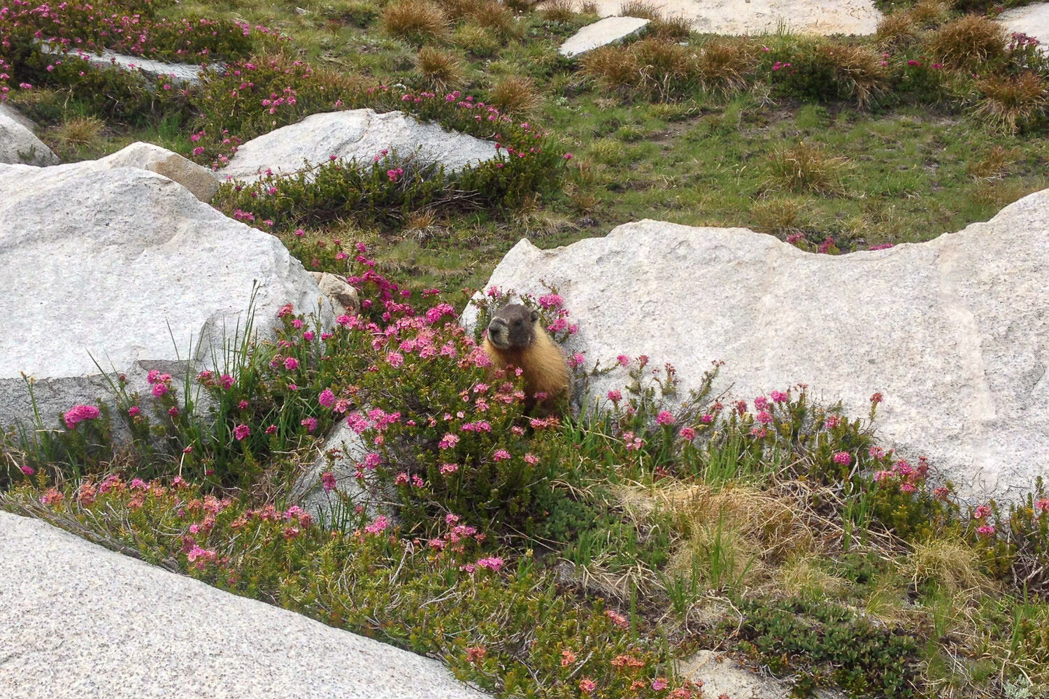
Mice, chipmunks, and squirrels will keep you company along the entire length of the PCT. Marmots (large, cute squirrel-beavers) live at or above the treeline in the Sierra Nevada. Make sure to store your food properly or you’ll surely wake up in the night to the scuffling sounds of these night robbers chewing holes in your gear and helping themselves to your precious supplies. Mice also carry disease and can be a real problem near human-made structures like cabins and picnic shelters.
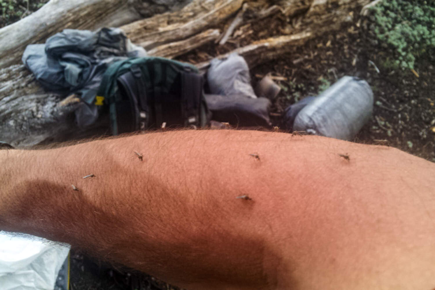
Mosquitoes
These tiny vampires bite and can leave itchy welts on the skin of some unlucky people. They can be thick on some parts of the PCT during the spring and summer months, so we recommend wearing a breathable but tightly-woven long-sleeve shirt and pants treated with permethrin in the Sierra Nevada and Oregon.
A head net can also be a lifesaver in the peak of mosquito season. Nets may look a bit dorky, but nobody will be laughing when they’re breathing in a cloud of mosquitoes and their high-pitched drone is ringing their ears.
As far as repellents go, we’ve found Picaridin to be one of the better options out there because it doesn’t degrade synthetic gear like DEET does. Learn more about DEET and learn more about mosquitos in our mosquitos & hiking: how to protect yourself guide.
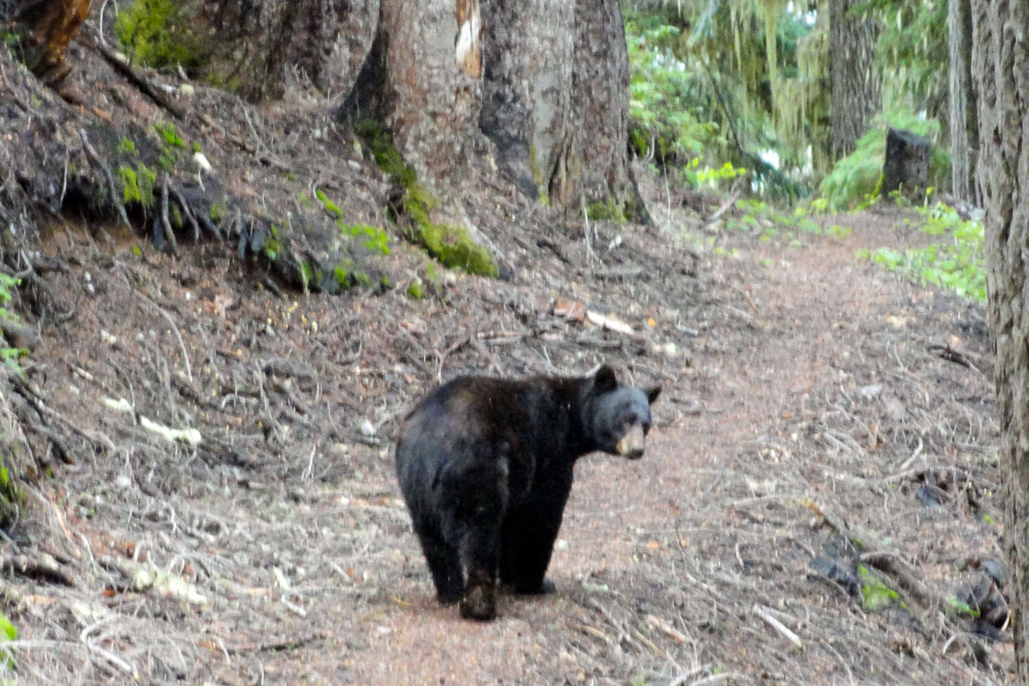
Black bears
The only bears you’ll encounter on the PCT are black bears, though their coats can be a variety of colors. They make their home in the mountains along the entire trail, but the largest populations of bears are in the Southern Sierra, Yosemite, and Lassen Volcanic National Park.
Enjoy any opportunity you get to see these amazing creatures in action, but respect them by not approaching them. Of course, always storing your food and other scented items properly. Bear canisters are required between Kennedy Meadows (mile 702) and Sonora Pass (mile 1017) and then again in Lassen Volcanic National Park (mile 1343-1363).
In reality, you pose a much larger threat to bears than they do to you. Feeding wildlife and attracting them to human-frequented areas can, in extreme cases, lead to a bear’s death. Check out our article on the facts and myths of bear encounters for more info.
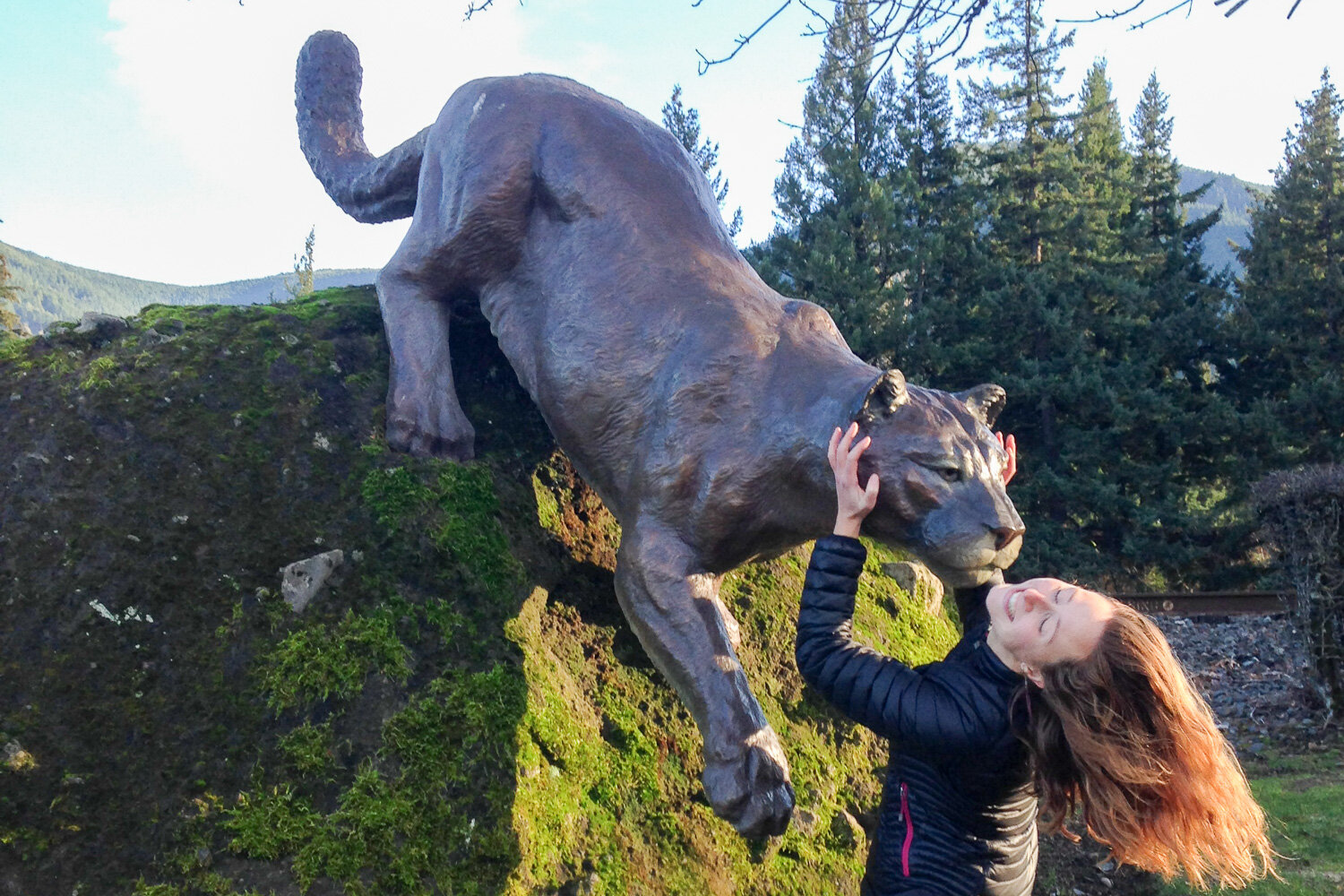
Mountain lions
There are mountain lions along the entire length of the PCT, but it’s very rare to see one. Attacks are extremely unlikely.
If you plan to hike with small children or dogs, it’s wise to be cautious. Generally speaking, adults are not at risk of being attacked. There are zero recorded deaths due to mountain lions on the PCT.
Mountain lions are extremely stealthy and most active at night. If you do come face to face with one in the day time, something is off – that’s extremely uncharacteristic. Make yourself big, make noise, and don’t turn your back. Back up slowly and don’t make eye contact. The lion will almost certainly scamp away.
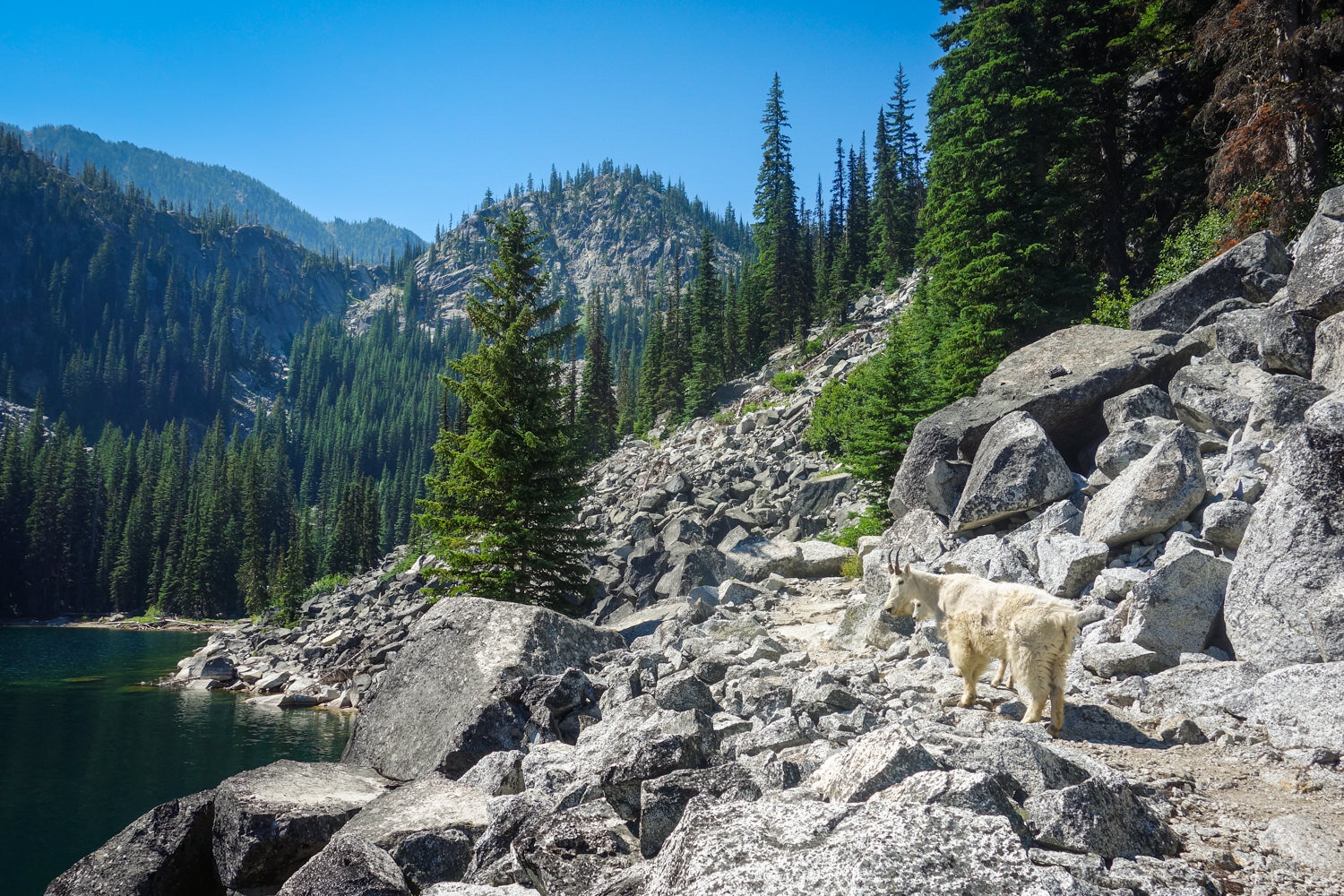
Mountain goats
Those with a keen eye may get to see some of these magnificent beasts scaling the steep, craggy slopes of Washington’s high country. Generally, mountain goats have a natural fear of humans and keep their distance, but there are rare cases of goat-human conflict. They use their sharp horns to defend themselves and can become aggressive if cornered.
Never approach a goat and give them the right of way. In some areas goats also seek human salts in urine or sweat soaked clothing. For this reason, it’s best to go off trail at least 50 yards to urinate. Also, don’t leave sweaty clothes or backpacks unattended for goats to chew on.
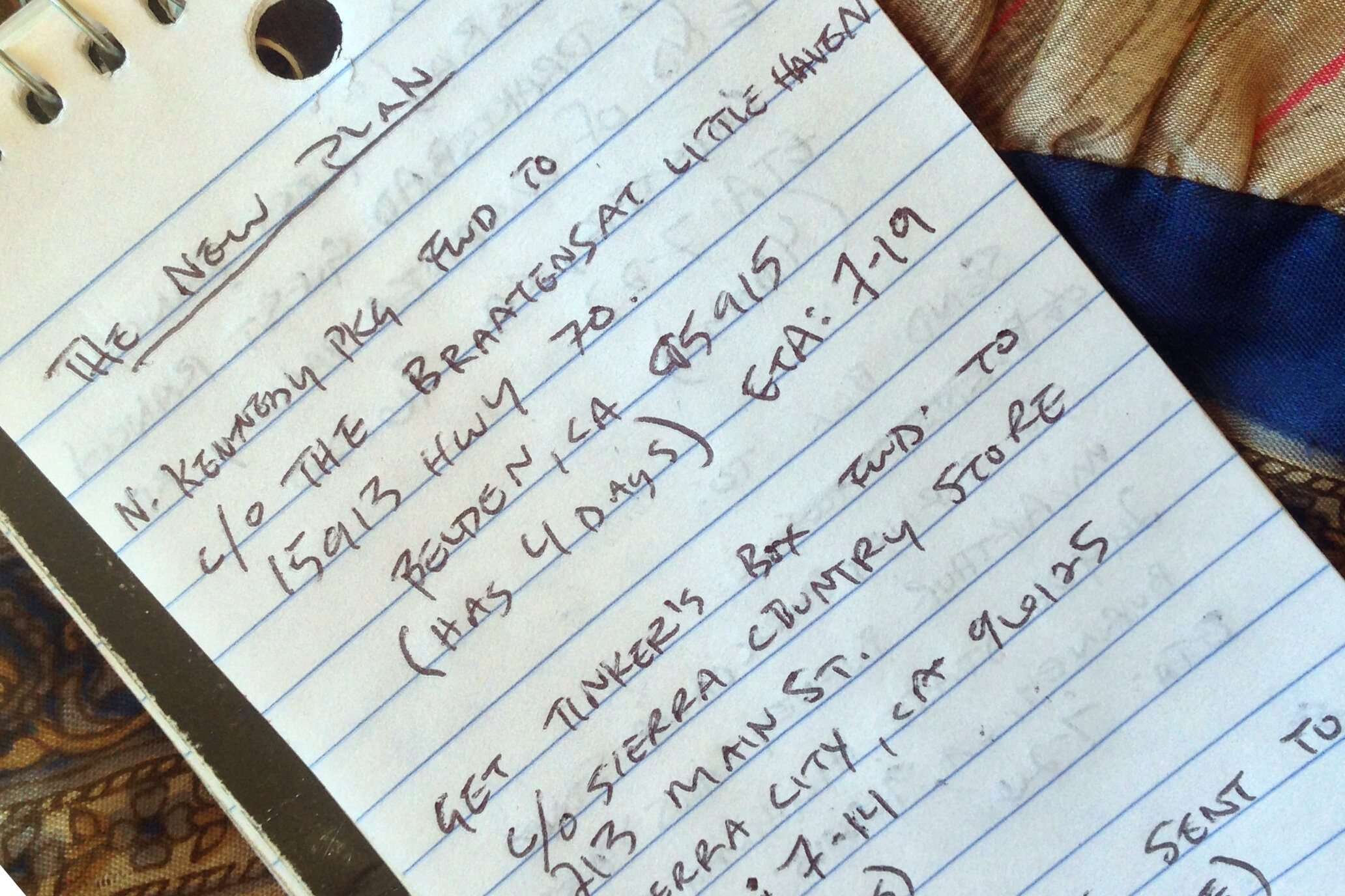
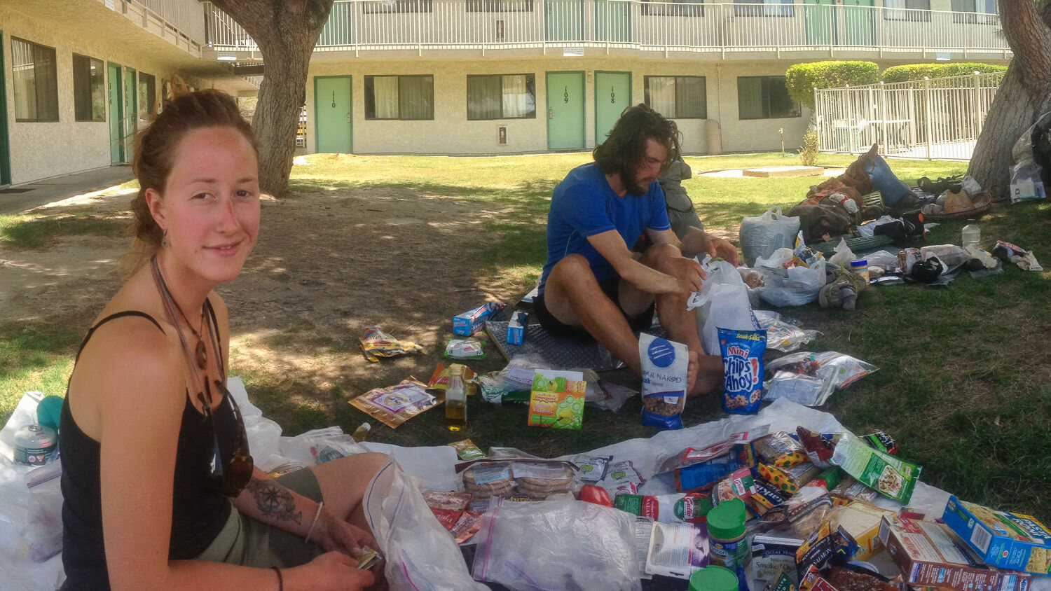
Resupplying
Most hikers do a combination of shopping along the way and mailing boxes. Both have their pros and cons. We recommend buying as you go and shipping supplies to the more remote locations (see below). Most people use Craig’s PCT Planner to get an idea of how long it will take them to get to resupply points at their own pace. We won’t go into full detail here, but halfway anywhere’s resupply guide is a great resource (and pretty hilarious).
MAIL DROPS
- Pros: Possibility of having more variety/being healthier, easier for those with dietary restrictions, less work/stress in trail towns, an opportunity for a friend or family member to be involved, making your own food can be fun
- Cons: A lot of initial work and planning, you have to keep track of/work with local post office schedules, extra expense of shipping

BUY AS YOU GO
- Pros: Ability to choose what you want when you want it, supports local communities along the trail, avoids shipping costs, no help needed (better option for international hikers)
- Cons: The options can be limited or poor quality (gas stations and dollar stores), more work/stress in trail towns (shopping and repackaging/shipping if no help at home), can be expensive in certain places, can be wasteful if you need to purchase packaging/get rid of excess
These are the places we recommend you DO send a mail drop to (from south to north):
- Warner Springs
- Kennedy Meadows
- Sierra City
- Crater Lake/Mazama Village Store
- Big Lake Youth Camp
- Timberline Lodge
- White Pass
- Snoqualmie Pass
- Stevens Pass/Skykomish
- Stehekin
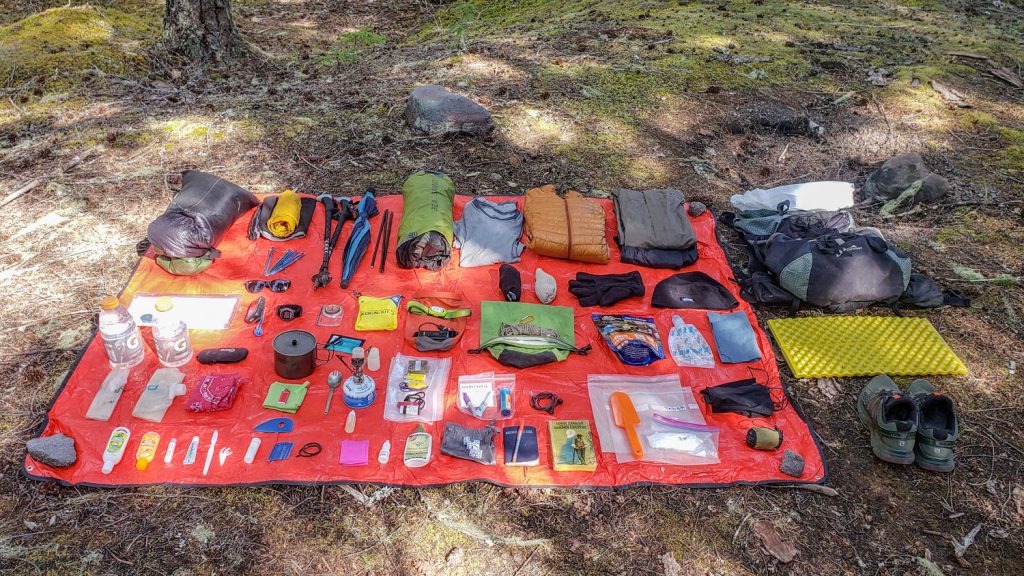
Gear List
Make sure to check out our Ultimate Backpacking Checklist, so you don’t forget something important.
Below you’ll find our current favorite backpacking gear. If you want to see additional options, our curated gear guides are the result of many years of extensive research and hands-on testing by our team of outdoor experts.
BACKPACK
- Best Backpacking Pack Overall: Gregory Paragon 58 – Men’s / Gregory Maven 58 – Women’s
- Best Ultralight Backpacking Backpack: Hyperlite Mountain Gear Unbound 40
- More: Check out our best backpacking backpacks guide for ultralight and trekking options
TENT
- Best Backpacking Tent Overall: Big Agnes Copper Spur HV UL2
- Best Ultralight Tent: Zpacks Duplex
- Best Budget Tent: REI Half Dome 2
- Best Tent Stakes Overall: All One Tech Aluminum Stakes
- More: Check out our best backpacking tents guide for more options
SLEEPING BAG/QUILT
- Best Sleeping Bag Overall: Men’s Feathered Friends Swallow YF 20 / Women’s Feathered Friends Egret YF 20
- Best Quilt Overall: Enlightened Equipment Revelation 20
- More: Check out our best backpacking sleeping bags guide and best backpacking quilts guide for more options
SLEEPING PAD
- Best Sleeping Pad Overall: NEMO Tensor All-Season
- Best Foam Sleeping Pad: NEMO Switchback
- More: Check out our best backpacking sleeping pads guide for ultralight and trekking options
CAMP KITCHEN
- Best Backpacking Stove Overall: MSR PocketRocket 2
- Best Backpacking Cookware Overall: TOAKS Titanium 750ml
- Best Backpacking Coffee Overall: Starbucks VIA
- More: Check out our best backpacking stoves guide and best backpacking cookware guide for ultralight and large group options
WATER & FILTRATION
- Best Water Filter Overall: Sawyer Squeeze
- Best Hydration Bladder Overall: Gregory 3D Hydro
- Best Backpacking Water Bottles: Smartwater Bottles
- More: Check out our best backpacking water filters guide and best backpacking water bottles guide for ultralight and large group options
CLOTHING
- Best Hiking Pants Overall: Men’s Outdoor Research Ferrosi / Women’s The North Face Aphrodite 2.0
- Best Hiking Shorts Overall: Men’s Patagonia Quandary / Women’s Outdoor Research Ferrosi
- Best Women’s Hiking Leggings: Fjallraven Abisko Trekking Tights HD
- Best Rain Jacket Overall: Men’s Patagonia Torrentshell 3L / Women’s Patagonia Torrentshell 3L
- Best Rain Pants: Men’s Patagonia Torrentshell 3L / Women’s Patagonia Torrentshell 3L
- Best Down Jacket Overall: Men’s Patagonia Down Sweater Hoodie / Women’s Patagonia Down Sweater Hoodie
- Best Fleece Jacket Overall: Men’s Patagonia Better Sweater / Women’s Patagonia Better Sweater
- Best Sunshirt Overall: Men’s Outdoor Research Echo / Women’s Outdoor Research Echo
- Best Socks Overall: Men’s Darn Tough Light Hiker Micro Crew / Women’s Darn Tough Light Hiker Micro Crew
- Beste Ultralight Liner Glove: Patagonia Capilene Midweight Liner
- More: Check out our best backpacking apparel lists for more options
FOOTWEAR & TRACTION
- Best Hiking Shoes Overall: Men’s HOKA Speedgoat 6 / Women’s HOKA Speedgoat 6
- Best Hiking Boots Overall: Men’s Salomon X Ultra 5 GTX / Women’s Lowa Renegade Evo GTX
- Best Hiking Sandals Overall: Men’s Chaco Z/1 Classic / Women’s Chaco Z/1 Classic
- Best Camp Shoes Overall: Crocs Classic Clogs
- Best Traction Device for Hiking Overall: Kahtoola MICROspikes
- More: Check out our best backpacking footwear lists for more options
NAVIGATION
- Best GPS Watch Overall: Garmin Instinct 2 Solar
- Best Personal Locator Beacon (PLB): Garmin inReach Mini 2
- More: Check out our article How to Use Your Phone as a GPS Device for Backpacking & Hiking to learn more
FOOD
FIRST-AID & TOOLS
- Best First-Aid Kit Overall: Adventure Medical Kits Ultralight/Watertight .7
- Best Pocket Knife Overall: Kershaw Leek
- Best Multitool Overall: Leatherman Wave+
- Best Headlamp Overall: Black Diamond Spot 400-R
- Best Power Bank Overall: Nitecore NB 10000 Gen 3
- More: Check out our best first-aid kit guide, best pocket knife guide, best multitool guide, best backpacking headlamps guide, and best power banks guide for more options
MISCELLANEOUS
- Best Trekking Poles Overall: Black Diamond Pursuit
- Best Backpacking Chair Overall: REI Flexlite Air
- Best Backpacking Stuff Sack Overall: Hyperlite Mountain Gear Drawstring
- More: Check out our best trekking poles guide, best backpacking chairs guide, and best stuff sacks guide for more options
PCT Regions Quick Facts
The PCT is divided into 18 sections in California, 6 in Oregon, and 5 in Washington (29 in total). It travels through a multitude of diverse landscapes, weather, and challenges. Below, we’ll outline a handful of fun facts about each section. Need a visual? Follow along with this great overview map from Magellan.
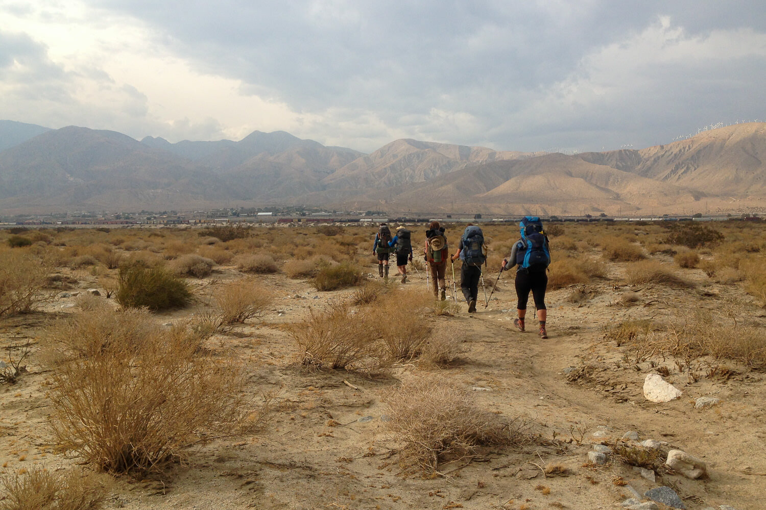
Southern California – miles 0-652
(Campo to Walker Pass)
- The “desert” section is far more varied than one might expect – passing through several mountain ranges where lingering snow and spring storms are common
- Daytime temperatures can reach over 100℉ while nighttime temps. can be below freezing
- There are several 25 to 30 mile water carries (there are a couple of water caches maintained by trail angels, but it’s never safe to assume that there will be water available)
- Many hikers take long afternoon breaks or ‘siestas’ in the shade to conserve energy and water
- Hikers should learn to identify and avoid touching the poodle-dog bush plant which can cause a severe allergic reaction
- Rattlesnakes are abundant in this section
- The trail climbs to 9,030 ft. in the San Jacinto Mountains before plunging to 1,190 ft. at San Gorgonio Pass
- The PCT follows the San Andreas Fault and the Los Angeles Aqueduct in the Mojave Desert
- Many hikers develop debilitating blisters or overuse injuries in this section. The best way to prevent blister in the first place is to wear quality footwear, start slow, and air out/elevate feet as often as possible.
Central California – miles 652-1157
(Walker Pass to Donner Pass)
- The South Fork of the Kern River marks the start of the Sierra Nevada
- Most hikers rest, resupply, and swap out/pick up additional gear (ice axe, bear canister, traction devices, mosquito net, etc.) at Kennedy Meadows
- In the Sierra Nevada, the trail repeatedly ascends to high rocky passes and descends into unimaginably beautiful lake basins
- The PCT crosses eight named passes above 11,000 feet in this section, the first being Forester Pass (elev. 13,153′), the highest point on the entire trail
- Water sources are plentiful, but hiker hunger is rampant at this point
- In Sequoia National Park, the John Muir Trail (JMT) and PCT merge for about 160 miles
- Most thru-hikers climb Mount Whitney (elev. 14,494′) from Crabtree Meadows
- Mosquitos can be thick in this area during prime hiking season
- There’s a large black bear (and tourist) population in Tuolumne Meadows where the PCT crosses through Yosemite National Park
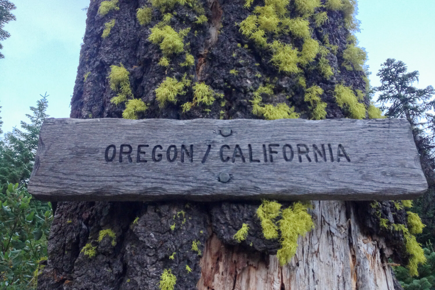
Northern California – miles 1157-1698
(Donner Pass to Oregon border)
- Quaint trail towns punctuate Northern California as the Sierras end and the Southern Cascades begin
- The North Fork of the Feather River is one of the most welcoming swimming holes after a hot day’s slog
- The PCT traverses Lassen Volcanic National Park, where bear canisters are now required due to increased habituation
- The PCT follows the extremely dry Hat Creek Rim (which requires a long water carry)
- The trail then turns toward greener pastures and lush forests, dotted by volcanoes
- At Interstate 5, the trail climbs into Castle Crags State Park and the Trinity Alps Wilderness where timber rattlesnakes are frequently encountered
Oregon – miles 1689-2144
(Oregon border to Bridge of the Gods/Washington border)
- From near Siskiyou Summit (elev. 4,310′) in southern Oregon to the Washington border, this section is both the shortest and the easiest
- Oregon’s Cascade Range has less significant elevation changes, going through old growth forests, past lakes and stunning volcanoes
- The highest point in Oregon is an unnamed saddle (elev. 7,560′) north of Mount Thielsen
- Other volcanoes, including Mount McLoughlin, Mount Mazama (Crater Lake), Diamond Peak, the Three Sisters, Mount Washington, Three Fingered Jack, Mount Jefferson, and Mount Hood are ever present along the skyline
- The PCT passes Crater Lake, the deepest lake in the country (you can jump in too if you take a short, steep side trail)
- One of Oregon’s main attractions is Mount Hood (elev. 11,239′), the state’s largest and most active volcano
- Many hikers love the weekend brunch at Timberline Lodge
- The only major elevation change in Oregon is the 3,160 foot drop into the Columbia River Gorge crossing Interstate 84 and the Columbia River on the Bridge of the Gods (elev. 180′)
- Make sure to stop by the PCT Days festival in Cascade Locks if it aligns with your schedule!
Washington – miles 2144-2659
(Washington border to Manning Prov. Park, B.C.)
- The North Cascades are wet, rugged, and stormy, with many steep climbs and descents
- Hikers should be prepared for heavy rains and intense river fords
- This section begins at the lowest point of the trail, Bridge of the Gods (elev. 180′), on the Columbia River
- After a long climb, the PCT traverses through Indian Heaven Wilderness, which is full of huckleberries and lakes
- Glacier Peak, and the rugged route around it, offers a memorable experience to trail users
- In September, the needles of western larch trees turn bright yellow providing a colorful conclusion to the end of a thru-hike
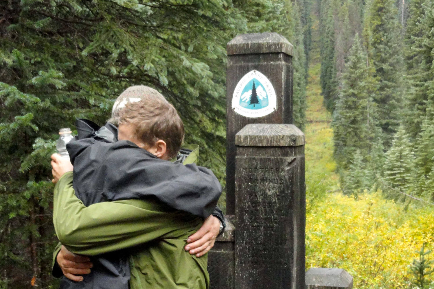
- The PCT ends at the US/Canada Border marked by a clear-cut line in the trees and Monument 78
- Northbounders continue hiking 8 miles over the Canadian border into Manning Park, British Columbia where they can catch a bus into Vancouver
Get Involved
The PCT truly is an amazing footpath, but it didn’t just appear there. Thousands of volunteers organized by the Pacific Crest Trail Association and other regional clubs help maintain and protect the trail every year. Here are a few ways you can help:
- Make a donation
- Volunteer with a trail crew
- Practice Leave No Trace (LNT)
Thru-hiking the PCT is a big challenge with big rewards, and we hope this guide helps you plan a successful hike. If we missed anything or you want to share your own PCT experience, leave us a comment below!
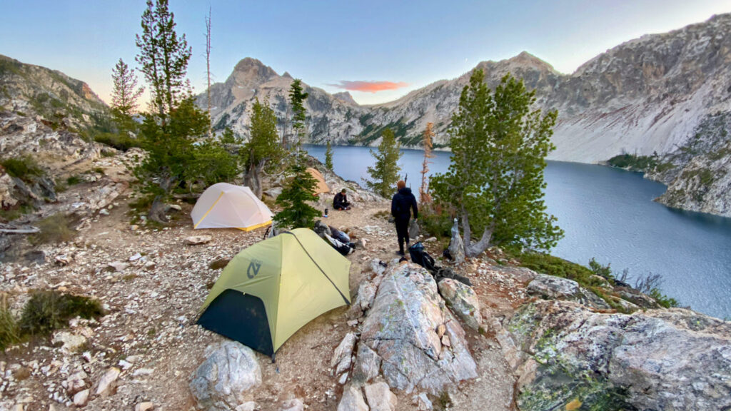
More PCT Photos
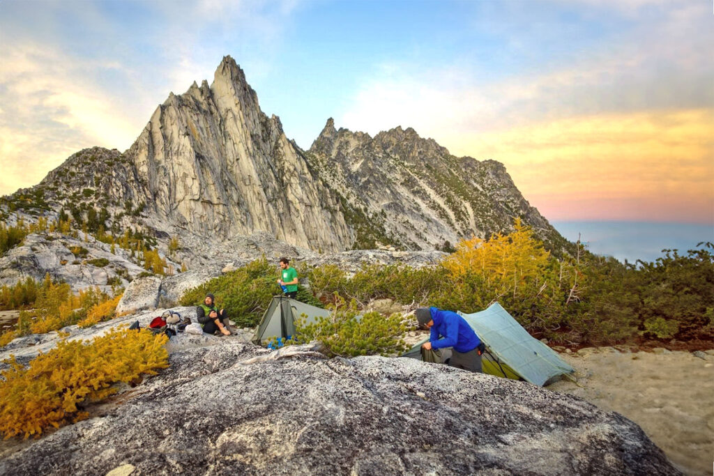
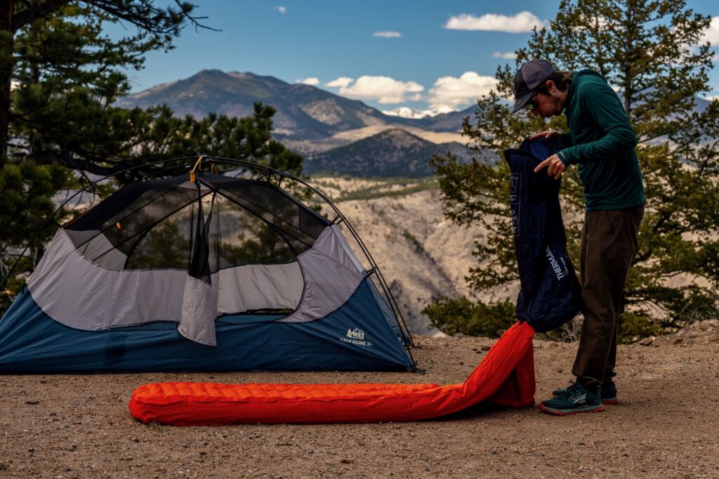
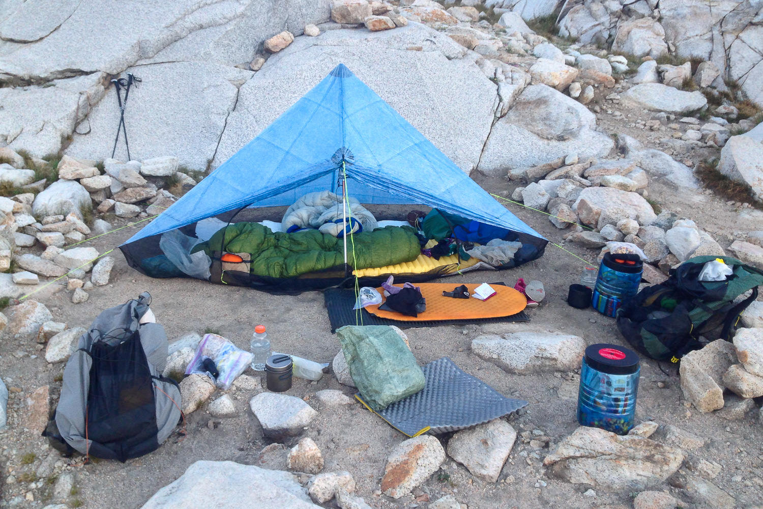
Timing up camp spots on the PCT like this is a pro move.
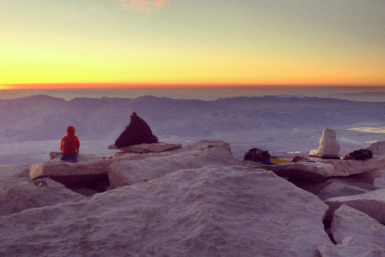
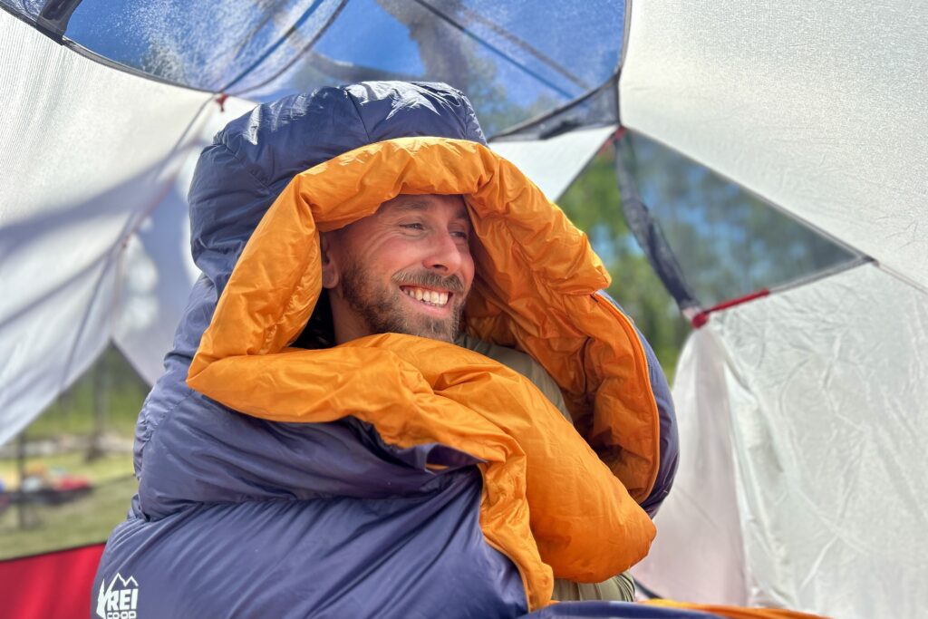
Hikers “wear” their sleeping bags to watch the sunrise at the summit of Mt. Whitney. – Photo Credit: Heather Eldridge (CleverHiker.com)
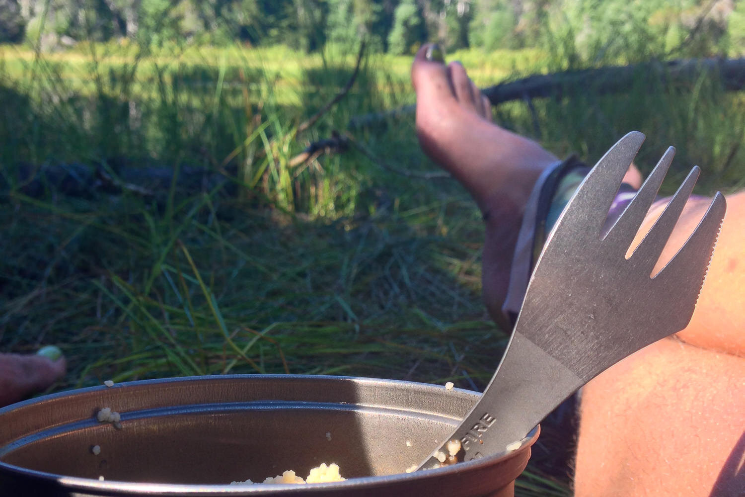
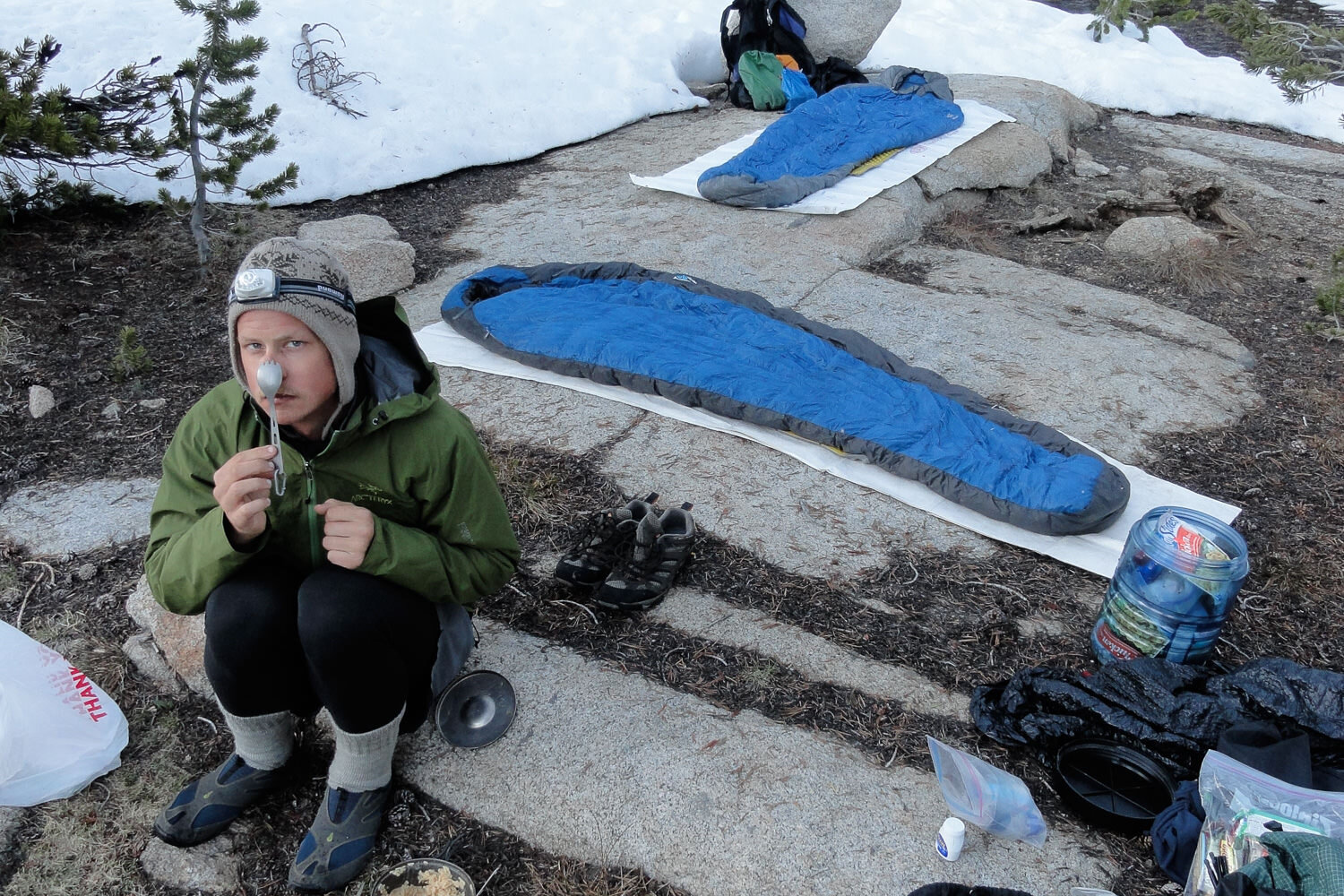
The best breaks are the ones where the boots come off and the spork comes out. – Photo Credit: Heather Eldridge (CleverHiker.com)

All hikers have their own style and different needs for thermo-regulation, but the basics are the same. – Photo Credit: Heather Eldridge (CleverHiker.com)
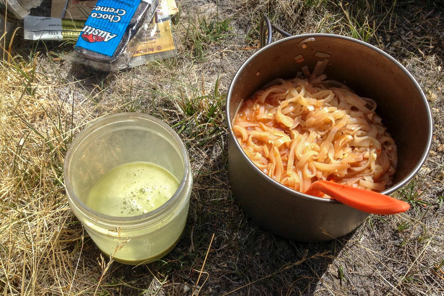
Backpacker Pad Thai and matcha (an empty peanut butter jar with a lid makes an excellent shaker for drink mixes). – Photo Credit: Heather Eldridge (CleverHiker.com)
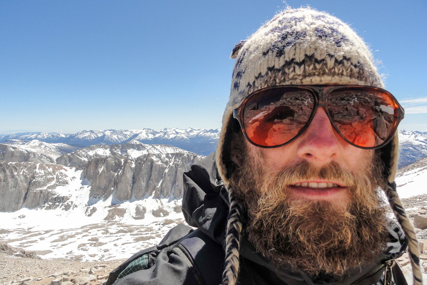
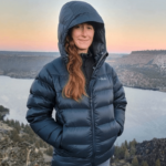
Don’t forget to send selfies to loved ones back home.

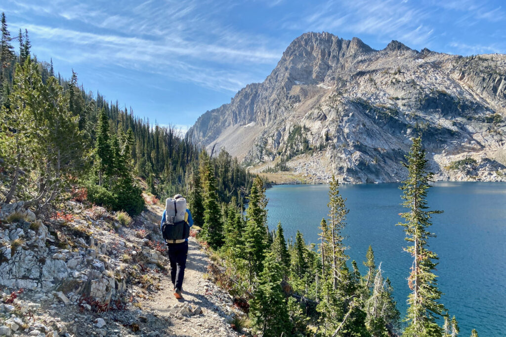
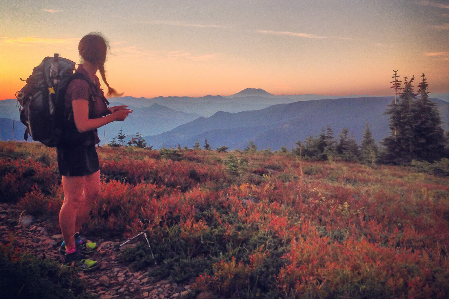
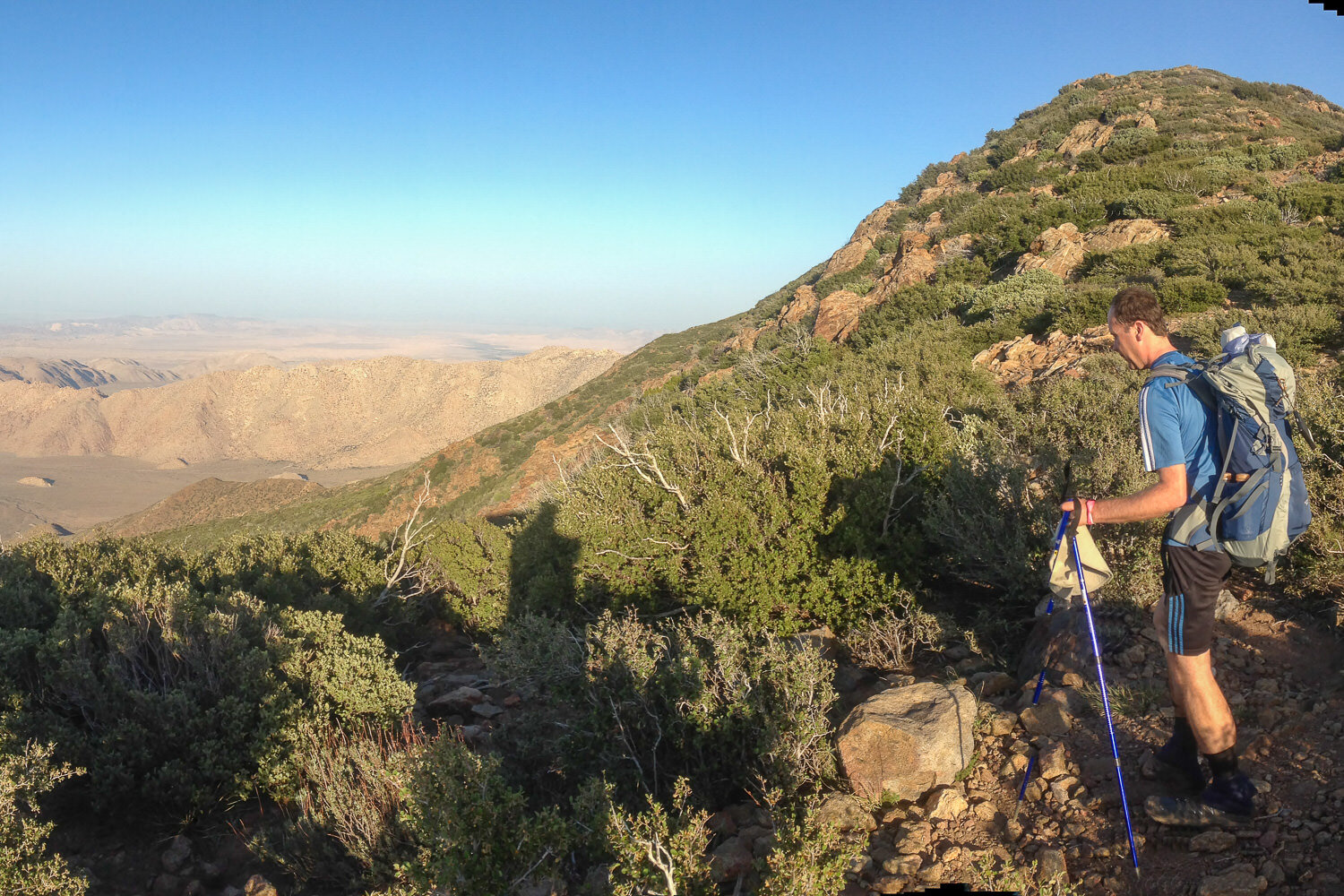
The PCT provides endless views.

Ice Axes are a useful tool on icey slopes, and make photos look cool.
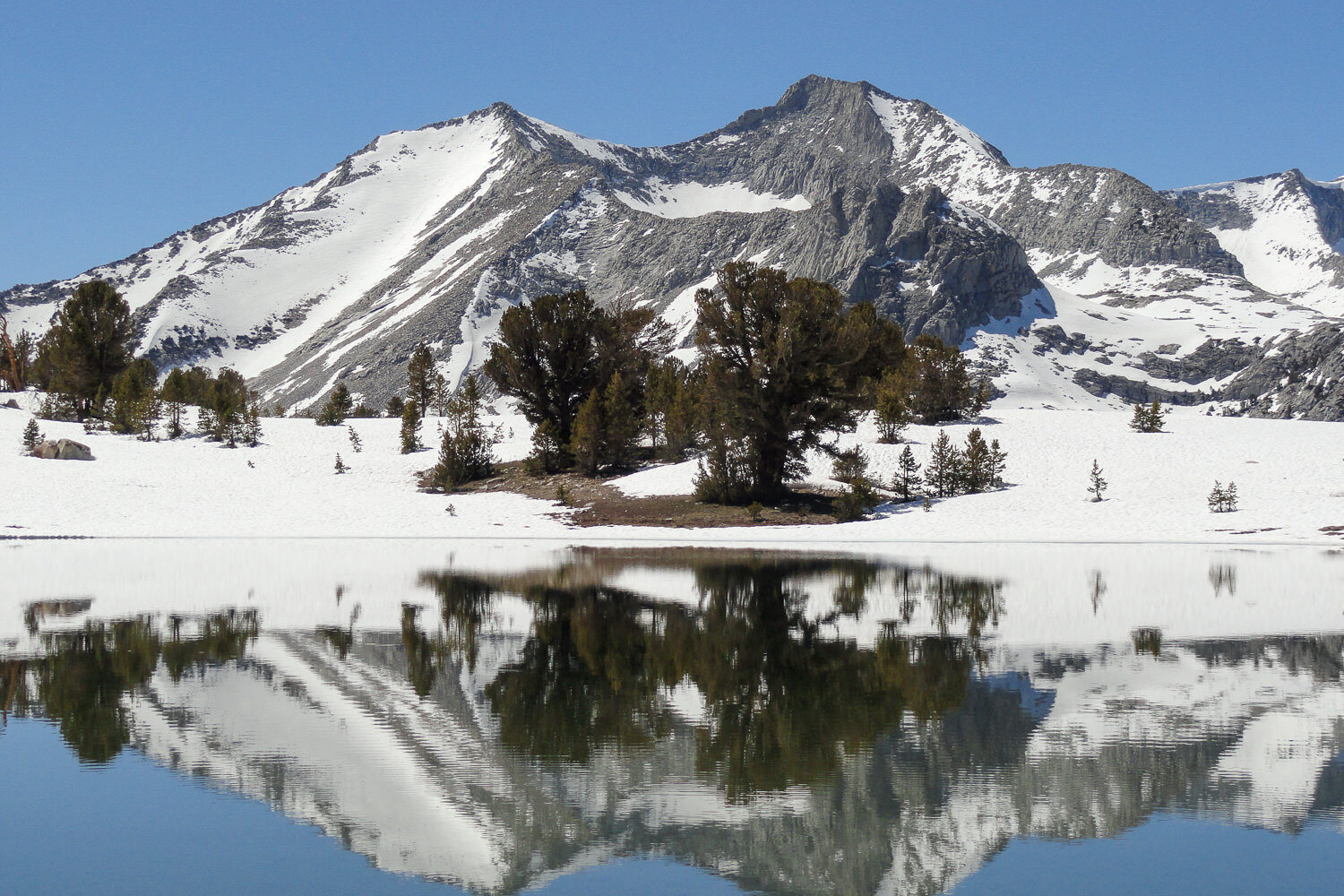
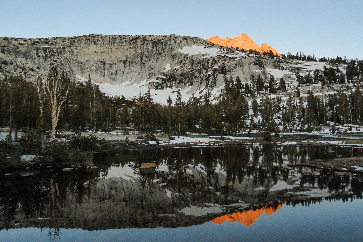
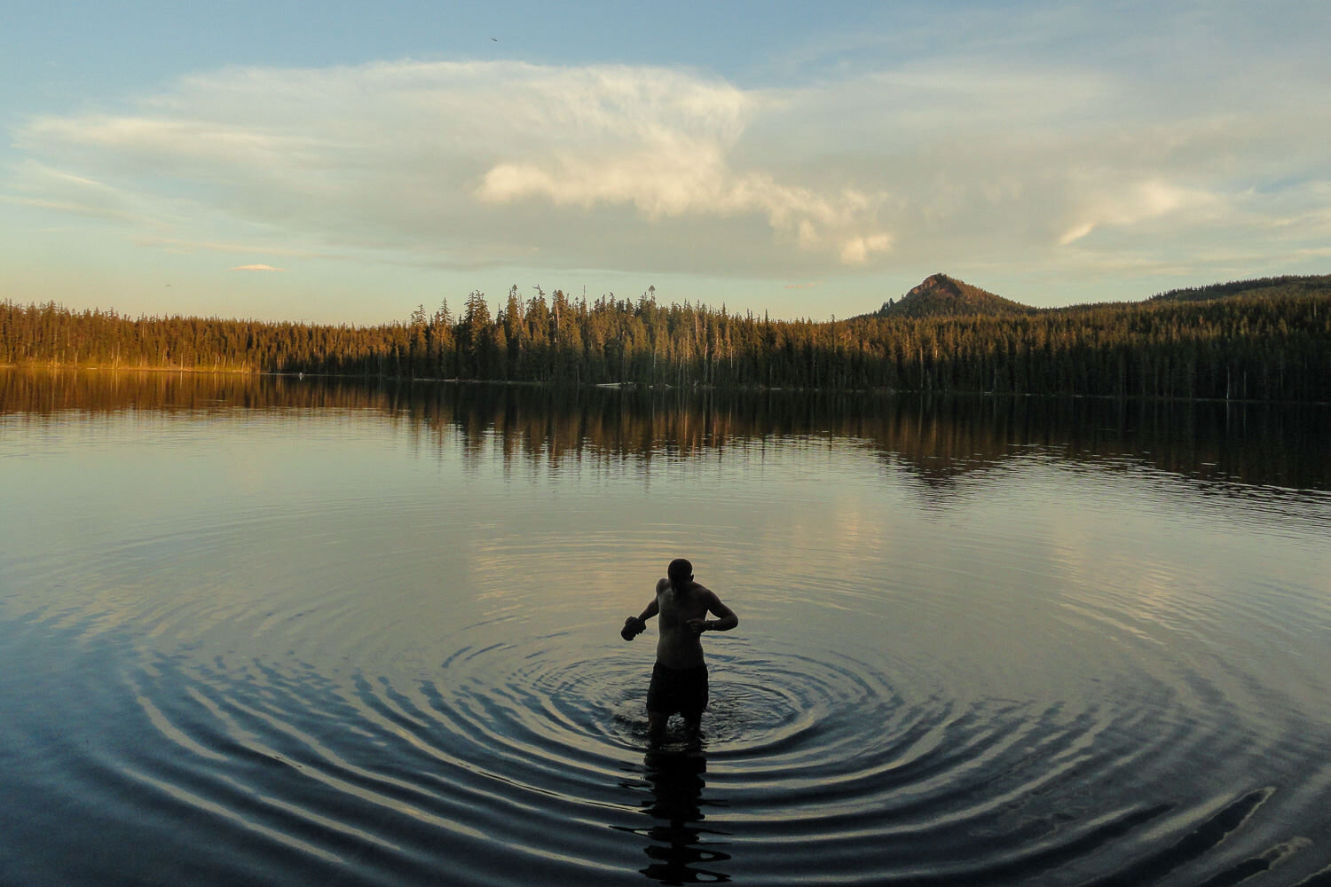
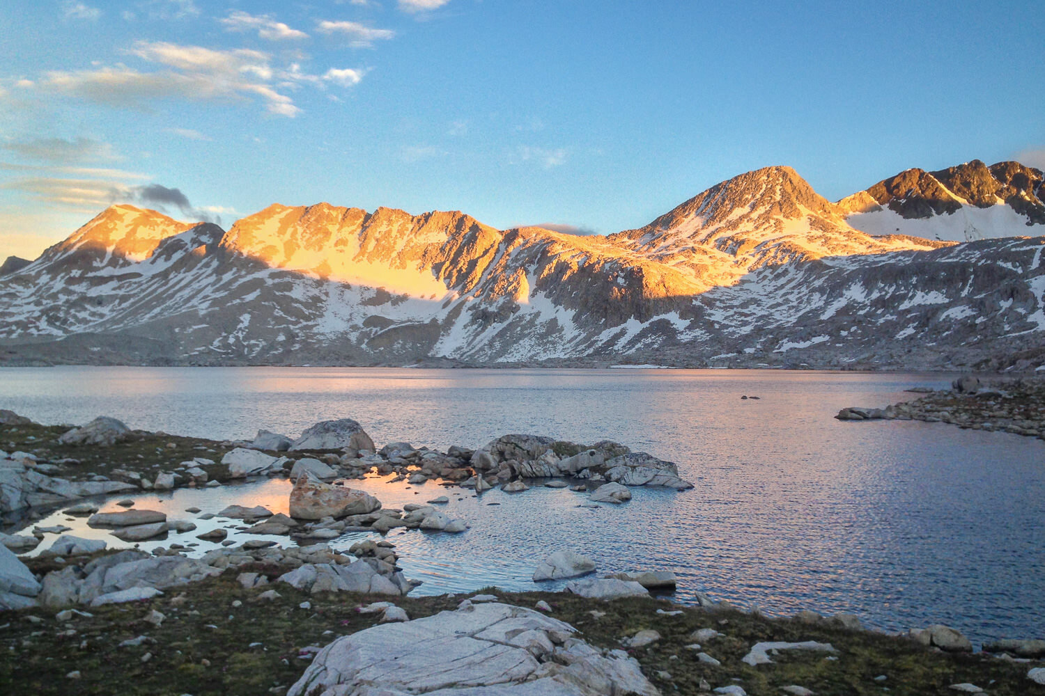
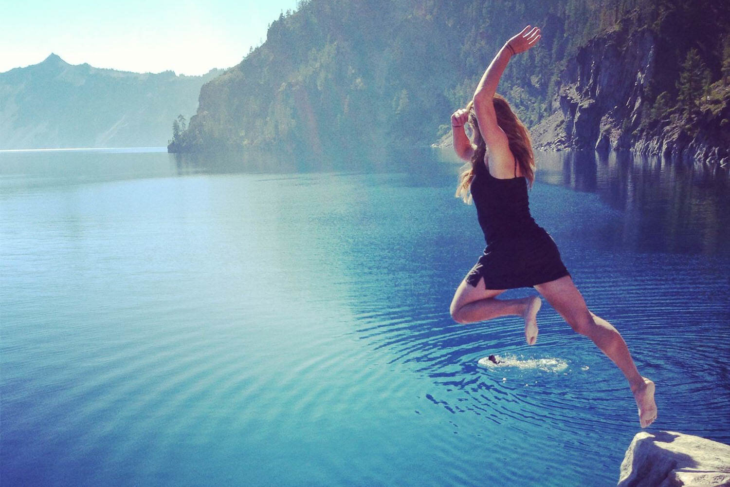
A still alpine lake is a great place to pause and…reflect.
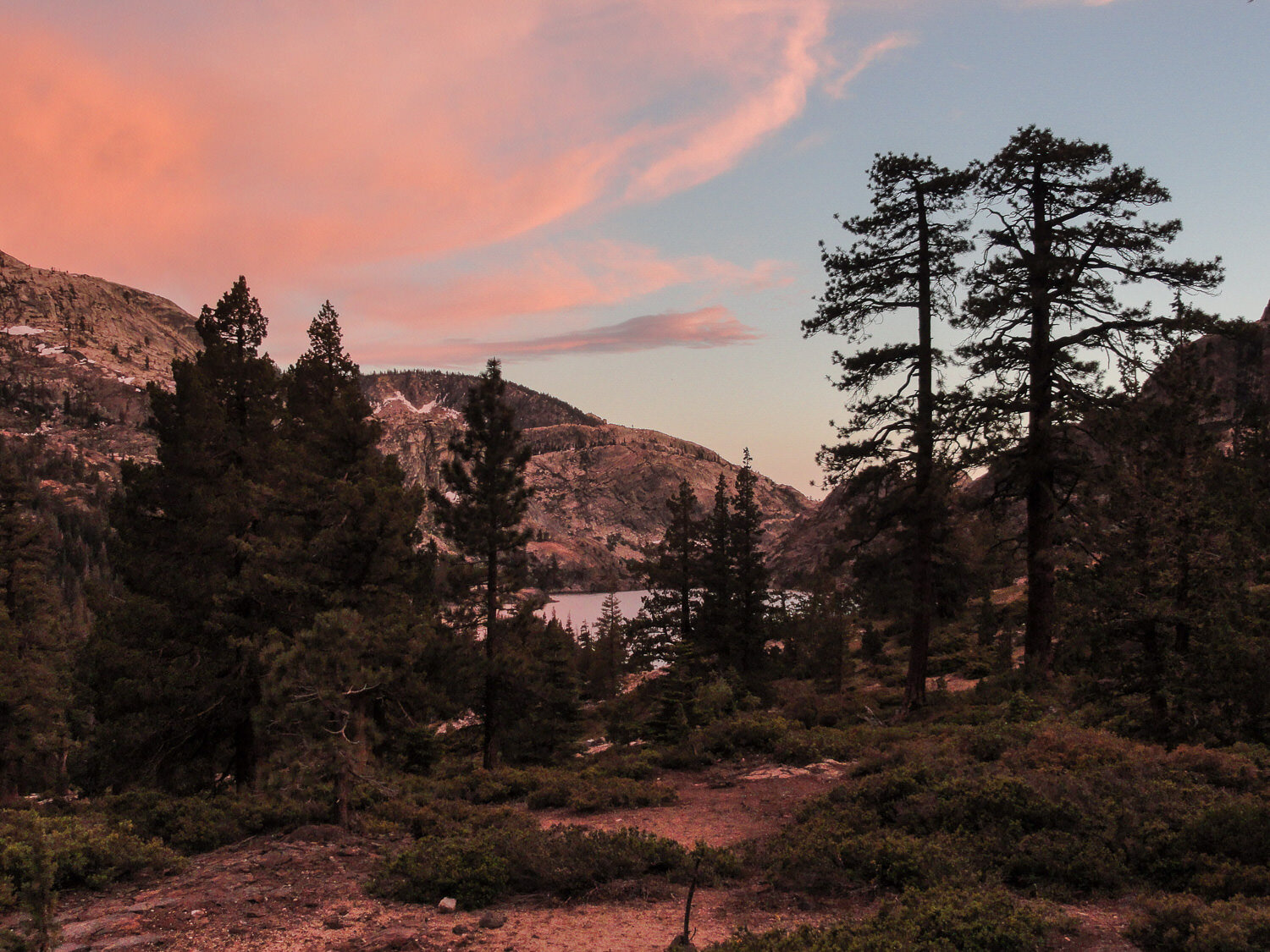
A sleep under the stars kind of camp spot.
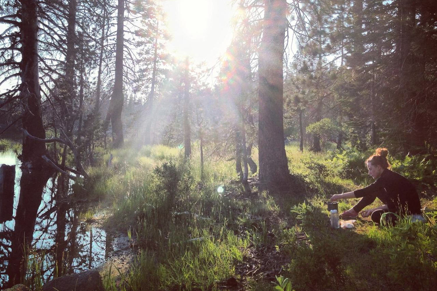
Sometimes thru-hikers will stop for dinner and then continue to hike until dark to maximize favorable temperatures.
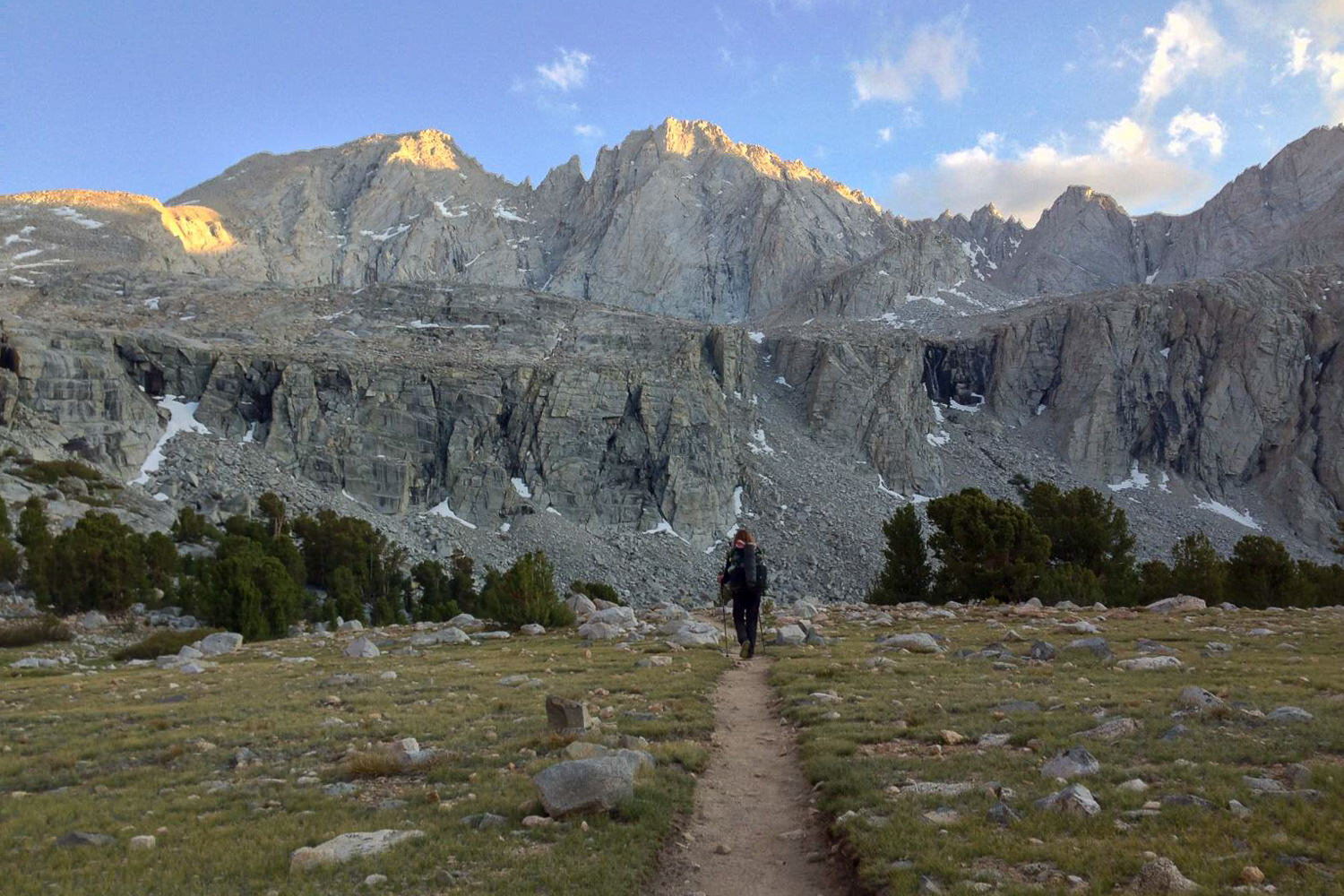
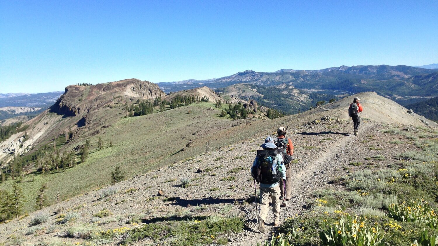
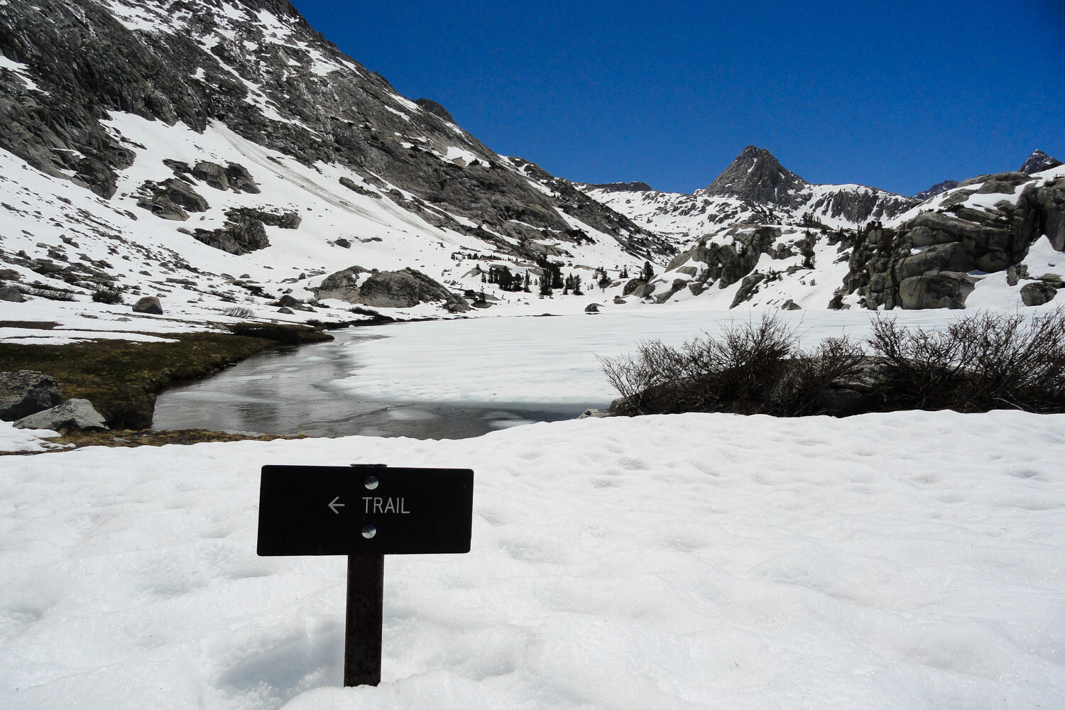
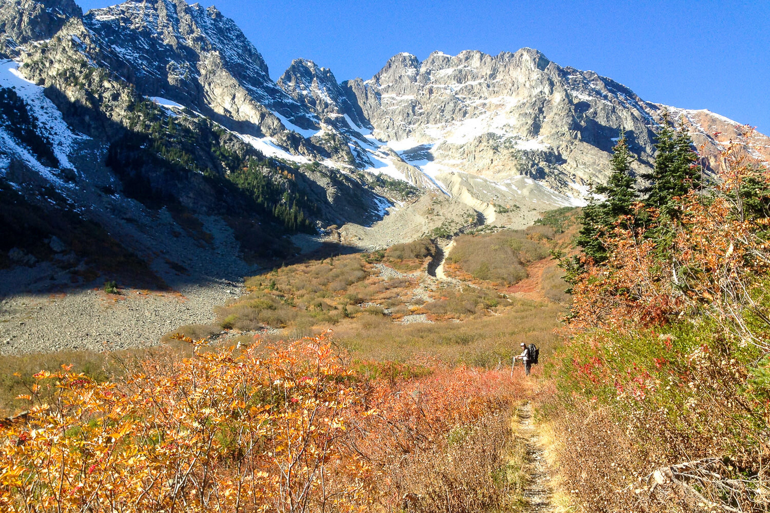
A well-trodden trail on the Pacific Crest Trail.
A PCT thru-hiker’s dream lunch break location.
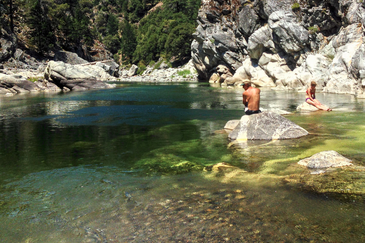
Swimming on one of the many alpine lakes along the PCT.
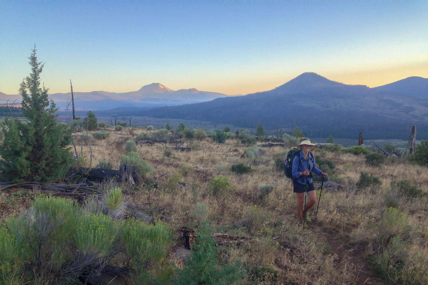
Alpenglow on the PCT.
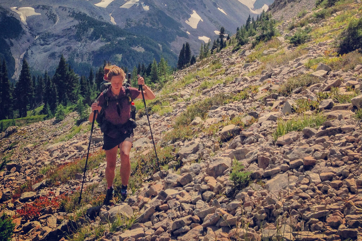
Trekking poles are a must, especially on scree fields.
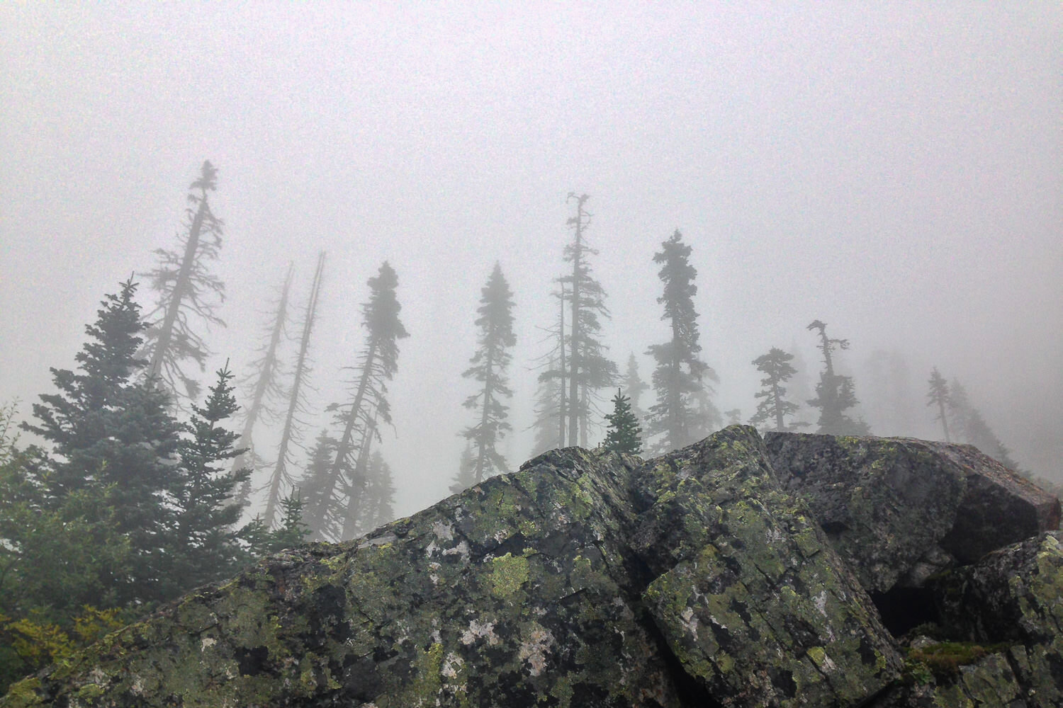
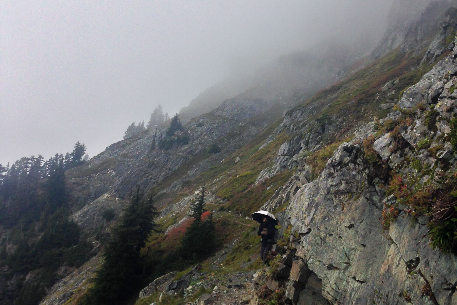
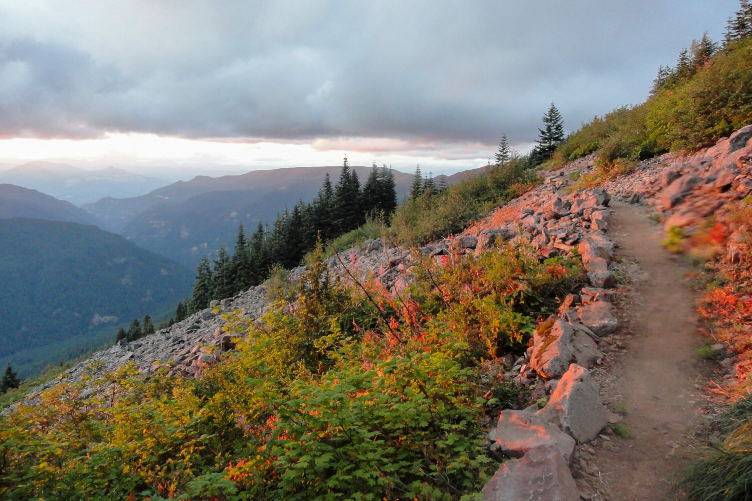
A low cloud deck can make for a moody trail.
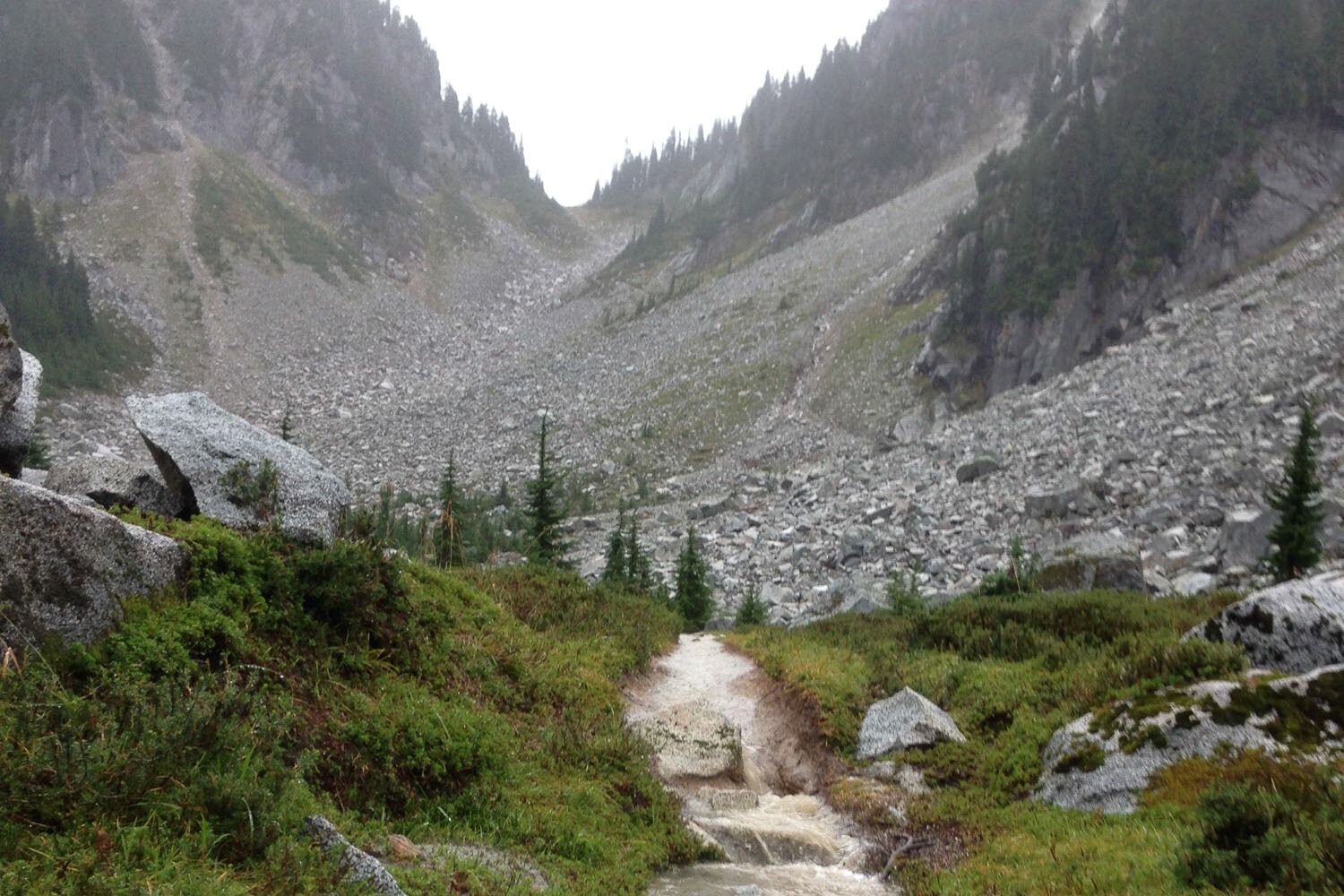
The PCT passes over many streams, scree fields, and cols.

Sometimes, the line between trail and stream is blurred on the PCT.

Keep an eye out for trail closures due to washed-out or damaged bridges.
Blue-bird day on the PCT.