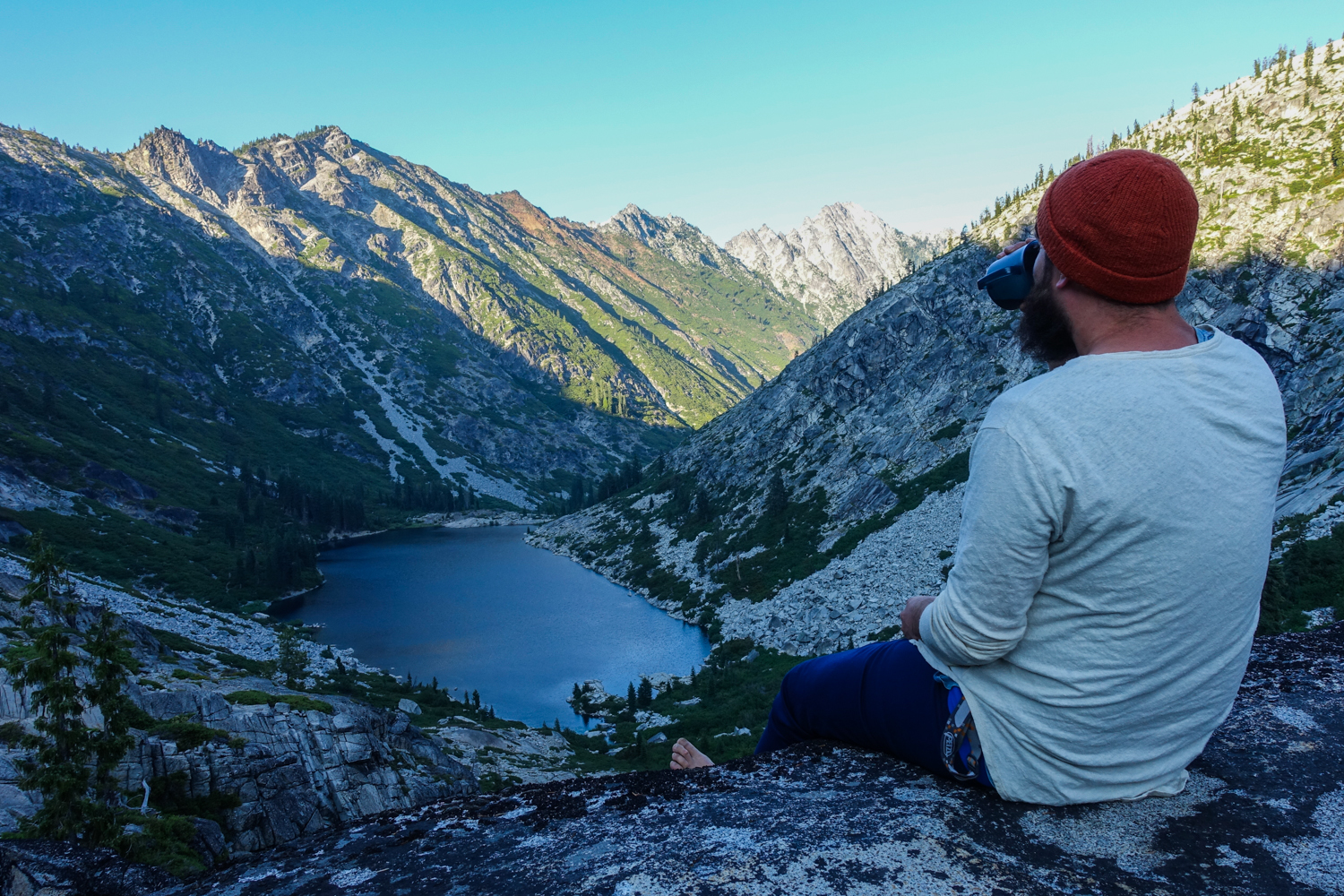
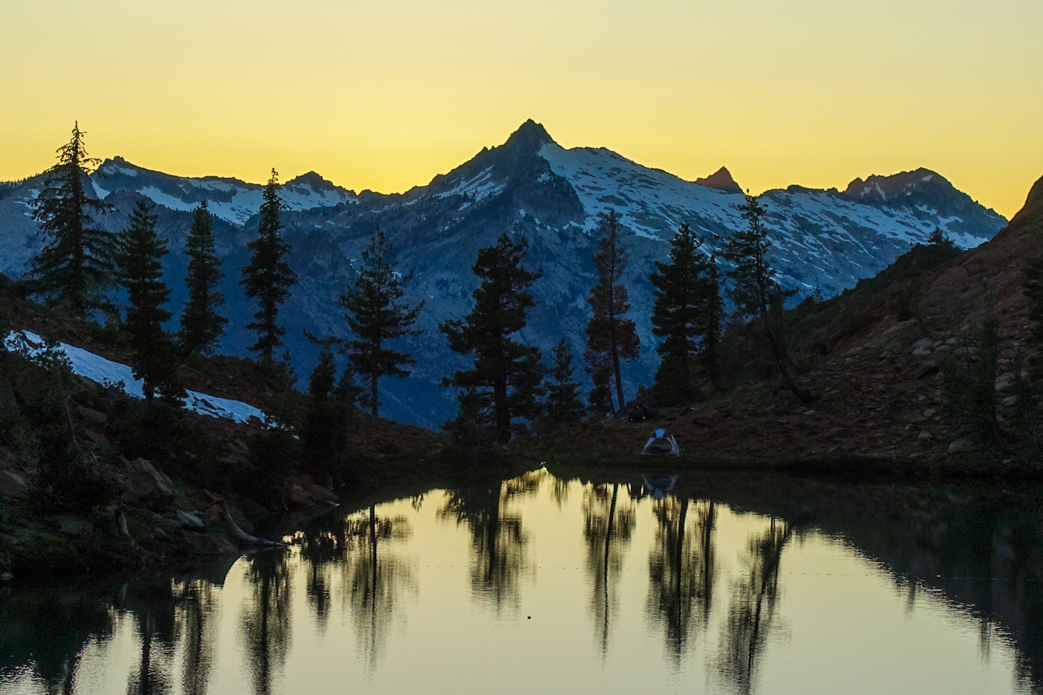
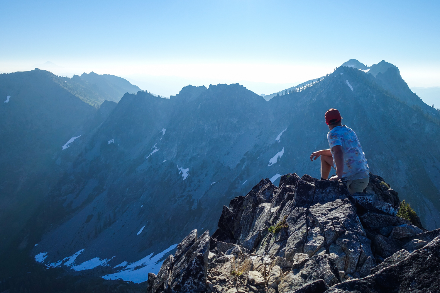
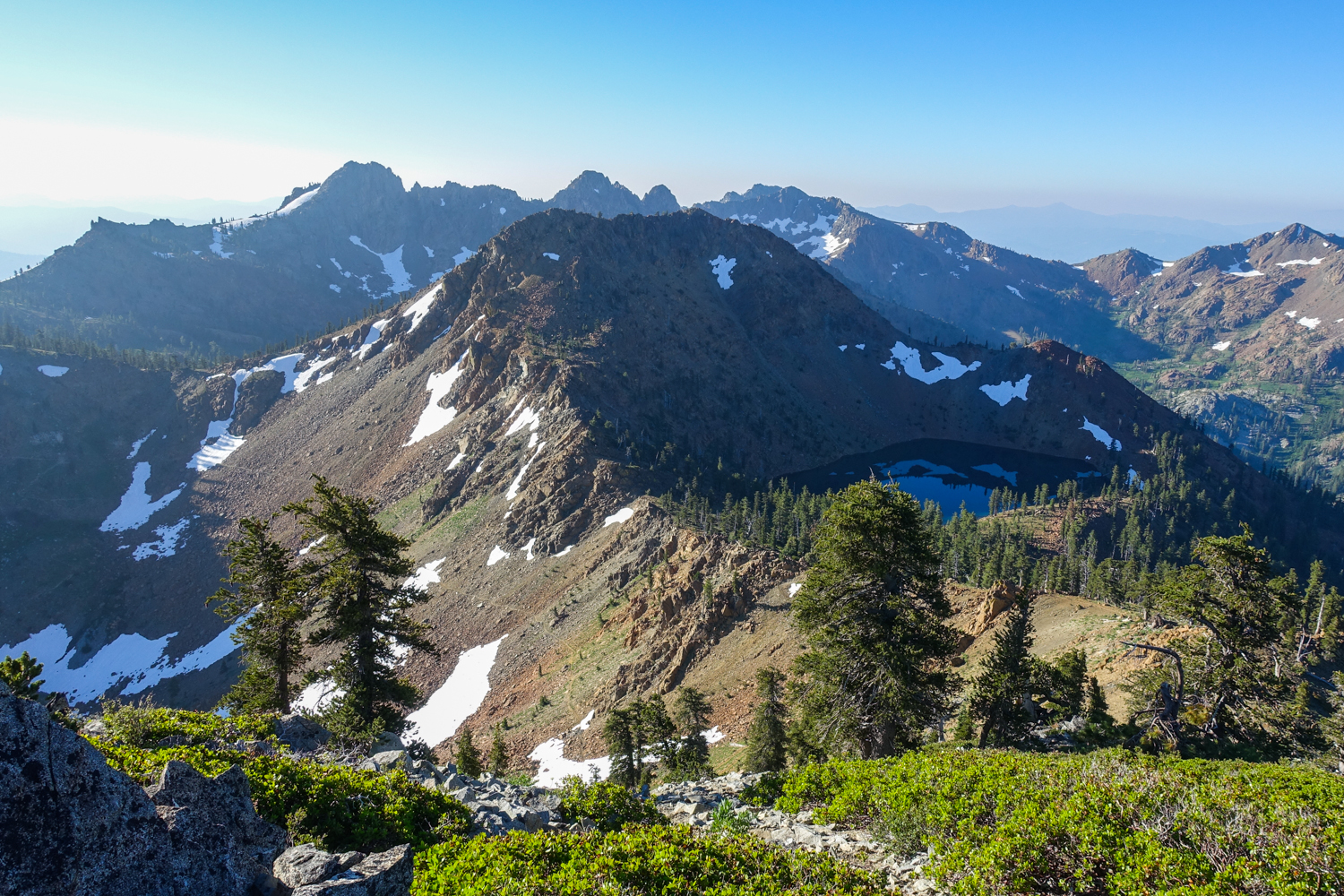
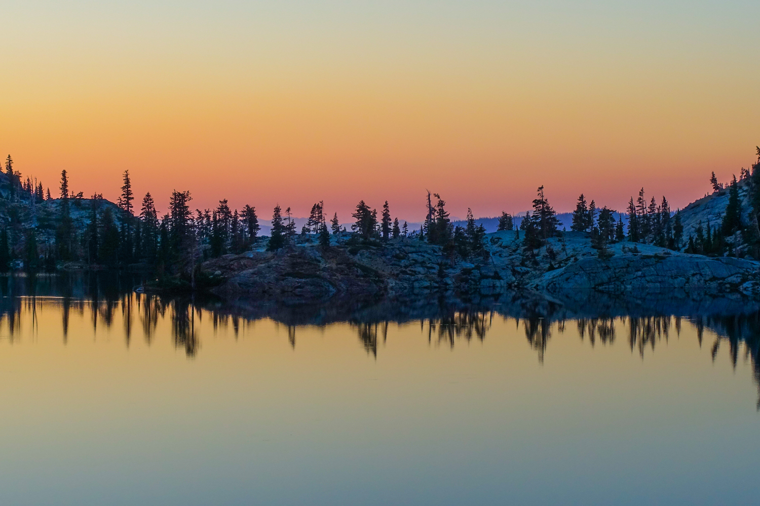
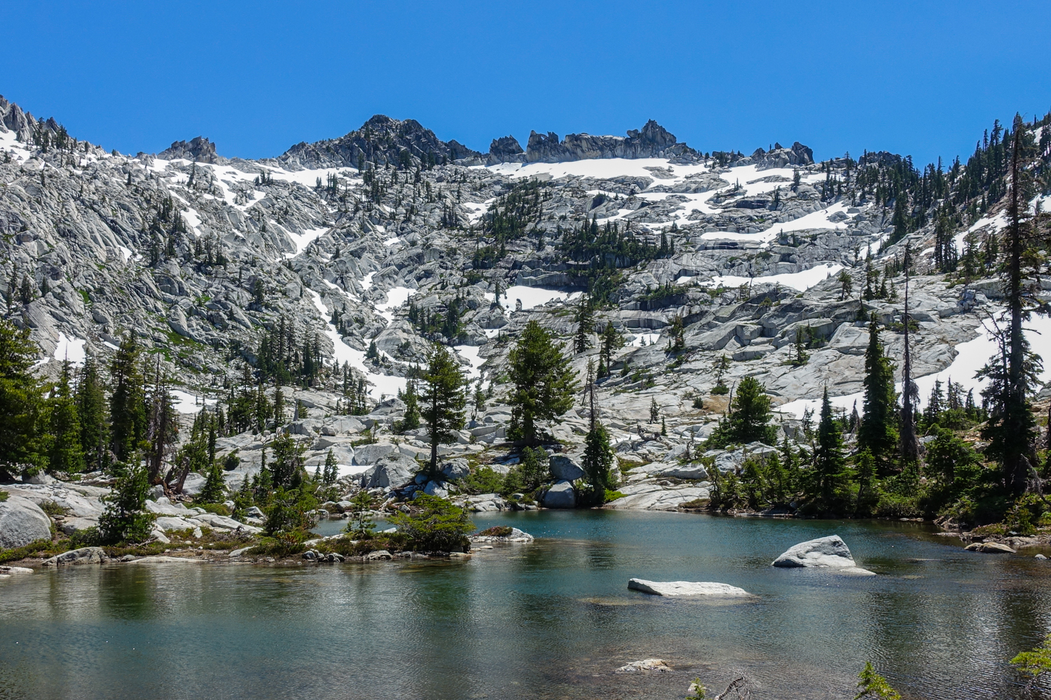
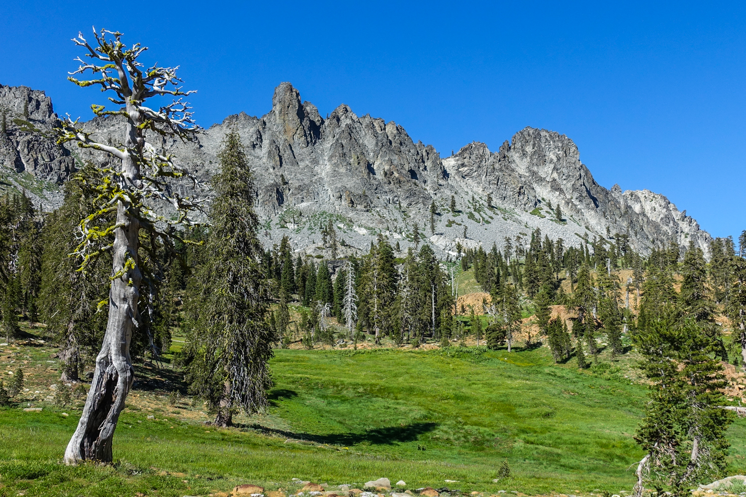
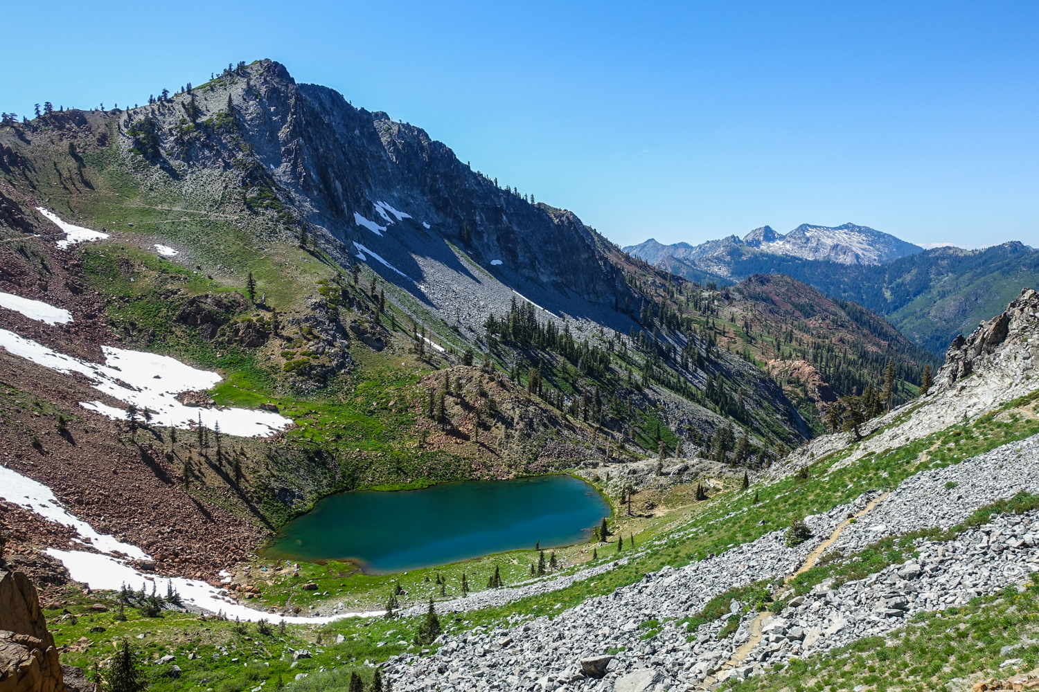
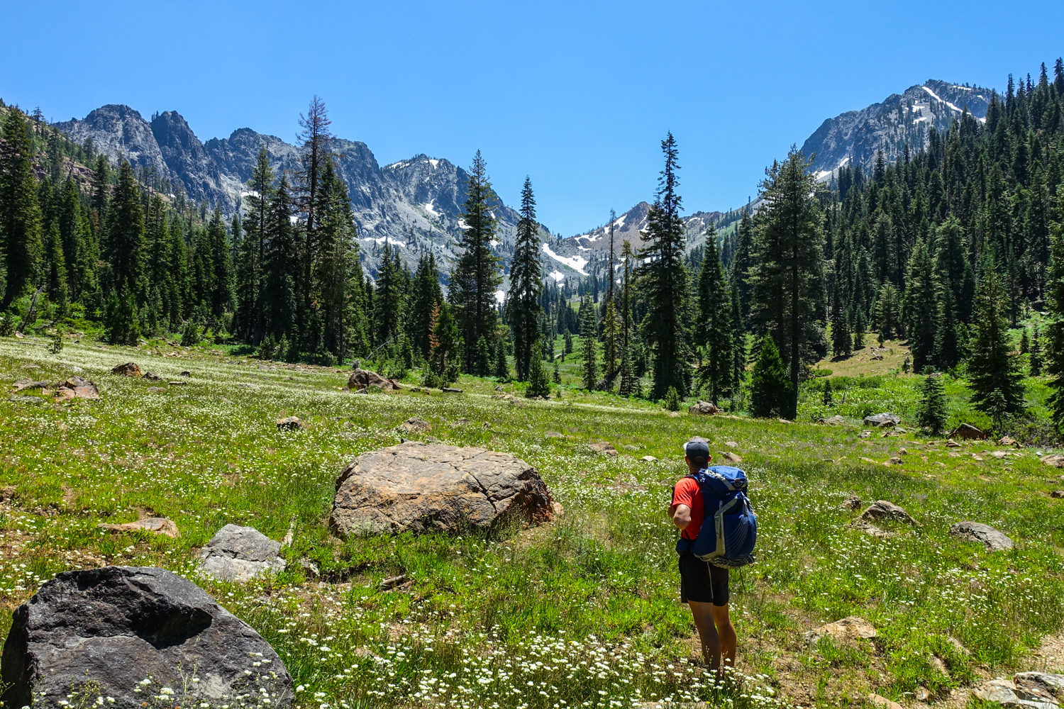
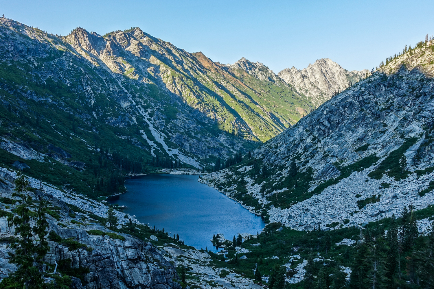
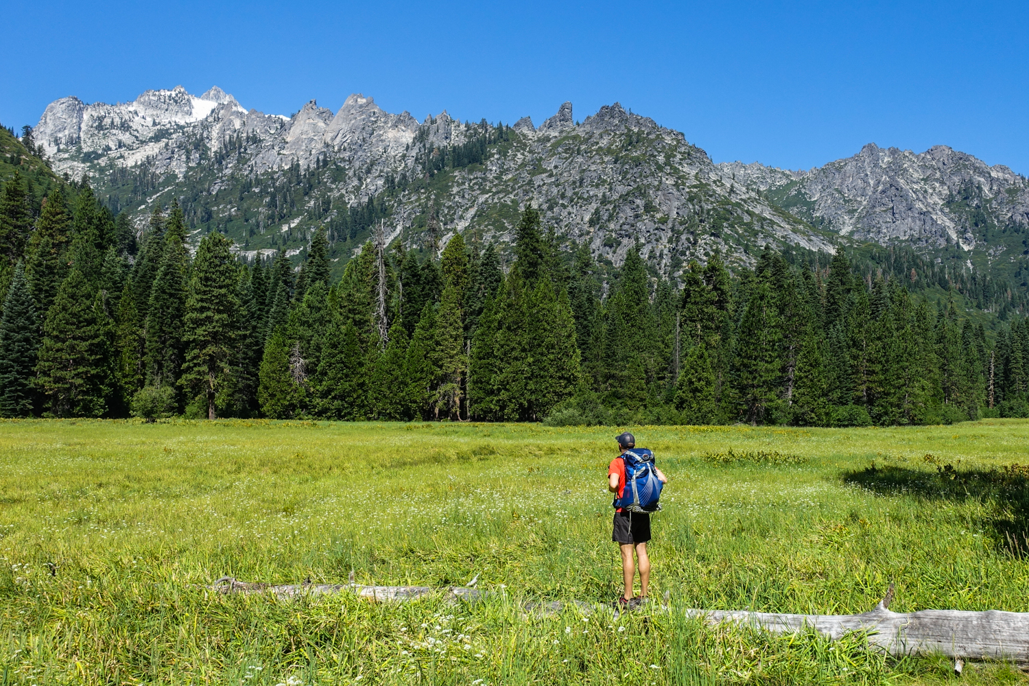
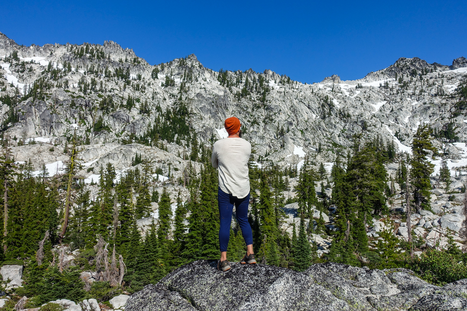
The Trinity Alps Wilderness, nestled between the Coastal Range and the Cascades, is located 50 miles west of Redding in Northwest California. This region is somewhat off the radar, as most choose to visit the famed southern neighbors in the Yosemite-Sequoia corridor. With a fraction of the visitors, the Trinity Alps offers equally stunning scenery. There are more than 600 miles of trails and over 525,000 acres of wilderness in the Alps, offering plenty of breathtaking opportunities for solitude. You can expect massive granite peaks, beautiful wildflower meadows, and tucked away glacial lakes. The hiking can be intense and your legs will feel the burn, but it will all be worth it to explore one of California’s lesser-known gems.
Quick Facts
-
Distance: varies, 20-50 miles depending on trip
-
Days Needed: 2-5 days
-
Elevation Gain/Loss: varies, 4-12k depending on trip
-
Best Time to Travel: July-September
-
Permits: Yes, pick up permits from self-service kiosk at ranger station
-
Difficulty: Moderate-Very Strenuous, depending on itinerary
Highlights
-
High alpine mountain scenery and lakes
-
Craggy granite peaks
-
Chilly but refreshing swimming
-
Beautiful wildflowers
-
Ample water sources
-
Ecosystem and wildlife diversity
-
Easy permit process
-
Good campsite opportunities
Lowlights
-
Seasonal bugs and snow (mosquitoes & ticks)
-
Busy on summer weekends
-
Hot summer temperatures
-
Steep ascents and descents (depending on itinerary)
-
Overgrown connecting trails
-
Rattlesnakes and poison oak are present
Best Time to Travel
In general, July through September is the best time to backpack in the Trinity Alps. Snowpack is a key factor for trip planning in this area. Some years a heavy winter snowpack and early season storms keep trails covered into July. On warmer years with light snowpack, June backcountry trips may be feasible. The same is true for autumn hiking in the Trinity Alps, some years early snowstorms make this area inaccessible and other years it’s stable into October. It’s always a good idea to contact a local ranger station (Weaverville Ranger Station – 530-623-2121) to ask about snow levels, accessibility, and current conditions.
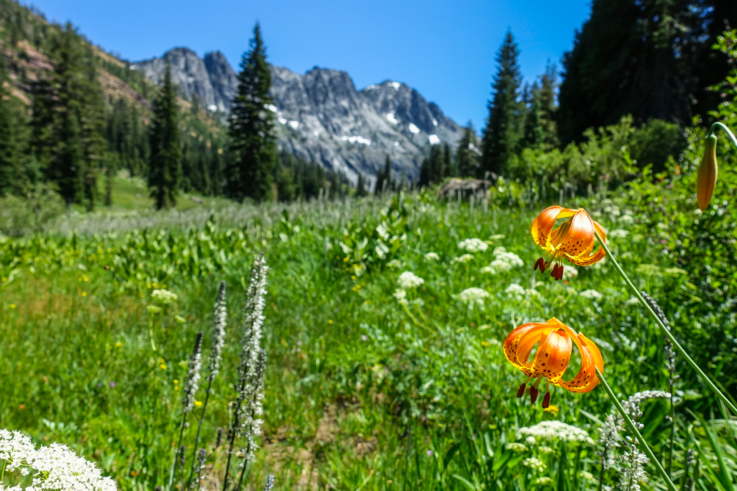
July and early August are usually great for wildflowers, but that’s also the time when mosquitoes will be at their peak. Use a combination of permethrin on your clothing and a small amount of 30% DEET on exposed skin for full protection. Mid-August through September can also be a good time to visit this area because there will be less crowds and bugs. Always pay close attention to the weather forecast before your trip and be prepared for changing conditions.
Difficulty
-
Total Distance: varies, 20-50 miles
-
Total Elevation Gain: varies, 4-12k (steep climbs and descents)
-
Overall Difficulty: Moderate to Very Strenuous
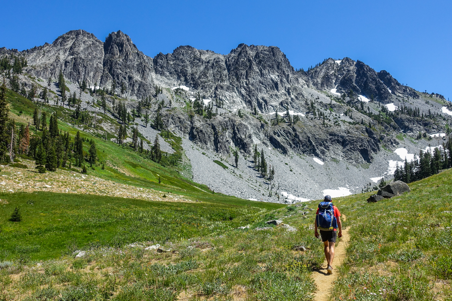
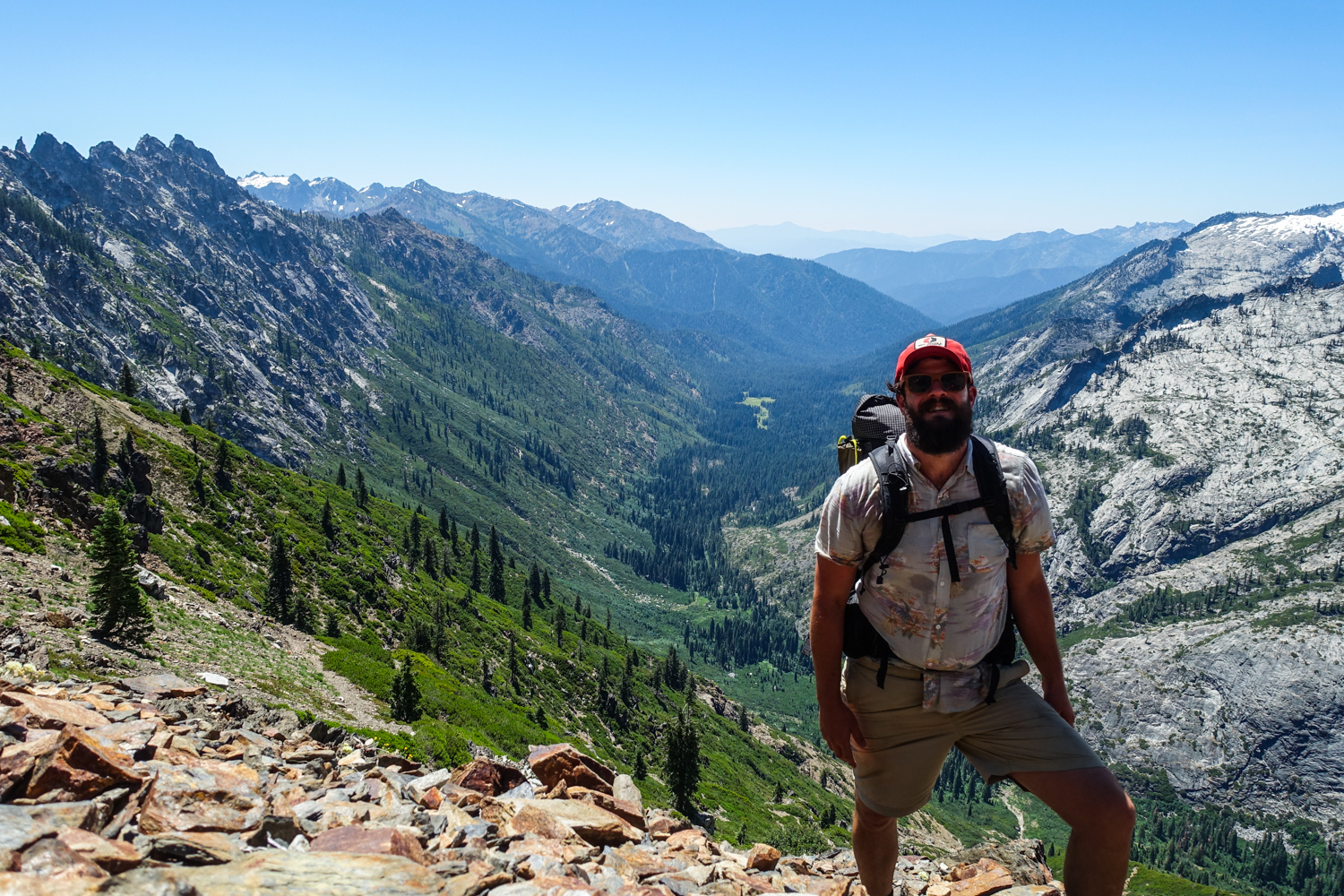
As always, difficulty ratings depend on your experience, physical fitness, pack weight, & weather conditions. There are many different trails to choose from in the Trinity Alps, but if you’re planning a multi-day trip into the high country, there’s no doubt you’ll encounter some strenuous ascents and descents along your route. For example, the climb from the Long Canyon Trailhead up to Summit Lake involves around 4,000 feet of elevation gain in the first 5 miles, which is no joke.
Don’t expect to come off the couch and enjoy hiking the Trinity Alps. We highly recommend training before your trek. Put a weighted backpack on and do some day hikes. Get your body ready; daily air squats and lunges will help build leg strength before your trek. Know your limitations, brush up on your skills, and dial in your lightweight gear. Doing so will make for a safe and enjoyable adventure.
Permits
Wilderness permits are required for overnight trips in the Trinity Alps Wilderness. Campfire permits are required for the operation of backpacking stoves as well. Both of these permits are issued at no cost to the visitor and can be picked up at ranger station kiosks before your trek. For more info check out the USDA Forest Service website.
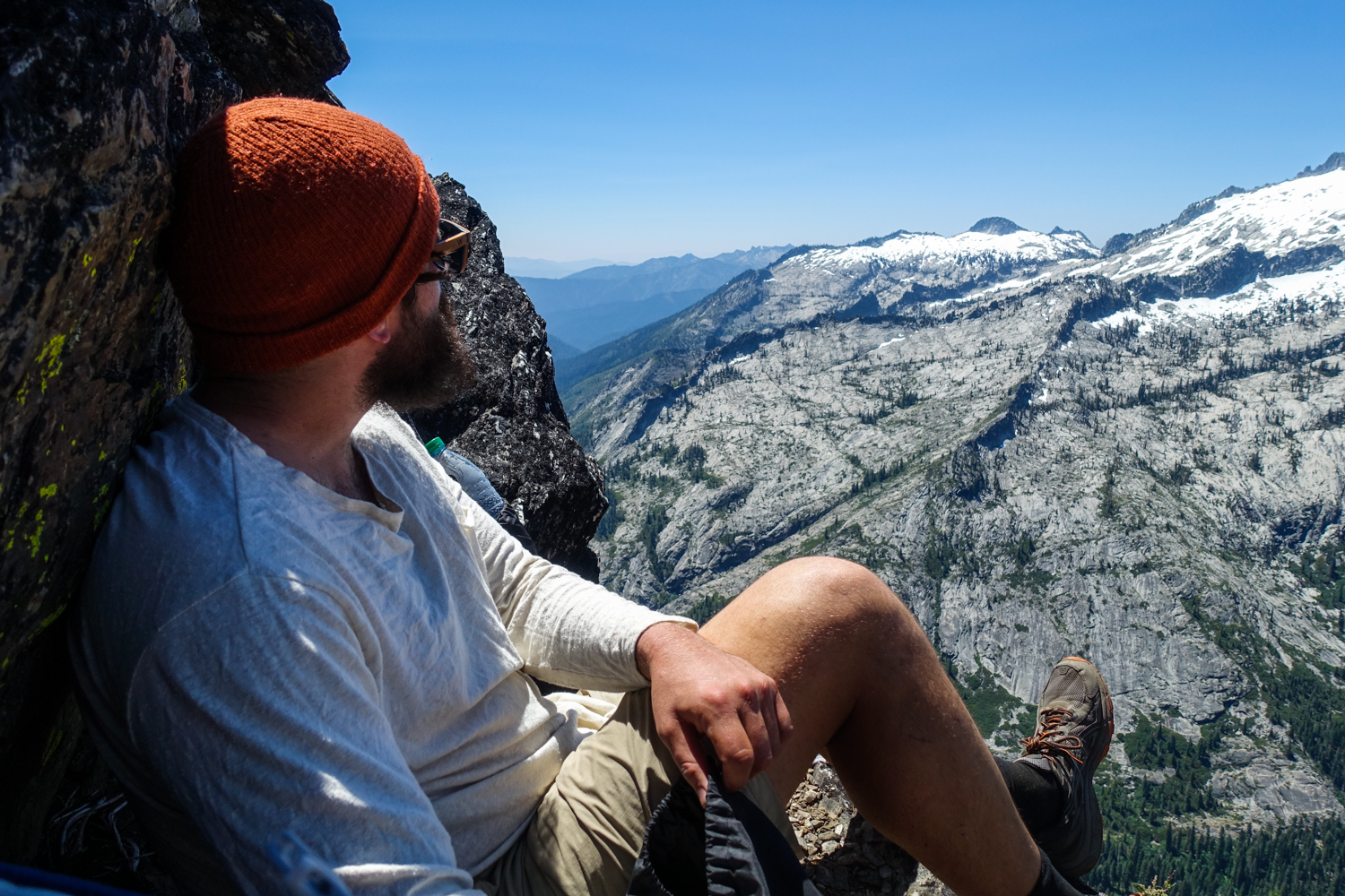
Solitude
Many of the trails throughout the Trinity Alps offer moderate solitude, depending on the time of year you’re hiking. You won’t be alone in the most popular areas and summer weekends can be busy, but there are usually lots of camping opportunities as well. You’ll probably have neighbors in the Trinity Alps, but you can also find solitude if you get off popular trails.
Getting There
The Trinity Alps Wilderness lies about 50 miles west of Redding California. If you’re coming from the north, it may make sense to head west on Highway 3 through Yreka if you’re accessing the north portion of the Alps. If approaching from the south, you’ll most likely be heading west on Highway 299 towards Weaverville. Once your itinerary is set, get specific directions to your trailhead (links provided in itinerary section below) and ensure you have an appropriate vehicle for road conditions.
Possible Trips & Trailheads
With a paved road encircling the Trinity Alps Wilderness, there are over 50 trailheads that wind their way into the interior of the Alps. Make sure your vehicle is moderately burly (a crossover SUV should do just fine), as some of the dirt roads to the trailheads can be rocky and gutted out. Below are some of our suggested multi-day backpacking trips in the Trinity Alps.
High Trinity Alps Traverse
-
Beginning Trailhead: Big Flat
-
Ending Trailhead: Long Canyon (two car shuttle required)
-
Miles: about 37
-
Days Needed: 3-6
-
Quick Summary: Although we generally prefer loop hikes, this comprehensive trip takes you through some of the very best the Trinity Alps has to offer, including the Caribou Basin, Emerald & Sapphire Lakes, and most of the Four Lakes Loop. There are also some spectacular side trips to consider along the way. You’ll need to bring two cars or arrange a shuttle to complete this hike.
Caribou Lakes Basin
-
Trailhead: Big Flat
-
Miles: 20-25 miles
-
Days Needed: 2-4
-
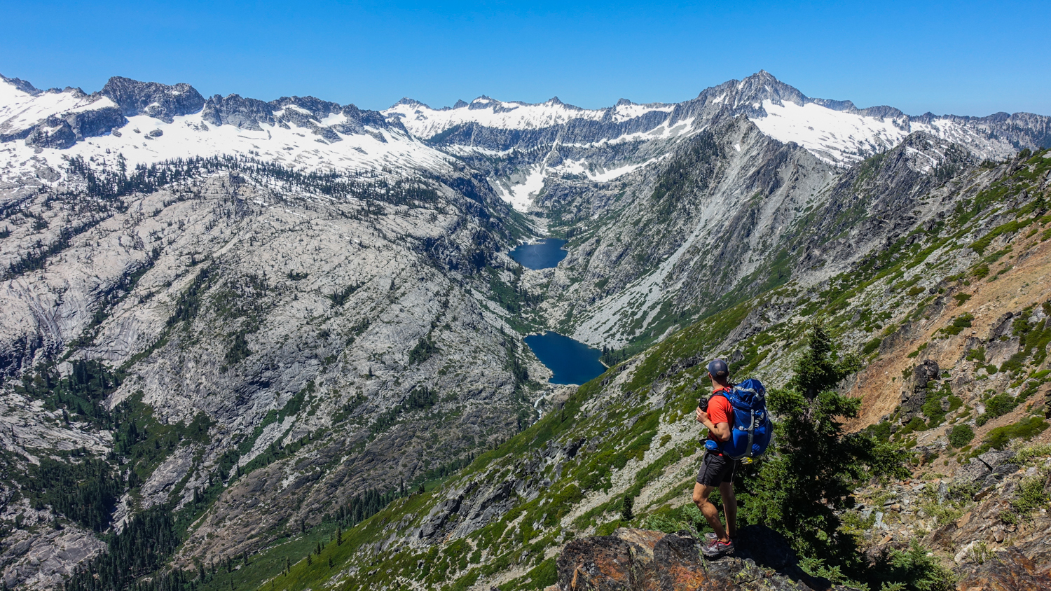
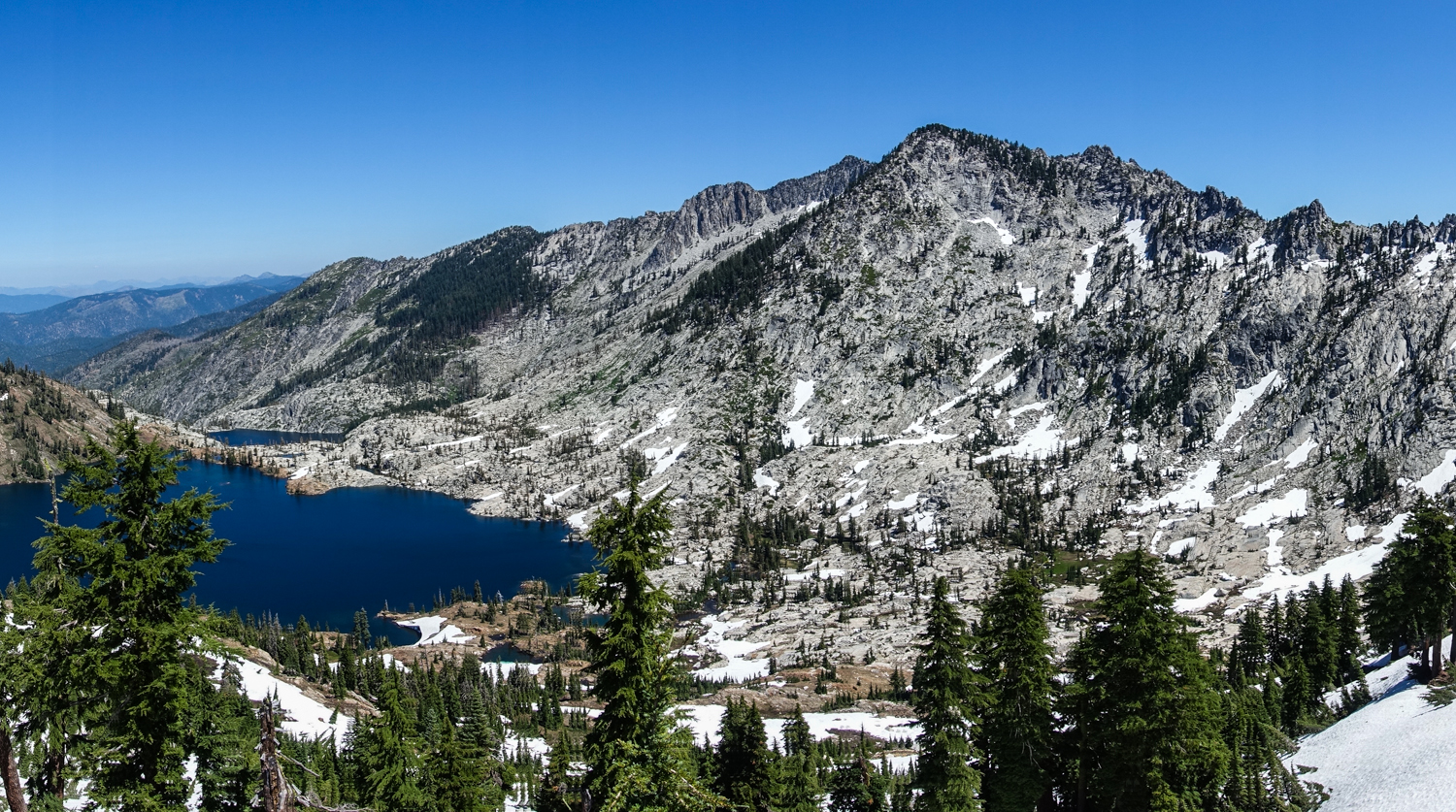
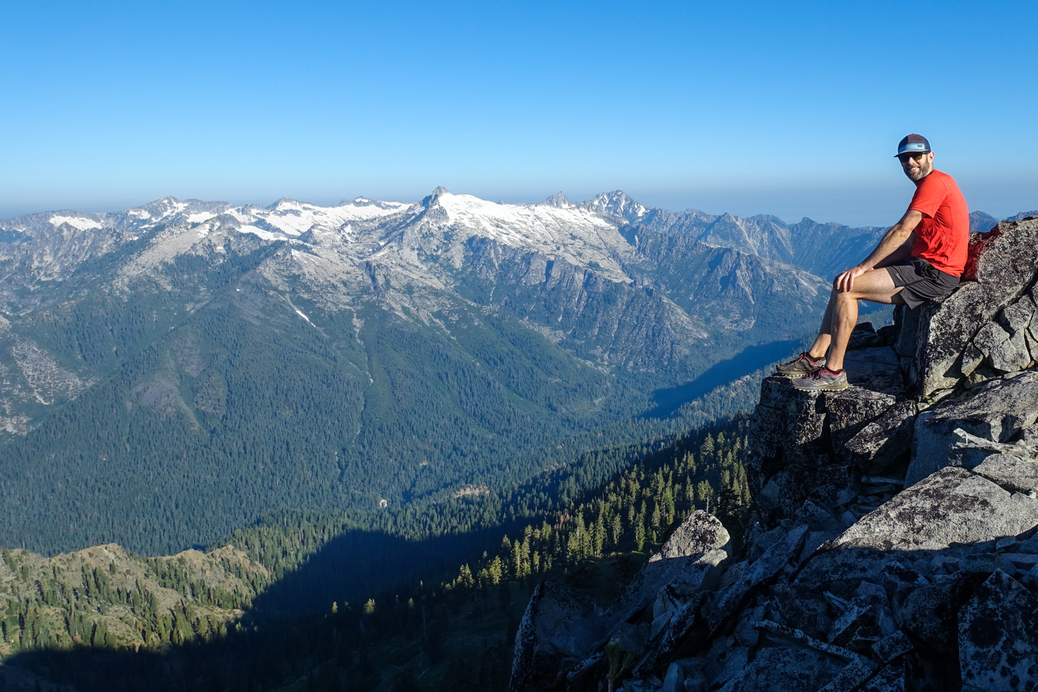
Quick Summary: If you want to enjoy some of the best parts of the High Trinity Alps, but don’t have the time or don’t want to deal with a car shuttle, this out-and-back trip may be a good fit. Start off with an ascent from Big Flat trailhead to the Caribou Lakes Basin, which is a stunning place to wander among alpine lakes. You can climb to the top of Caribou Mountain and scramble to the top of Sawtooth Ridge for epic views over the Trinity Alps. Those with extra time and energy can make the steep descent down Sawtooth Ridge to visit Emerald and Sapphire Lakes.
Four Lakes Loop
-
Trailhead: Long Canyon or Stoney Ridge
-
Miles: 17-22, depending on trailhead
-
Days Needed: 2-3
-
Quick Summary: The beautiful Four Lakes Loop is 5.2 miles itself, but you’ll have to hike out and back to get to the loop. The two most popular trailheads for this hike are Long Canyon and Stony Ridge. The Long Canyon trailhead provides the shortest route to the loop (6 miles one way), but requires a steep climb (about 4,000 feet). The Stoney Ridge route has an easier climb (about 3,000 feet) and is a bit more scenic, but the hike in is longer (8.2 miles one way). Either way you enter, the Four Lakes Loop will bring you around beautiful granite peaks and stunning alpine lakes, with the opportunity to scramble to the top of Siligo Peak, a worthy side trip.
Stuart Fork to Emerald and Sapphire Lakes
-
Trailhead: Stuart Fork (aka Bridge Camp)
-
Miles: 30, out-and-back trail
-
Days Needed: 2-4
-
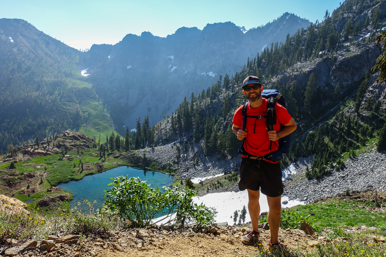
Quick Summary: This route has a more gradual ascent than most trails in the Trinity Alps, making it a popular choice. You’ll wander alongside the Stuart Fork river as you gradually climb through beautiful meadows and ascend into a world of granite peaks and alpine lakes. Head out in late spring and early summer for a spectacular wildflower show.
Maps & Guidebooks
-
Hiking California’s Trinity Alps Wilderness – A comprehensive guidebook for a bunch of excellent hikes in the trinity alps.
-
Best Backpacking Trips in California and Nevada – A great book for stunning backpacking trips around CA and NV. The High Trinity Alps Traverse is covered in this book with detailed and useful information.
-
We use Caltopo to research, plan trips, and print maps for the Trinity Alps. It takes a little time to learn the tool, but Caltop is an excellent resource for backpackers.
-
We use Gaia GPS for navigation in the Trinity Alps. We always bring printed topo maps and a good compass, but Gaia is a great tool in the field.
-
Basic USDA Forest Service Information – Trinity Alps Wilderness
Water
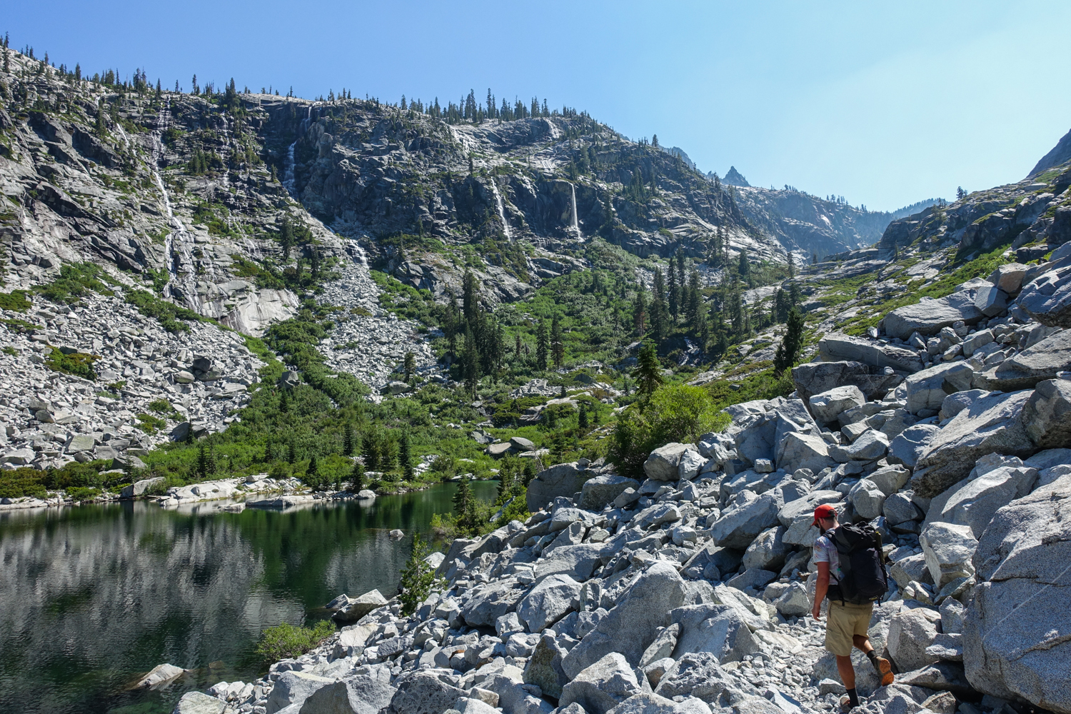
Water is plentiful in the Trinity Alps and is easily accessible from streams and lakes. Carry enough water to get from one source to the next and a lightweight water purifier. The water is clear enough throughout the Alps that we prefer the SteriPEN Ultra as our water purification method. However, depending on trip locations and water sources, we also like the Sawyer Squeeze and Aquamira Drops as other great purification methods.
Navigation
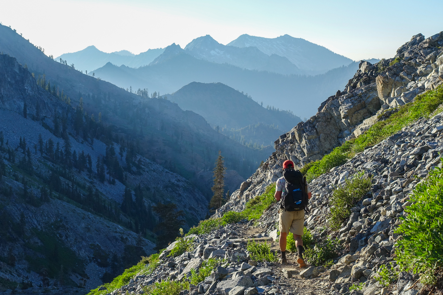
Main trails in popular areas are well-defined and easy to follow in the Trinity Alps. However, this isn’t an area where you should expect all side trails to be well-marked and maintained. Some old trails are faint and signage may be hard to follow or non-existent (Gaia GPS will help with less popular routes or off-trail routes). Connecting trails can be overgrown and brushy in places along the Alps. As always when backpacking, make sure to carry a physical map, a good compass, and know how to use them.
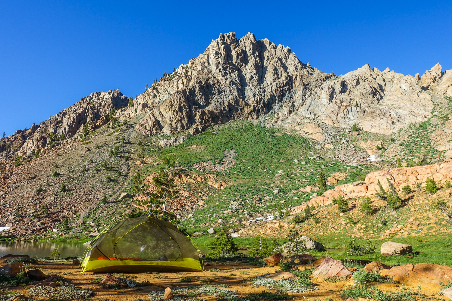
Backpacking Gear
We prefer lightweight backpacking because it’s more comfortable and it allows us to cover more ground with less effort. For recommendations on our favorite lightweight backpacking equipment, check out the CleverHiker Gear Guide and Top Picks page.
WHAT TO PACK
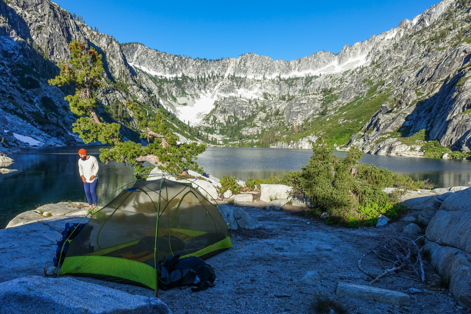
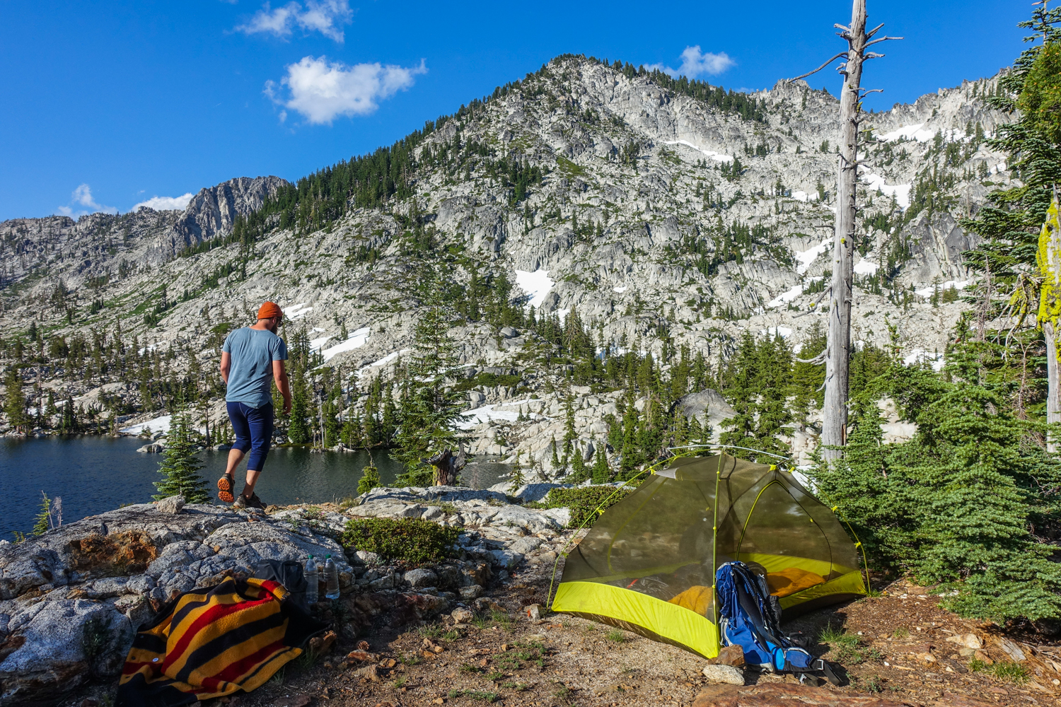
TENT: We used the Marmot Tungsten 2P UL tent on this trip. We think its strikes a good balance between weight, cost, and livability and that’s why it makes our list of the best lightweight backpacking tents.
BACKPACK: We used the Osprey Exos 48 and Ultralight Adventure Equipment Circuit backpacks on this trek. Both are lightweight, convenient, comfortable, and make our list of the best lightweight backpacking packs.
SLEEPING BAG: We used Enlightened Equipment Revelation Quilt and Feathered Friends Swallow Nano 20 sleeping bags on this trek. Both sleeping setups are lightweight, incredibly warm, and make our list of the best backpacking sleeping bags.
SLEEPING PAD: We used the Therm-a-Rest NeoAir XLite and Sea to Summit UltraLight Insulated sleeping pads on this trip. Both are light, comfortable, warm, and make our list of the best backpacking sleeping pads.
COOKING SYSTEM: We used the BRS Stove, Snow Peak Mini Solo Cookset, and Snow Peak Folding Spoon on this trek, all of which make our top picks gear list and best lightweight stove list.
WATER PURIFIER: We used the SteriPEN Ultra as our main purification method on this trip. It’s lightweight, works fast, and doesn’t require any pumping/squeezing or chemicals. Check out our best water purifiers list for our other top recommendations.
SHOES OR BOOTS: We wore Saucony Peregrine 7 trail runners (men’s and women’s) on this trail and they were excellent. If you prefer boots, make sure they’re lightweight and break them in really well before your trip. Here’s why we prefer hiking in trail running shoes: 5 Reasons to Ditch Your Hiking Boots.
HEADLAMP: A small headlamp like the Petzl Actik is an affordable, bright, and lightweight option.
FOOD: When backpacking in the Trinity Alps you’ll have to carry all your food. For some suggestions on common backpacking food options, check out our backpacking food video.
CLOTHING:
Here are some of our favorite hiking/backpacking clothing items from our Top Gear list.
-
1 Rain jacket shell – Patagonia M10 / Rab Kinetic Plus
-
1 Pair rain pants – Mountain Hardwear Stretch Ozonic
-
1 Down jacket – Patagonia Ultralight Down Hoody
-
1 Fleece jacket – Extra warmth under your down jacket that will be warmer when damp and better to hike in.
-
1 Pair hiking pants or running tights
-
1 Pair hiking shorts – Nike dri fit running shorts
-
1-2 Hiking t-shirts – Nike dri fit t-shirts
-
1 Long-sleeve shirt – Nike dri fit quarter zip
-
1-3 Pair underwear – ExOfficio boxer briefs or or ExOfficio women’s briefs
-
2-3 Pair socks (add thin sock liners if using boots) – Balega running socks for warm weather & SmartWool mountaineer socks for snow.
-
1 Pair long john bottoms – long john top optional for nighttime use.
-
1 Warm hat
-
1 Sun hat
-
1 Pair gloves or mittens
MAP &COMPASS:You’ll want to bring a topographical map and we print ours from the phone app Caltopo. We also used Gaia GPS as on offline GPS. As always, make sure to carry a physical map and a good compass, and know how to use them.
FIRST AID KIT: Always bring a small personalized first aid kit. We used the .5 Ultralight Kit and added extras, like painkillers and personal medications.
SUN PROTECTION: Sunglasses (polarized recommended), sunscreen, and spf lip balm are an absolute must.
POCKET KNIFE: We brought along a small Swiss Army Knife, which came in handy here and there.
OTHER ITEMS:
-
SMALL TOWEL: the Nano pack towel is great.
-
CASH and ID
-
PERMITS
-
PERSONAL TOILETRIES
-
HAND SANITIZER: Always apply after using a bathroom and before eating.
-
WET WIPES: These can be useful for cleaning up after hiking.
-
INSECT REPELLANT: At higher elevations insects weren’t a problem for us at all. For lower elevations, a 1oz bottle of DEET will do the trick.
-
CAMERA: The Sony RX100 is our go-to camera for lightweight backpacking.
Bears & Food Storage
There are technically no specific food storage requirements for the Trinity Alps, however bears are common in this area and we highly recommend taking food storage seriously. Mice and chipmunks are also a common annoyance and they’ll chew through expensive gear to get into your food supply if it isn’t stored properly.
For trips in the Trinity Alps, we recommend using an Ursack for food storage. Bear canisters are also a good choice as a foolproof food storage method, but they’re a bit heavier and bulkier than Ursacks.
Bugs
Mosquitoes are seasonally present in the Trinity Alps, so they might not be too bad depending on what time of year you travel. That said, we always prepare for bugs because they can quickly ruin an otherwise glorious hike. Use a combination of permethrin on your clothing and a small amount of DEET on exposed skin for full protection.
More Information
We hope this guide helps you plan a fun adventure in the Trinity Alps Wilderness. As always, leave a comment below if you have any recommendations, questions, or suggestions. For more popular CleverHiker content, check out the following links:
Trinity Alps Photo Gallery
Some of the links on this page are affiliate links, which means we may receive a small commission if purchases are made through those links. This adds no cost to our readers and helps us keep our site up and running. Our reputation is our most important asset, which is why we only provide completely honest and unbiased recommendations.