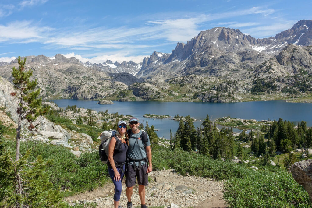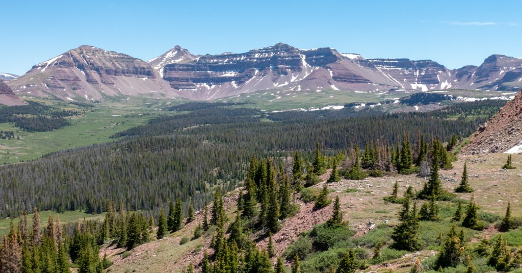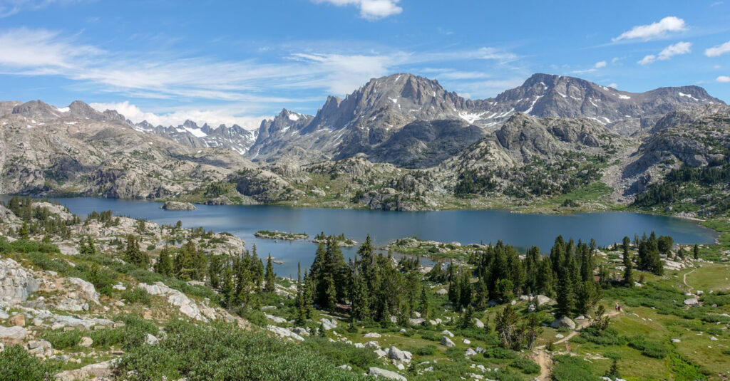
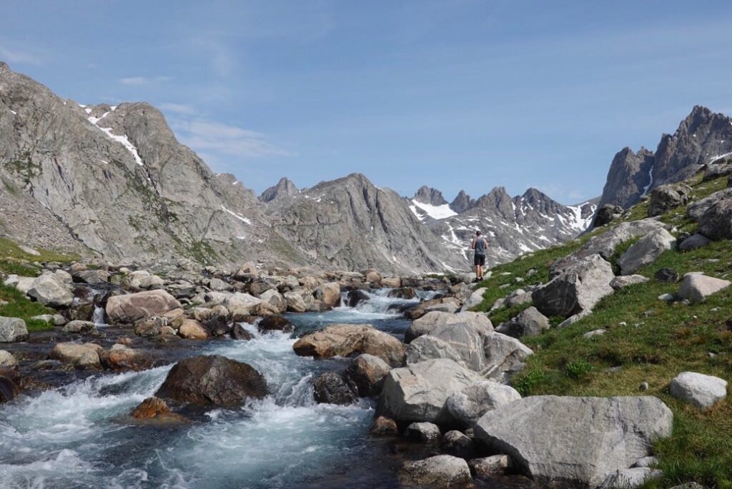
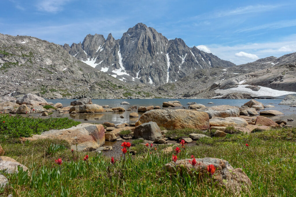
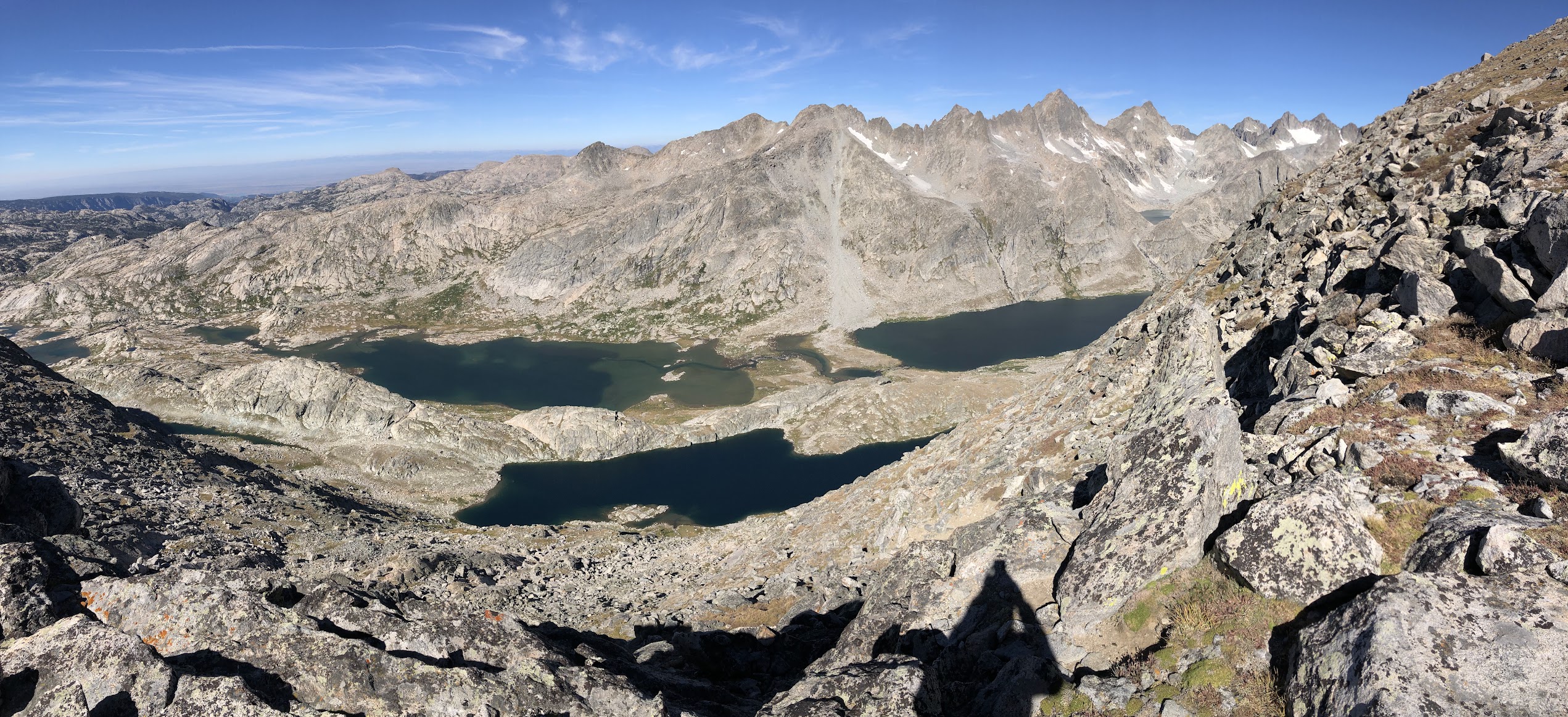
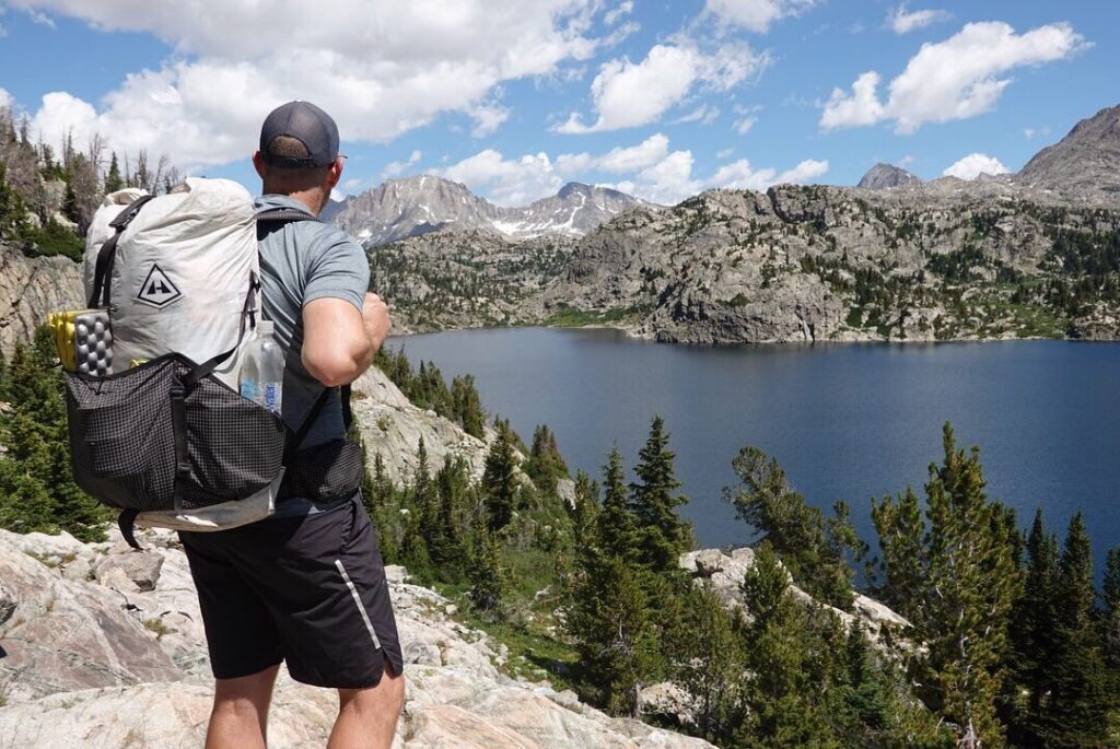
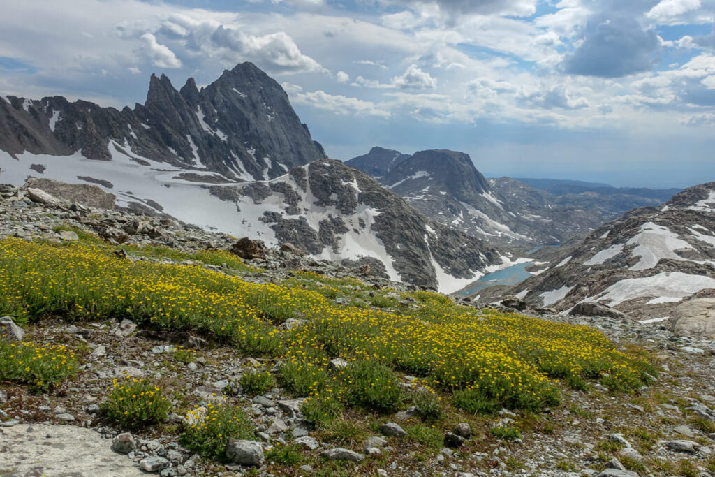
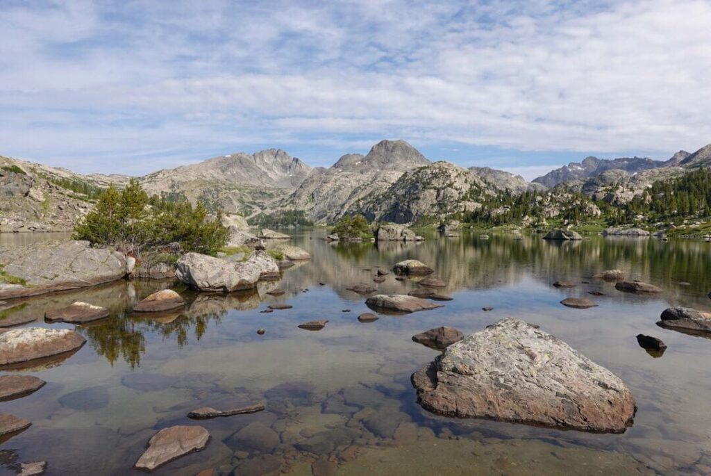
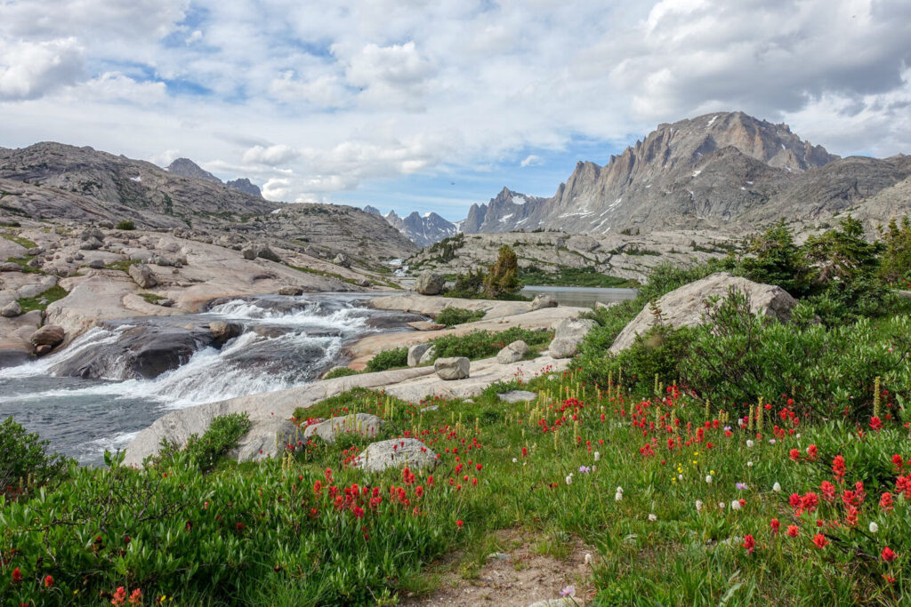
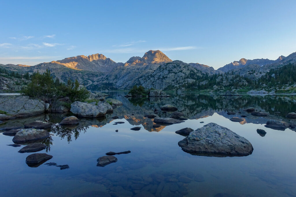
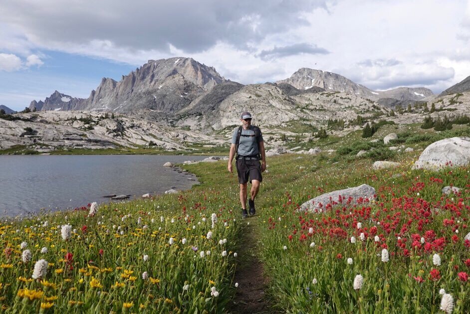
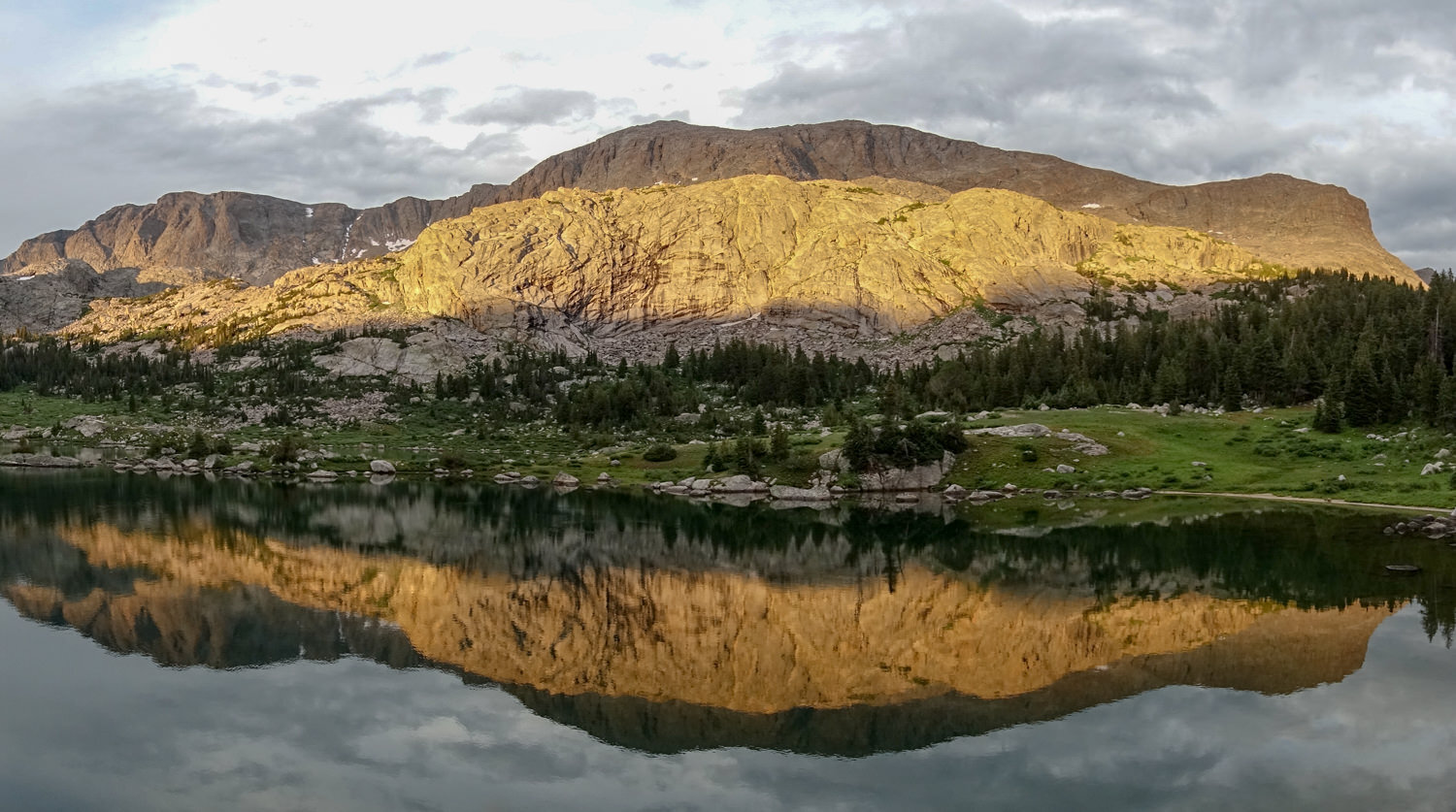
Backpacking in the Titcomb Basin has all the elements of a breathtaking trip. With dense forests, granite slabs, high alpine meadows, and lakes cradled beneath craggy granite peaks, the Wind River Range, or The Winds, as fans call them, are jammed with bucket-list day hikes and backpacking trips that reward you with epic views and unbelievable beauty.
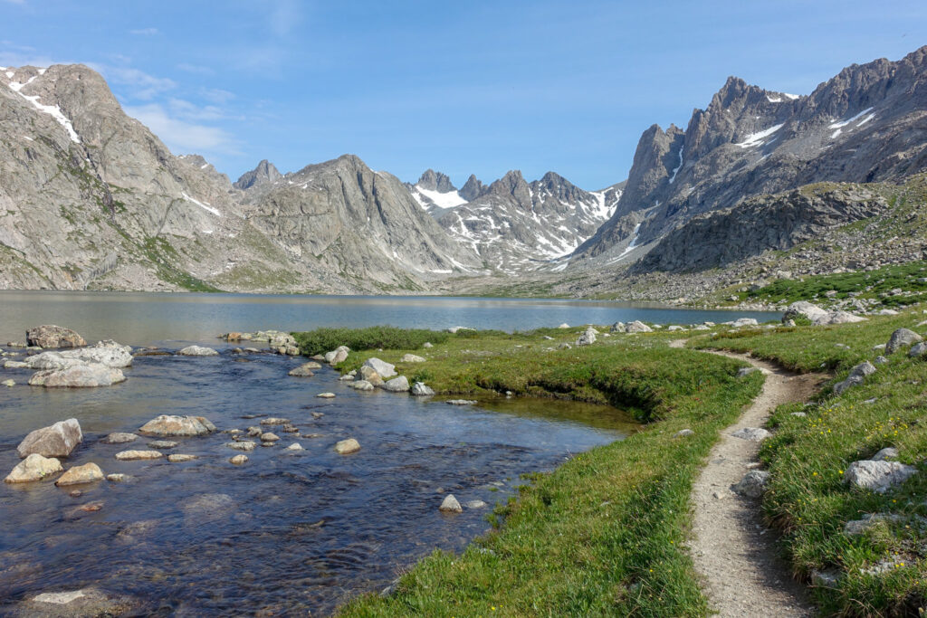
The trail out to Titcomb Basin, located deep in the range, is an unforgettable destination surrounded by peaks towering 3,000 feet above the granite slab cirque. Wyoming’s highest peak, the 13,804-foot Gannett Peak, stands like a sentinel among them in this area.
In this guide, we focus on getting out to Titcomb Basin and circumnavigating the spectacular basin. Just keep in mind when planning that the window is short, the weather is fierce, and fire season is intensifying. So that means lots of people are trying to get in about the same time. This area is no secret, and there isn’t a permitting system to control the number of people visiting/camping here. Adjust your expectations for solitude.
Quick Facts
Distance: 30 miles
Days Needed: 3-6 days
Peak Elevation: 10,631 ft. / 3,240 m
Elevation Gain/Loss: 3,409 ft / 1,039 m
Best Travel Time: August to Mid-September
Permits: None(except for stock and organized groups)
Difficulty: Moderate to Difficult
Highlights
- Wildlife galore, including pika, marmot, ground squirrel, chipmunk, beaver, moose, elk, bighorn sheep, gray wolf, mule deer, and grizzly and black bear
- Glacial action left cirques, kettles, U-shaped valleys, and hanging troughs
- Excellent fishing – many of the lakes hold grayling, mountain whitefish, and trout
- Surrounded by craggy peaks and granite block mountains
- Amazing lighting makes great photos
- Well-maintained trails
- Dogs can travel with you (but we don’t recommend it)
Lowlights
- Snow well into August at high elevations
- Sudden storms; lightning is not uncommon
- Few trees in the higher elevations
- Early snow in the fall
- Can be intensely windy(duh)
- Mosquitos, gnats and deer and horseflies are plentiful
- Campsites can be hard to find, either due to crowding or water proximity rules
- Icy cold lakes make swimming tempting but challenging
- Giardia and Campylobacter are prevalent in the streams and lakes
- Lots of people
Best Time to Travel
Winter snows generally remain on the high passes and highest trails until mid-July. In some years, you can access the trails by mid-June, but you’ll likely encounter bugs and snow. Stream flows are high and swift during snowmelt runoff from June through July, and some stream crossings can be challenging and dangerous. Late August to early September offers the best weather. Mid-September through late September offers the fewest bugs and people. Snow typically remains on the high passes and highest trails until mid-July.
Sudden rain and occasional snow flurries may occur at ANY TIME (hikers have been caught in hail and snowstorms on the same day in August). Even with highs in the high-70s or low 80s, night temperatures may be as low as 25 degrees at night. Streams typically run high and swift during snowmelt runoff in June and July, and some stream crossings can be hazardous. This can be particularly dangerous with dogs.
Afternoon thunderstorms and lightning are common in the summer. And range is called the Winds for a good reason. It can get ferocious. Keep that in mind when hiking out in the open above timberline. Avoid lone trees, open granite slab areas, high meadows, ridges, and mountaintops if the weather is uncertain. Look for dense stands of trees or boulder fields with rocks big enough to wedge yourself under for the duration of the storm. Before beginning your trip, check at the Pinedale Ranger Station Office or call them at 307-367-4326, and visit the National Weather Service.
Lastly, smoke has shut down a few of our staff’s backpacking missions into the winds. It is best to monitor the weather and smoke, and keep a flexible calendar to ensure a good weather window.
Difficulty
We rate most backpacking trips in this area as moderate to difficult due to many steep ascents and the elevation. As always, difficulty ratings depend on the route you choose, experience, physical fitness, pack weight, and weather conditions.
Although most routes in the Winds are not technically demanding, you should always plan thoroughly, train properly, know your limitations, brush up on your skills, and dial in your gear. Doing so will make for a safer and enjoyable adventure.
Permits
Permits are not required for most hikers into the Titcomb Basin. Permits are required for organized groups (such as clubs, schools, churches, scouts, etc.), all parties using pack and saddle stock overnight, and commercial uses (including outfitters and guides).
Obtain a permit from the Pinedale Ranger District, PO Box 220, Pinedale, WY 82941, 307-367-4326. There is no charge for these permits as long as the groups are not commercial. You will need to provide the following information:
- Dates of trip
- Location of entrance, exit, and planned campsites
- Number of people in group (15 is maximum)
- Scout groups are also required to send a copy of the Scout Council Tour Permit in advance of their planned Wilderness trip.
Hunting and Fishing
Hunting and fishing are allowed with a valid Wyoming hunting or fishing license. Order ahead or visit the Wyoming Game and Fish Department, State of Wyoming, Cheyenne, Wyoming 82002, or pick up at any appointed licensing agents throughout the state (supply and outdoor stores).
We liked having a tenkara rod because it is super lightweight (2.8 oz) and collapses to 20 inches which is perfect for the side of our pack.

Trailhead Options
Elkhart Park Trailhead – This is a major—highly popular—access point into the Wind River Range. It’s sometimes also referred to as the Pole Creek Trailhead. It’s located 15 miles northeast of Pinedale on a fully paved access road. There’s a very small campground with 8 campsites and toilets, but no drinking water (so fill up before you leave town)—only non-potable water. But there is a manned Forest Service Visitor Center, located at the entrance to Elkhart Park. (Google map)
Green River Lakes Trailhead– At the northernmost tip of the Wind River Range, the Green River Lakes Trailhead, located at an elevation of 8,000 feet, lies 52 miles north of Pinedale over about 21 miles of rough, sometimes rutted gravel and dirt road. The Forest Service operates the Green River Lakes Campground at the trailhead with 39 sites. It’s a high-use area with toilets and potable drinking water. (Google map)
Green River Lakes Trailhead is one of the lowest trailheads in the Winds. It offers incredible views of Squaretop Mountain, which towers over the sprawling river valley. It’s also the access point to Stroud Glacier and the headwaters of the Green River.
Possible Itineraries
TWO NIGHT OPTIONS
Elkhart Park Trailhead to Titcomb Basin
- Starting Trailhead –Elkhart Park
- Camp 1 – Island Lake
- Camp 2–Day hike to Titcomb Basin, then camp at Seneca Lake
- Ending trailhead – Elkhart Park
Green River Lakes to Summit Lake
- Starting Trailhead – Green River Lakes
- Camp 1 – Trapper Lake
- Camp 2 – Summit Lake with day hike to Elbow Lake
- Ending Trailhead – Green River Lakes
THREE NIGHT OPTIONS
Elkart Park to Titcomb Basin to Cook Lakes
- Starting Trailhead –Elkhart Park
- Camp 1 – Island Lake
- Camp 2 – Island Lake (day hike to Titcomb Basin & Indian Basin)
- Camp 3 – Cook Lakes
- Ending Trailhead – Elkhart Park
Green River Lakes to Lost Lake
- Starting Trailhead –Green River Lakes
- Camp 1 – Trapper Lake
- Camp 2 – Summit Lake
- Camp 3 – Beaver Park
- Ending Trailhead – Green River Lakes
FOUR NIGHT OPTION
Green River Lakes to Titcomb Basin
- Starting Trailhead –Green River Lakes
- Camp 1 – Three Forks Parks
- Camp 2 – Summit Lake (day hike to Titcomb Basin)
- Camp 3 – Summit Lake
- Camp 4 – Trapper Lake
- Ending Trailhead – Green River Lakes
FIVE NIGHT OPTION
Green River Lakes to Titcomb Basin
- Starting Trailhead –Green River Lakes
- Camp 1 – Three Forks Parks
- Camp 2 – Summit Lake
- Camp 3 – Island Lake (day hike to Titcomb Basin)
- Camp 4 – Jean Lakes
- Camp 5 – Three Fork Parks
- Ending Trailhead – Green River Lakes
FIVE NIGHT OPTION WITH SHUTTLE
Green River Lakes to Titcomb Basin to Elkhart Trailhead
- Starting Trailhead –Green River Lakes
- Camp 1 – Trail Creek Park
- Camp 2 – Elbow Lake (side trip to Peak Lake)
- Camp 3 – Indian Basin via Indian Pass
- Camp 5 – Titcomb Lakes or Seneca Lake
- Ending Trailhead – Elkhart Lake (requires shuttle)
Shuttle Info
Some CleverHiker staff have organized a car swap and drop-offs by coordinating with others (never hurts to try posting on FB or reaching out to the NOLS branch, or the Great Outdoor Shop in Pinedale!). If you don’t have that option, there are a couple of shuttle operations to use.
GOTCO operates shuttles to trailheads on the west side of the Continental Divide. Reservations and rates can be found online. Options include:
VEHICLE SHUTTLE
Park your vehicle at the entrance trailhead. Sometime during the trip, GOTCO will pick up your vehicle and drive it to the exit trailhead. Options include Pinedale to Green River Lakes and Pinedale to Elkhart Park (or vice versa).
PEOPLE SHUTTLE
Park your vehicle at the exit trailhead, and GOTCO picks you up at the designated time and transports you to the entrance trailhead, where you may begin your trip. Pinedale to Green River Lakes or Pinedale to Elkhart Park (or vice versa)
POINT-TO-POINT SHUTTLE
Get picked up at any designated location (airport, hotel, trailhead, or other) and then shuttle you to another location (airport, hotel, trailhead, or other). Call for prices.
East Side Options
Should you decide to explore Titcomb Basin or other parts of the Winds via the east side of the Continental Divide, Wind River Shuttle will transport you from your car park at 8 am at Trail Lake TH (Google map) in Dubois and shuttle you to Bruce’s Bridge (Google map) in Lander. This is about a 2-hour ride for a hiking start time of 10 am.
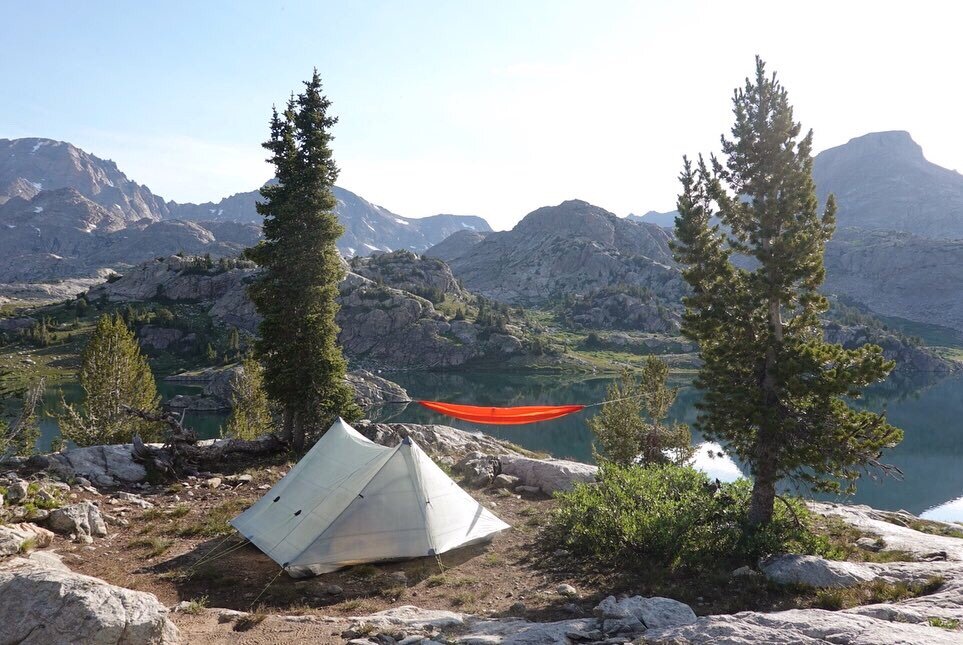
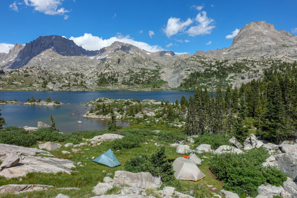
Campsites
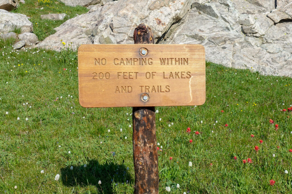
All camping is undesignated, but always look for pre-existing sites. Wilderness Rules apply and are enforced by rangers in the area. Look for existing-use sites, 100 ft. from the river, 200 ft. from the trail or lakeshore. Also, try to find a campsite away from other people’s campsites, not only for your privacy but also for theirs.
Note that the forest between the Green River Lakes Trailhead and Trail Creek Park is dead. Lodgepole pine bark beetle wiped out most of the low-elevation forests in the region. Add to that the fact that the river valley limits your options to the riverbank. So finding a legal campsite (100-ft. rule) in this area is difficult. In other areas, granite slabs and talus dominate.
Camping is also difficult to find in Titcomb Basin—most of the sites are illegal. Look near the outlet of Lower Titcomb Lake, as well as slightly above Titcomb Basin at Mistake Lake. If you get lucky and find a suitable legal camp in the basin, make sure your food is properly stored. There are no trees in the basin; you’ll need to wedge your bear canister under a large boulder—out of reach of marauders.
Island Lake is a very popular place to camp. But the camping, fishing, sandy beaches, and many incredible mountain views mean you will be sharing it with a lot of other backpackers. Also, campfires are illegal at Island Lake and areas above it.
Surrounded by sheer granite cliffs, Seneca Lake is also a difficult place to find camping, though a small single tent won’t be as difficult to site. Campsites for these can be found at the lake inlet or on the southwest corner of the lake. Groups will have a much harder time finding a place to pitch multiple tents.
A note about pooping in this area
The granite that forms these incredible peaks and contains these sparkling lakes makes for some tricking wild bathrooming. Water is everywhere, and there are lots of people camping in limited spots. That means there are lots of catholes contained in a small area. It’s a known issue in the area that is contaminating the waters.
Here’s our PSA: hold it. Just kidding, kind of. Most people do their business in the morning while they are still in camp. If you want to spread out the impact of human waste, try to do your #2 while you’re hiking (it’s good motivation to get out of camp) and below the treeline, where there is more organic matter to dig down 6″. Wag bags are also a noble option if you are committed to keeping this area pristine.
Finally, please pack out your toilet paper as well. Or burn it (just don’t light the wilderness on fire).
Maps & Guidebooks
- Beartooth Publishing Wind River Range Map– All trailheads and access roads are shown to get your trip started. Scaled to 1:100,000 with contours at 100 ft. 2017 ed. Get this for planning purposes, since the USFS is no longer issuing their wilderness maps of this area.
- Earthwalk Press North Wind River Range – Wind River Topographic Map, from Elkhart Park to Union Pass. It is the equivalent of 18 7.5-minute USGS quadrangles. Scaled to 1:48000. Planning trips information and backcountry regulations are included. Printed on waterproof and tear resistant material.
- Hiking Wyoming’s Wind River Range – This book offers excellent trail descriptions and includes a mileage log and elevation chart.
- Beyond Trails in The Wind River Mountains of Wyoming by Nancy Palliser. This unbelievably thorough guide is designed primarily for advanced hikers with some climbing and glacier travel skills, although it also includes some easy routes. The maps are on an included CD-ROM, which also includes photos, pass routes, high-quality topos with overlayed use-trails, and virtual tours. This is an
- Climbing and Hiking in the Wind River Mountains by Joe Kelsey. The trail descriptions are brief, but they offer very good trail diagrams. It also describes some off-trail routes, including Class 2 scrambles.
Water
Water is abundant along the trail, except just above upper Green River Lake and Elbow Creek below Beaver Park. The water is incredibly silty from glacial runoff most of the year in these locations.
In other places along the trail, water in the Bridger Wilderness looks incredibly pure. Due to all the animals roaming around it and humans pooping everywhere, it’s not. The parasite Giardia, an ever-present organism in the feces of infected animals and humans, is commonly spread through water. Other microbes, including Campylobacter, which can upset the stomach and irritate the intestinal tract, are also present.
- Giardia: filter with a pore size less than one-half micron.
- Campylobacter: requires boiling for five minutes or filtering.
Regulations
This area falls within the Bridger Wilderness Area. The following hiking and backpacking-related activities are prohibited within the Bridger Wilderness:
- Camping within 200 feet of a trail or lakeshore.
- Open campfires within the seven special management areas.
- Horse grazing within 200 feet of lakes.
- Placing or maintaining a cache in the wilderness.
- Cutting or otherwise damaging any live tree or other vegetation without a permit.
- Staying in one campsite for more than 16 days. Visitors who vacate a campsite after 16 days may not return to the same site for at least 5 days.
- Party size is restricted to 15 people.
- Non-burnable garbage must be packed out, not buried.
- Camp structures such as hitch racks, tent frames, pegs and fire rings must be dismantled after use.
- Bury human waste in a shallow hole at least 100 feet from any water supply, so that rain or snow runoff will not carry contaminants into lakes and streams. Body waste decomposes fastest in holes dug 6-8 inches deep.
- Soap (even biodegradable brands) and food particles pollute lakes and streams. Do not wash your dishes, clothes, and yourself near the shore of lakes, ponds, or streams.
- Carry out cans, bottles, plastics, aluminum foil, and anything else that will not burn. Burying won’t work. Frost action will likely push your buried garbage (like toilet paper) to the surface, or animals will dig it up.
- Keep your dog under your control at all times and away from other people and wildlife.
Campfire Regulations
If you can get by without a campfire, do so. Lightweight gas stoves are more efficient and faster for cooking than fires, and they leave no impact. Campfires destroy organic matter in the topsoil and may inhibit plant growth for many years. Blackened rocks, charred wood, and accumulated ash also alter the natural appearance of the site.
If a campfire is used, here are suggestions to minimize impact:
- Burn dead and down wood, and only what you need. Standing dead and gnarled snags are components of the wilderness scenery and important habitat for cavity-nesting birds and many small mammals.
- A ring of rocks is unnecessary. Instead, dig a fire pit about six inches deep, keep the sod intact, and pile it nearby.
- On breaking camp, permit the fire to burn down to white ash and drown the coals thoroughly. If there is a buildup of ash, remove it from the fire pit and scatter it well away from camp, where people won’t walk through it, and the rain and snow will wash it away.
- Replace the sod and pour water on it.
- Scatter any unused firewood in natural-looking locations.
- Keep your fire small to reduce impact and the danger of forest fire.
- Select a spot a safe distance from trees, brush, and down logs,
- Leave no fire rings. Leave no trace.
Bears & Food Storage
There are bears in the Wind River Range, both grizzly bears and black bears. So protection and food storage are critical. Because this loop is in such a popular area, it’s highly unlikely that you will encounter any bears along your trip. Still, take the correct precautions just in case.
We carried bear spray when hiking in the Winds because there are grizzly bears in the area. We knew it was highly unlikely that we would see any, but if we did, we wanted to be prepared to protect ourselves. We consider bear spray an essential item when hiking in grizzly country. It could easily save your life in the rare event of an attack.
Food storage is another important consideration. Bear resistant food storage containers are mandatory in the Pinedale Ranger District north of Boulder Creek and outside of the Bridger Wilderness, and are highly recommended elsewhere in The Winds. They are available on loan from the Pinedale District office.
Make sure you know how to hang a bear bag properly or carry a food storage container. Bear canisters and Ursacks are the most effective storage methods and the easiest to use.
Bugs
Mosquitoes, deerflies, and horseflies are plentiful from mid-June to early-September, making insect repellent and, perhaps, even a hat with netting, a must. We recommend spraying your clothing with permethrin, as well as bringing plenty of Picaradin. If you’re heading into the Titcomb Basin when skeeters are at their peak, you may even consider packing in a Thermacell Backpacker Mosquito Repeller, which screws onto a standard fuel canister and works very well.
Backpacking Gear
We prefer lightweight backpacking because it’s more comfortable and allows us to cover more ground with less effort. For recommendations on our favorite lightweight backpacking equipment, check out the CleverHiker Gear Guide and Top Picks page.
Gear List
Make sure to check out our Ultimate Backpacking Checklist, so you don’t forget something important.
Below you’ll find our current favorite backpacking gear. If you want to see additional options, our curated gear guides are the result of many years of extensive research and hands-on testing by our team of outdoor experts.
BACKPACK
- Best Backpacking Pack Overall: Gregory Paragon 58 – Men’s / Gregory Maven 58 – Women’s
- Best Ultralight Backpacking Backpack: Hyperlite Mountain Gear Unbound 40
- More: Check out our best backpacking backpacks guide for ultralight and trekking options
TENT
- Best Backpacking Tent Overall: Big Agnes Copper Spur HV UL2
- Best Ultralight Tent: Zpacks Duplex
- Best Budget Tent: REI Half Dome 2
- Best Tent Stakes Overall: All One Tech Aluminum Stakes
- More: Check out our best backpacking tents guide for more options
SLEEPING BAG/QUILT
- Best Sleeping Bag Overall: Men’s Feathered Friends Swallow YF 20 / Women’s Feathered Friends Egret YF 20
- Best Quilt Overall: Enlightened Equipment Revelation 20
- More: Check out our best backpacking sleeping bags guide and best backpacking quilts guide for more options
SLEEPING PAD
- Best Sleeping Pad Overall: NEMO Tensor All-Season
- Best Foam Sleeping Pad: NEMO Switchback
- More: Check out our best backpacking sleeping pads guide for ultralight and trekking options
CAMP KITCHEN
- Best Backpacking Stove Overall: MSR PocketRocket 2
- Best Backpacking Cookware Overall: TOAKS Titanium 750ml
- Best Backpacking Coffee Overall: Starbucks VIA
- More: Check out our best backpacking stoves guide and best backpacking cookware guide for ultralight and large group options
WATER & FILTRATION
- Best Water Filter Overall: Sawyer Squeeze
- Best Hydration Bladder Overall: Gregory 3D Hydro
- Best Backpacking Water Bottles: Smartwater Bottles
- More: Check out our best backpacking water filters guide and best backpacking water bottles guide for ultralight and large group options
CLOTHING
- Best Hiking Pants Overall: Men’s Outdoor Research Ferrosi / Women’s The North Face Aphrodite 2.0
- Best Hiking Shorts Overall: Men’s Patagonia Quandary / Women’s Outdoor Research Ferrosi
- Best Women’s Hiking Leggings: Fjallraven Abisko Trekking Tights HD
- Best Rain Jacket Overall: Men’s Patagonia Torrentshell 3L / Women’s Patagonia Torrentshell 3L
- Best Rain Pants: Men’s Patagonia Torrentshell 3L / Women’s Patagonia Torrentshell 3L
- Best Down Jacket Overall: Men’s Patagonia Down Sweater Hoodie / Women’s Patagonia Down Sweater Hoodie
- Best Fleece Jacket Overall: Men’s Patagonia Better Sweater / Women’s Patagonia Better Sweater
- Best Sunshirt Overall: Men’s Outdoor Research Echo / Women’s Outdoor Research Echo
- Best Socks Overall: Men’s Darn Tough Light Hiker Micro Crew / Women’s Darn Tough Light Hiker Micro Crew
- Beste Ultralight Liner Glove: Patagonia Capilene Midweight Liner
- More: Check out our best backpacking apparel lists for more options
FOOTWEAR & TRACTION
- Best Hiking Shoes Overall: Men’s HOKA Speedgoat 6 / Women’s HOKA Speedgoat 6
- Best Hiking Boots Overall: Men’s Salomon X Ultra 5 GTX / Women’s Lowa Renegade Evo GTX
- Best Hiking Sandals Overall: Men’s Chaco Z/1 Classic / Women’s Chaco Z/1 Classic
- Best Camp Shoes Overall: Crocs Classic Clogs
- Best Traction Device for Hiking Overall: Kahtoola MICROspikes
- More: Check out our best backpacking footwear lists for more options
NAVIGATION
- Best GPS Watch Overall: Garmin Instinct 2 Solar
- Best Personal Locator Beacon (PLB): Garmin inReach Mini 2
- More: Check out our article How to Use Your Phone as a GPS Device for Backpacking & Hiking to learn more
FOOD
FIRST-AID & TOOLS
- Best First-Aid Kit Overall: Adventure Medical Kits Ultralight/Watertight .7
- Best Pocket Knife Overall: Kershaw Leek
- Best Multitool Overall: Leatherman Wave+
- Best Headlamp Overall: Black Diamond Spot 400-R
- Best Power Bank Overall: Nitecore NB 10000 Gen 3
- More: Check out our best first-aid kit guide, best pocket knife guide, best multitool guide, best backpacking headlamps guide, and best power banks guide for more options
MISCELLANEOUS
- Best Trekking Poles Overall: Black Diamond Pursuit
- Best Backpacking Chair Overall: REI Flexlite Air
- Best Backpacking Stuff Sack Overall: Hyperlite Mountain Gear Drawstring
- More: Check out our best trekking poles guide, best backpacking chairs guide, and best stuff sacks guide for more options