The Trinity Alps Wilderness is located 50 miles west of Redding, California. Nestled between the Coastal Range and the Cascades, this region is somewhat off backpackers’ radars because most of them head south to the Yosemite-Sequoia corridor. We’ve hiked both. The Trinity Alps offers equally stunning scenery with a fraction of the visitors of Yosemite and Sequoia.
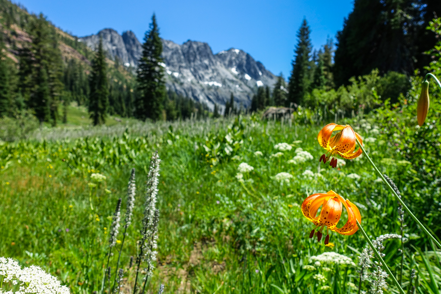
There are more than 600 miles of trails and over 525,000 acres of wilderness in the Trinity Alps, offering plenty of breathtaking opportunities for solitude. You can expect massive granite peaks, beautiful wildflower meadows, and tucked-away glacial lakes. The hiking can be intense, and your legs will feel the burn. But it will all be worth it to explore one of California’s lesser-known gems.
Our guide will help you plan and pull off your backpacking trip to the Trinity Alps.
Quick Facts
- Distance: varies, 20-50 miles depending on trip
- Days Needed: 2-5 days
- Elevation Gain/Loss: varies, 4,000-12,000 feet depending on the trip
- Best Time to Travel: July-September
- Permits: Yes, pick up permits from the self-service kiosk at the ranger station
- Difficulty: Moderate-Very Strenuous, depending on your itinerary
Highlights
- High alpine mountain scenery and lakes
- Craggy granite peaks
- Chilly but refreshing swimming
- Beautiful wildflowers
- Ample water sources
- Diversity of ecosystems and wildlife
- Easy permit process
- Good campsite opportunities
Lowlights
- Seasonal bugs and snow (mosquitoes & ticks)
- Busy on summer weekends
- Hot summer temperatures
- Steep ascents and descents (depending on itinerary)
- Overgrown connecting trails
- Can get hazy/smokey during fire season
- Rattlesnakes and poison oak
Best Time to Travel
Snowpack is a key factor for trip planning in the Trinity Alps. Sometimes, heavy winter snowpack and early-season storms keep trails covered into July. On warmer years with light snowpack, June backcountry trips may be feasible.
The same is true for autumn hiking. Early snowstorms can make this area inaccessible, and in other seasons, it’s accessible into October.
It’s always a good idea to contact a local ranger station (Weaverville Ranger Station – 530-623-2121) to ask about snow levels, accessibility, and current conditions.
- In general, July through September is the best time to backpack in the Trinity Alps.
- July and early August are usually great for wildflowers, but that’s also when mosquitoes are at their peak. For full protection, use a combination of permethrin on your clothing and picaridin on exposed skin.
- Mid-August through September can also be a good time to visit this area because there will be fewer crowds and bugs.
Always pay close attention to the weather forecasts before your trip, and be prepared for changing conditions. Also, watch out for wildfire activity. Smoky backpacking trips are hard on your lungs, and it’s a real bummer to have limited visibility of the panoramic views you worked hard to see. We like NOAA’s point forecasts and the National Interagency Fire Center to plan safe trips.
Difficulty
- Total Distance: varies, 20-50 miles
- Total Elevation Gain: varies, 4-12k (steep climbs and descents)
- Overall Difficulty: Moderate to Very Strenuous
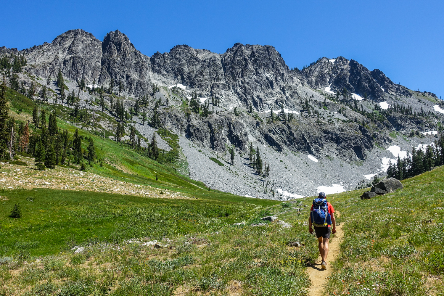
As always, difficulty ratings depend on your experience, physical fitness, pack weight, & weather conditions. There are many different trails to choose from in the Trinity Alps, but if you’re planning a multi-day trip into the high country, there’s no doubt you’ll encounter some strenuous ascents and descents along your route. For example, the climb from the Long Canyon Trailhead up to Summit Lake involves around 4,000 feet of elevation gain in the first 5 miles, which is no joke.
Don’t expect to come off the couch and enjoy hiking the Trinity Alps. We highly recommend training before your trek. Put a weighted backpack on, and do some day hikes. Get your body ready; daily air squats and lunges will help build leg strength before your trek. Know your limitations, brush up on your skills with CleverHiker’s video tutorials, and dial in your lightweight gear. Doing so will make for a safe and enjoyable adventure.
Permits
Wilderness permits are required for overnight trips in the Trinity Alps Wilderness. Campfire permits are required for the operation of backpacking stoves as well. Both of these permits are issued at no cost to the visitor and can be picked up at ranger station kiosks before your trek.
For more information on permits, check out the USDA Forest Service website. Also be sure to see the Shasta-Trinity Alp Forest Service page for up-to-date information on fire restrictions and road closures.
Solitude
You’ll probably have neighbors in the Trinity Alps. But you can also find moderate solitude if you get off popular trails and avoid summer weekends. There usually are plenty of camping spots, which allow backpackers to spread out.
Getting There
The Trinity Alps Wilderness lies about 50 miles west of Redding, California. If you’re coming from the north, it may make sense to head west on Highway 3 through Yreka if you’re accessing the north portion of the Alps. If approaching from the south, you’ll most likely be heading west on Highway 299 toward Weaverville.
Once your itinerary is set, get specific directions to your trailhead (links provided in the itinerary section below) and ensure you have an appropriate vehicle for road conditions.
Possible Trips & Trailheads
With a paved road encircling the Trinity Alps Wilderness, there are over 50 trailheads that wind their way into the interior of the Alps. Make sure your vehicle is moderately burly (a crossover SUV should do just fine) – some of the dirt roads to the trailheads can be rocky and rutted out.
Below are some of our suggested multi-day backpacking trips in the Trinity Alps.
High Trinity Alps Traverse
- Beginning Trailhead: Big Flat
- Ending Trailhead: Long Canyon (two-car shuttle required)
- Miles: about 37
- Days Needed: 3-6
Quick Summary: Although we generally prefer loop hikes, this comprehensive trip takes you through some of the very best the Trinity Alps has to offer, including the Caribou Basin, Emerald & Sapphire Lakes, and most of the Four Lakes Loop. There are also some spectacular side trips to consider along the way. You’ll need to bring two cars or arrange a shuttle to complete this hike.
Caribou Lakes Basin
- Trailhead: Big Flat
- Miles: 20-25 miles
- Days Needed: 2-4
Quick Summary: If you want to enjoy some of the best parts of the High Trinity Alps without a car shuttle, this out-and-back trip may be a good fit. Start off with an ascent from Big Flat trailhead to the Caribou Lakes Basin, which is a stunning place to wander among alpine lakes. You can climb to the top of Caribou Mountain and scramble to the top of Sawtooth Ridge for epic views over the Trinity Alps. Those with extra time and energy also can make the steep descent down Sawtooth Ridge to visit Emerald and Sapphire Lakes.
Four Lakes Loop
- Trailhead: Long Canyon or Stoney Ridge
- Miles: 17-22, depending on trailhead
- Days Needed: 2-3
Quick Summary: The beautiful Four Lakes Loop is 5.2 miles, but you’ll have to hike out and back to get to the loop. The two most popular trailheads for this hike are Long Canyon and Stony Ridge. The Long Canyon trailhead provides the shortest route to the loop (6 miles one way) but requires a steep climb (about 4,000 feet). The Stoney Ridge route has an easier climb (about 3,000 feet) and is a bit more scenic, but the hike in is longer (8.2 miles one way).
Either entrance you choose, the Four Lakes Loop will bring you around beautiful granite peaks and stunning alpine lakes, with the opportunity to scramble to the top of Siligo Peak, a worthy side trip.
Stuart Fork to Emerald and Sapphire Lakes
- Trailhead: Stuart Fork (aka Bridge Camp)
- Miles: 30, out-and-back trail
- Days Needed: 2-4
Quick Summary: This route has a more gradual ascent than most trails in the Trinity Alps, making it a popular choice. You’ll wander alongside the Stuart Fork River as you gradually climb through beautiful meadows and ascend into a world of granite peaks and alpine lakes. Head out in late spring and early summer for a spectacular wildflower show.
Maps & Guidebooks
- Hiking California’s Trinity Alps Wilderness – A comprehensive guidebook for a bunch of excellent hikes in the Trinity Alps.
- Best Backpacking Trips in California and Nevada – A great book for stunning backpacking trips around CA and NV. The High Trinity Alps Traverse is covered in this book with detailed and useful information.
- We use Caltopo to research, plan trips, and print maps for the Trinity Alps. It takes a little time to learn the tool, but Caltop is an excellent resource for backpackers.
- We use Gaia GPS for navigation in the Trinity Alps. We always bring printed topo maps and a good compass, but Gaia is a great tool in the field.
- Basic USDA Forest Service Information – Trinity Alps Wilderness
Water
Water is plentiful in the Trinity Alps and is easily accessible from streams and lakes. Carry enough water to get from one source to the next and a lightweight water purifier.
The water in the Alps only needs to be filtered – not purified. We like the Sawyer Squeeze as our lightweight water filter. If you also want to purify your water for piece of mind, we prefer the SteriPEN Ultra (or Aquamira Drops).
Navigation
The main trails in popular areas are well-defined and easy to follow in the Trinity Alps. However, this isn’t an area where you should expect all side trails to be well-marked and maintained. Some old trails are faint, and signage may be hard to follow or non-existent (Gaia GPS will help with less popular routes or off-trail routes). Connecting trails can be overgrown and brushy in places along the Alps.
As always when backpacking, make sure to carry a physical map and good compass – and know how to use them.
Bears & Food Storage
There are technically no specific food storage requirements for the Trinity Alps. However, bears are common in this area, and we highly recommend taking food storage seriously. Mice and chipmunks are also a common annoyance, and they’ll chew through expensive gear to get into your food supply if it isn’t stored properly.
Bear canisters are a foolproof food storage method, but they’re heavy and bulky. Since the National Forest does not require bear cannisters, we recommend an Ursack. We usually carry the bear-resistant Ursack, but the Ursack All-Mitey is safe for both bears and critters (mice, chipmunks, marmots, etc).
Bugs
Mosquitoes are seasonal in the Trinity Alps, so they may or may not be bad – depending on what time of year you travel. That said, we always prepare for bugs because they can quickly ruin an otherwise glorious hike. Use a combination of permethrin on your clothing and a small amount of DEET on exposed skin for full protection.
Gear List
Make sure to check out our Ultimate Backpacking Checklist, so you don’t forget something important.
Below you’ll find our current favorite backpacking gear. If you want to see additional options, our curated gear guides are the result of many years of extensive research and hands-on testing by our team of outdoor experts.
BACKPACK
- Best Backpacking Pack Overall: Gregory Paragon 58 – Men’s / Gregory Maven 58 – Women’s
- Best Ultralight Backpacking Backpack: Hyperlite Mountain Gear Unbound 40
- More: Check out our best backpacking backpacks guide for ultralight and trekking options
TENT
- Best Backpacking Tent Overall: Big Agnes Copper Spur HV UL2
- Best Ultralight Tent: Zpacks Duplex
- Best Budget Tent: REI Half Dome 2
- Best Tent Stakes Overall: All One Tech Aluminum Stakes
- More: Check out our best backpacking tents guide for more options
SLEEPING BAG/QUILT
- Best Sleeping Bag Overall: Men’s Feathered Friends Swallow YF 20 / Women’s Feathered Friends Egret YF 20
- Best Quilt Overall: Enlightened Equipment Revelation 20
- More: Check out our best backpacking sleeping bags guide and best backpacking quilts guide for more options
SLEEPING PAD
- Best Sleeping Pad Overall: NEMO Tensor All-Season
- Best Foam Sleeping Pad: NEMO Switchback
- More: Check out our best backpacking sleeping pads guide for ultralight and trekking options
CAMP KITCHEN
- Best Backpacking Stove Overall: MSR PocketRocket 2
- Best Backpacking Cookware Overall: TOAKS Titanium 750ml
- Best Backpacking Coffee Overall: Starbucks VIA
- More: Check out our best backpacking stoves guide and best backpacking cookware guide for ultralight and large group options
WATER & FILTRATION
- Best Water Filter Overall: Sawyer Squeeze
- Best Hydration Bladder Overall: Gregory 3D Hydro
- Best Backpacking Water Bottles: Smartwater Bottles
- More: Check out our best backpacking water filters guide and best backpacking water bottles guide for ultralight and large group options
CLOTHING
- Best Hiking Pants Overall: Men’s Outdoor Research Ferrosi / Women’s The North Face Aphrodite 2.0
- Best Hiking Shorts Overall: Men’s Patagonia Quandary / Women’s Outdoor Research Ferrosi
- Best Women’s Hiking Leggings: Fjallraven Abisko Trekking Tights HD
- Best Rain Jacket Overall: Men’s Patagonia Torrentshell 3L / Women’s Patagonia Torrentshell 3L
- Best Rain Pants: Men’s Patagonia Torrentshell 3L / Women’s Patagonia Torrentshell 3L
- Best Down Jacket Overall: Men’s Patagonia Down Sweater Hoodie / Women’s Patagonia Down Sweater Hoodie
- Best Fleece Jacket Overall: Men’s Patagonia Better Sweater / Women’s Patagonia Better Sweater
- Best Sunshirt Overall: Men’s Outdoor Research Echo / Women’s Outdoor Research Echo
- Best Socks Overall: Men’s Darn Tough Light Hiker Micro Crew / Women’s Darn Tough Light Hiker Micro Crew
- Beste Ultralight Liner Glove: Patagonia Capilene Midweight Liner
- More: Check out our best backpacking apparel lists for more options
FOOTWEAR & TRACTION
- Best Hiking Shoes Overall: Men’s HOKA Speedgoat 6 / Women’s HOKA Speedgoat 6
- Best Hiking Boots Overall: Men’s Salomon X Ultra 5 GTX / Women’s Lowa Renegade Evo GTX
- Best Hiking Sandals Overall: Men’s Chaco Z/1 Classic / Women’s Chaco Z/1 Classic
- Best Camp Shoes Overall: Crocs Classic Clogs
- Best Traction Device for Hiking Overall: Kahtoola MICROspikes
- More: Check out our best backpacking footwear lists for more options
NAVIGATION
- Best GPS Watch Overall: Garmin Instinct 2 Solar
- Best Personal Locator Beacon (PLB): Garmin inReach Mini 2
- More: Check out our article How to Use Your Phone as a GPS Device for Backpacking & Hiking to learn more
FOOD
FIRST-AID & TOOLS
- Best First-Aid Kit Overall: Adventure Medical Kits Ultralight/Watertight .7
- Best Pocket Knife Overall: Kershaw Leek
- Best Multitool Overall: Leatherman Wave+
- Best Headlamp Overall: Black Diamond Spot 400-R
- Best Power Bank Overall: Nitecore NB 10000 Gen 3
- More: Check out our best first-aid kit guide, best pocket knife guide, best multitool guide, best backpacking headlamps guide, and best power banks guide for more options
MISCELLANEOUS
- Best Trekking Poles Overall: Black Diamond Pursuit
- Best Backpacking Chair Overall: REI Flexlite Air
- Best Backpacking Stuff Sack Overall: Hyperlite Mountain Gear Drawstring
- More: Check out our best trekking poles guide, best backpacking chairs guide, and best stuff sacks guide for more options
Trinity Alps Photo Gallery
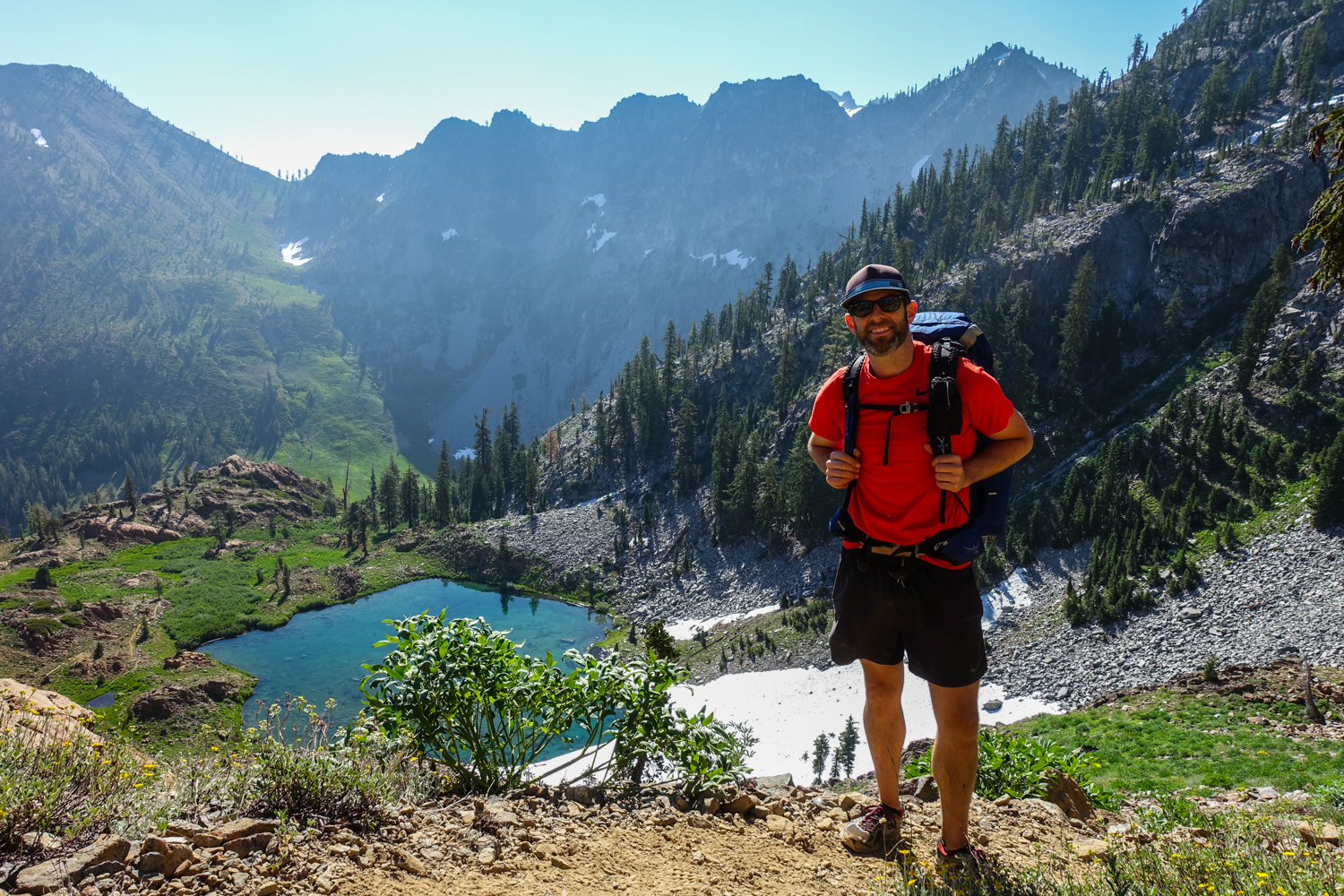
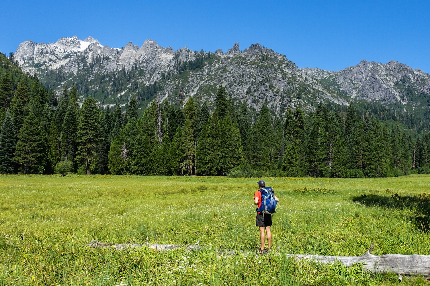
We used the Osprey Exos 48 and Ultralight Adventure Equipment Circuit backpacks on this trek. Both are lightweight, convenient, and comfortable. – photo credit: dave collins (cleverhiker.com)
You’ll want to bring a topographical map. We printed ours from the phone app Caltopo. We also used Gaia GPS as an offline GPS. As always, make sure to carry a physical map and a good compass, and know how to use them. – photo credit: dave collins (cleverhiker.com)
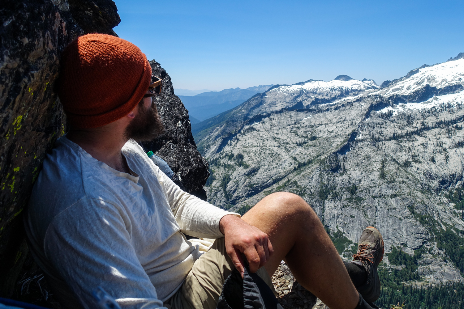
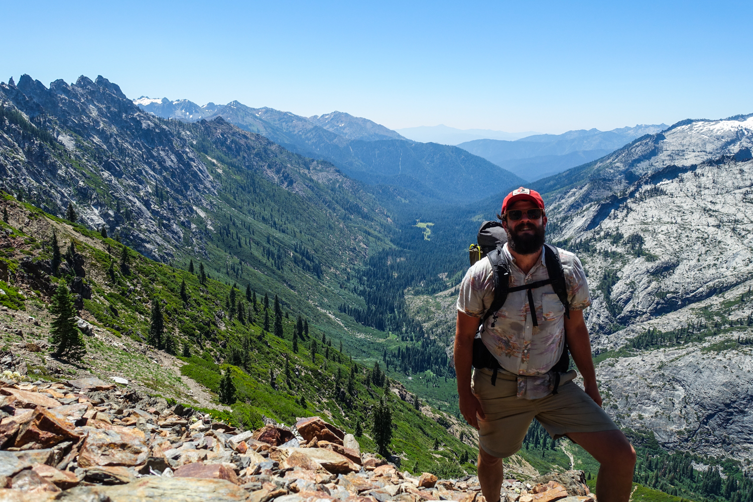
Sunglasses (polarized recommended), sunscreen, hats, and spf lip balm are an absolute must in the Trinity Alps. Beards help shield the sun too. – photo credit: dave collins (cleverhiker.com)
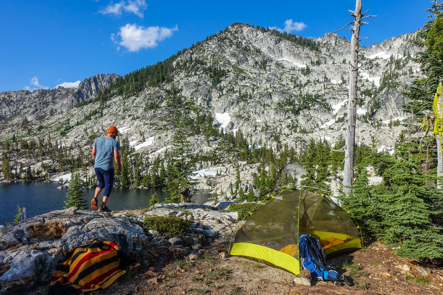
We used the Marmot Tungsten 2P UL tent on this trip. We think its strikes a good balance between weight, cost, and functionality. – photo credit: dave collins (cleverhiker.com)
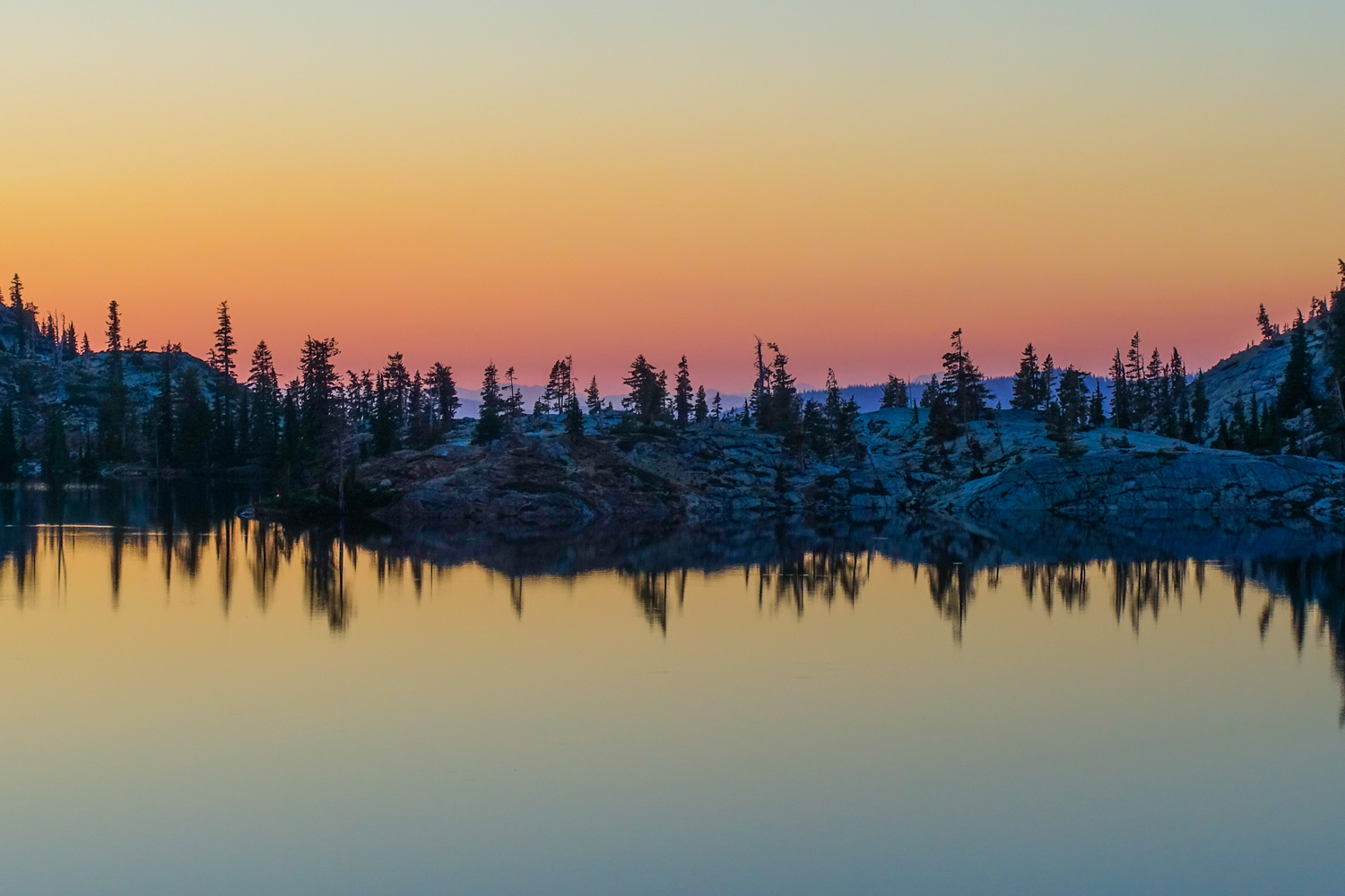
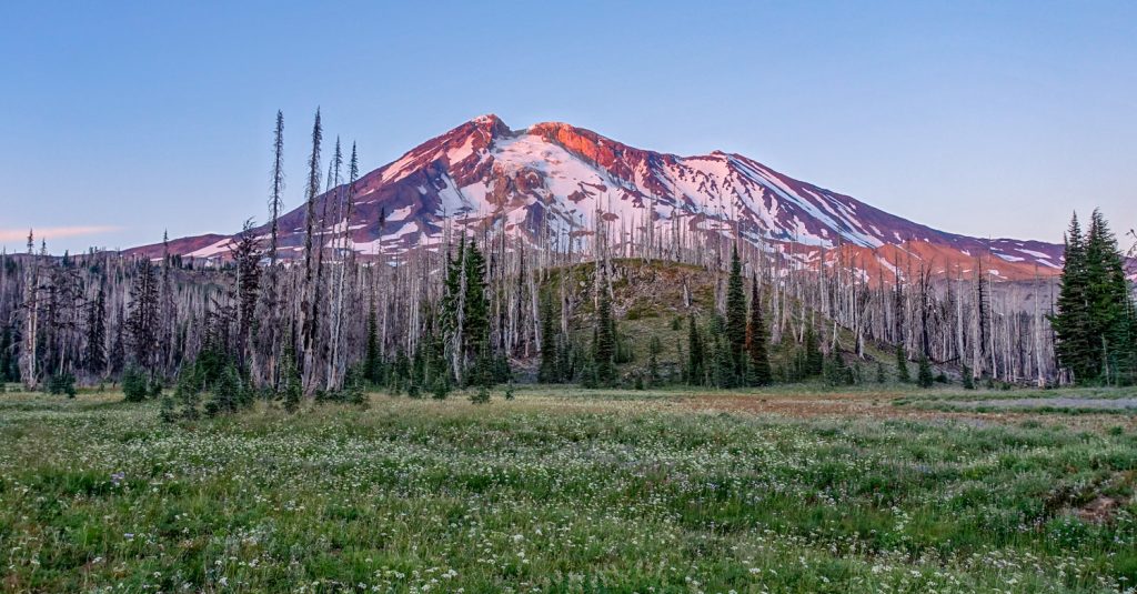
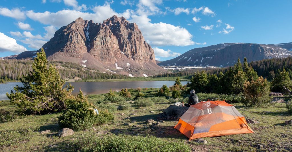
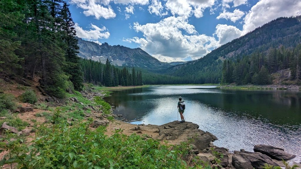
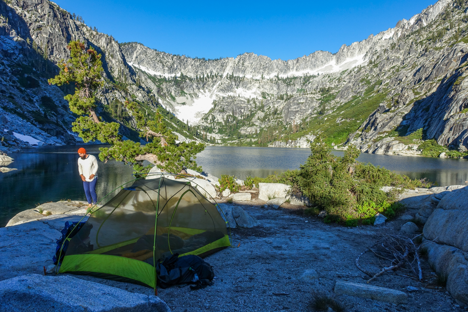
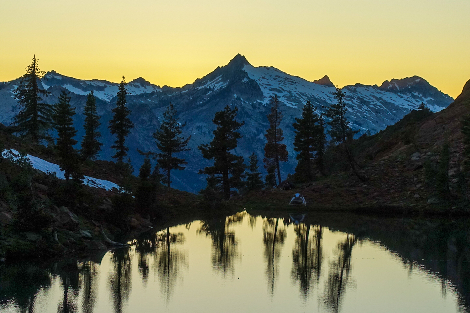
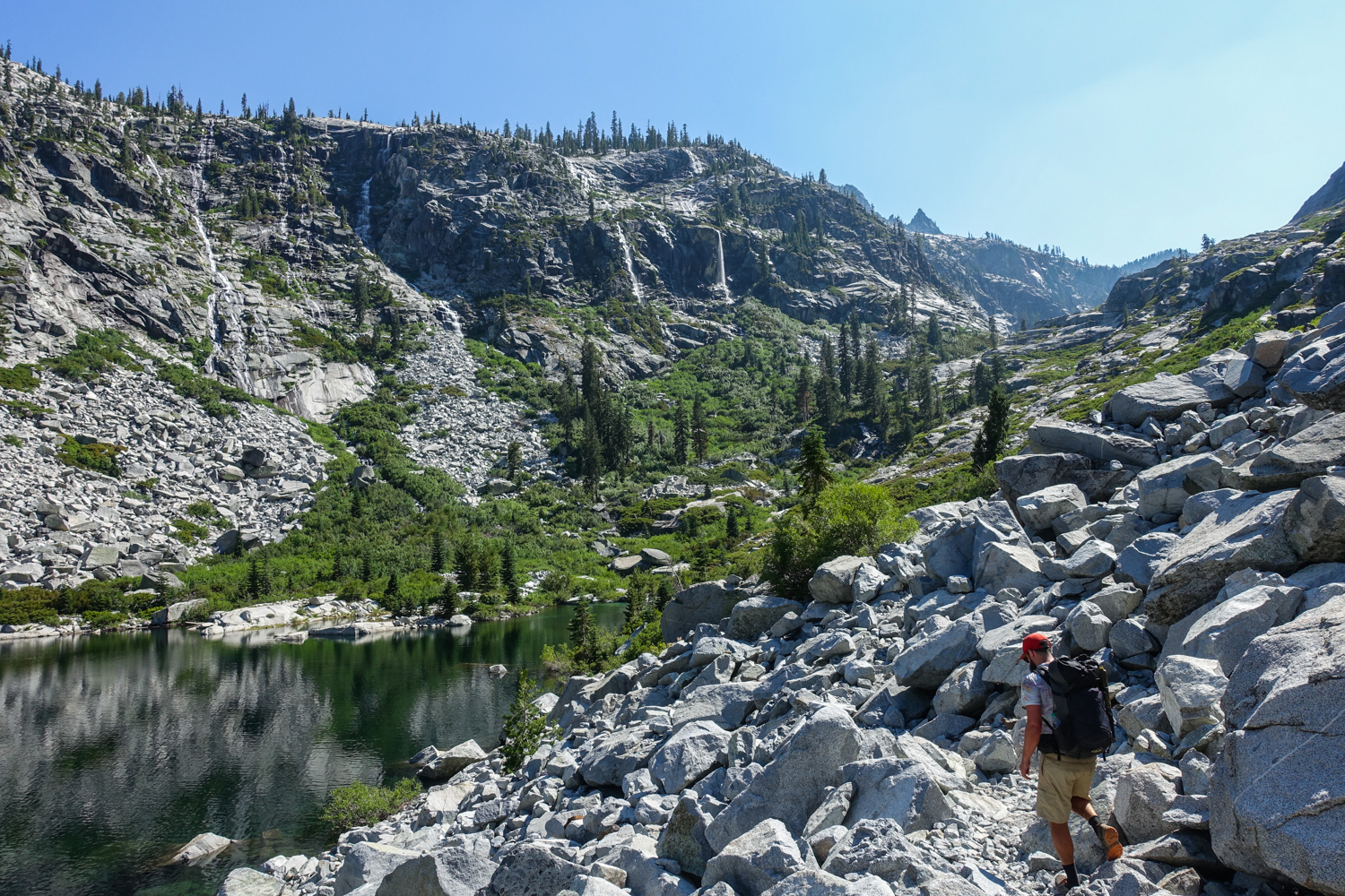
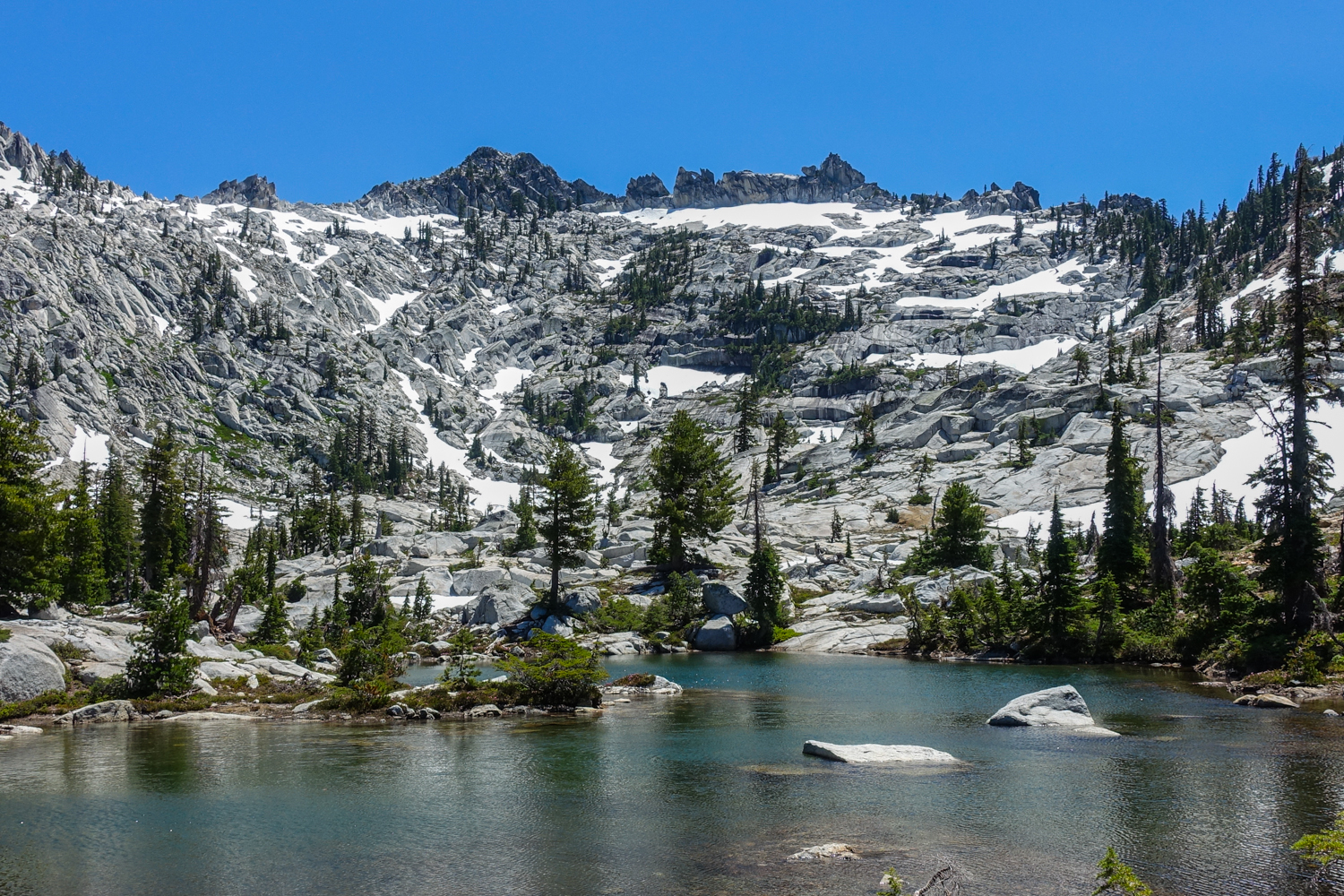
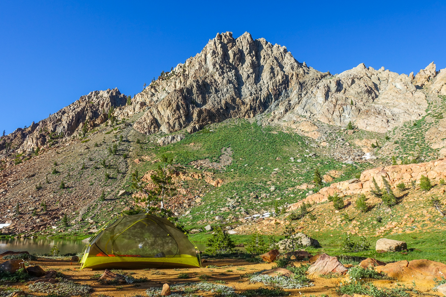
The lakeside camping was a memorable treat of the trinity alps. – photo credit: trinity alps (cleverhiker.com)
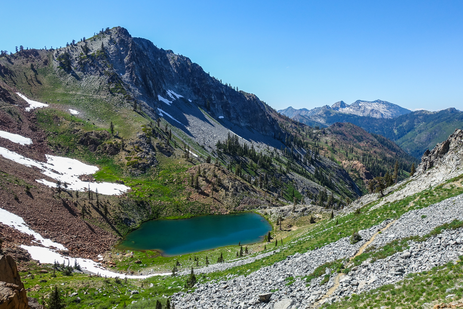
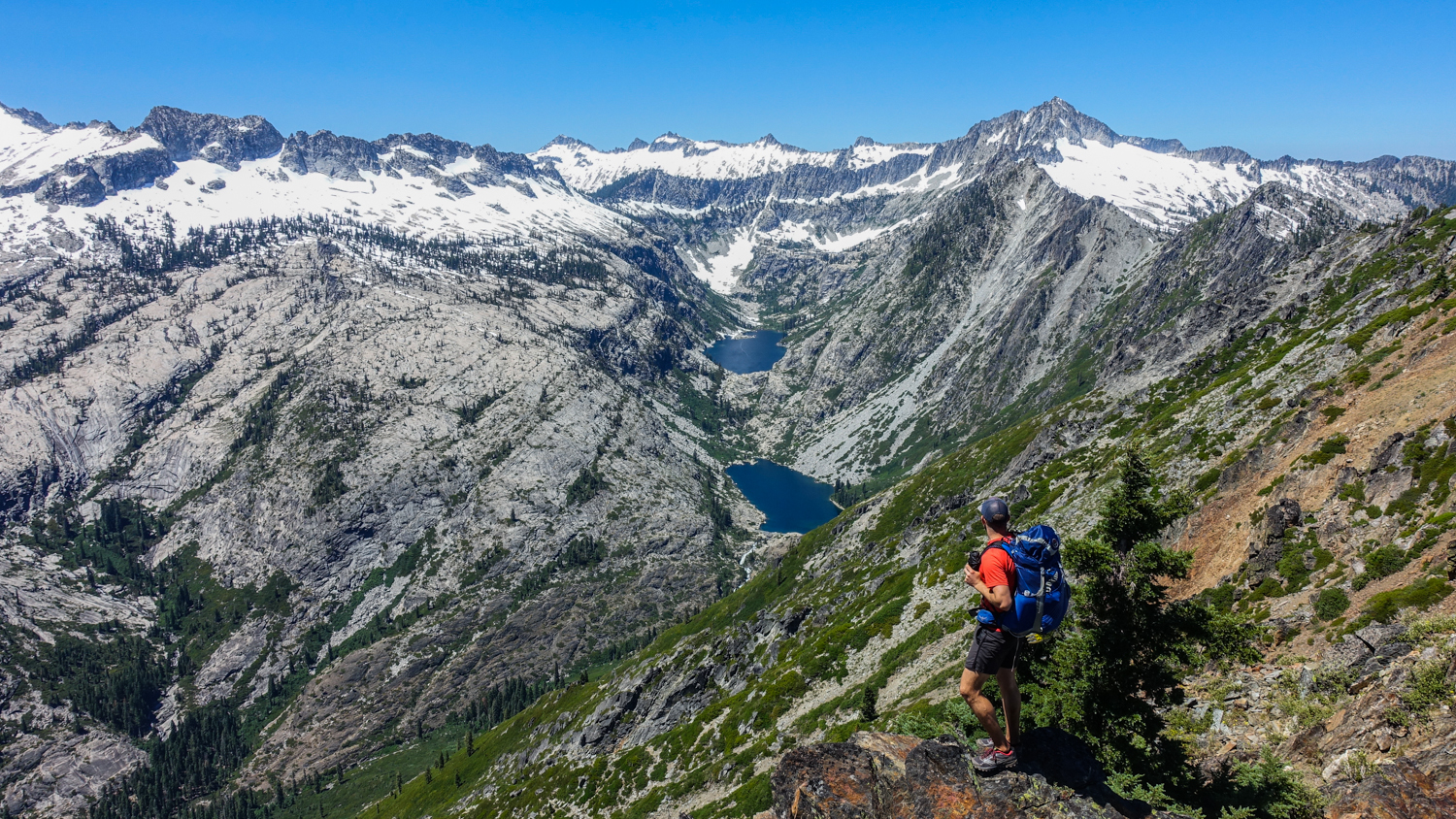
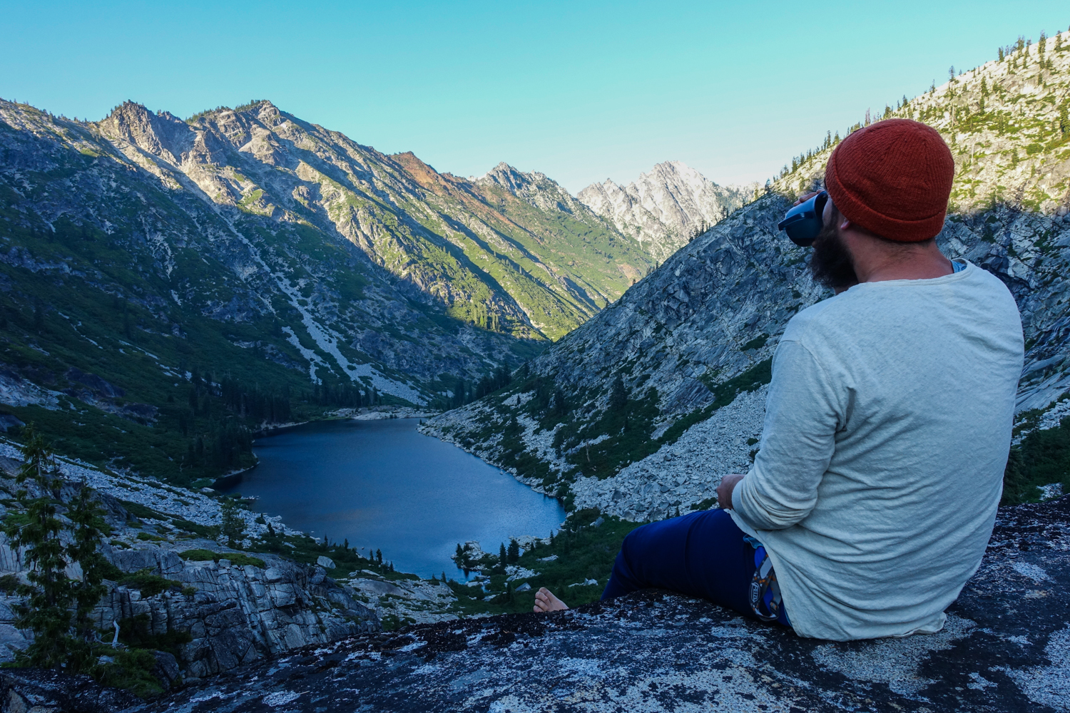
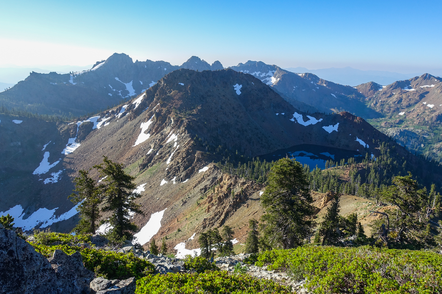
makes sense why so many of the lakes in this area are named after gems. – photo credit: dave collins (cleverhiker.com)
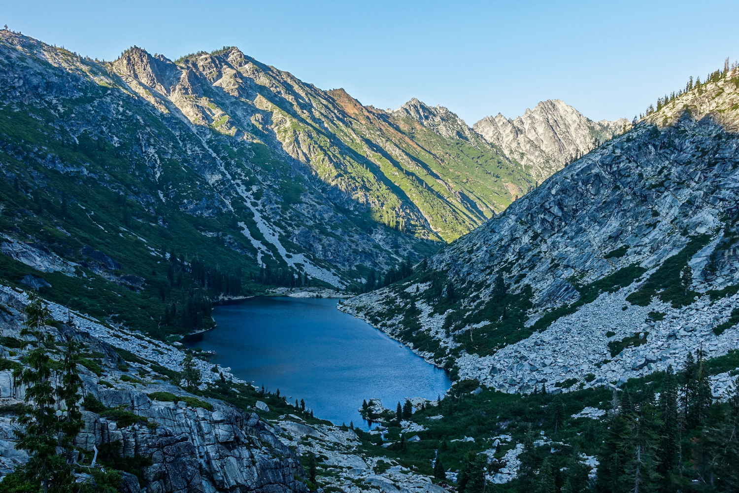
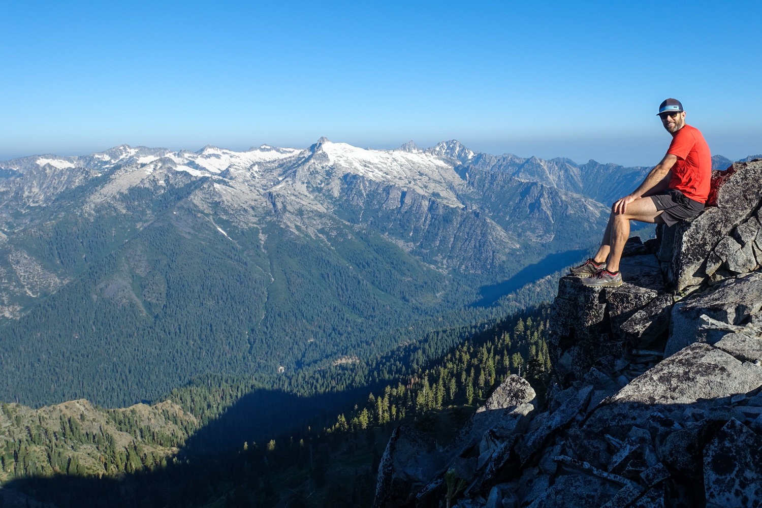
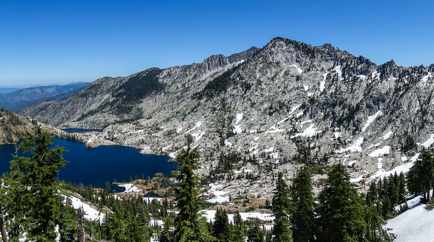
The four lakes loop is highly recommended for your trinity alps backpacking itinerary. – photo credit: dave collins (cleverhiker.com)
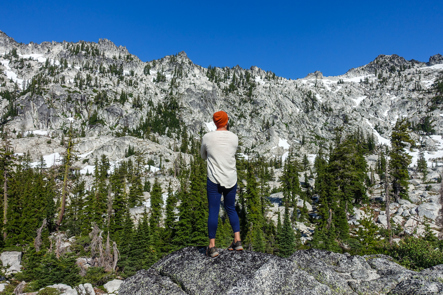
We wore Saucony Peregrine 7 trail runners (men’s and women’s) on this trail and they were excellent. If you prefer boots, make sure they’re lightweight and break them in really well before your trip. – photo credit: dave collins (cleverhiker.com)
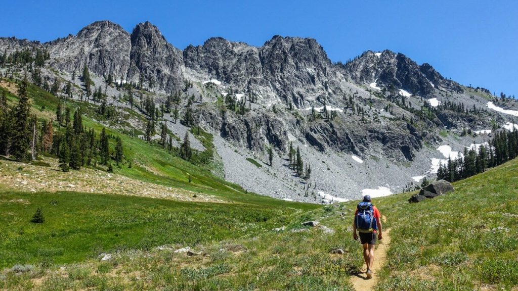
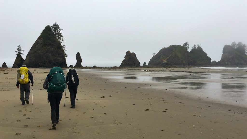
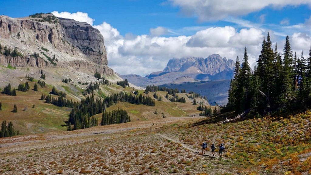
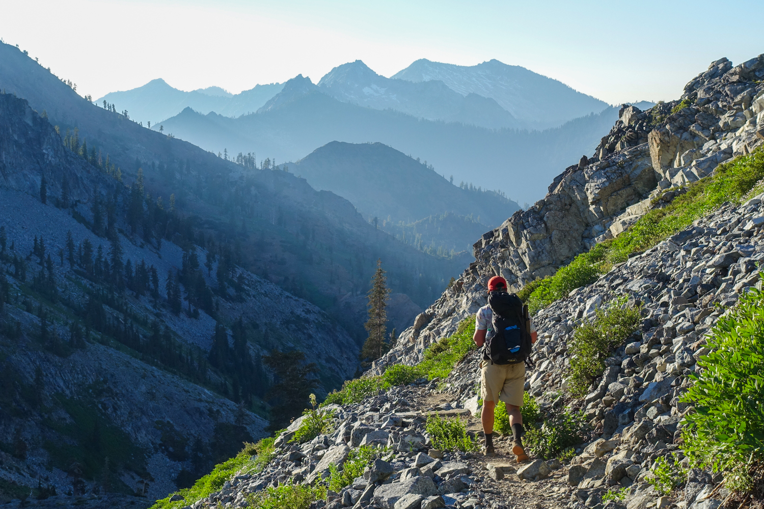
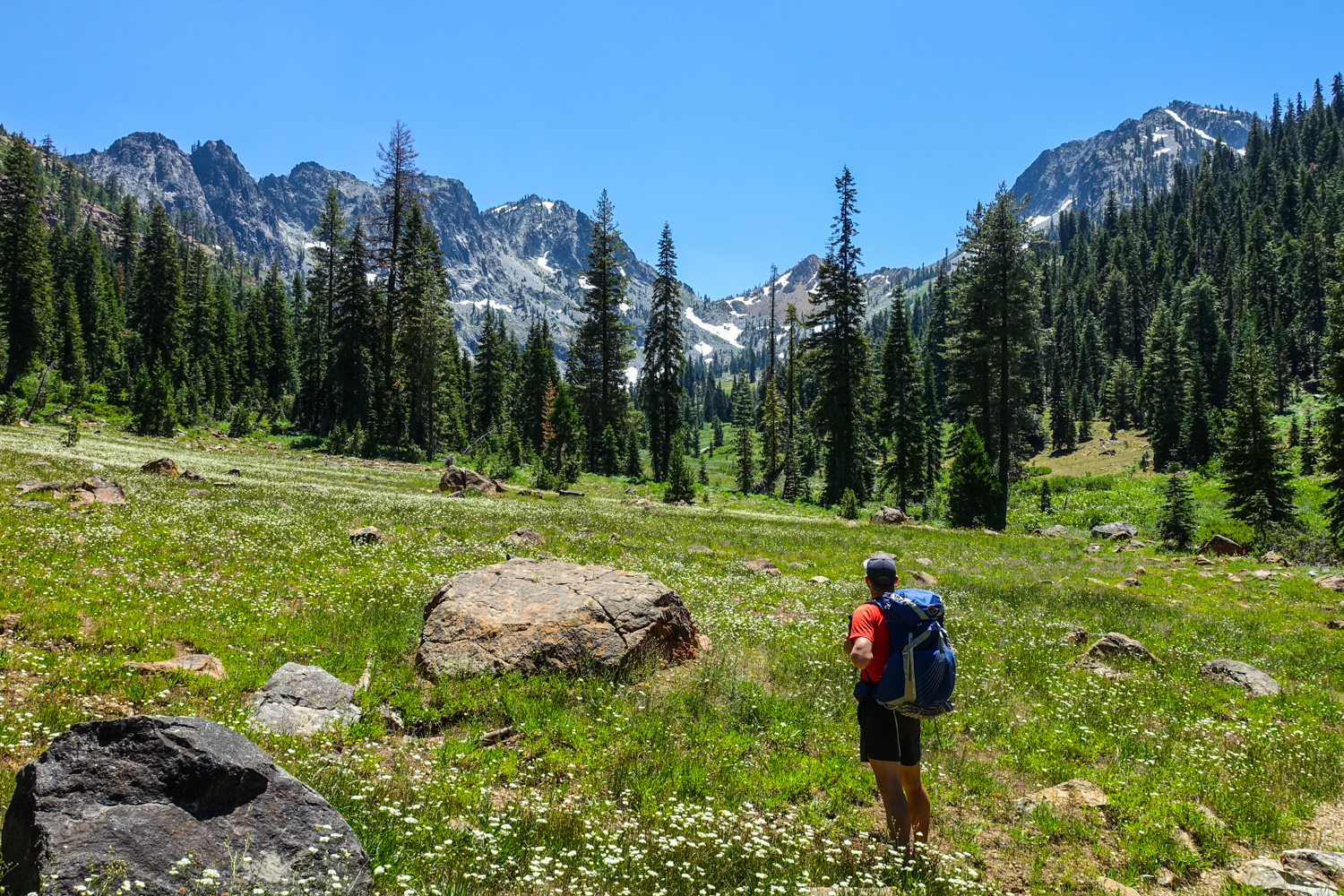
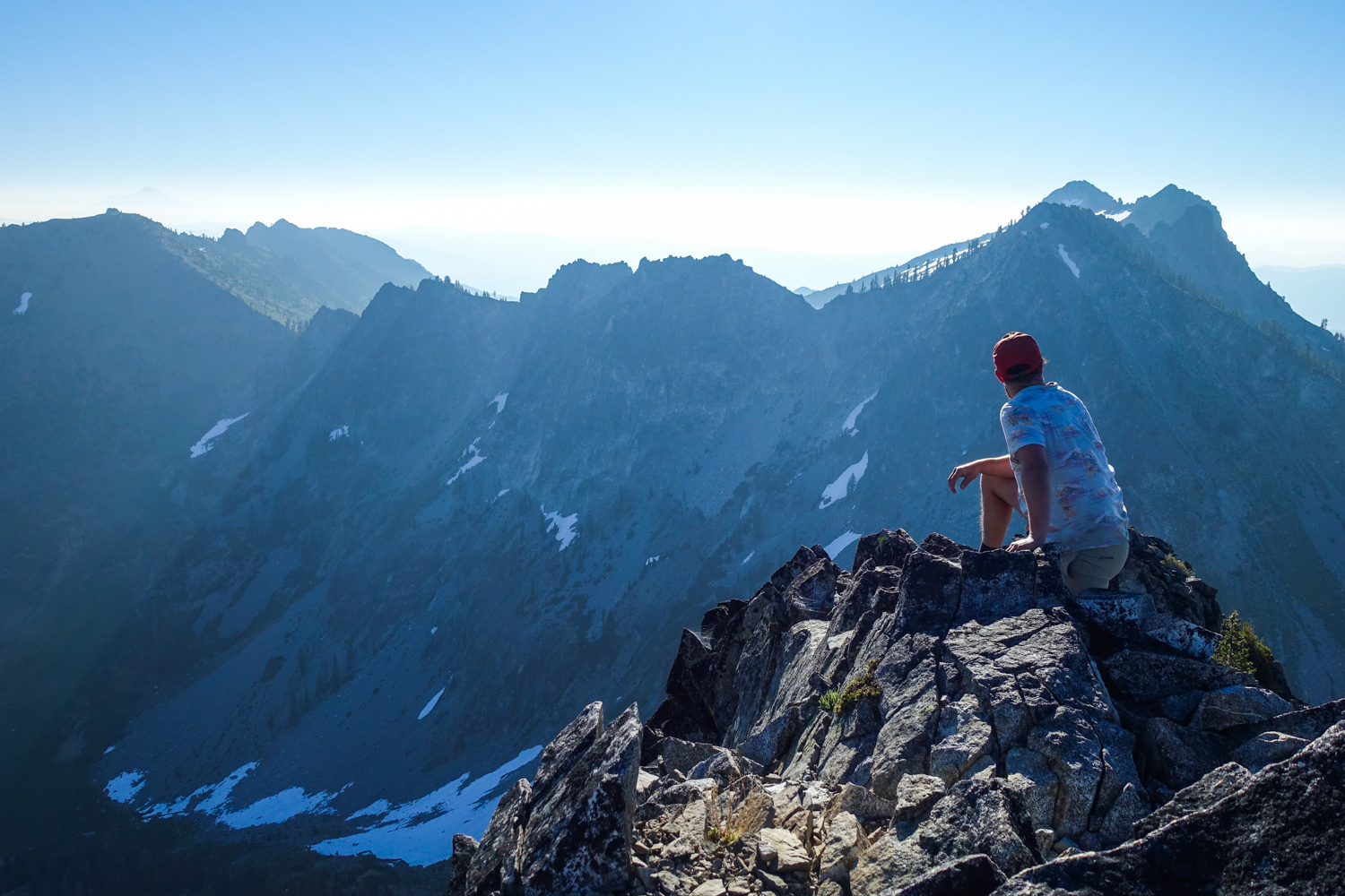
The trinity alps has over 600 miles of trails to choose from. They vary from beginner friendly to challenging mult-day options. – photo credit: dave collins (cleverhiker.com)
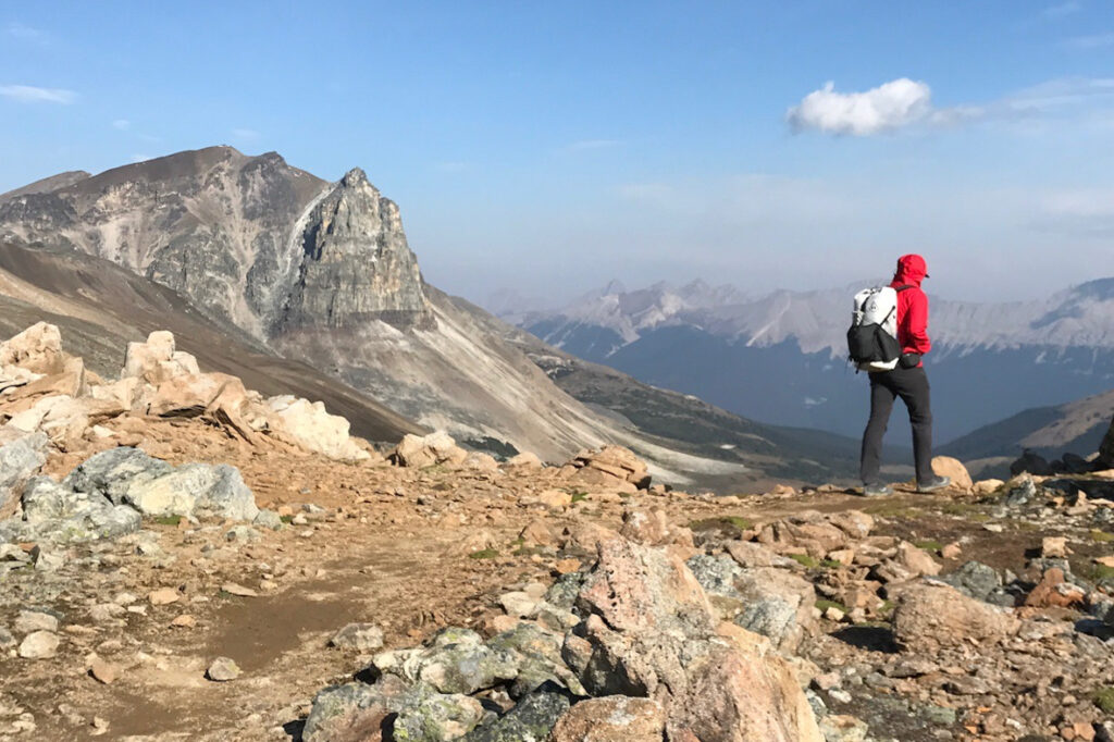
Wildlife flourishes in the trinity alps, where black bears, mountain lions, deer, and numerous bird species are frequently spotted. The Trinity River, winding through the area, is famous for its salmon and steelhead migrations, drawing anglers from across the globe. – photo credit: dave collins (cleverhiker.com)